GCSE AQA geography paper 1 predictions
1/46
There's no tags or description
Looks like no tags are added yet.
Name | Mastery | Learn | Test | Matching | Spaced | Call with Kai |
|---|
No analytics yet
Send a link to your students to track their progress
47 Terms
Where is the river Severn located ?
In the west of the uk , some parts of Wales
What is the name of the waterfall ?
The Severn breaks its neck
What are the river Severn's major erosional and depositional landforms?
Waterfalls , meanders , oxbow lakes , interlocking Spurs and estuaries
When the Severn reaches its mouth how wide is the Severn?
13km wide
What is the length of the Severn ?
350km
Why is there less flooding in Gloucester?
The river starts to widen and quickly develop into an estuary
Why are floods a threat as the river runs its course ?
They are surrounded by flat land and is 30 metres above sea level so heavy rain easily causes floods as it can burst their banks (land alongside a body of water)
What is the land used for in this deep estuary?
Industries like factories and dock facilities. There are also ports
Why's re some Victorian houses more at risk to the flooding ?
They are built closer to the flood plain near to the river due to rapid urbanisation so there wasn't anywhere else the houses could be built
Where is the source of the river Severn located?
The source of the River Severn is located in the Cambrian Mountains of Mid Wales, and it flows 🎶east and south to its mouth🎶where the river joins the Bristol Channel underneath the Severn Bridges.
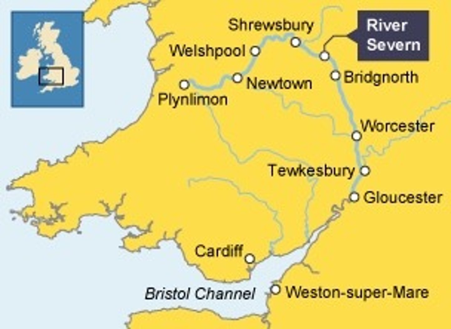
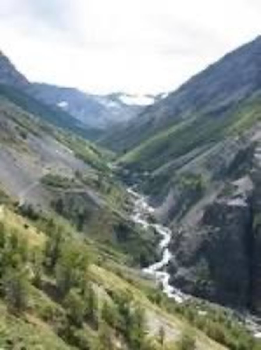
What erosional landforms form in the upper course of the Severn ?
The upper course has hard impermeable rocks. Here, vertical erosion has formed a V-shaped valley.The River Severn has many waterfalls in its upper course.
What erosional landforms form in the middle course of the Severn ?
As the River Severn starts to erode sideways (lateral erosion), it forms meanders. These can be identified in the middle course near Kempsey.
What depositional landscapes form
In the lower course of the river Severn ?
Near Tewkesbury, the meanders in the lower course are much larger. In this area there are also levees which have formed when the river has flooded.
The River Severn has a very large mouth with mudflats and sandbanks which support wildlife in the area. Many of the sites are protected areas.
How do tropical storms form?
Form over warm oceans (27°C+)
Warm air rises, creating low pressure
More air rushes in, rises and cools
Condensation releases heat, powering the storm
Coriolis effect causes the storm to spin
Develops into a circular, rotating system with strong winds and heavy rain
What is climate change mitigation?
Actions that reduce or prevent greenhouse gas emissions
Switching to renewable energy (solar, wind, HEP)
Carbon capture and storage
Afforestation
Improving energy efficiency
International agreements (e.g., emission‑reduction targets)
What is climate change adaptation?
Actions that adjust to the impacts of climate change
Building flood defences and sea walls
Designing drought‑resistant crops
Changing agricultural practices
Improving water management
Creating heat‑resilient infrastructure
What are the effects of climate change on tropical storms (distribution, intensity, frequency)?
Distribution: Storms may form in wider areas as more ocean regions reach 26.5°C
Intensity: Stronger storms due to warmer oceans providing more energy
Frequency: Overall number may not increase, but more high‑category storms are expected
How do rainforest animals use camouflage in rainforests?
Many animals have camouflaged skin or fur
Helps them blend into leaves, bark, or shadows
Protects them from predators and helps them hunt prey
How are rainforest animals adapted for movement and survival?
Strong limbs / prehensile tails for climbing (e.g., monkeys)
Gliding adaptations (e.g., flying squirrels, frogs)
Sharp beaks/claws for feeding
Nocturnal behaviour to avoid daytime heat
What are drip tips and why are they useful?
Leaves have pointed drip tips
Allow water to run off quickly
Prevents fungus and bacteria growing on leaves
Why do rainforest trees have buttress roots?
Provide support for tall trees
Spread out widely to absorb nutrients from thin soil
Help stabilise trees in shallow ground
How are rainforest trees adapted to compete for sunlight?
Tall emergent trees grow above the canopy
Large leaves in lower layers to capture limited light
Smooth, straight trunks to grow quickly upwards
What are lianas and how are they adapted to the rainforest?
Woody climbing plants rooted in the ground
Use trees for support to reach sunlight
Grow upwards through the canopy
Allows them to access light without investing energy in thick trunks
what is selective logging and replanting?
Only fully grown trees are cut down
Most trees remain, protecting the forest structure
New trees are replanted to replace those removed
Helps maintain biodiversity and long‑term forest cover
how do conservation and education help manage rainforests sustainably?
Areas are protected in reserves or national parks
Prevents illegal logging and land clearance
Education teaches local people and businesses the value of sustainable use
Encourages research, responsible tourism, and long‑term protection
how does ecotourism support sustainable rainforest management?
Low‑impact tourism that protects the environment
Provides income for local communities
Encourages people to preserve forests rather than cut them down
Money funds conservation projects and ranger patrols
how do international agreements help protect tropical hardwoods?
Agreements like CITES restrict trade in endangered hardwoods
Promotes sustainable forestry certification (e.g., FSC)
Encourages countries to manage forests responsibly
Reduces global demand for unsustainably sourced timber
how does debt reduction help manage rainforests sustainably?
Countries have debt cancelled in exchange for protecting rainforests
Money saved is used for conservation, monitoring, and sustainable development
Reduces pressure to cut down forests for quick economic gain
Encourages long‑term environmental protection
what are the main causes of desertification?
Climate change — higher temperatures increase evaporation and reduce rainfall, drying out soil
Population growth — more people increases demand for food, fuel and land
Removal of fuel wood — trees cut for firewood leave soil exposed and vulnerable
Overgrazing — too many animals eat vegetation faster than it can regrow
Over‑cultivation — growing crops repeatedly exhausts soil nutrients
Soil erosion — wind and water remove unprotected topsoil, reducing fertility
What strategies are used to reduce the risk of desertification?
Water and soil management — contour ploughing, stone lines, and irrigation to trap water and reduce runoff
Tree planting — trees act as windbreaks, stabilise soil, and provide shade to reduce evaporation
Appropriate technology — low‑cost, simple tools (e.g., sand dams, solar cookers) that local people can maintain and use sustainably
Medmerry: reasons for the scheme
The Environment Agency considered South East England most at risk of flooding due to climate change
A shingle ridge was the only protection from the sea, and in the 1990s, beach reprofiling took place every winter, at an annual cost of £200k
In 2008, 5 million pounds of damage was caused
Medmerry: what strategy was used?
Work began in 2011 and was finished by 2014
A new embankment was built, up to 2km inland from the shore, using clay from within the area. This enclosed the future intertidal area and protected areas behind.
Rock armour was placed on the seaward edges of the embankment (60,000 tonnes of rock from Norway)
Once this was all set up, a 110-metre breach was made in the shingle bank to allow the sea to flood the land behind to create a new intertidal range
Medmerry: positive effects: social
now a 1 in 1000 chance of coastal flooding
maintenance track behind the embankment provides a cycle route and footpath
10km of footpath
7km of bikepaths
5km of bridalways
sewage was heavily upgraded
Medmerry: positive effects: economic
Tourism is expected to increase. 2 new carparks and 4 new viewing points provide easy access
newly flooded area is expected to become to fishing nursery that will boost the local fishing in Selsey
Caravan parks and the Selsey main road are now protected
Medmerry: positive effects: environmental
designers were able to take measures to protect species
300 hectares of new intertidal environments are forming
Mudflats, salt marshes, and transitional grasses have already attracted ducks and lapwings. The area is becoming a huge nature reserve
Medmerry: negative effects: social
Some local residents do not think the land should have been given up that easily, and insisted in them looking into different options
Some opponents of the scheme came from outside the area; they resented such an expenditure in a sparsely populated area
Medmerry: negative effects: economic
For £28 million, the scheme was very expensive
Three farms growing oilseed rape and winter wheat had to be abandoned. This was regarded as wasteful
Medmerry: negative effects: environmental
Despite planning, habitats of existing species, such as badgers, would have been disturbed.
Dorset Coast: Studland Bay
Studland Bay has eroded faster than its neighbouring landform, Ballard Point. This is because it is made of clays and sand, which have little resistance to erosion. This has led to the formation of sandy beaches, perfect for tourism!
Dorset Coast: Ballard Point
Ballard Point is a chalk headland. Chalk is surprisingly resistant to erosion; therefore, the coastline takes longer to erode and so sticks out. Some caves are forming in the headland, which are home to coastal wildlife such as seagulls.
Dorset Coast: Old Harry & His Wife
Old Harry is a stack, and his wife is a stump, near to Ballard Point. The chalk is resistant enough for a cave-arch-stack-stump sequence to have formed. A cave has widened into an arch, which, over time, collapsed to leave a stack standing alone from the mainland.
Dorset Coast: Swanage Bay
Swanage Bay is another bay that has formed between two headlands. This is because the clay and sand between two bands of hard, resistant rock erode at a faster rate. Sandy beaches are a favourite with tourists, and so the area can benefit from seasonal income.
Dorset Coast: Durlston Head
Durlston Head is formed from limestone, a very resistant rock, which erodes at a slow rate compared to the soft sand and clay nearby.
The beaches are rocky, from mass movement of materials off the cliffs, making the beaches less accessible.
Dorset Coast: Poole Harbour
One of the largest natural harbours in Europe, Poole Harbour has formed due to increased deposition at the mouth of several rivers in the local region. This has formed a large estuary, with calm seas for sailing, and many salt marshes for wildlife
What are rockfalls and how do they occur?
Rapid, free‑fall of rock from a steep cliff face.
Caused by gravity; worsened by freeze‑thaw which loosens well‑jointed rock.
Water enters joints → freezes → expands → cracks rock.
Forms a scree slope at the cliff base.
Can block transport routes.
How do sliding/mudflows occur?
Happen on steep slopes over 10°, often where permeable soil lies over impermeable subsoil.
Rapid, sudden movement after heavy rain.
Saturated soil becomes heavy and flows over impermeable layer.
More likely when vegetation is sparse.
Can cause major devastation and endanger lives.
What causes slumping (landslips/landslumps)?
Rapid movement of earth/rock along a concave slip plane.
Occurs after heavy rain saturates overlying rock, making it heavy and unstable.
Undercutting by rivers or sea erosion weakens the slope.
Chemical weathering from the sea further weakens rock bonds.