9 Locational reference systems and Map projections
1/29
There's no tags or description
Looks like no tags are added yet.
Name | Mastery | Learn | Test | Matching | Spaced | Call with Kai |
|---|
No analytics yet
Send a link to your students to track their progress
30 Terms
Why is it difficult to locate features on the earth’s surface?
no standard reference system, each has their own purpose
What does LRS stand for?
Locational Reference System(s)
Which model for the Earth surface is used for LRS?
(Which model is the datum?)
What are characteristics of a LRS?
geometry (spherical / planar = “projected”)
coverage (global / continental / local)
units (metric / imperial / angular)
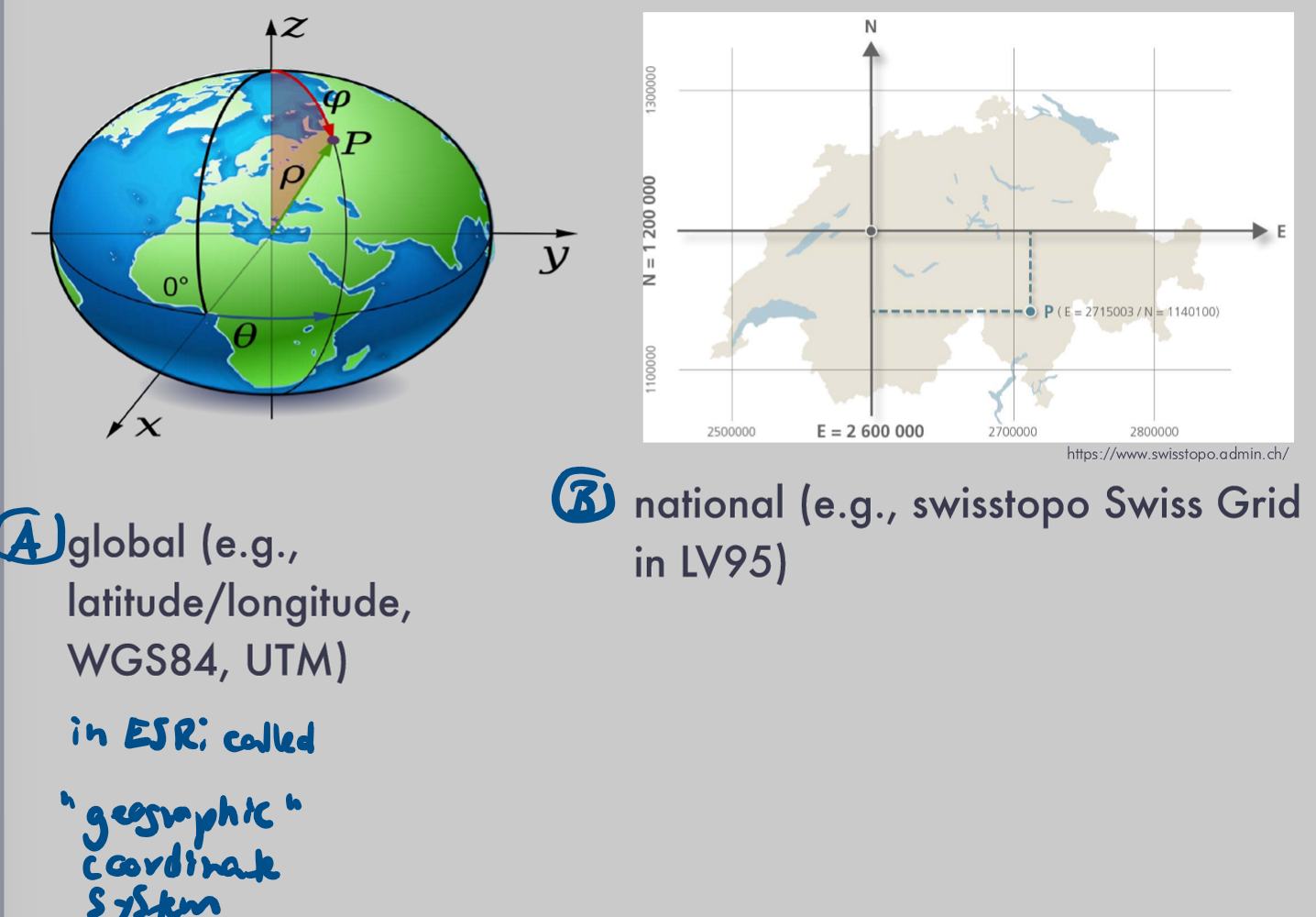
Name 3 examples for LRS
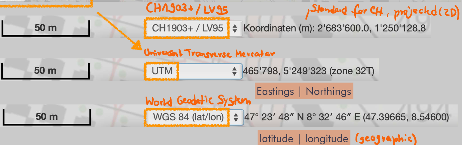
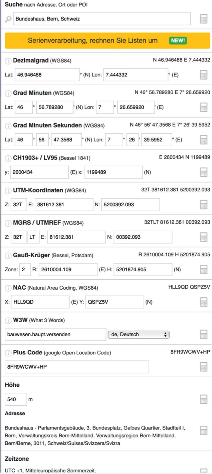
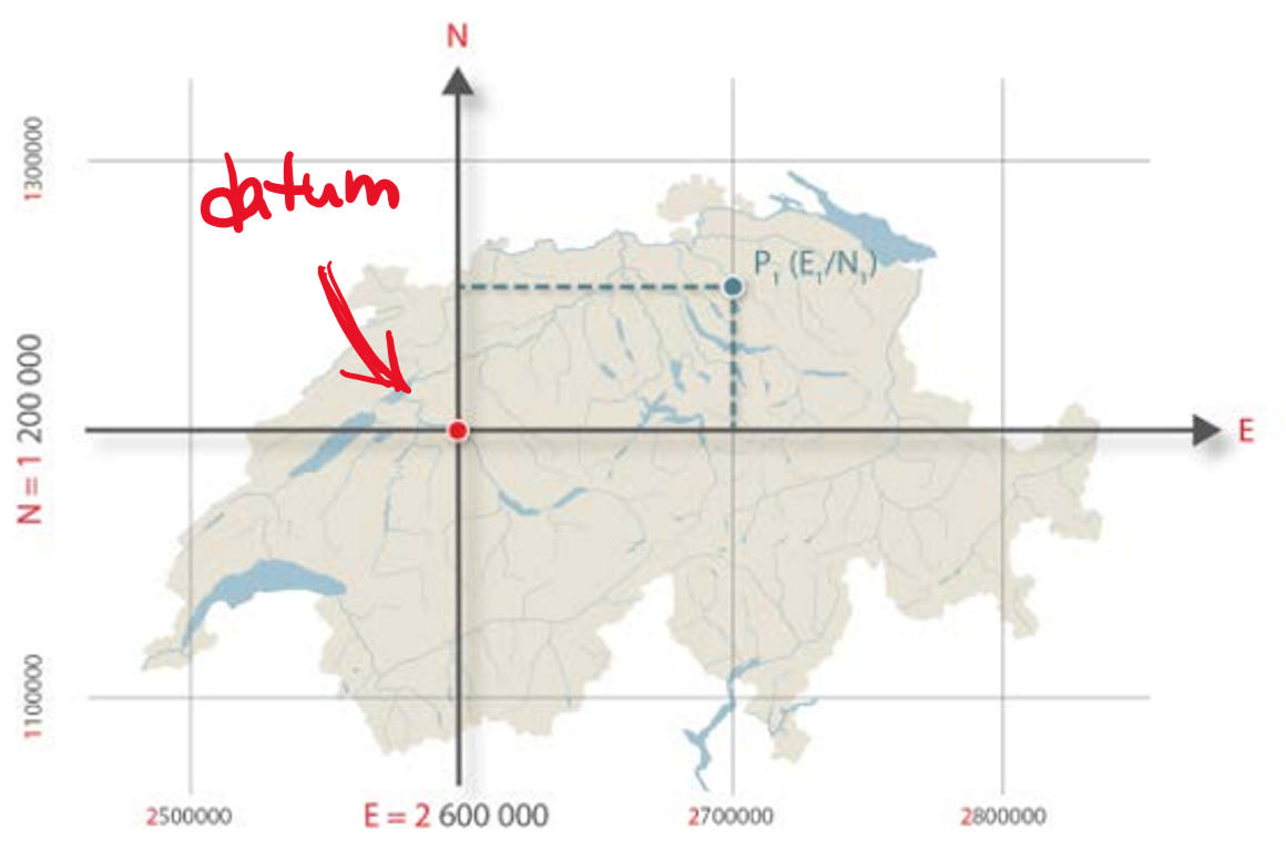
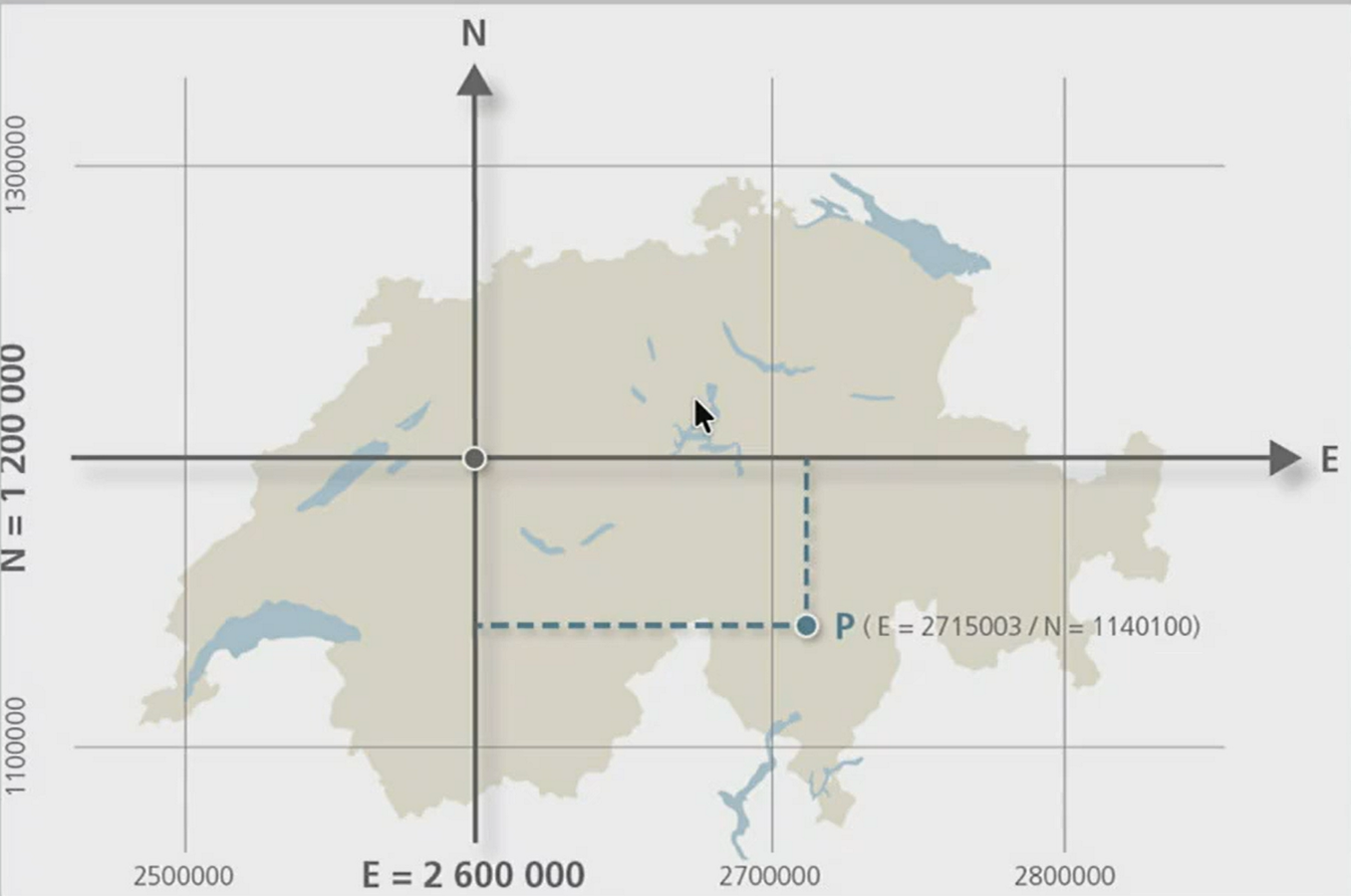
Example 1: What is the CH1903+ / LV95?
Swiss local reference system
based on Bessel-Ellipsoid, datum at Zimmerwald
planar, uses 2 dimensions, third dimension is used for height
works because CH is small
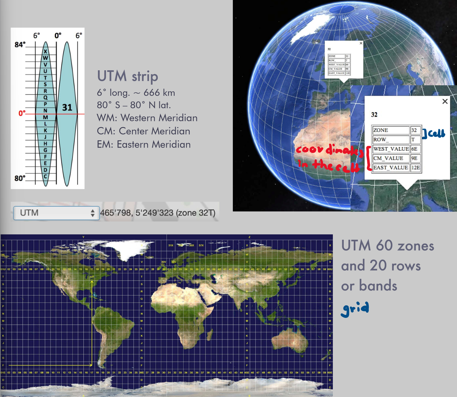
Example 2: What is the UTM?
Global reference system for military
planar, easting and northing
world is sectioned in grid, coordinates for cell in the grid
Example 3: What is the WGS 84?
Global reference system for GPS
geocentric, datum at the center of the earth
geographic, latitude and longitude
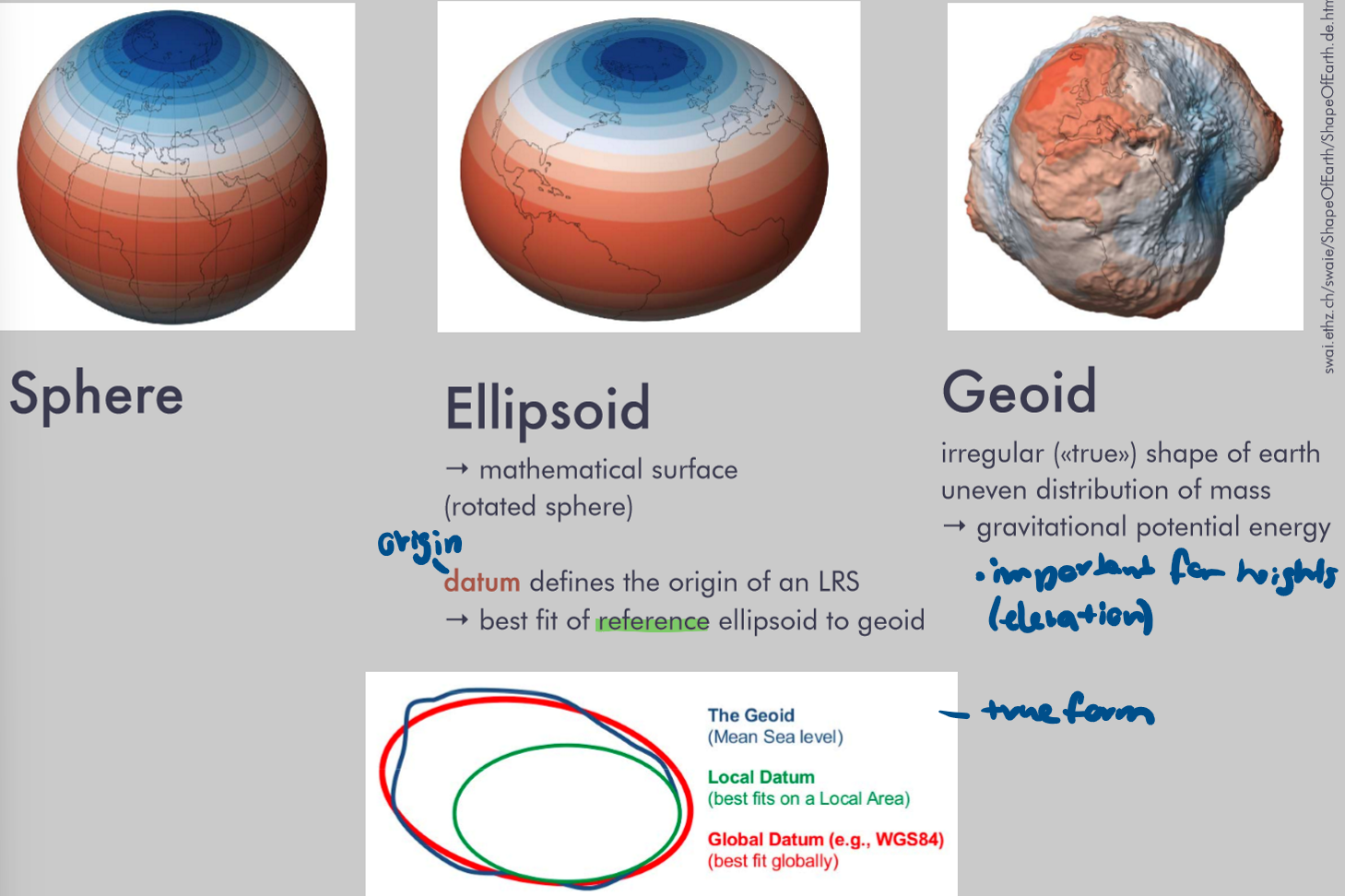
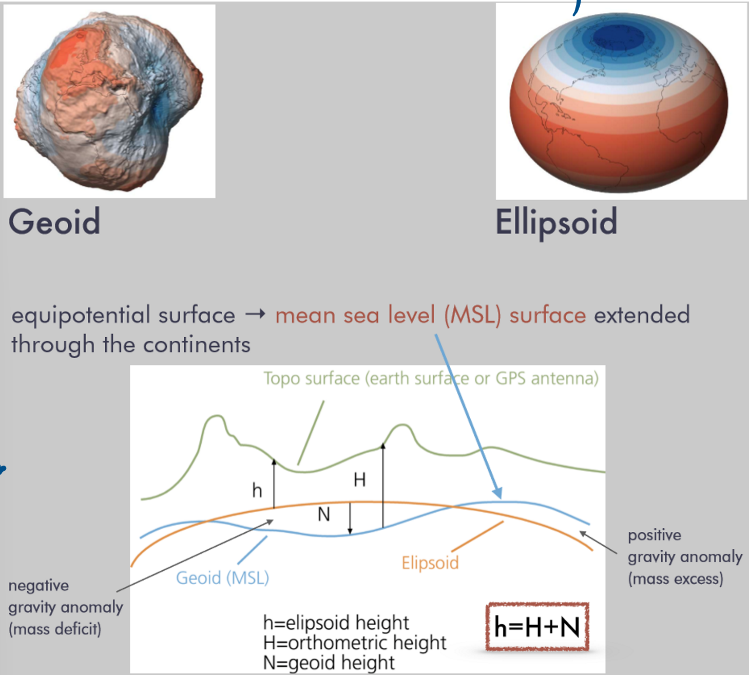
How can height be measured?
vertical datum usually based on ellipsoid, because it’s easier
Principle of projection (of the curved earth to planar 2D)
Earth’s surface is flattened
use approximation (3D)
do transformation (3D → 2D)
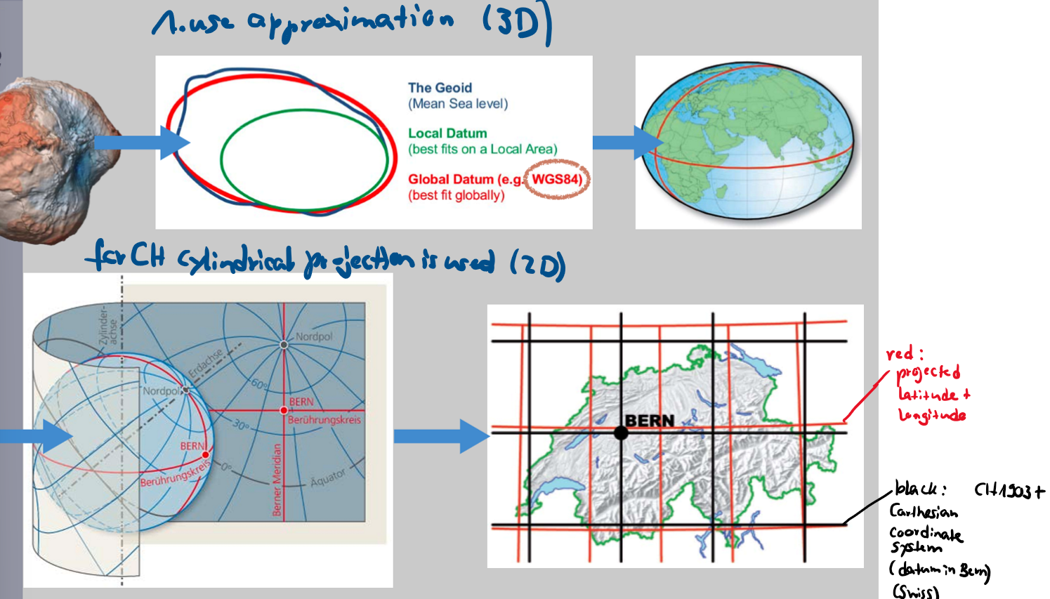
How is this projection done for the Swisstopo maps?
Datum at Zimmerwald (Bern)
3D approximation: ellipsoid
2D transformation: oblique, tangential cylinder projection; conformal (anges are preserved)
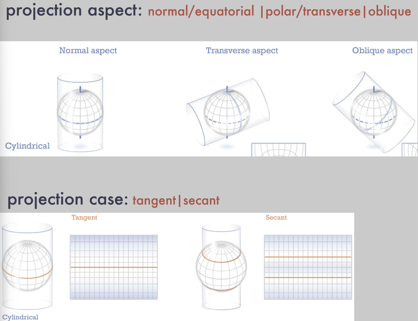
Which steps should you take to find the ideal map projection?
set scale of reference globe
choose developable surface (cone / cylinder / plane)
project globe to surface
rock an unroll
Does the projection matter for the analysis of a map?
Yes
sometimes it has to be adjusted
What aspects and cases can a projection have?
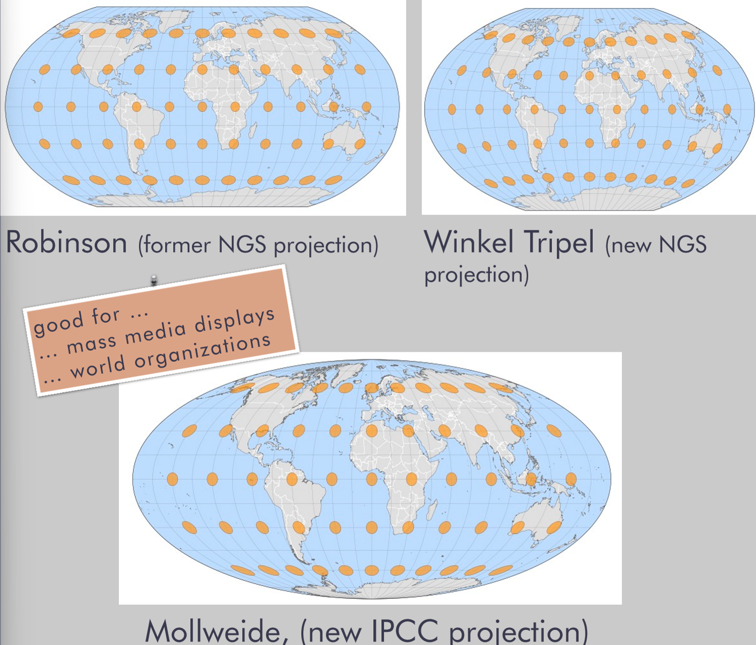
Projection uses in cartography / GIS:
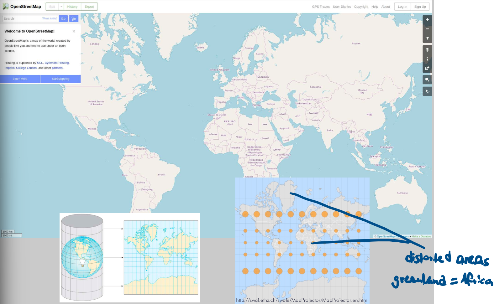
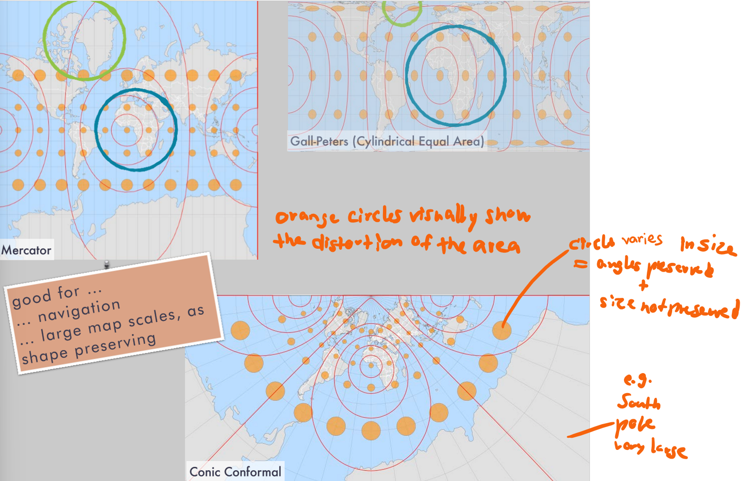
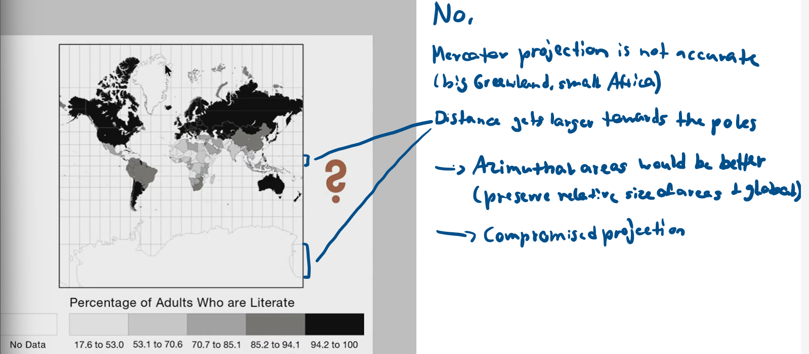
What is (Web) Mercator used for?
Advantages
Disadvantages
online mapping
Advantages:
always up north
seamless, works for the entire globe
Disadvantages:
not equivalent (not area-preserving), e.g. Africa is smaller than reality
Projection uses in cartography / GIS:
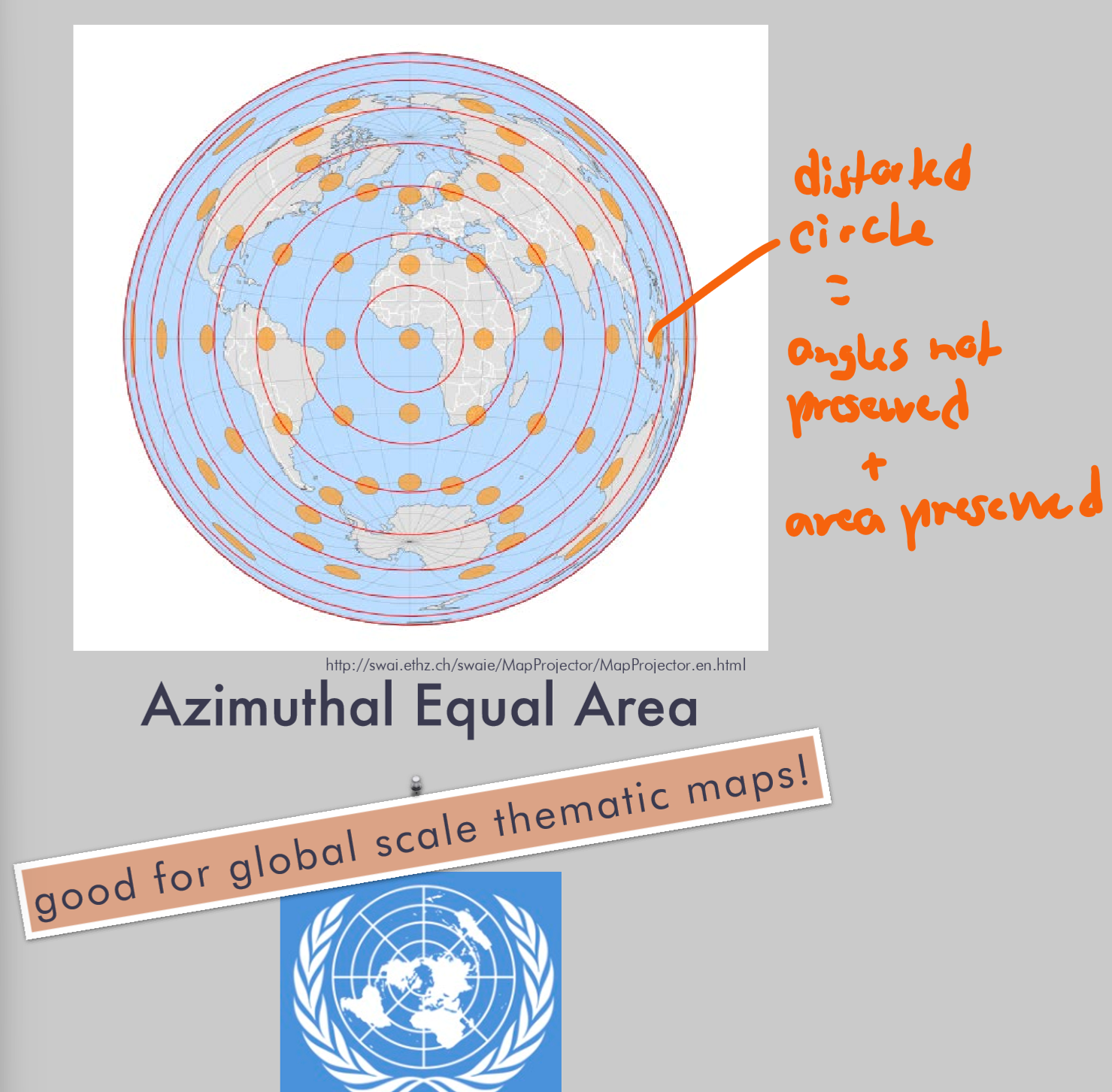
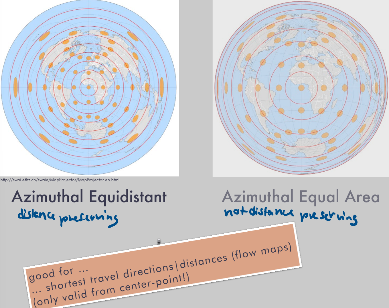
What is Azimuthal Equal Area used for?
Advantages
Disadvantages
global scale thematic maps
Advantages:
area preserving
Disadvantages:
angles distorted
Projection uses in cartography / GIS:
What are 3 angle-preserving projections
What are they used for?
Advantages
Disadvantages
Mercator, Gall-Peters (Cylindrical Equal Area), Conic Conformal
Navigation, large map scales
Advantage: angle-preserving
Disadvantage: area distorted
Projection uses in cartography / GIS:
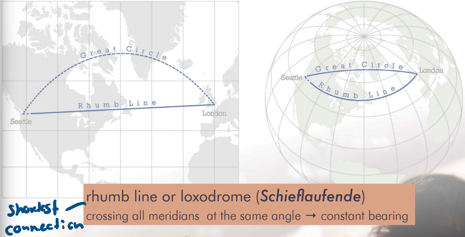
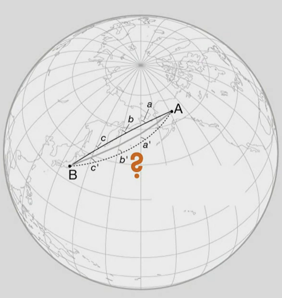
What is the rhumb line?
What is it used for?
Rhumb line or loxodrome (Schieflaufende crosses all meridians at the same angle
Angle-preserving
→ shortest connection between 2 points
→ good for navigation, large map scales
Projection uses in cartography / GIS:
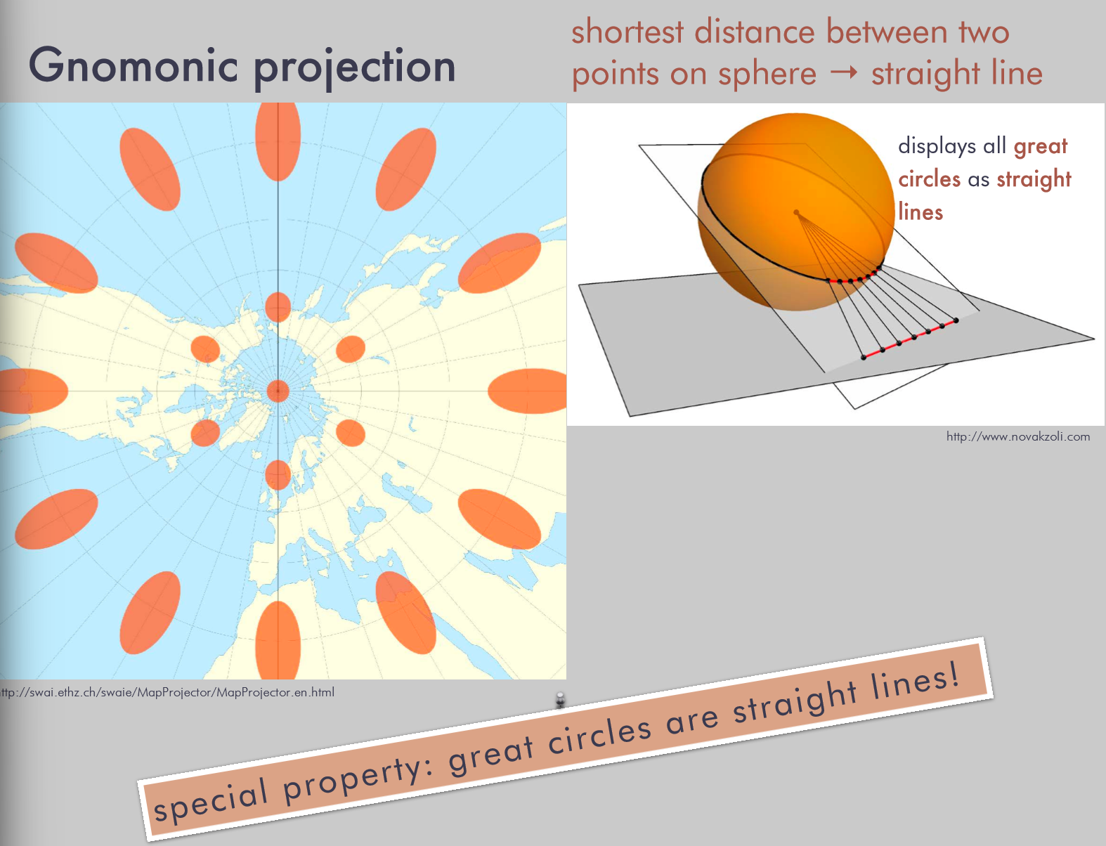
What is Gnomonic projection used for?
Advantages
Disadvantages
shows shortest distance between two points on sphere
Advantage: direction preserving
Disadvantage: direction preserving only at central touching point
Projection uses in cartography / GIS:
What is Azimuthal Equidistant projection used for?
Advantages
Disadvantages
distances (flow maps), shortest travel directions
Advantage: distance-preserving
Fazit?
No best projection!
Each projection can preserve one or more, never all characteristics
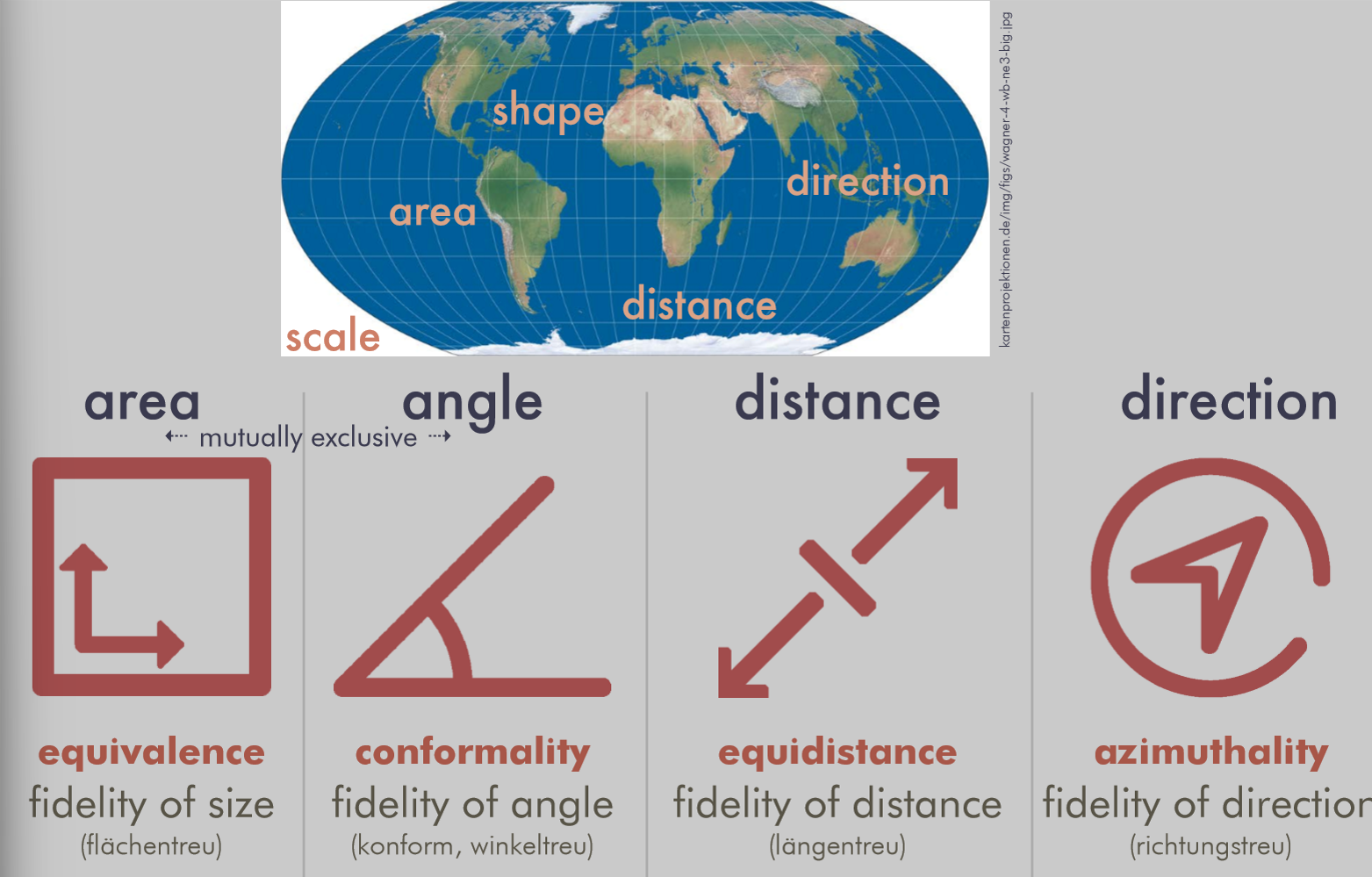
But, what are compromise projections?
Balance between distortion properties

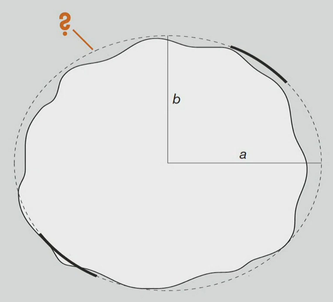
Klicker:
How do we call the form expressed by the dashed line?
Ellipsoid (dotted line)
Geoid (white circle)

Klicker:
This locational reference system is?
Local
LV95
Cartesian

Klicker:
The dashed line is called?
Loxodrome (Schieflaufende)
Klicker:
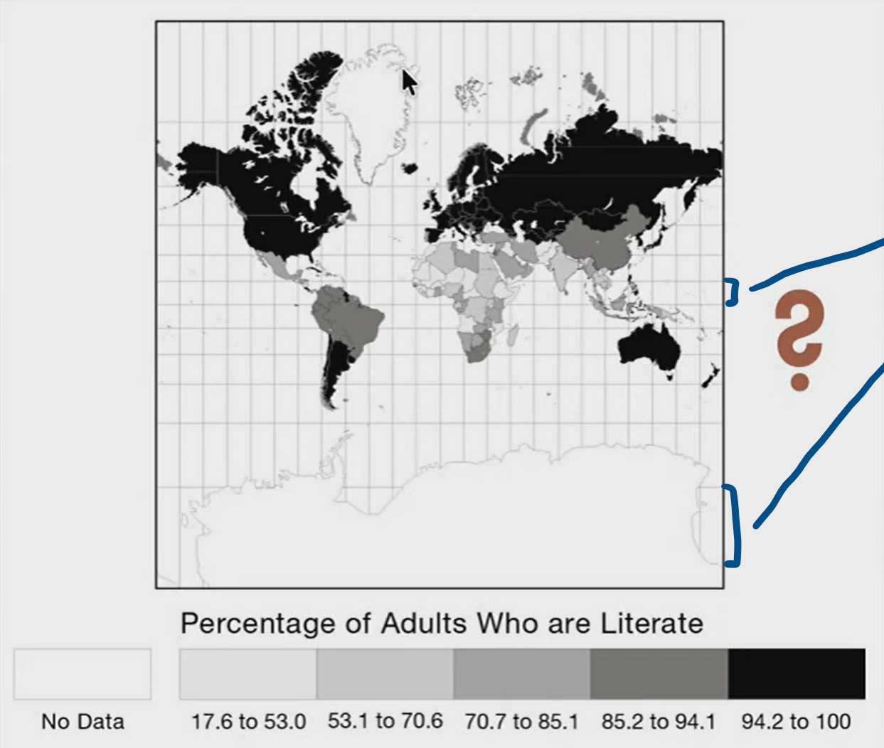
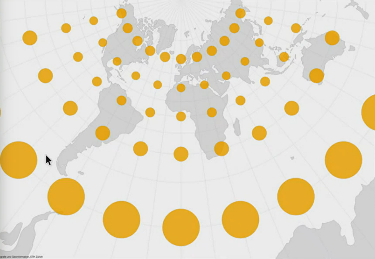
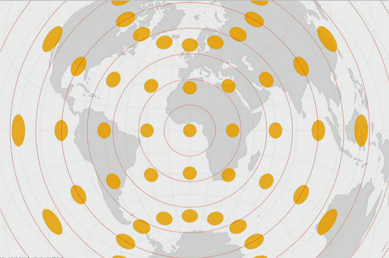
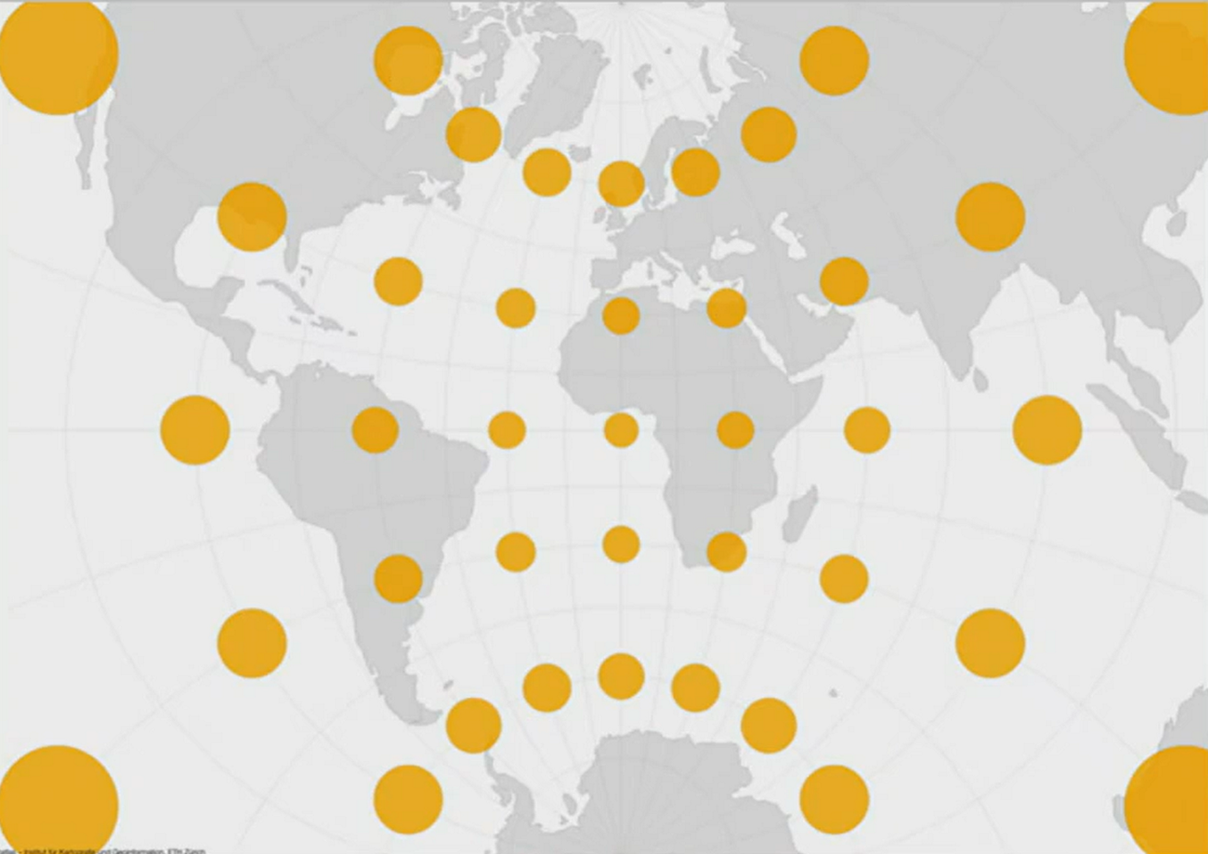
Is this an appropriate map projection to show the literacy rates of countries on a global scale?
Klicker:
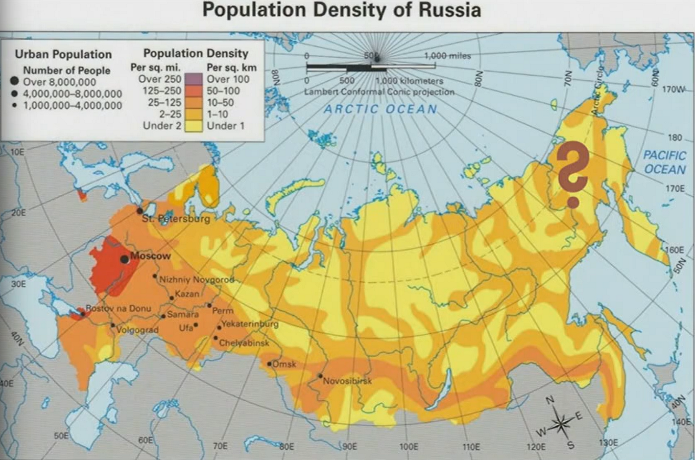
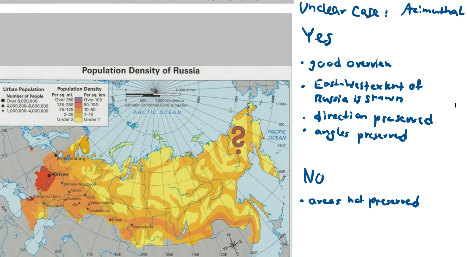
Is this a useful map projection for showing the population density of Russia?

Klicker:
This map projection is?
Conformal (angles preserved - see circles, ellipses would mean angle distortion)
Azimuthal

Klicker:
This map projection is?
Equidistant
Klicker:
This map projection is?
Conformal (distorted areas, preserved angles)
