4/3: CLIMATE & BIOMES
1/12
There's no tags or description
Looks like no tags are added yet.
Name | Mastery | Learn | Test | Matching | Spaced | Call with Kai |
|---|
No analytics yet
Send a link to your students to track their progress
13 Terms
Weather
- atmospheric conditions over a short period time
current conditions/individual events (today,tmrw,week)
what you get
Climate
- avg annual patterns of temp & precipitation over long periods of time
what you expect
Climatographs
- climate graph demonstrating avg temp & precipitation for a location over a course of a year
x-axis: months (jan-dec)
y-axis: bars; precipitation (rain/snow), line; temperature
helps determine biome, temp range, warmest/coldest months, wettest/driest months
large range = more seasonal climate, small range = stable climate
Davis Biome: Temperate Shrubland & Woodland
hot, dry summers
cool, moist winters
dense vegetation
vulnerable to summer fires
found globally: south africa, australia, asia
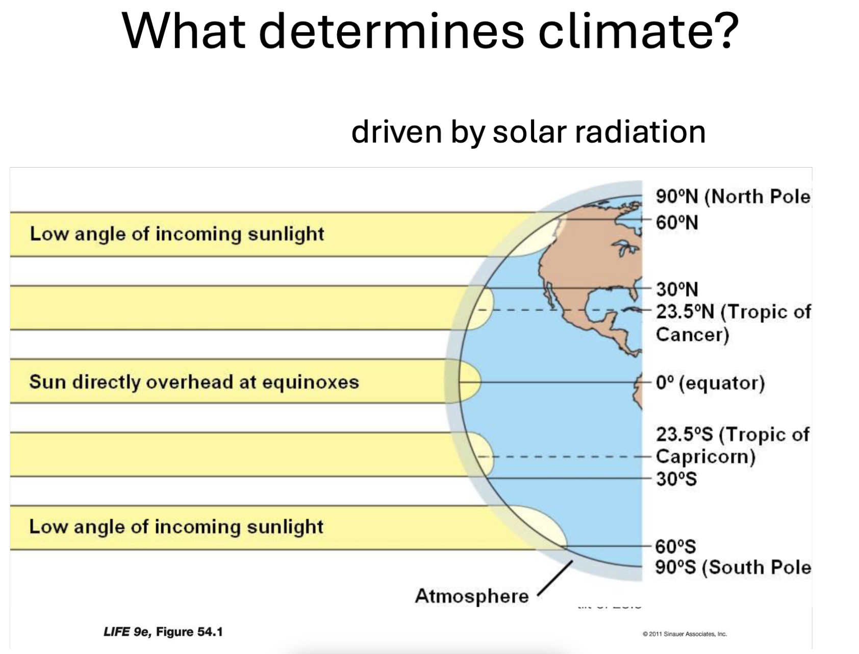
Q: What determines Climate?
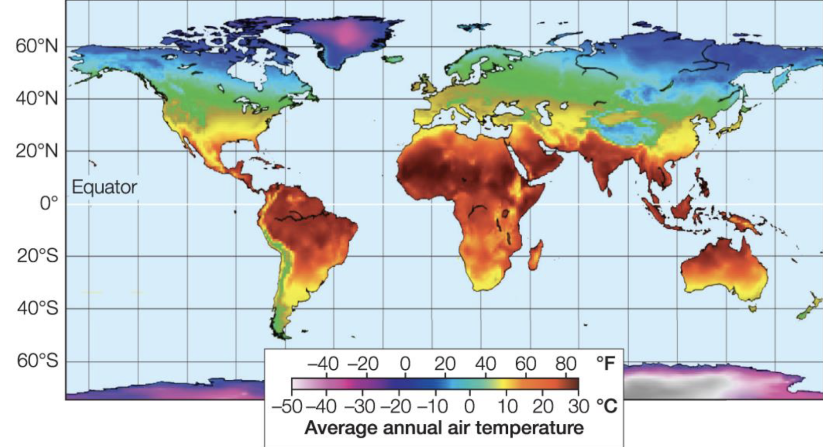
- incident solar radiation; amount of sunlight an area receives
near the equator/low lat (0˚-30˚): direct sunlight; hotter climates, tropical
temperate zones/mid lat (30˚-60˚): moderate climate, distinct seasons
pole regions/high lat (60˚-90˚): low angle of incoming sunlight; colder climates
Earth is tilted (~23.5˚); causing seasons
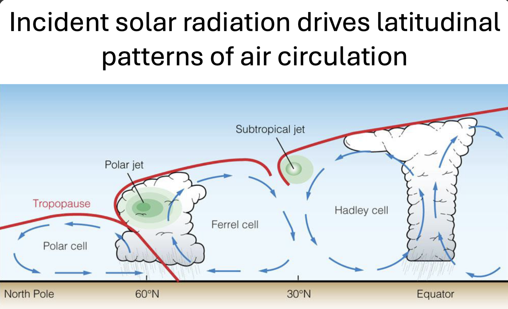
Q: What drives Latitudinal Patterns of Air Circulation?
- incident solar radiation (uneven heating from the Sun creates global wind patterns
Hadley Cell (0˚-30˚) equator
air heats up & rises → cools & forms rain
creating wet tropical rainforests at 0˚ & dry desserts around 30˚ n & s equator
Ferrel Cell (30˚-60˚) mid-latitudes
air flows from 30˚→ 60˚
middle circulation driven by other cells
creating variable weather; storms & changing conditions
Polar Cell (60˚-90˚) high latitudes
cold air sinks at poles
creating cold, dry climates
Jet Streams (red lines) - fast moving winds found btwn cells
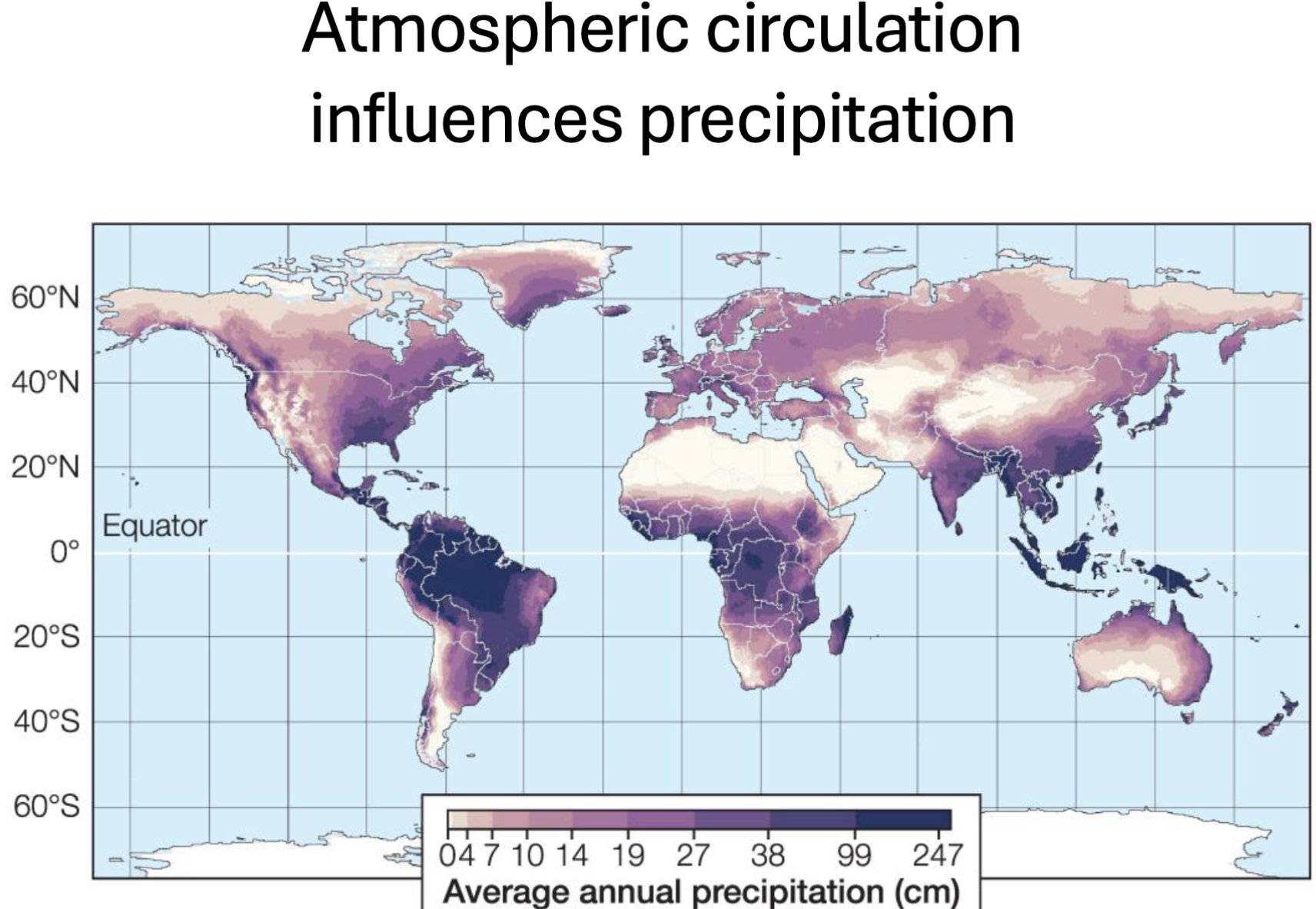
Q: What influences Precipitation?
- atmospheric circulation
- rising warm air → (evaporates & cools) forms clouds → heavy raina
high precipitation near equator (0˚) due to strong sunlight (rainforests; amazon, congo)
little to no precipitation around (30˚) due to sinking air warming (desserts; sahara, arabian, australian)
moderate/dynamic precipitation (30˚-60˚) due to interactions of warm & cold air masses along the polar front (U.S., europe)
low precipitation (60˚-90˚) due to cold air sinking & little moisture in air (north & south poles, alaska, antartica)
Q: What influences Vegetation?
- controls what plants can survive in a region through temp & precipitation
- influences type, density, & diversity of vegetation
warm & wet → dense vegetation
hot & dry → sparse vegetation
moderate temp & rain → grasslands
cold temp → limited vegetation
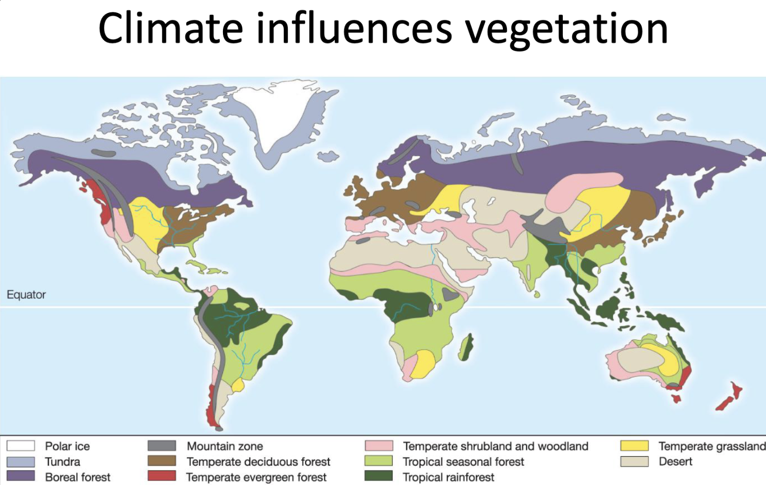
Biomes
- the world’s major communities, classified by predominant vegetation & characterized by adaptations of organisms to a particular climate.
tundra
boreal forest
mountains
temperate deciduous forest
temperate evergreen forest
temperate shrubland & woodland
tropical seasonal forest & savannahs
tropical rain forest
temperate grassland
dessert
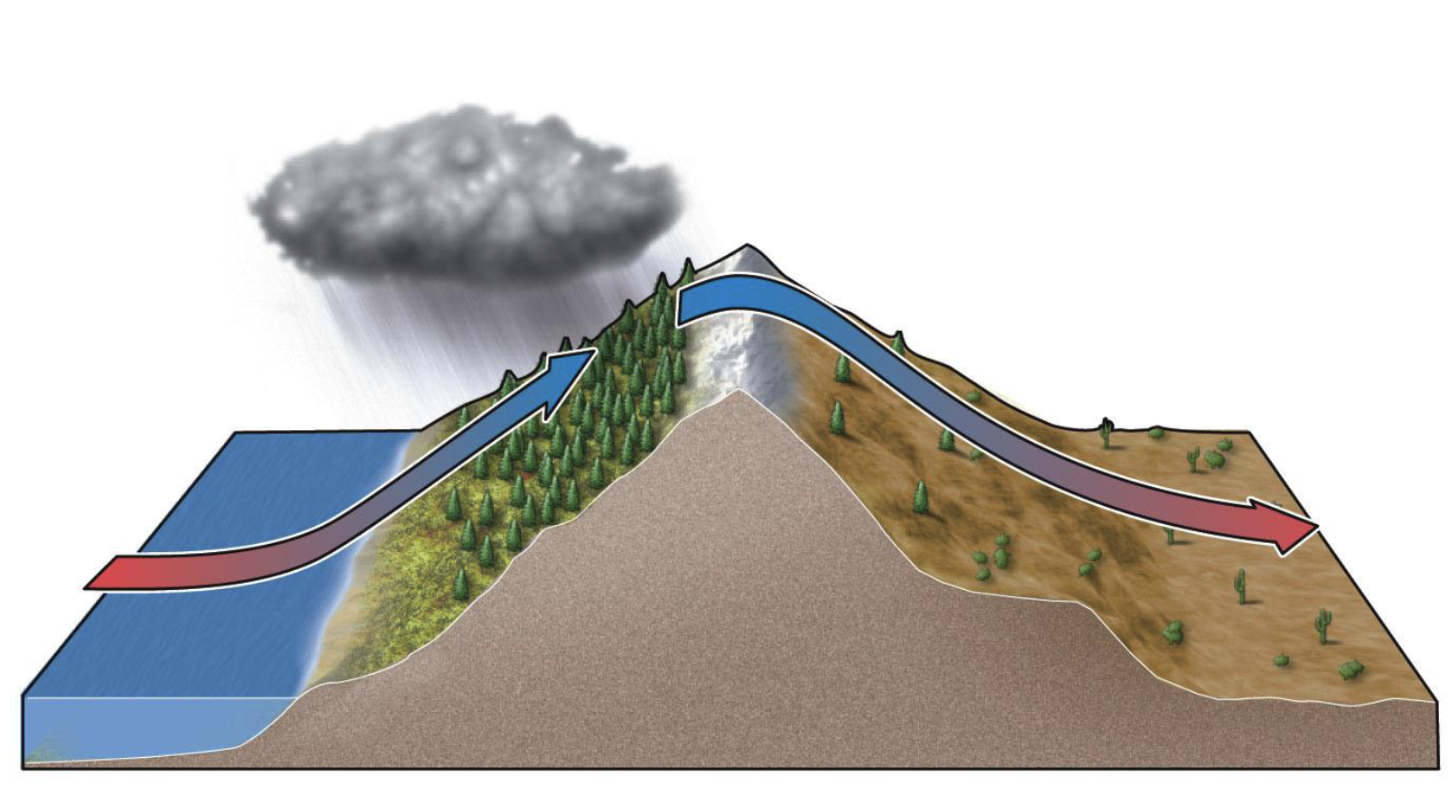
Rain Shadow Effect
- moist air rises over a mountain, cools & precipitates on the windward side → then descends as warm and dry air on the leeward side, creating dry conditions
double whammy - occurs when dry air picks up moisture once again & as it ascends it creates an opportunity for another rain shadow effect (wet, dry, wet, dry)
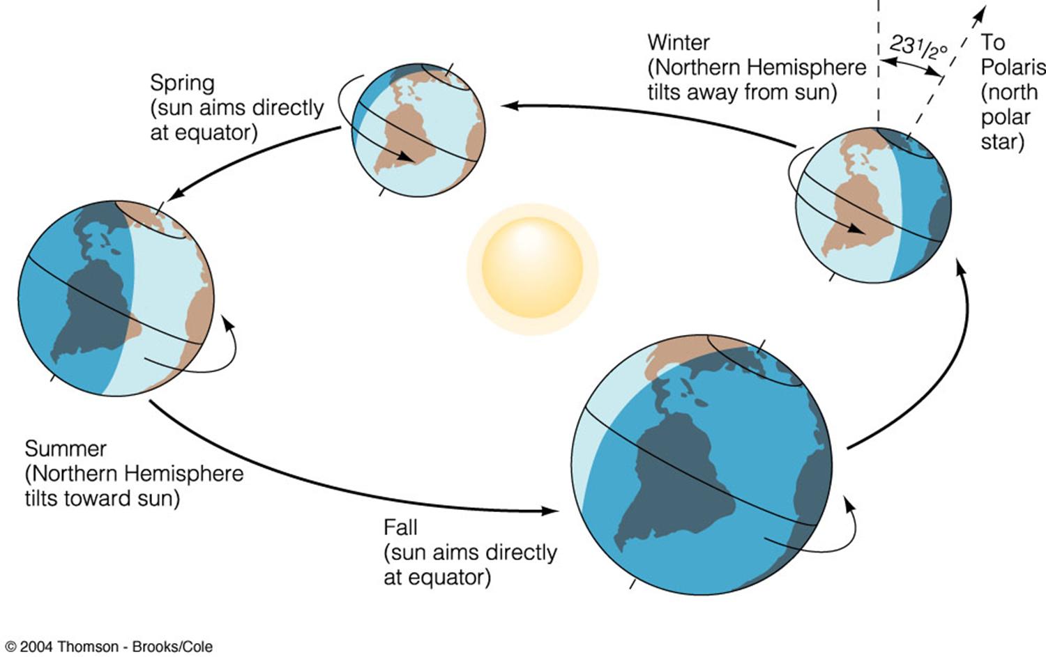
Seasonal Variation in Climate
- change in temp, sunlight, & precipitation over the year (seasons)
caused by Earth’s tilt (23.5˚) & as it orbits the sun
diff parts of Earth get diff angles of sunlight
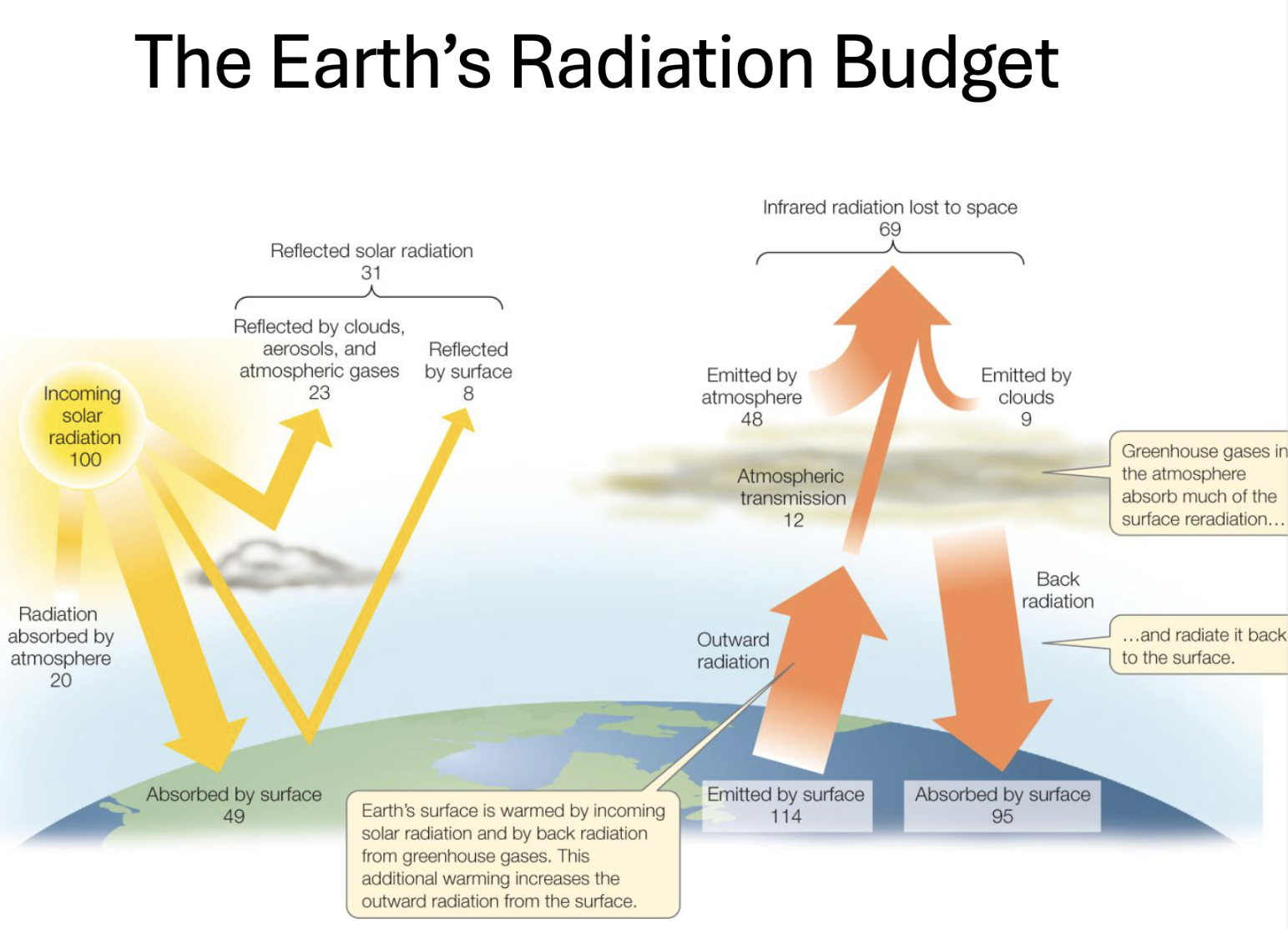
Earth’s Radiation Budget
- the process of incoming & outgoing energy from the sun emitted or reflected by Earth into space
Incoming solar energy (100 units of sunlight)
- 31% reflected back to space
23% by clouds/atmosphere
8% by Earth’s surface
- 69% is absorbed
20% by atmosphere
49% by Earth’s surface
absorbed energy warms planet
Re-emitted energy
absorbed energy gets released as infrared (heat)
surface emits 114 units of heat upward
Greenhouse effect
greenhouse gases absorb & trap most of outgoing heat
and send back down to Earth (back radiation) & out to space
Back radiation
surface absorbs 95 units
heating Earth by sunlight & heat trapped & re-radiated by atmosphere
Energy leaving Earth
69 units are lost to space
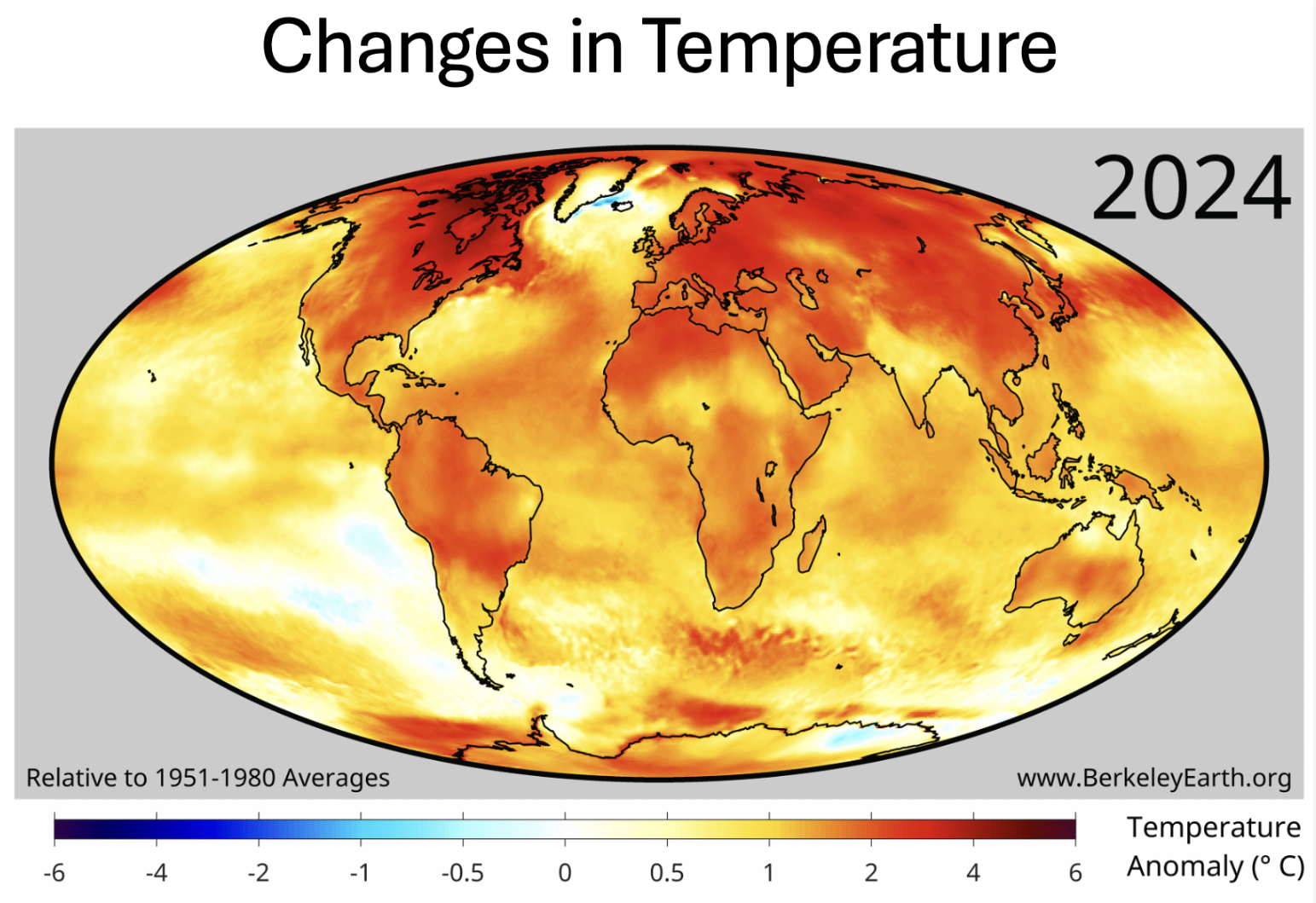
Polar Amplification
- Artic & Antarctic warm faster than global abg as planet heats up
solar radiation reflects off sea ice, but as it mets deep ocean absorbs heat & increases temp