ADVANCED PB GLOSSARY
1/89
There's no tags or description
Looks like no tags are added yet.
Name | Mastery | Learn | Test | Matching | Spaced | Call with Kai |
|---|
No analytics yet
Send a link to your students to track their progress
90 Terms
AIS
Automatic Identification System
Almanac
Information about ports & harbours including tidal heights, curves. Published annually
Anticyclone
High pressure weather system
AVS
Angle of vanishing stability. Angle from the vertical beyond which a craft will no longer return upright but will capsize
Back Bearing
A bearing taken astern of a crest (using hand held bearing compass) to a feature to ensure vessel stays on intended track
Bearing
Direction of one object from another
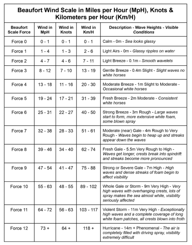
Beaufort sale
International scale of wind speed and wave height
Broaching
When a vessel becomes broadside to a wave and is rolled onto its side
Bucket
Deflector used on jet drives to redirect water flow
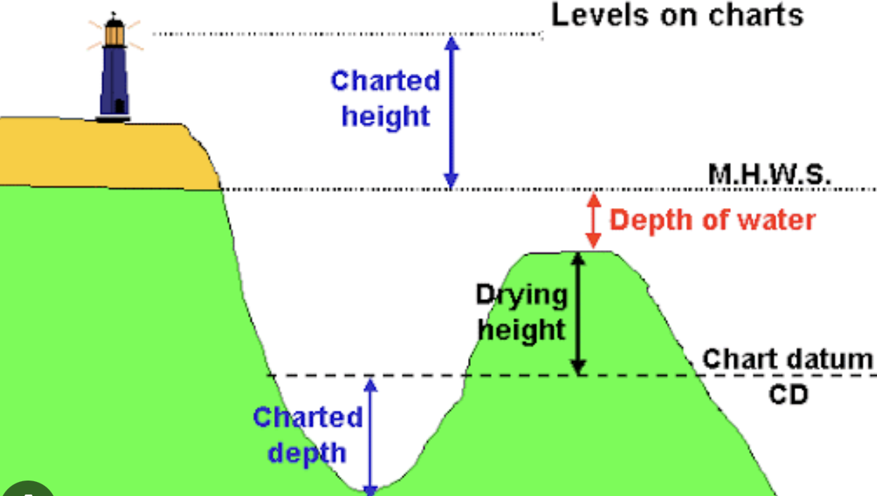
Chart Datum
The vertical level to which charts are drawn representing the lowest astronomical tides (LAT)
Chartplotter
Electronic chart system
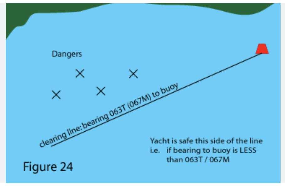
Clearing lines / ranges
Position lines/range to clear hazards on charts / chart plotters
COLREGS
Collision regulations - International regulations preventing collisions at sea
Compass Rose
Representing of compass card on chart
Contour Lines
Lines on a chart linking points of equal depth
COG (Course over ground)
The course a craft is processing along although the craft may not be pointing in the direction
Crabbing
Moving sideways without any ahead or astern movement
Cross Bearing
Bearing to port or starboard
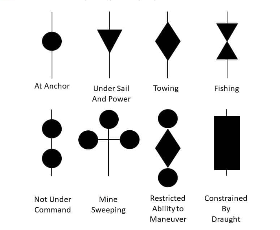
Day shapes
Shapes or cones (combinations of) to indicate why vessels movement may be constrained
Dead reckoning
Position based on time distance and direction traveled though water from know position
Deflector
Used on jet drives to redirect water flow
Depression
Low pressure weather system
Deviation
Compass error caused by presence of electromagnetic fields or ferrous objects (iron or alloys containing a high percentage of iron)
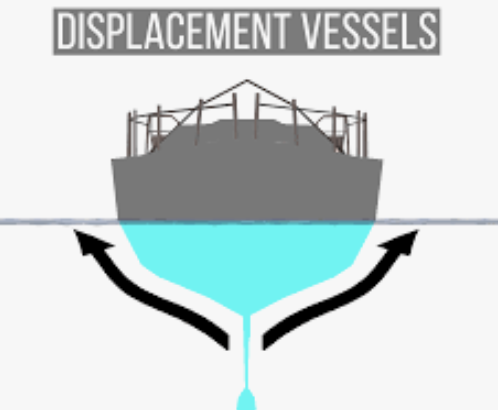
Displacement hull
Traditional shape hull where craft moves through (displaces)
DSC
Digital selective calling system, part of a VHF radio
EBL
Electronic bearing line. Found on radar to measure bearing s to an object
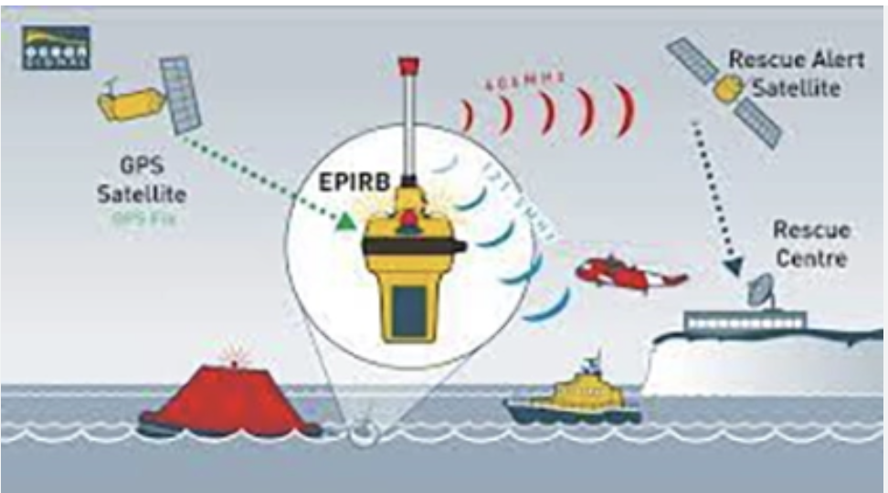
EPRIB
Emergancy position indicating radio beacon
Ergonomics
Study if efficiency of persons in working environment such as how instruments and controls and laid out at the helm.
Estimated position
Dead reckoning but with total steam adding in to
Ferry gliding
Technique for moving a craft sidewise balances steam or wind, the angle of the credit and ahead or astern throttle
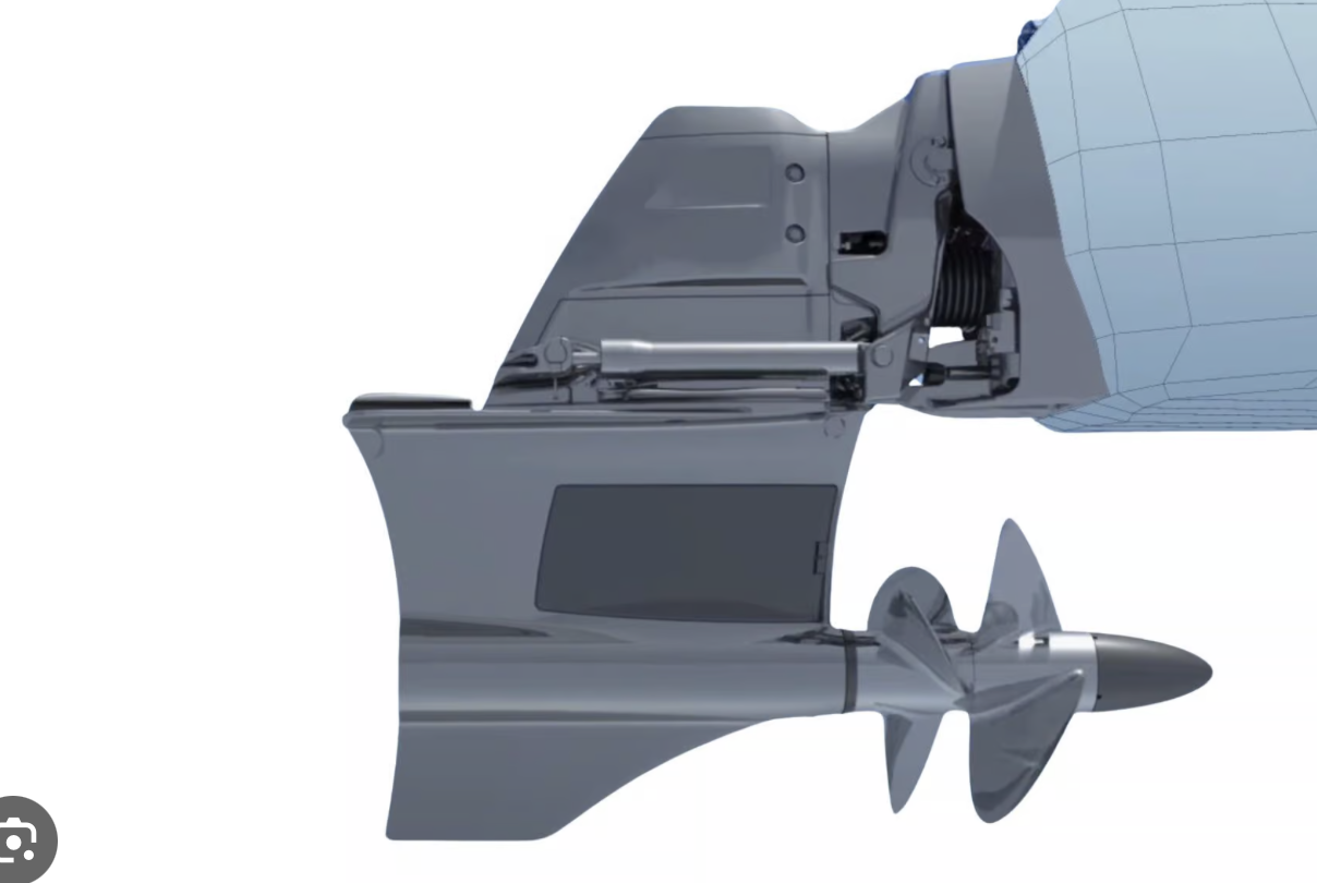
Forward-facing drive
Pivoting drive system through hull of craft with propellers facing forwards
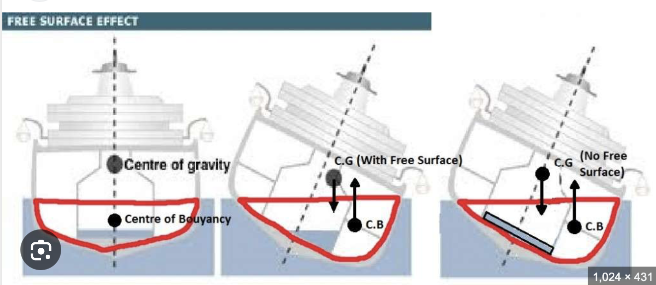
Free surface effect
Loss of stability of vessel resulting from water in bilges or on deck that is unable to drain rapidly
GNSS
Global Navigation Satellite System
Ground Track
Direction the craft is actually moving over surface of the earth
Head Bearing
A bearing taken ahead of a cradt using a hand bearing compass to a feature to ensure vessel stays on intended track
Heading
Direction in which the vessel is actually pointing at any given time
Helm
Stearing positon H
Horizontal chart datum
The datum the chart is drawn to E.G WGS84
IMO
International Maritime Organisation
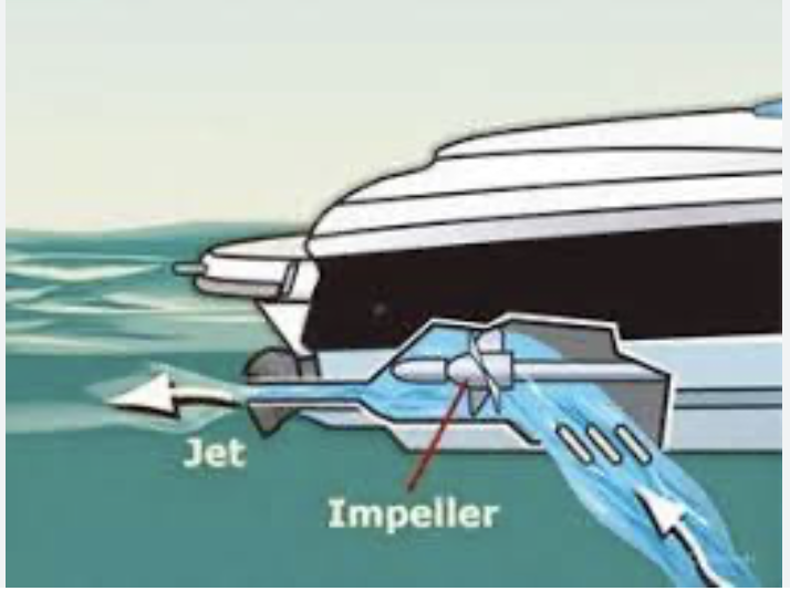
Impeller
Propeller encased in a jet drive unit
Jet Drive
Water pumped through a steerable nozzle to create thrust and turn a craft
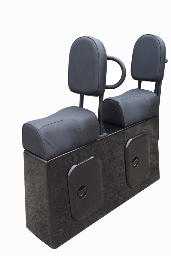
Jockey Seat
Astride seats
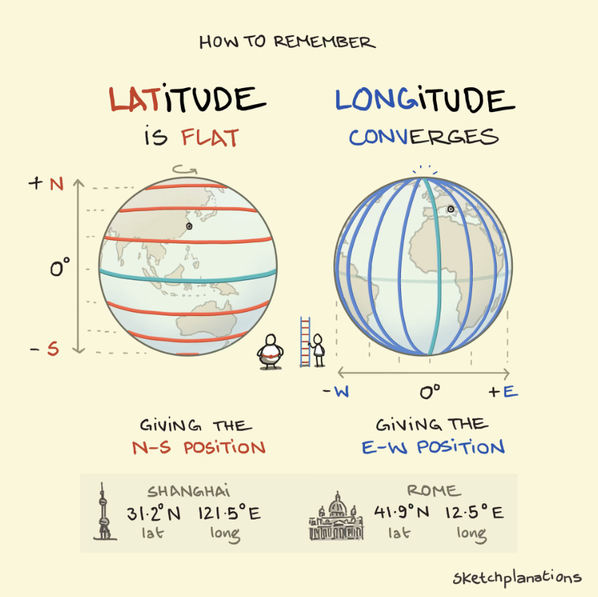
Latitude
lines bisecting the earth horizontal expressed as an angle relative to equator and measured in degrees and minutes
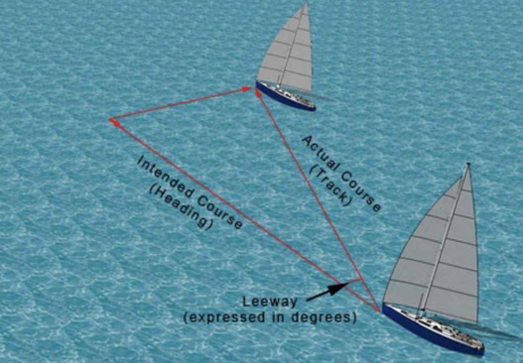
Leeway
Effect of wind on vessel pushing it away from intended track
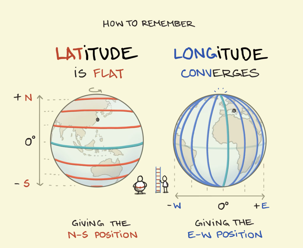
Longitude
Horizontal lines between poles referred to as east or west off the prime meridian - measured in degrees and minutes
MARPA
Mini automatic radar plotting aid
MARPOL
International Convention for the prevention of pollution from ships
MMSI
Maritime mobile service identity - unique number
MRCCs
Maritime rescue co-ordinations centres
Mullions
Vertical bars between the windows in a vessels cabin
NDP
Nominated departure point for vessels operator license
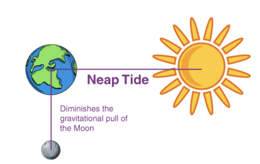
Neap tides
Where the sun & moon act at right angles to the earth leading to more moderate high and low tides
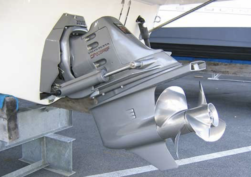
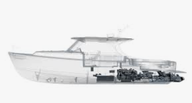
Outdrive
Drive system through stern
Paddlewheel effect
Propwalk
Pilotage
Navigation of vessel within close proximity to land visible object
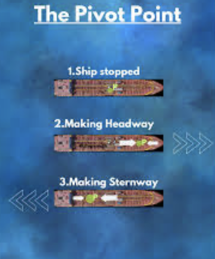
Pivot points
Point in the craft about which it pivots - varies between astern and forward
Planning hull
When gaining speed enable the cradt to travel on the surface of the water
Propwalking
Sideways movement of stern caused by rotation of propeller in reverse
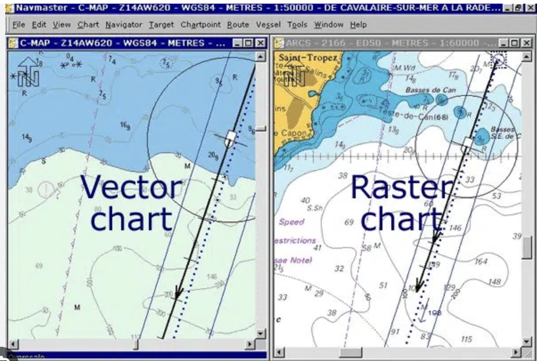
Raster Chart
Direct electronic copy or scan of existing paper chart
Rule of Twelfths
Mathematical process for estimating heights of the rides at given the time between high and low waters
Safe Haven
A place that a vessel cpu;d see setter in poor conditions. A term relevant to the licensing of commercial craft
Secondary ports
Smaller ports which don’t have their own tidal curve in an almanac. An adjustment process is used to utilise a tidal curve from a standard port
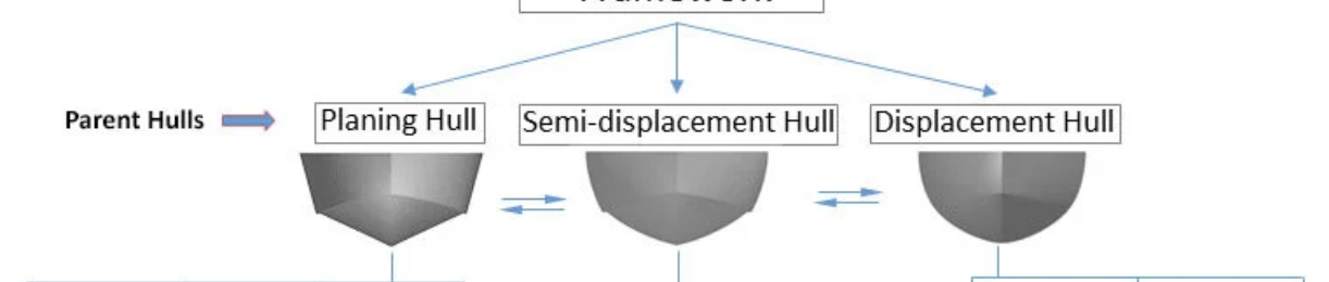
Semi Displacement Hull
Hull shape combining benefits of displacement and planing type
Shaft-drives
Drive systems for inboard engines entitling a shaft rotating the propeller and rudder for steerage
SOLAS
Convention for the safety of life at sea
SOG - Speed Over Ground
The actual speed a craft is achieving after stream and wind have been factored in
Spring tides
Where the sun and moon act together to produce higher high tides and lower low tides
Springs
Morning lines running diagonally from boat to berth to arrest / limit forward/astern movement of the craft
Standard Ports
Lager ports that appear in almanacs with their own tidal curves and tidal data
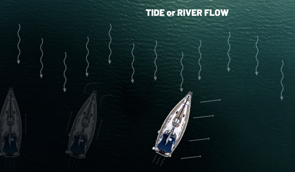
Stream
Movement if water caused by tide or river flow
Strum box
Strainer on the bilge end of the build pump pipe
Stuffing
In a following sea a craft is driven over a wave and ploughs into back of the next one
Synoptic charts
Weather charts given a general view of weather conditions
Thruster - bow & stern
Bow & stern thrusters
Tidal Streams
Horizontal movement of tides
Tidal Vector
Line drawn on a chart representing direction and flow of tide
Transit
Line up two points either to native along or to establish position with
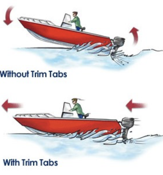
Trim
Changing the boats attitude for the best safety comfort and consumption and handling
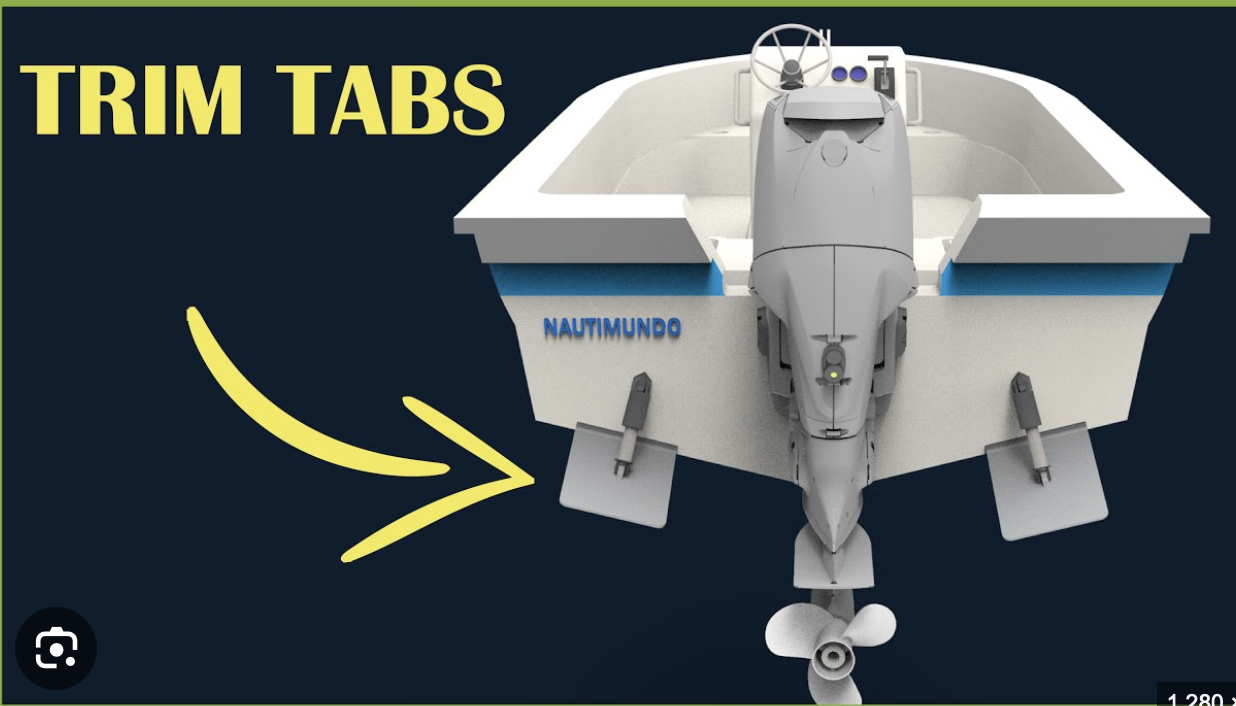
TRIM TABS
Mechanical driven plates mounted either side or stern to adjust to trim
TSS
Traffic Separation Scheme
UNCLOG
United Nations convention of the law of the sea
Variation
Difference between magnetic north and true north
Vector Chart
Digitised version of a paper chart with ability to select/hide some information
VRM
Variable range marker. Found on Radar often used to measure distance to object
Waypoints
GNSS position storage
WGS84
World geodetic system 1984 datum standard
Williamson turn
Method of turning to return along vessels own wakeWind
Windage
Wind resistance of the side area of boat
XTE
Cross tract error - known as off course distance to one Side of the exact tract between two waypoints