CC Cycle 2 Geography Weeks 1-24 Memory Master
1/149
There's no tags or description
Looks like no tags are added yet.
Name | Mastery | Learn | Test | Matching | Spaced | Call with Kai |
|---|

150 Terms

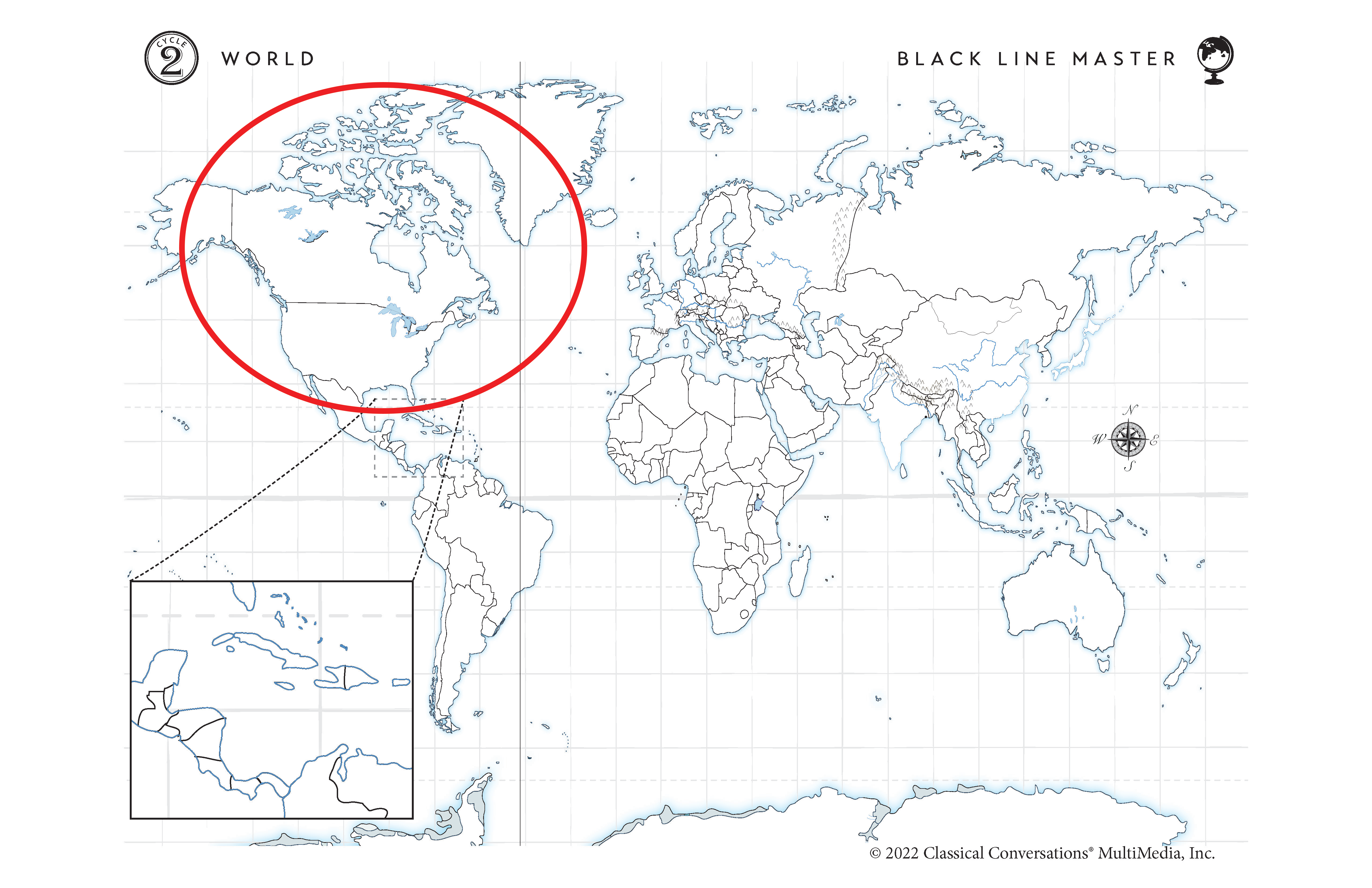
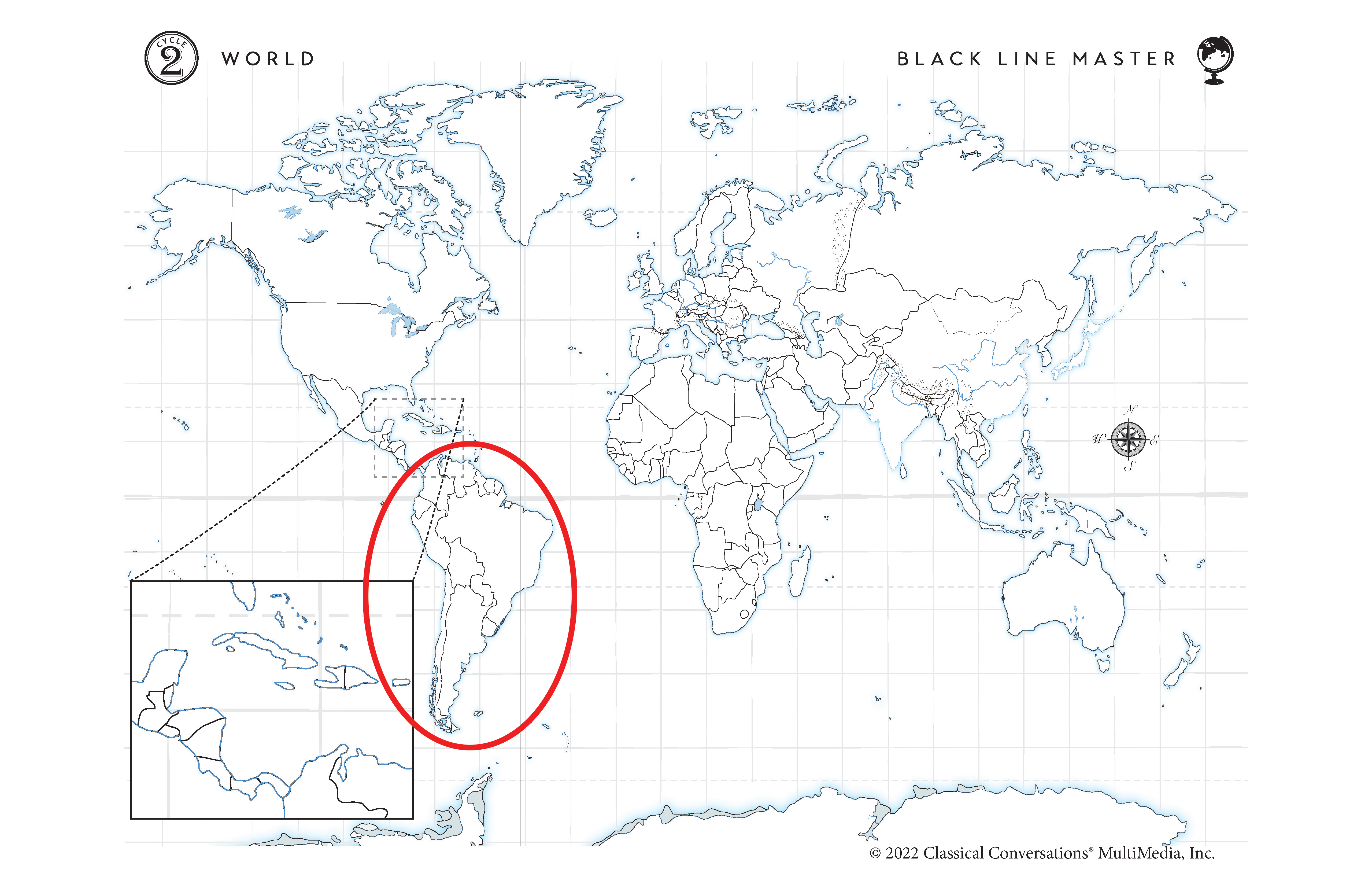
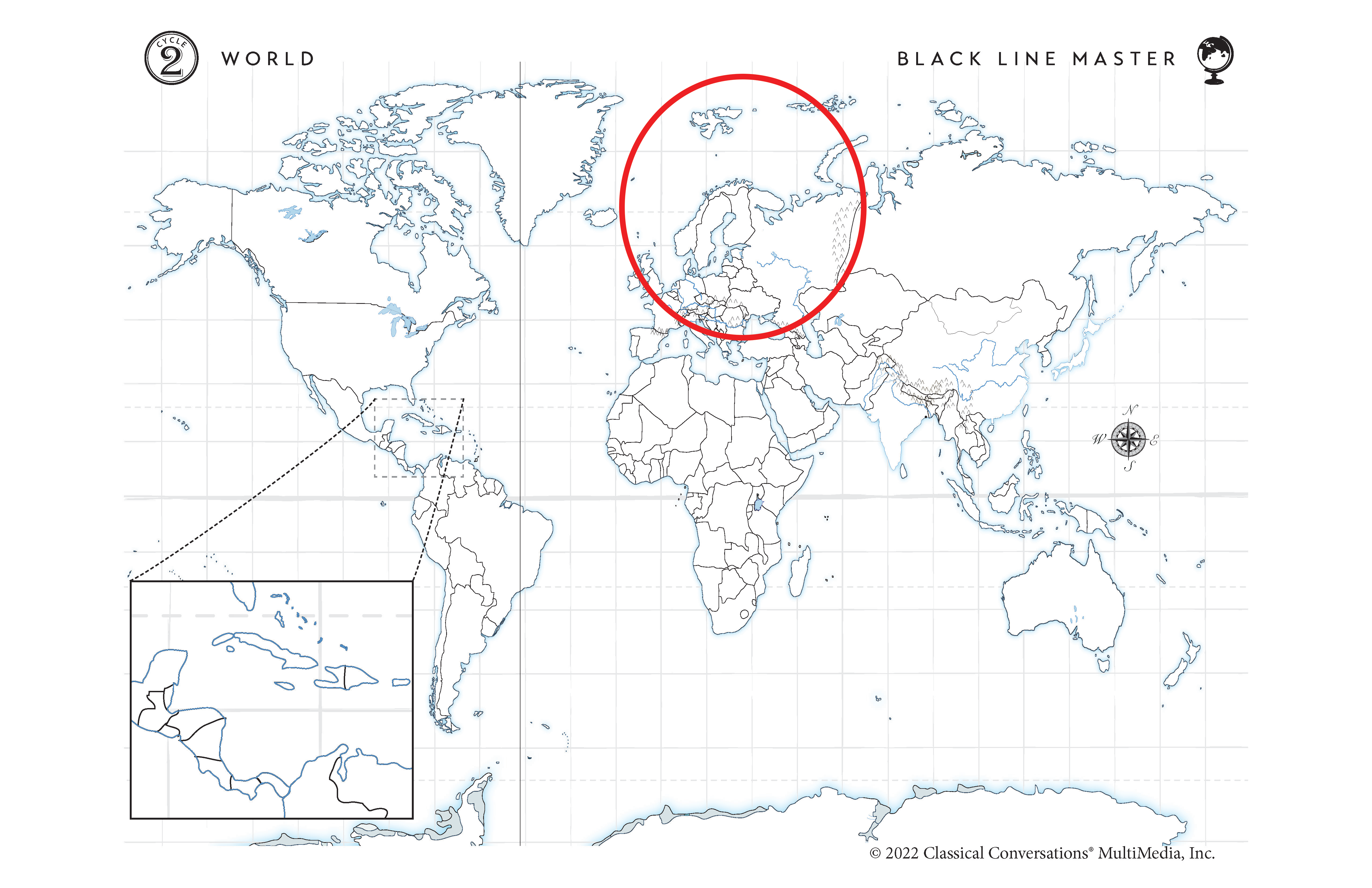
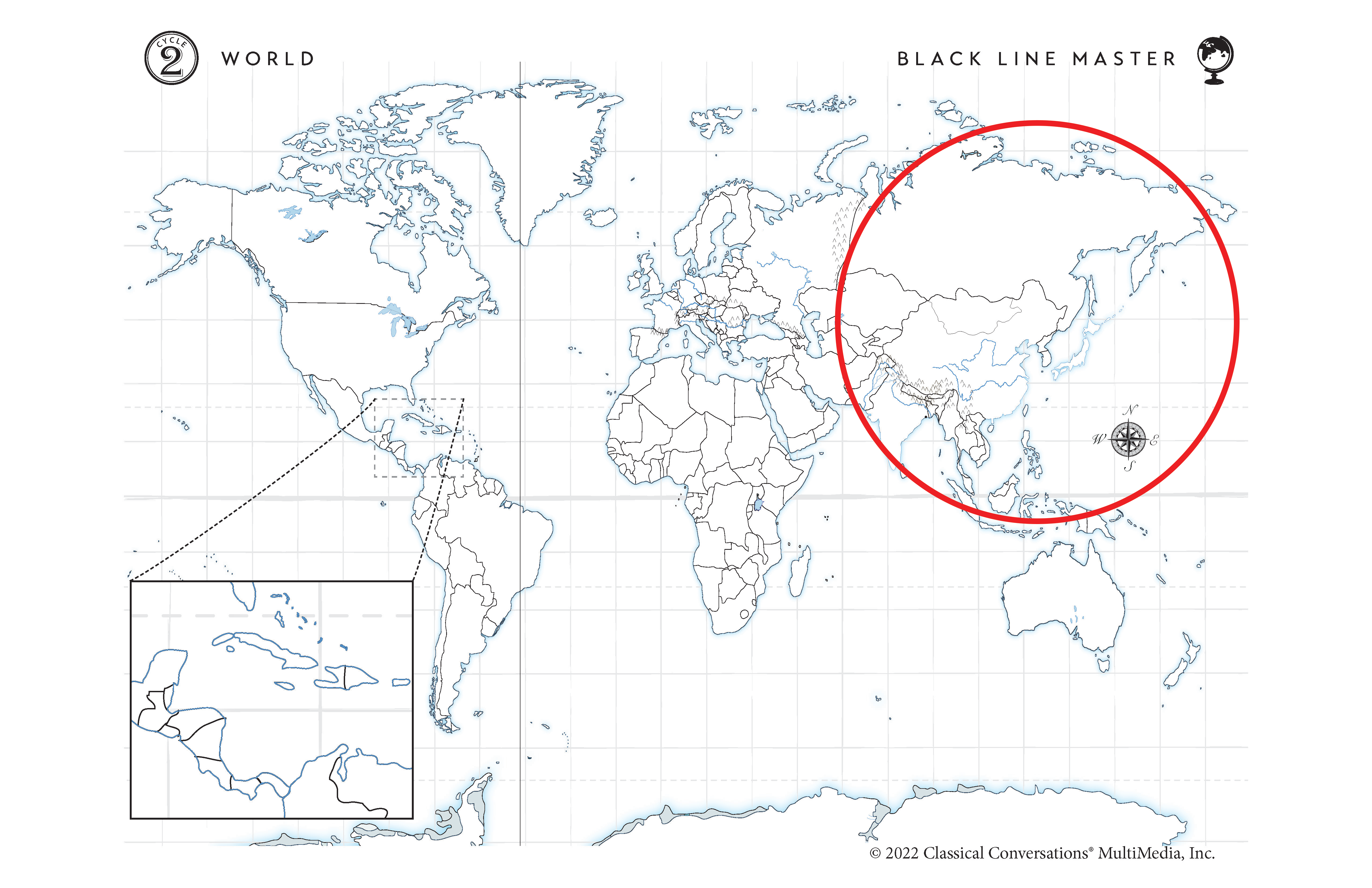
W1 Continents & Oceans Review Card
Continents:
North America, South America, Europe, Asia,
Africa, Australia, Antarctica
Oceans:
Indian Ocean, Arctic Ocean, Atlantic Ocean, Pacific Ocean,
Southern Ocean

Tell me the continent
Blue outline. North America

Tell me the continent
Red Outline. South America

Tell me the continent
Orange Outline. Europe. The Mediterranean Sea, quack, quack, divides Europe and Africa.

Tell me the continent
Green Outline. Asia. To the East of Europe.

Tell me the continent
Purple Outline. Africa. South of Europe. The Mediterranean Sea, quack quack, divides Europe and Africa.

Tell me the continent
Teal Outline. Australia. Island South of Asia (Green).

Tell me the continent
Gray Outline. Antarctica. Bottom of the map.

Tell me the ocean
Pacific Ocean to the West of the USA and North America (Blue), and East of Asia (Green).

Tell me the ocean
Atlantic Ocean. Between North America and Europe (Green), Africa (Purple).

Tell me the ocean
Indian Ocean. South of India (shark’s tooth) in Asia (Green).

Tell me the ocean
Arctic Ocean. North of Europe (Orange).
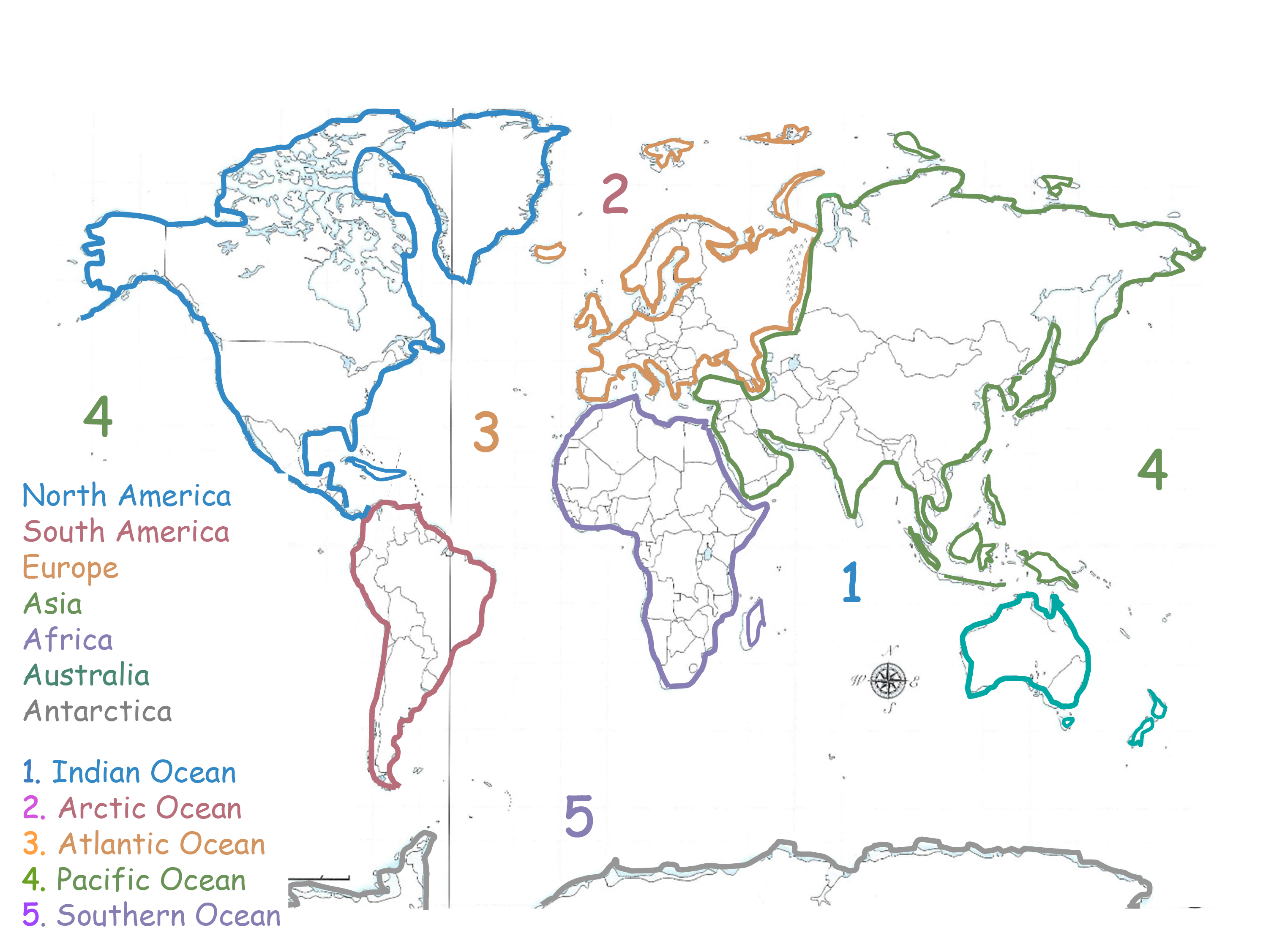
Tell me the ocean
Southern Ocean. North of Antarctica (Gray).


W2 European Waters Review Card
North Sea
Baltic Sea
Adriatic Sea
English Channel
Mediterranean Sea


Tell me the body of water
Adriatic Sea. Orange outline. East of Italy (the cowboy boot).

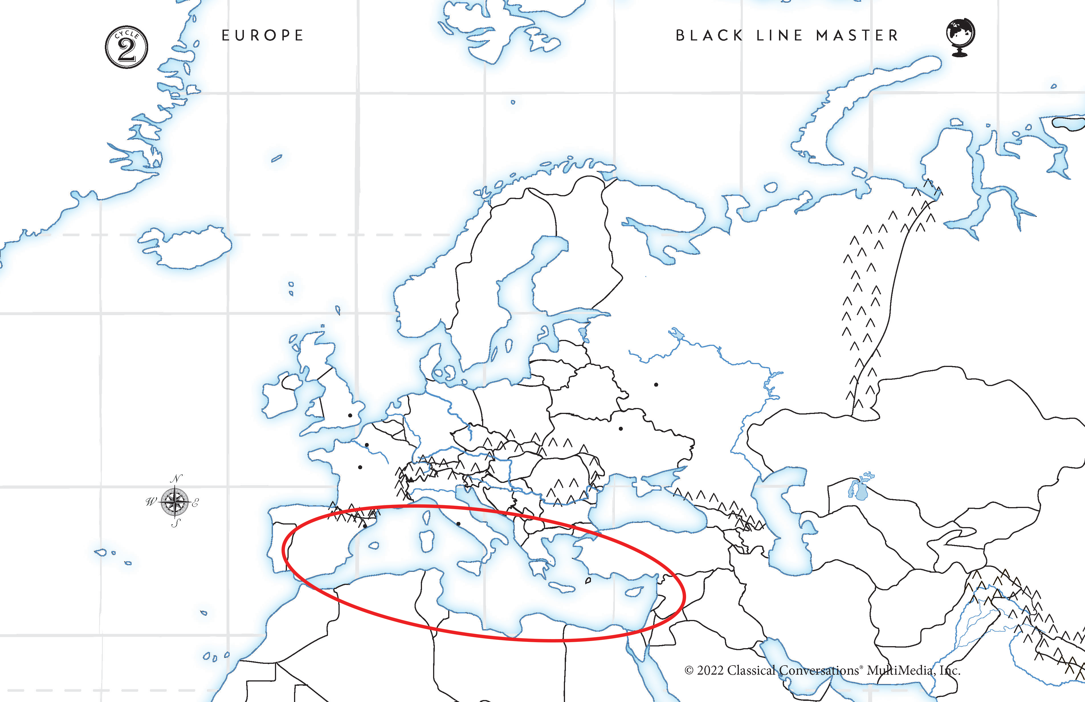
Tell me the body of water
Mediterranean Sea. Purple outline. Shaped like a duck and separates Europe and Asia.


Tell me the body of water
English Channel. Green outline. Between England and France.

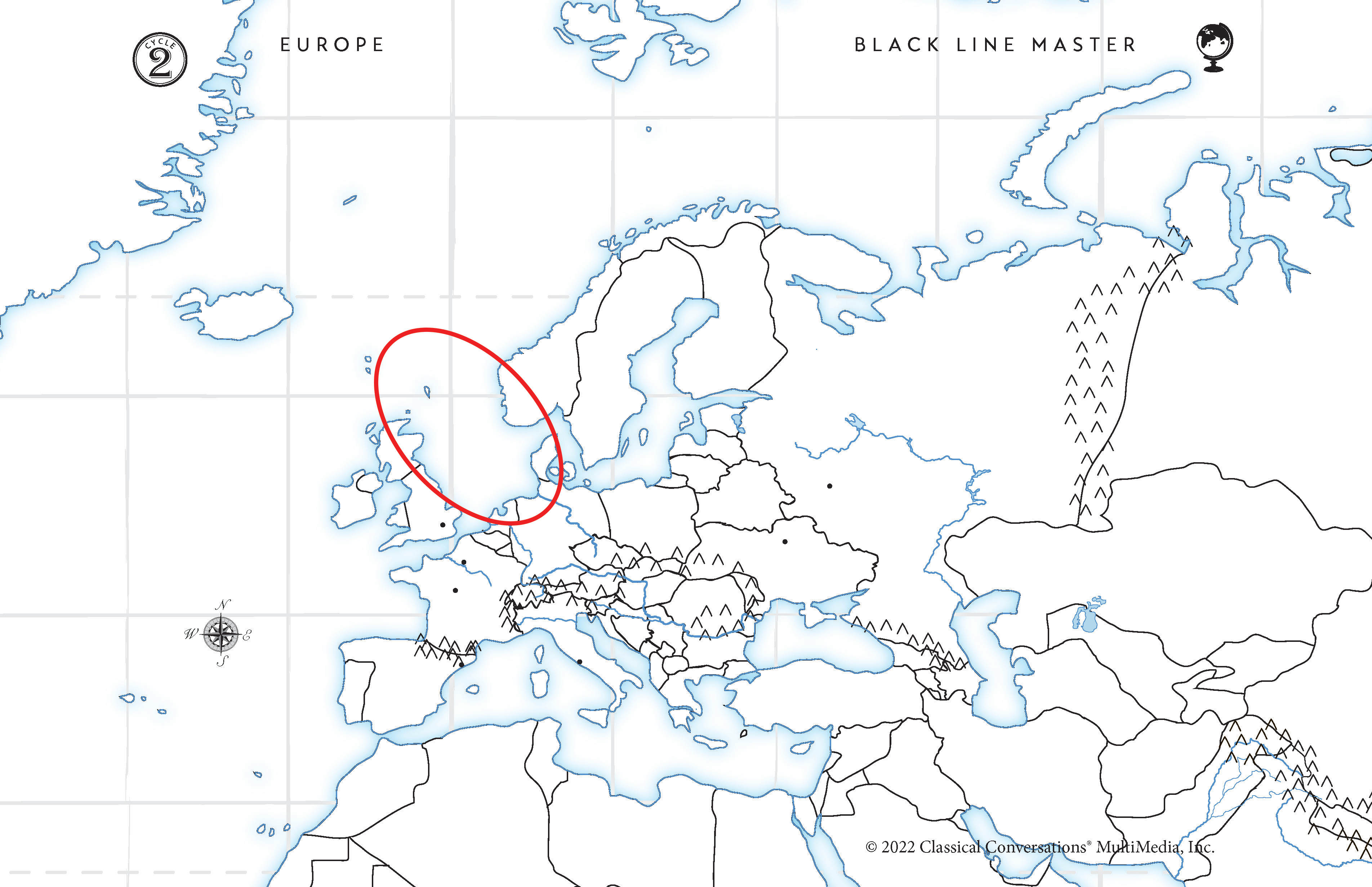
Tell me the body of water
North Sea. Blue outline. East of England
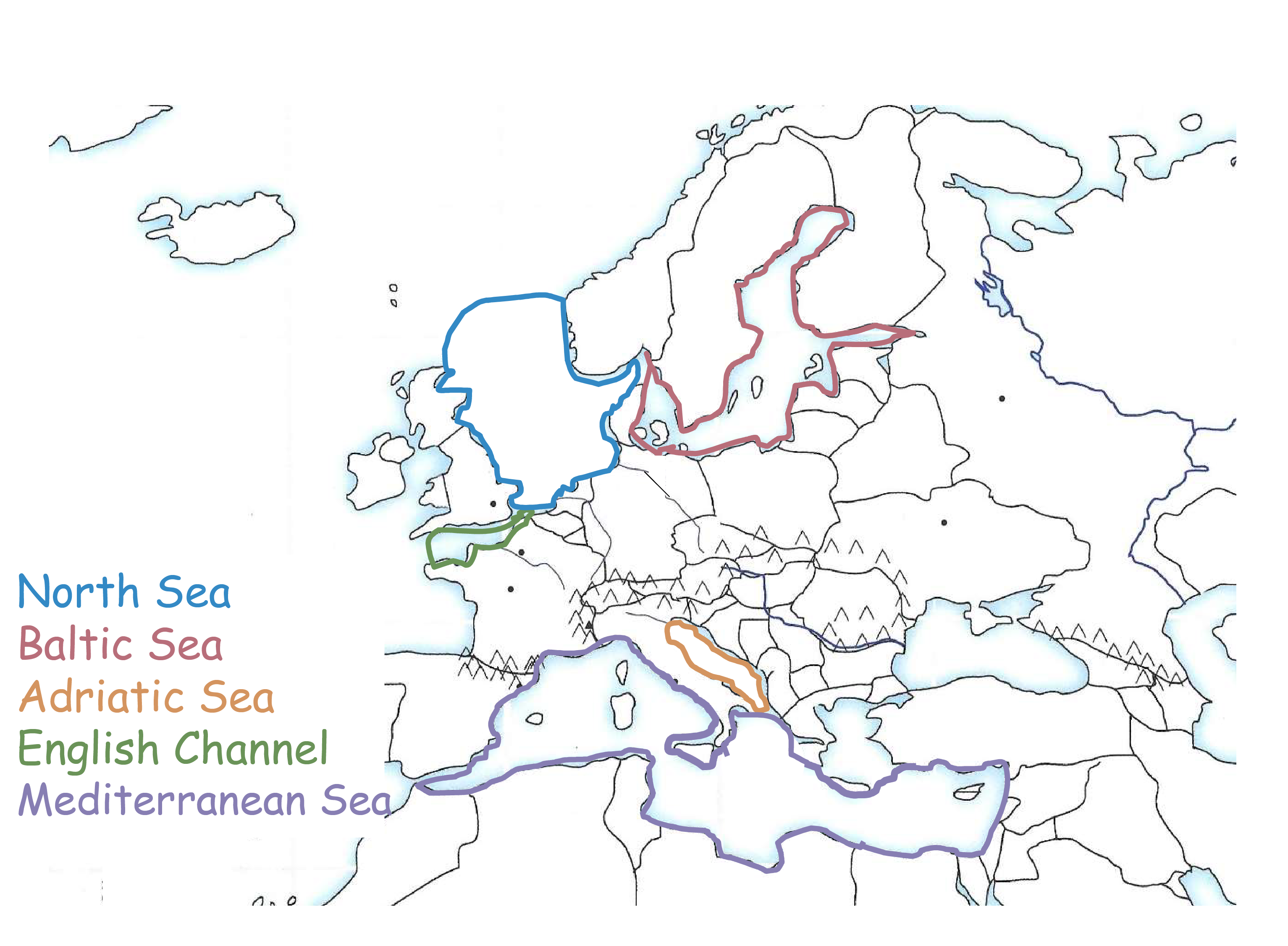
Tell me the body of water
Baltic Sea. Red outline. East of the North Sea and shaped like a dinosaur taking a bite!

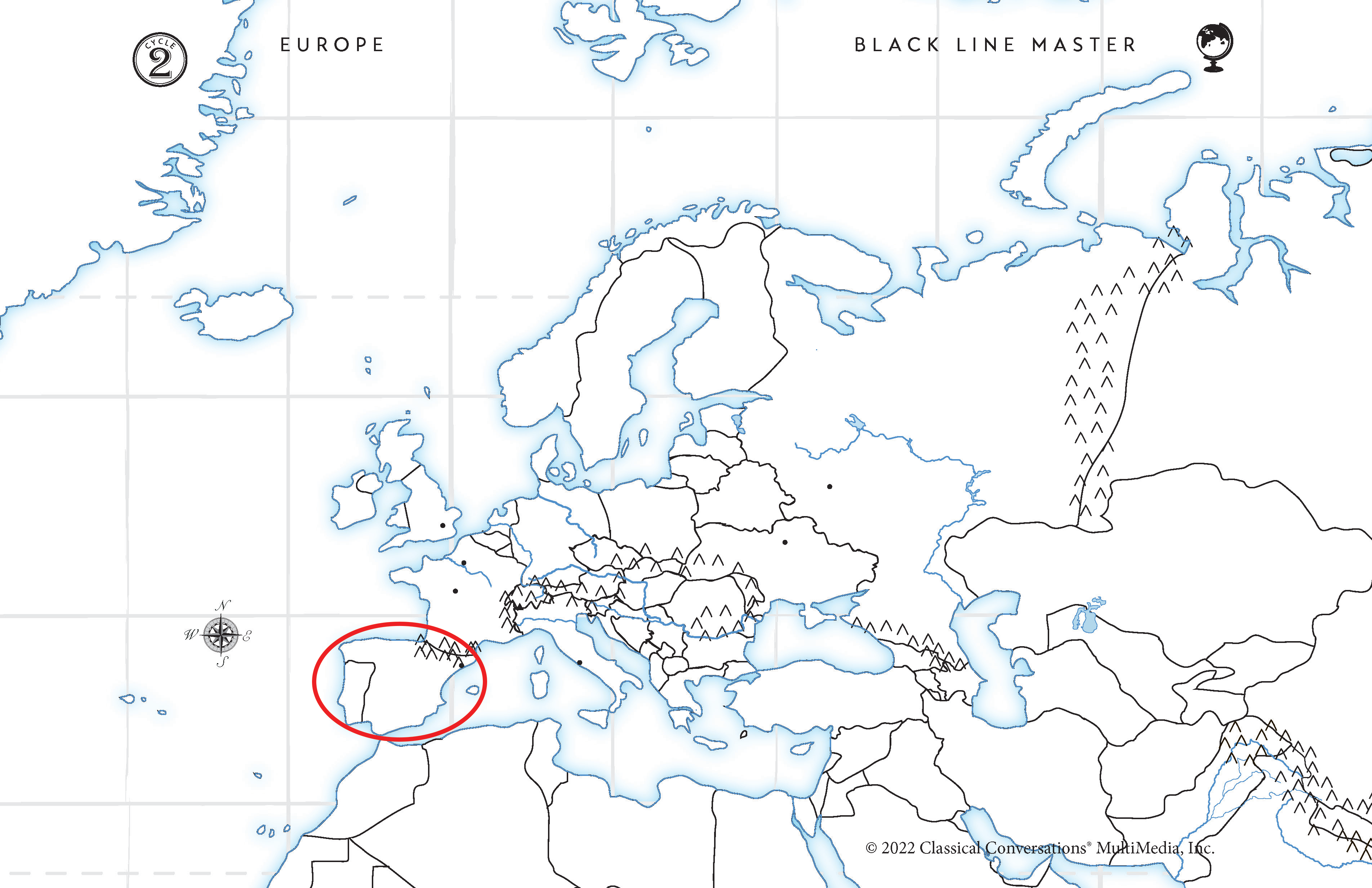
W3 Western European Countries Review Card
Ireland
England
Portugal
Spain
France
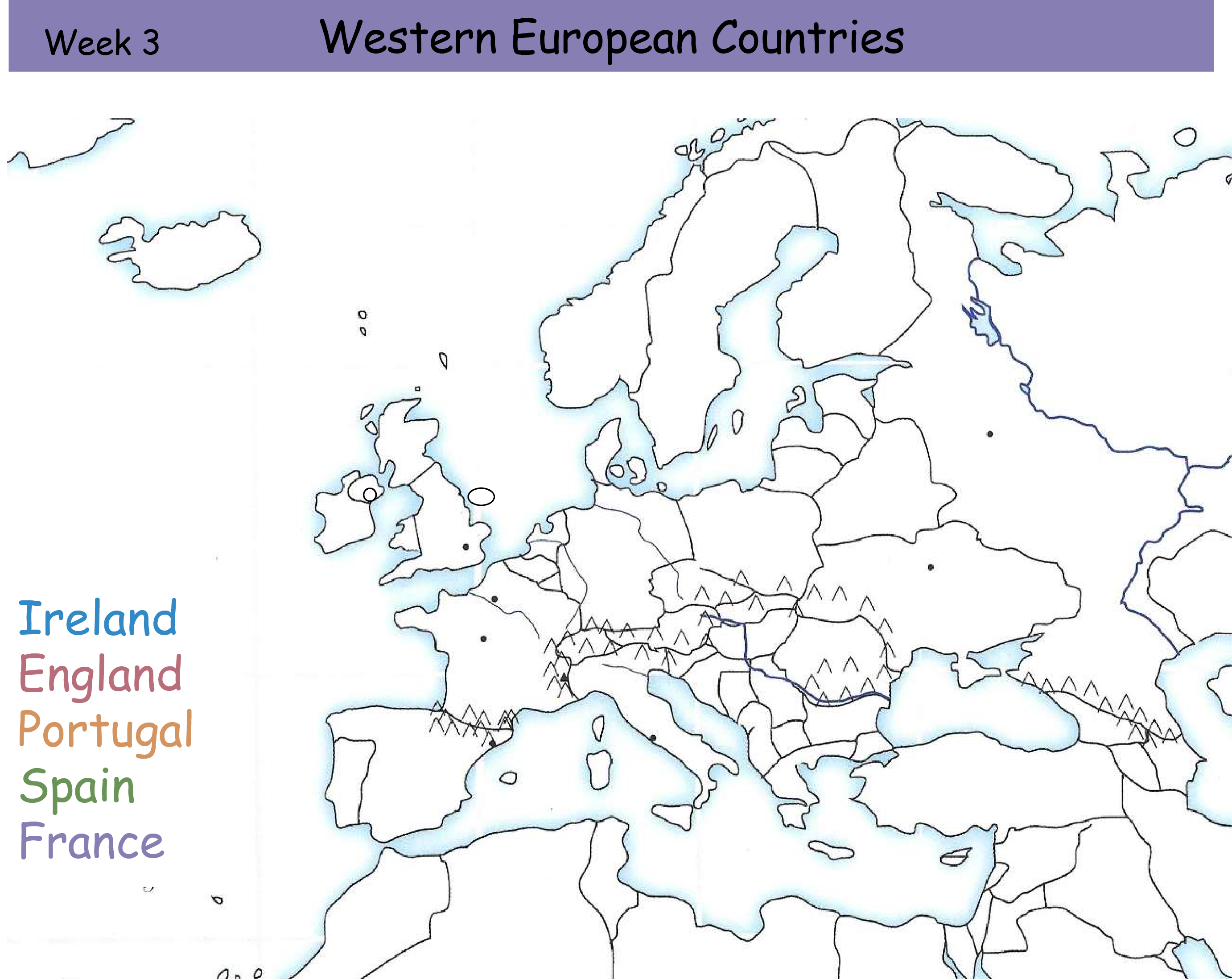
Tell me the country
Blue Outline. Ireland. Look for 2 islands and its the western island.


Tell me the country
Red Outline. England. East of Ireland and North of France.


Tell me the country
Purple Outline. France. Across the English Channel and East of Spain.

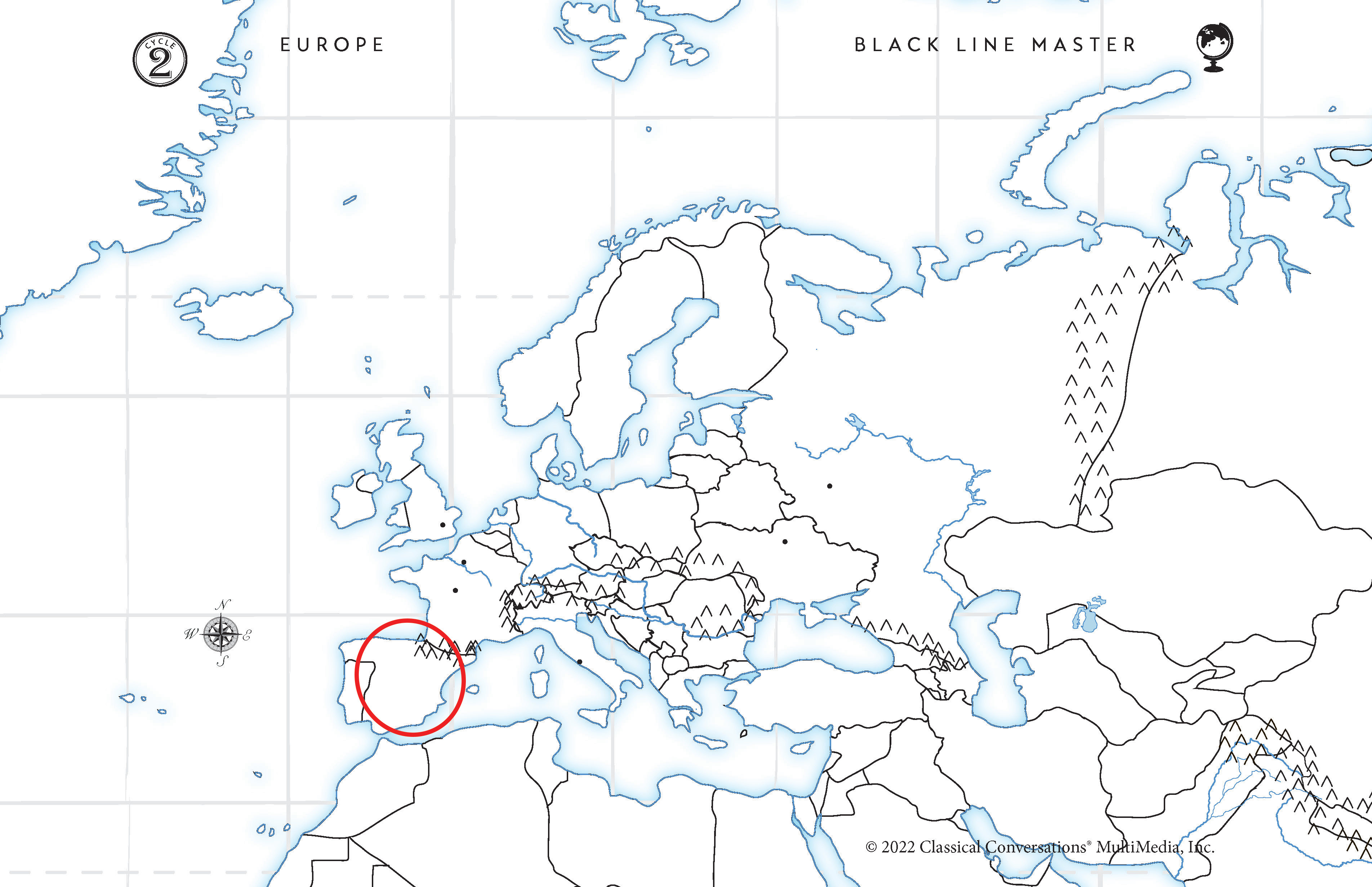
Tell me the country
Green Outline. Spain. Looks like the hair of “pretty Portugal”.
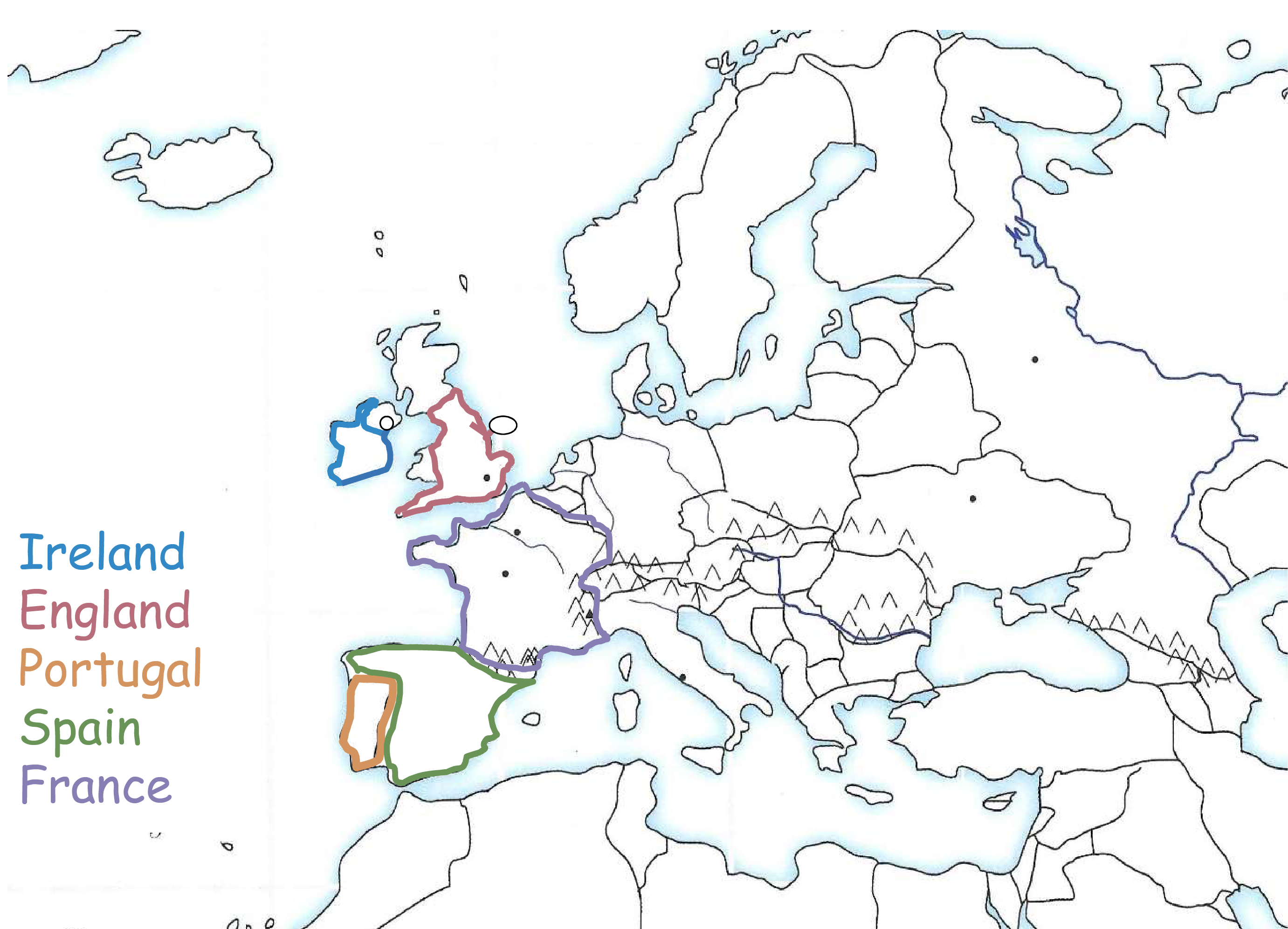
Tell me the country
Orange Outline. Portugal. Looks like a face. “Pretty Portugal”.

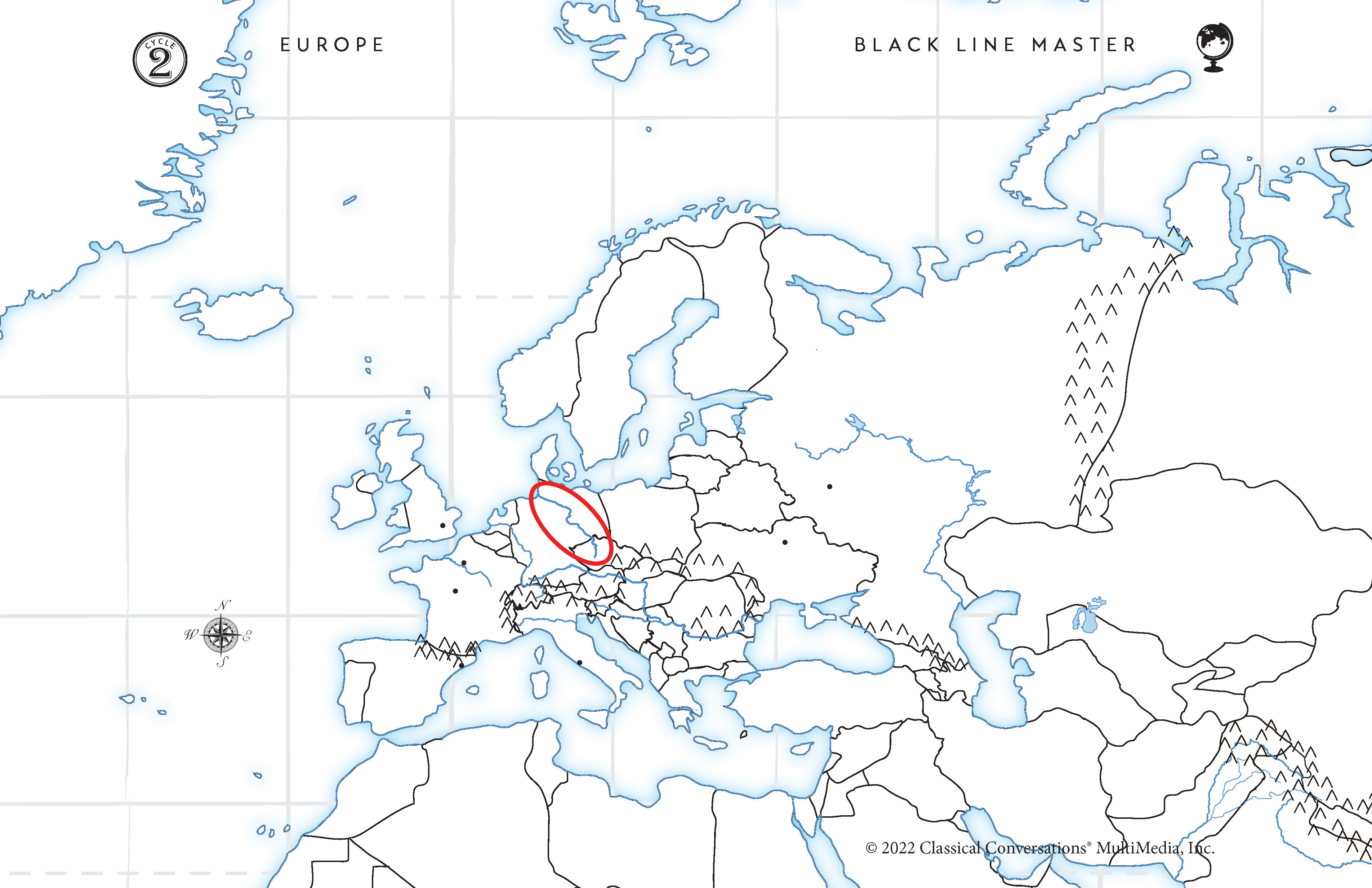
W4 European Rivers Review Card
European Rivers
Seine River
Rhine River
Elbe River
Po River
Danube River
Volga River


Tell me the River
Blue Line. Seine River. Runs through France ending in the English Channel. The Seine, Rhine, and Elbe all run parallel.

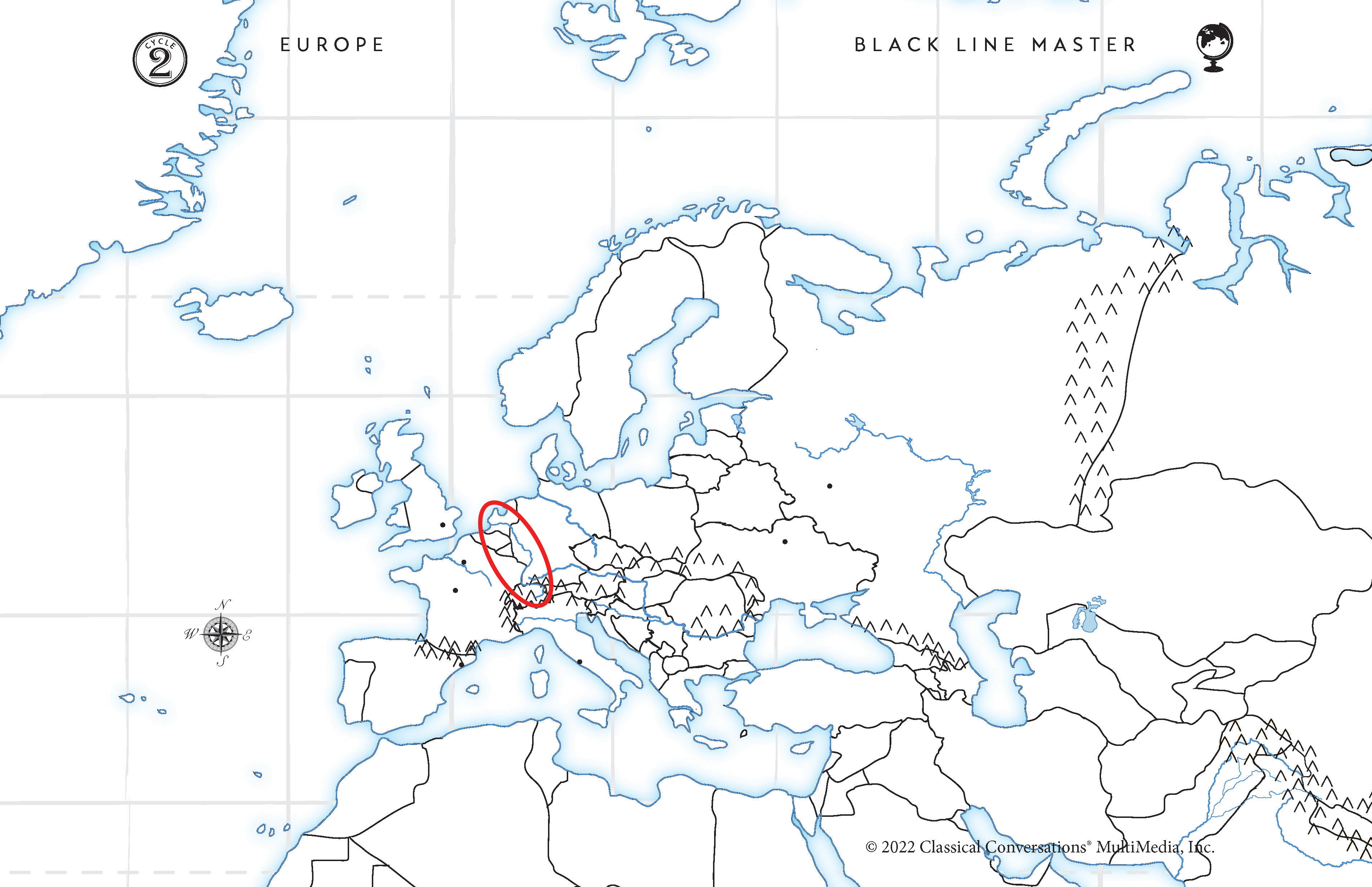
Tell me the River
Red Line. Rhine River. Rounds to the North Sea. Seine, Rhine, and Elbe all run parallel.

Tell me the River
Orange Line. Elbe River. East of Rhine River. The Seine, Rhine, and Elbe all run parallel.
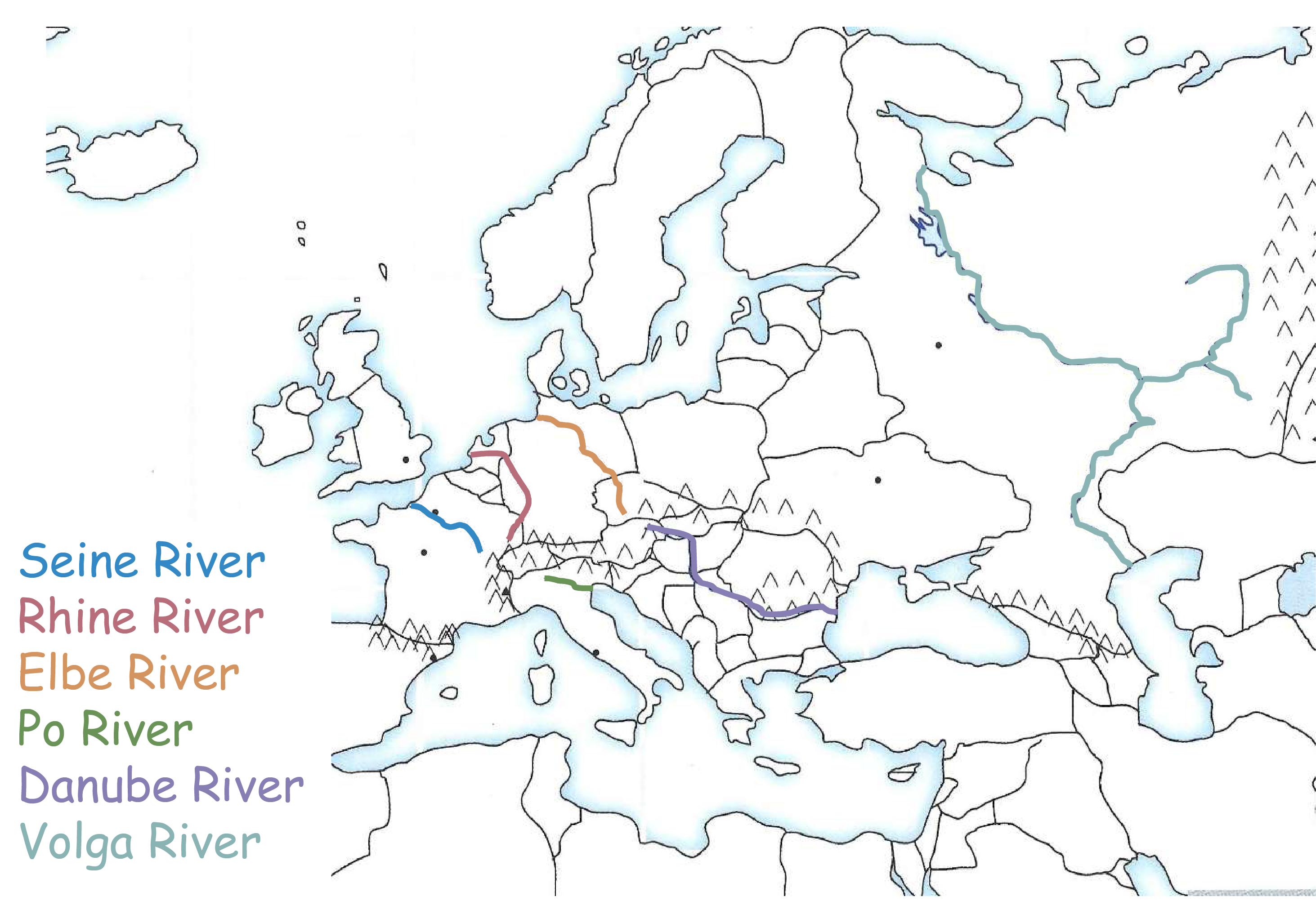

Tell me the River
Green Line. Po River. Runs through Italy.

Tell me the River
Purple Line. Danube River. Runs to the Black Sea (hiking boot).

Tell me the River
Teal Line. Volga River. Splits into a “V” and is in Russia.

W5 European Cities Review Card
European Cities
London
Paris
Rome
Barcelona
Orleans


Tell me the city
Blue dot. London. In England. Southeast part and near the English Channel.


Tell me the city
Red dot. Paris. In France and beside the Seine River.

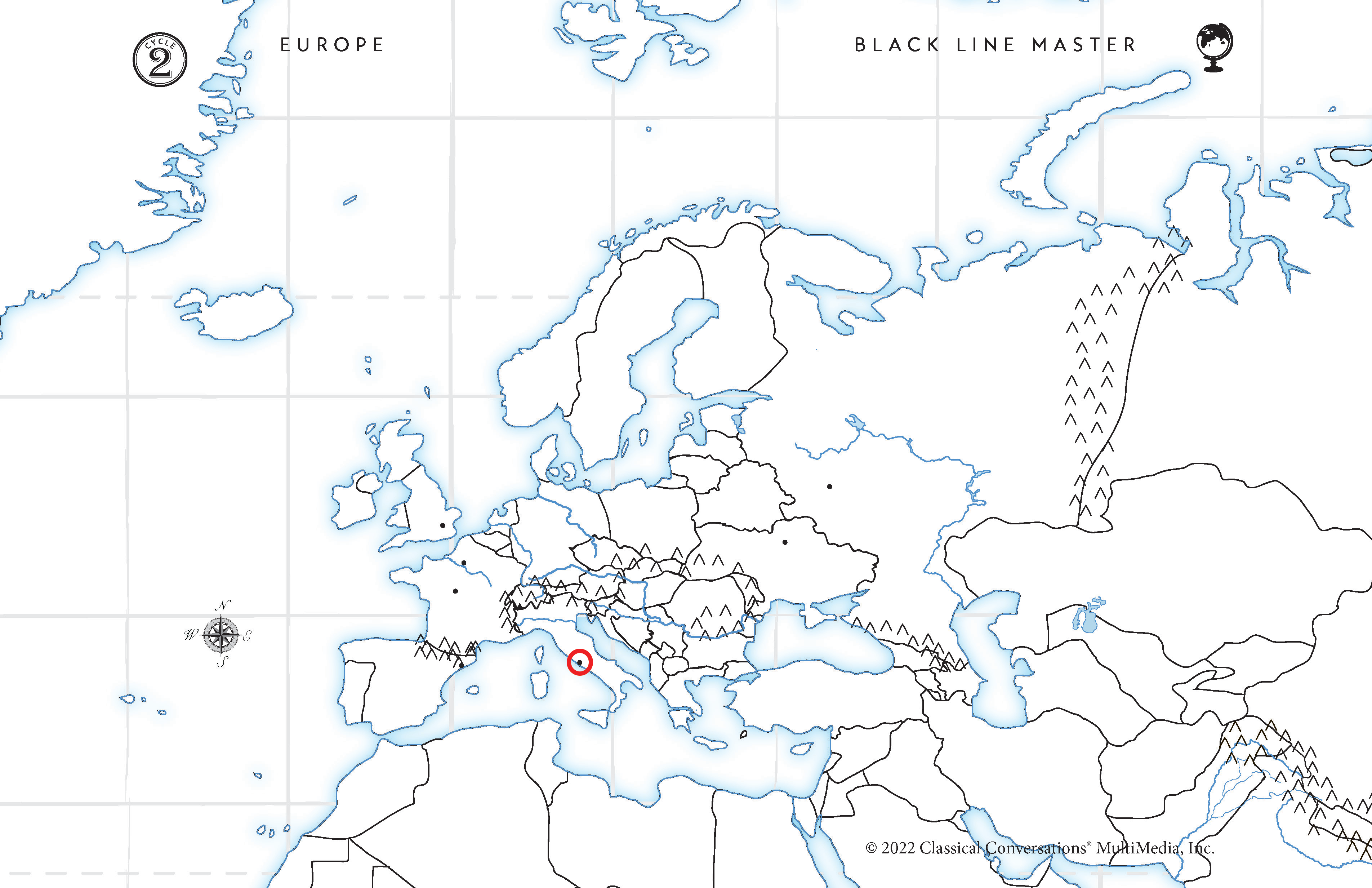
Tell me the city
Orange dot. Rome. In Italy middle West side near the Mediterranean Sea.

Tell me the city
Green dot. Barcelona. In Spain’s Northeast corner on the Mediterranean Sea.


Tell me the city
Purple dot. Orleans. “Famous in France”. Also in France, but on the Western side.

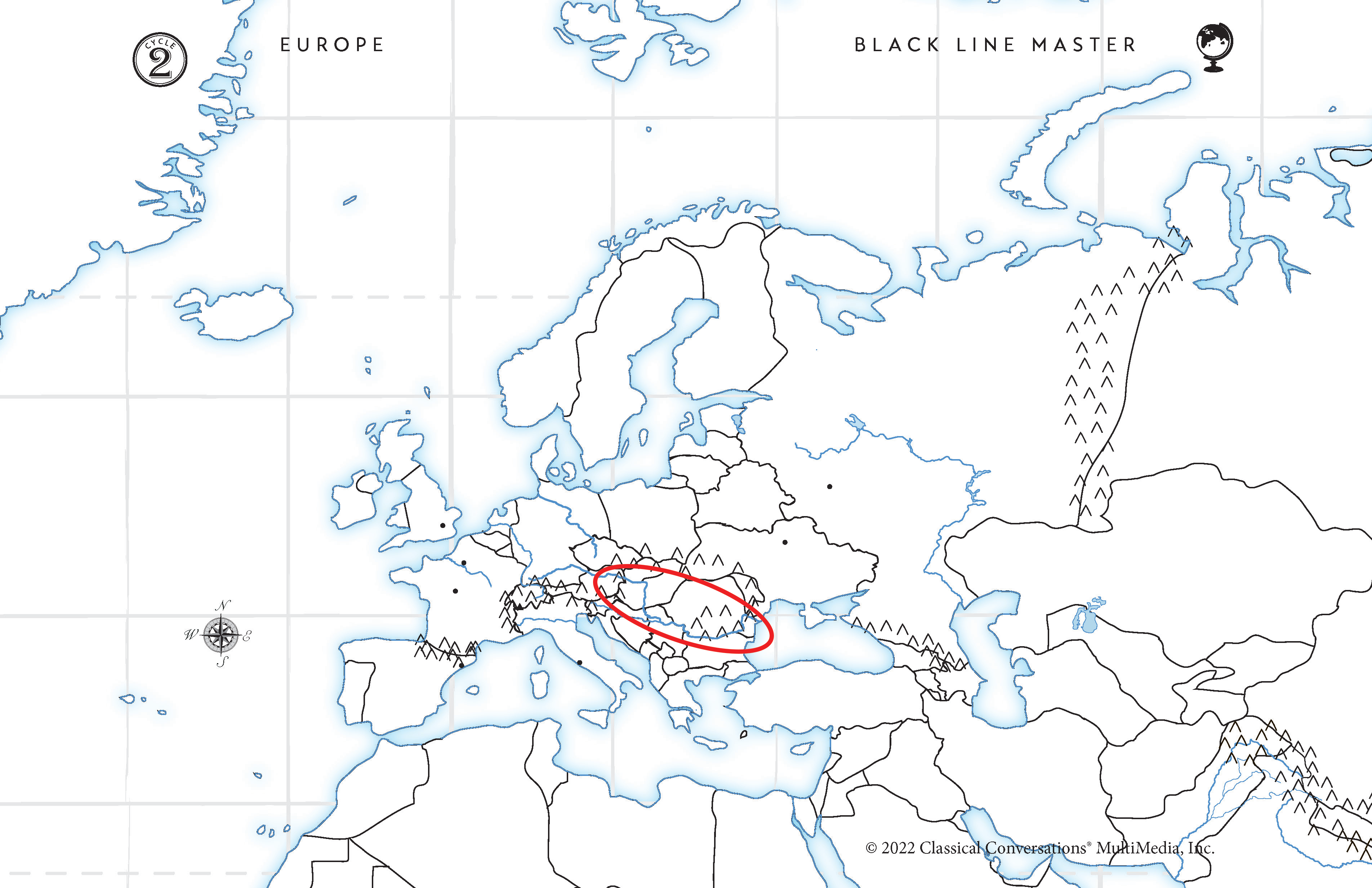
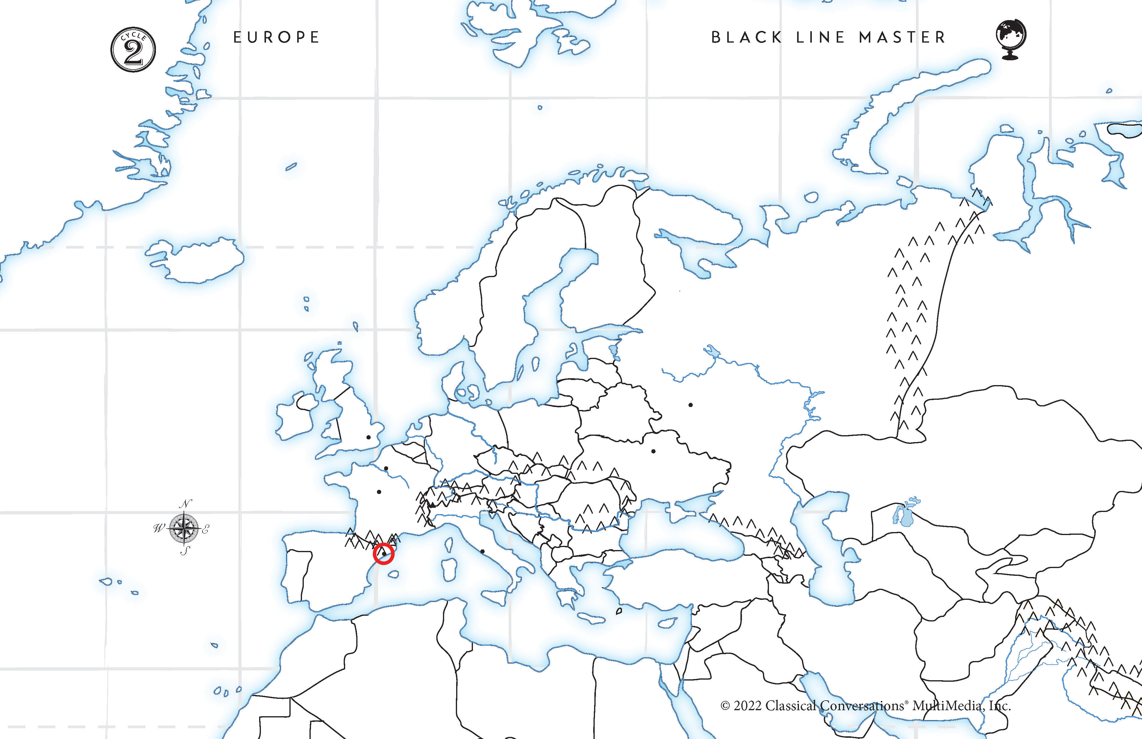
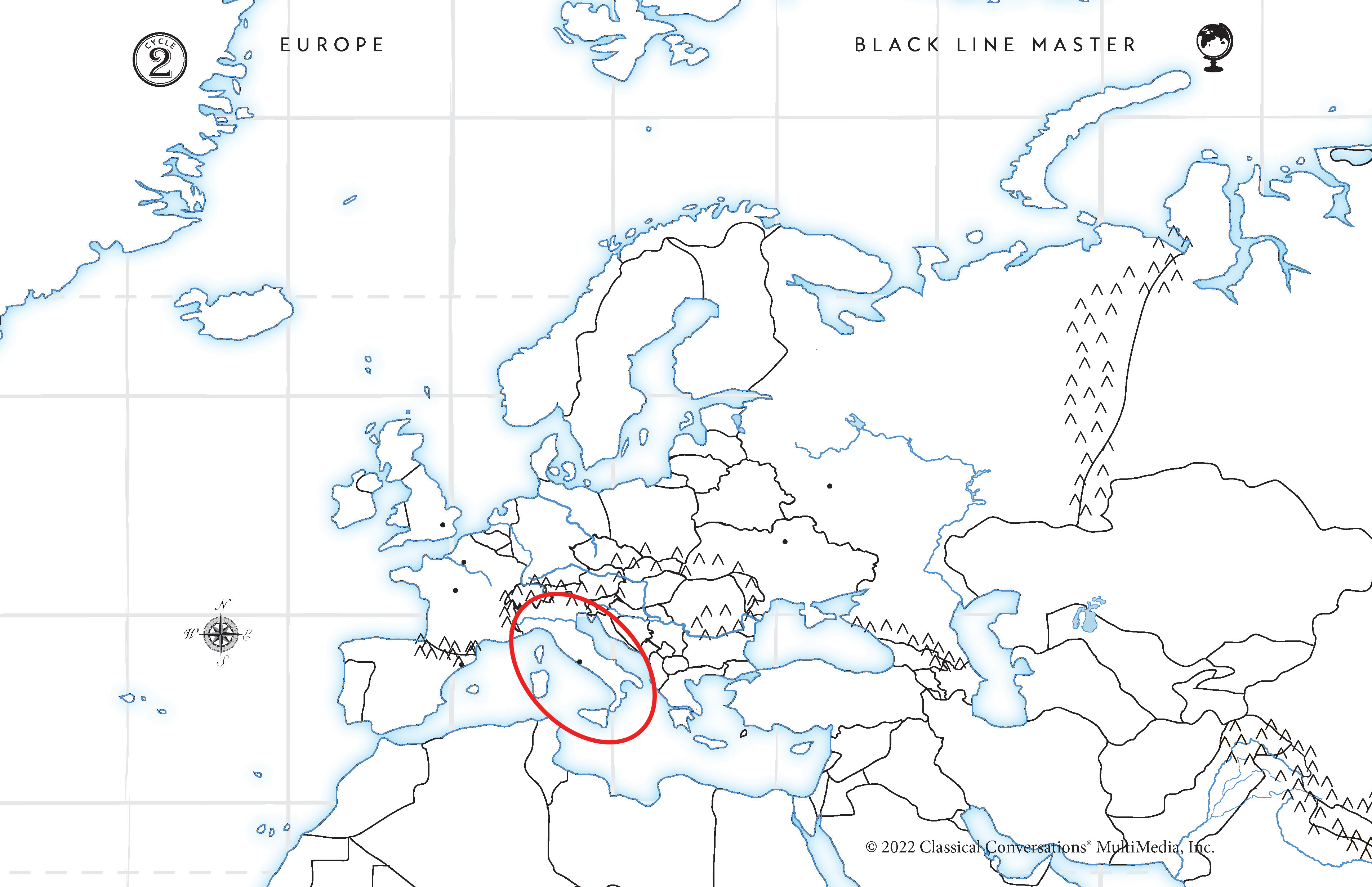
W6 European Mountains Review Card
Pyrenees
Alps
Carpathians
Caucasus
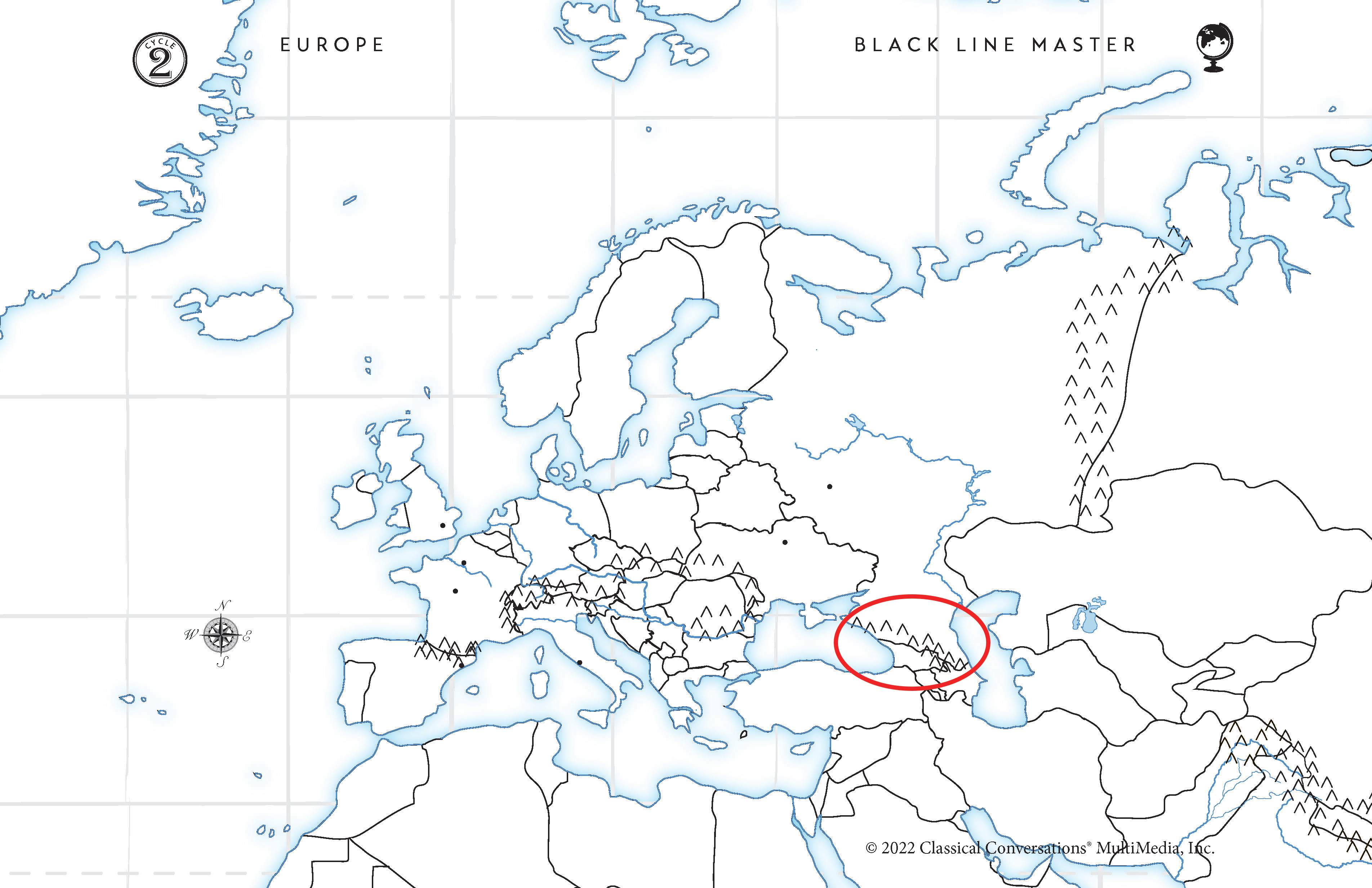
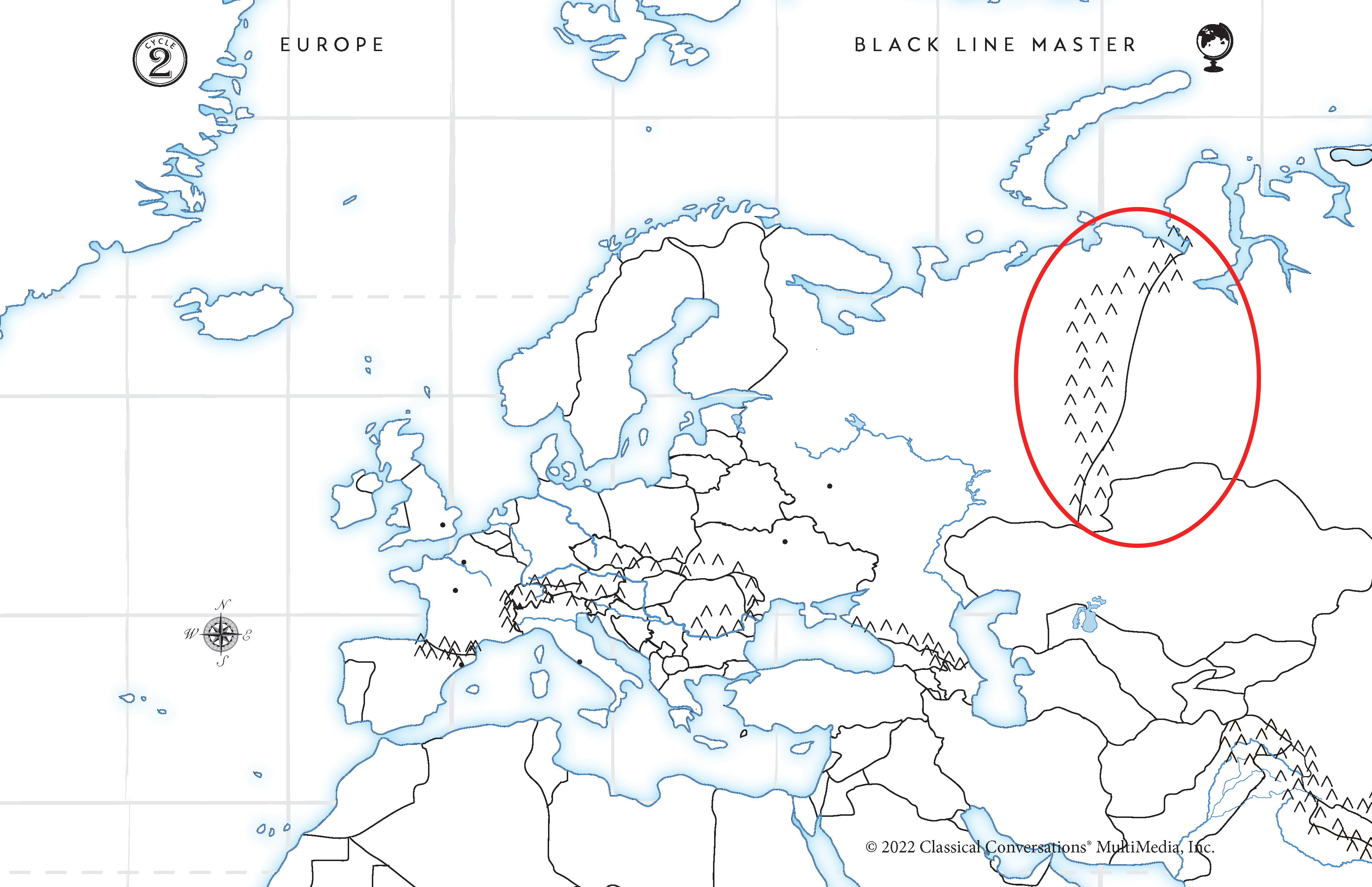
Ural
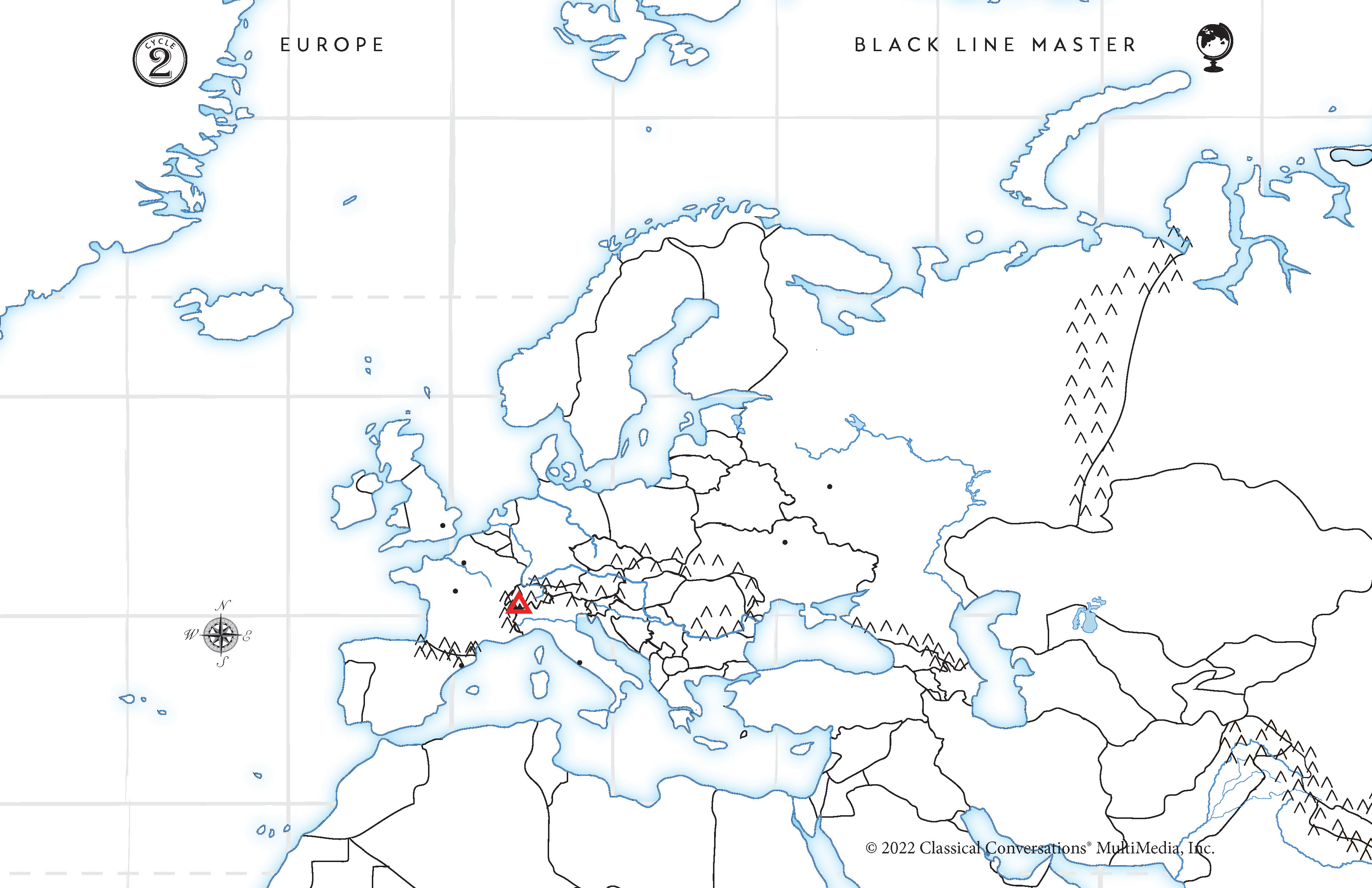
Matterhorn

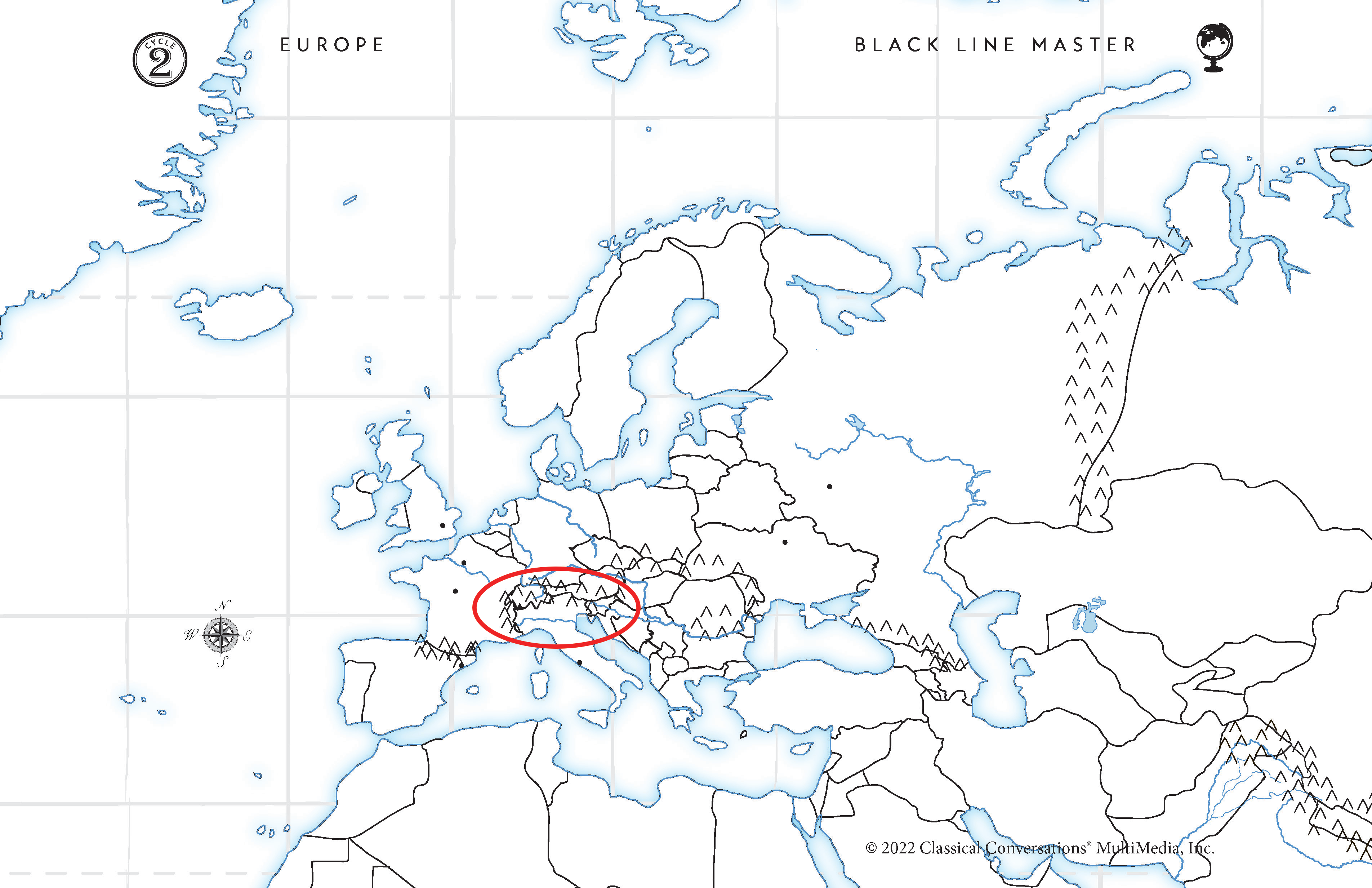
Tell me the mountain range or mountain
Alps located in Italy. Red Outline.
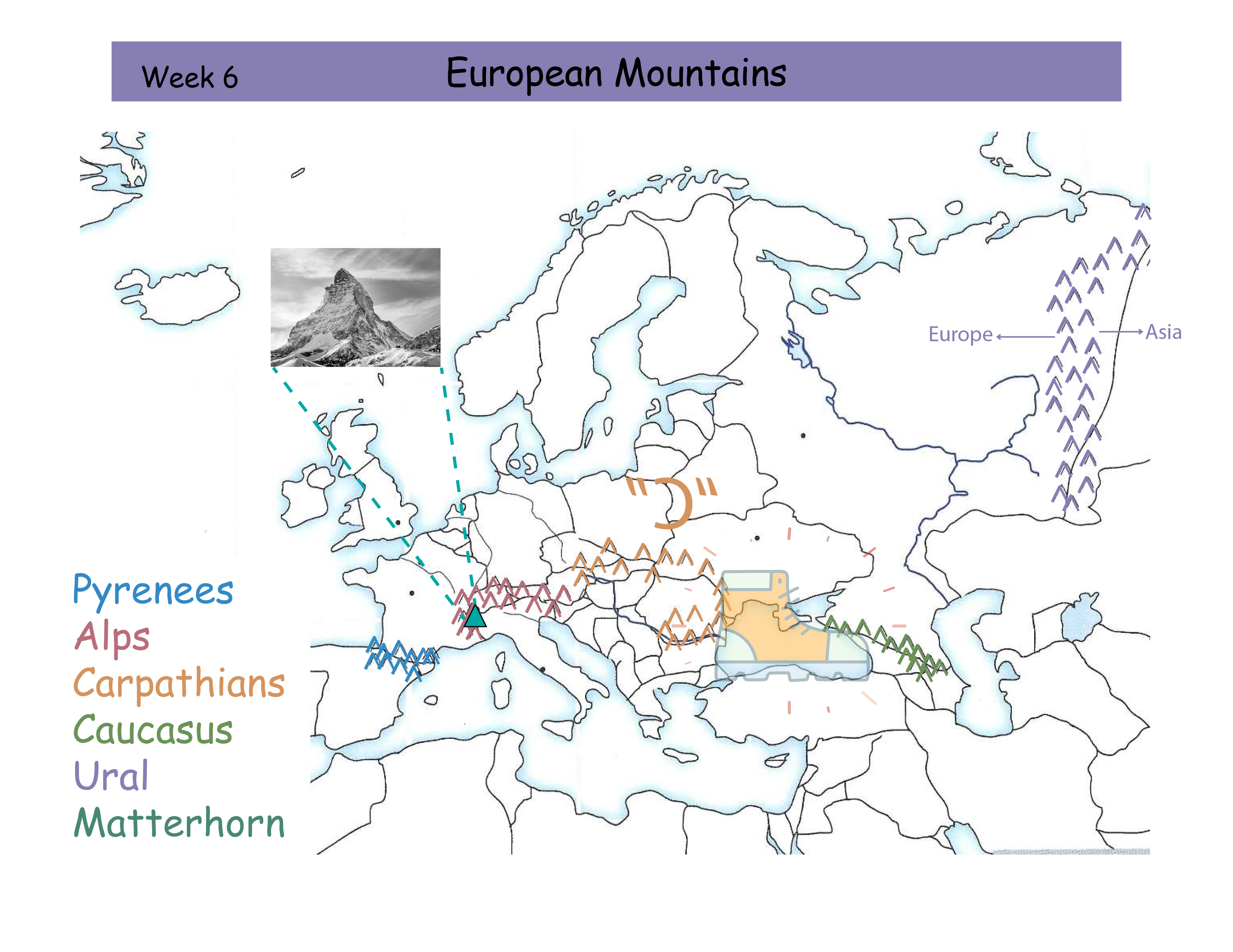

Tell me the mountain range or mountain
Pyrenees Mountain Range in between France and Spain. Blue Outline.

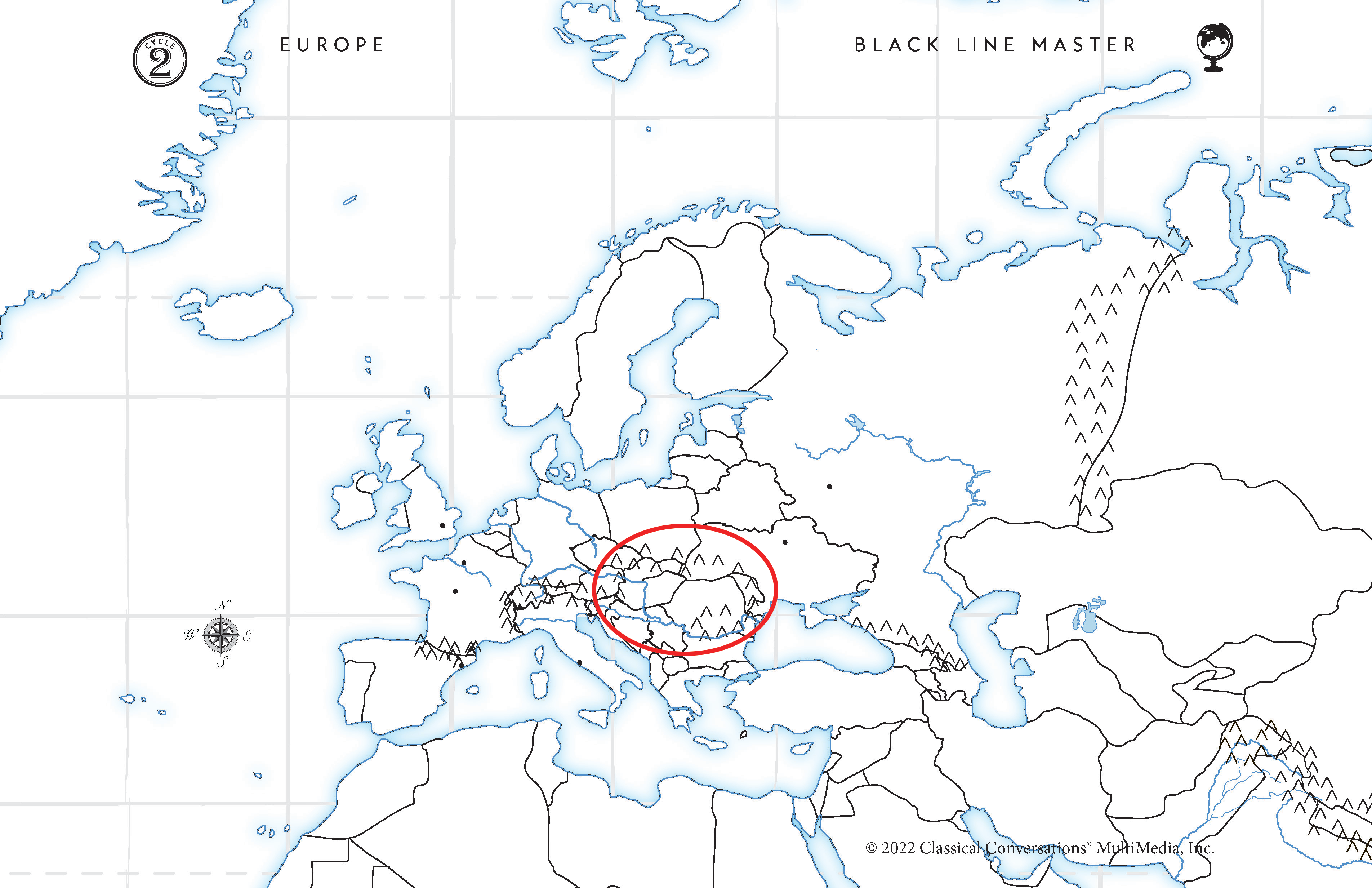
Tell me the mountain range or mountain
The Carpathians make a backwards “C” and bump into the Black Sea “boot”. Orange Outline.

Tell me the mountain range or mountain
Caucasus Mountains. Getting kicked by the Black Sea “boot”. Green Outline.

Tell me the mountain range or mountain
Ural Mountains separate Asia and Europe. Purple Outline.

Tell me the mountain range or mountain
Matterhorn located in the Alps Mountains in Italy. Teal Triangle.

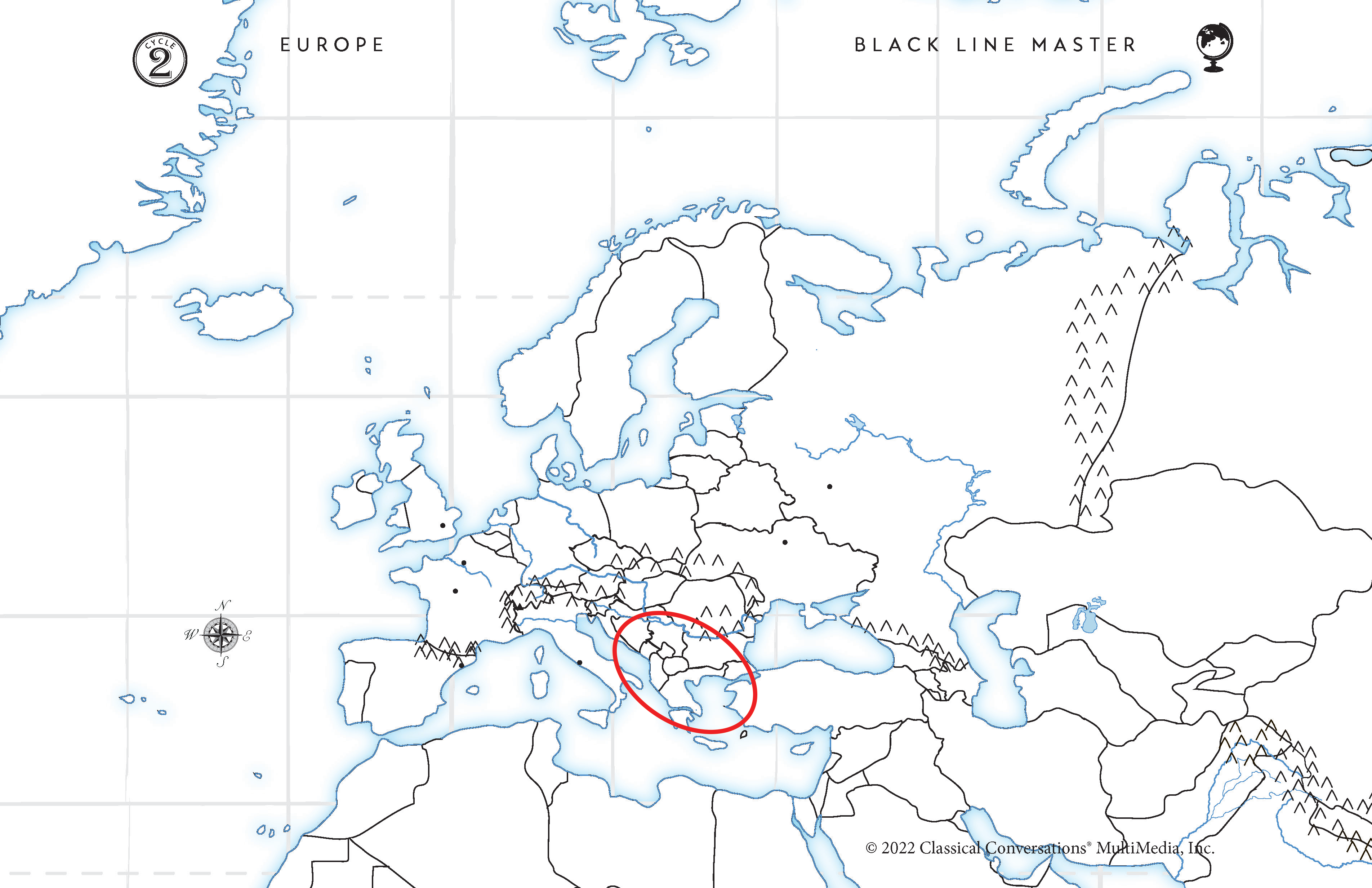
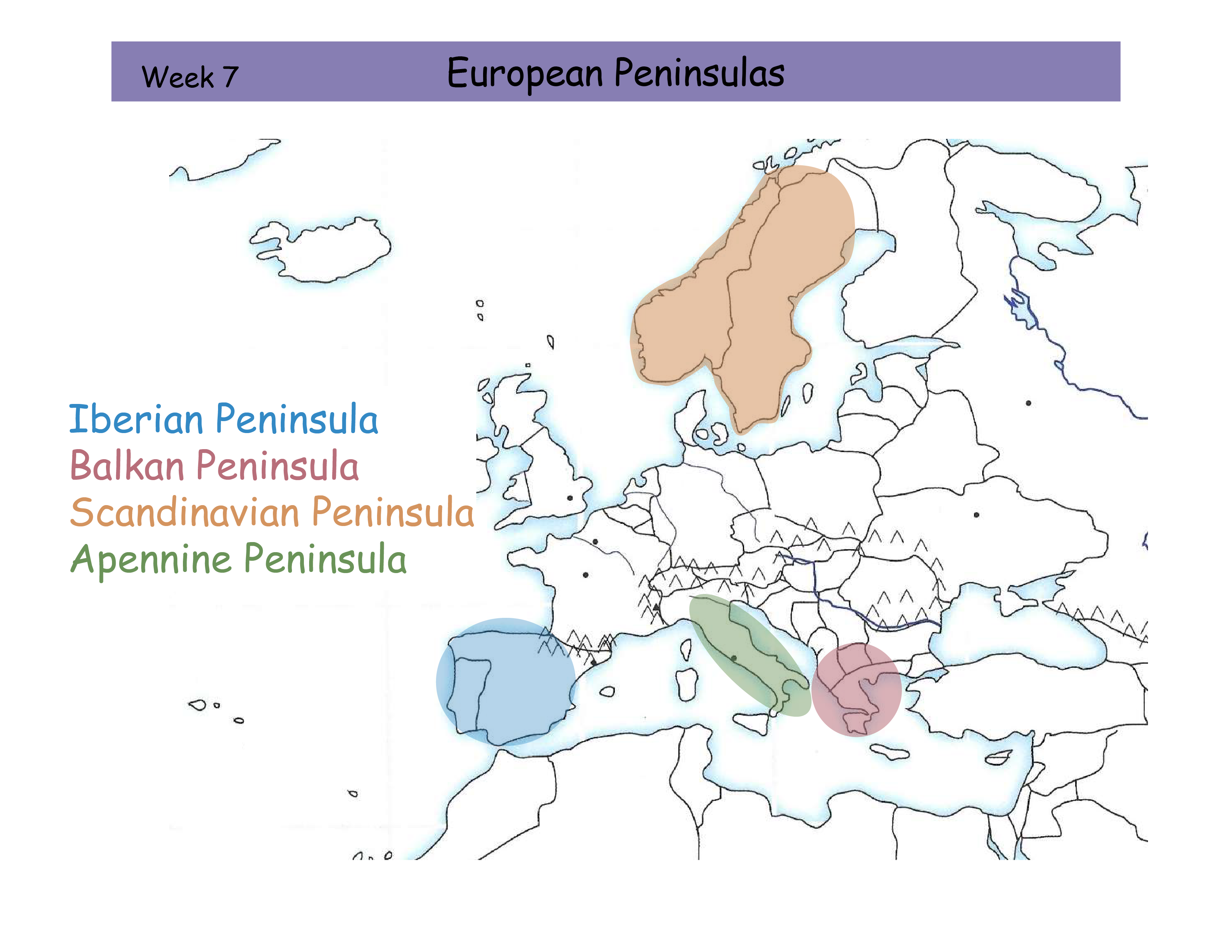
W7 European Peninsulas Review Card
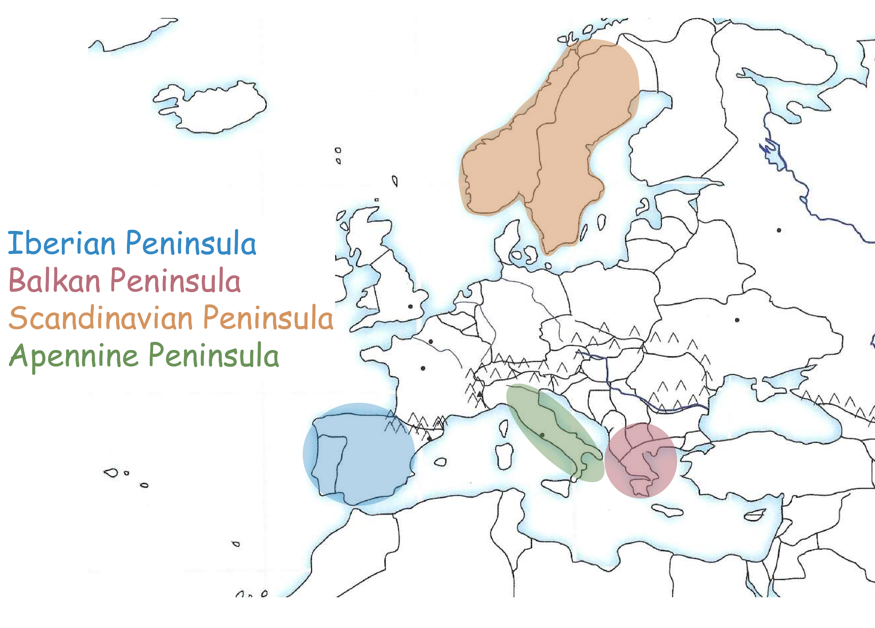
Iberian Peninsula
Balkan Peninsula
Scandinavian Peninsula
Apennine Peninsula
Tell me the Peninsula
Iberian Peninsula. Blue outline. Iberian Peninsula has Pretty Portugal and her sparkling Spanish hair. The western Peninsula on the Mediterranean Sea.

Tell me the Peninsula
Apennine Peninsula. Green outline. Italy, the boot is called the Apennine Peninsula. The Middle Peninsula on the Mediterranean Sea.

Tell me the Peninsula
Balkan Peninsula. Red outline. Greece is the outermost part of the Balkan Peninsula. Look for the Baltic Sea and move South to find the Balkan Peninsula. Eastern Peninsula on the Mediterranean Sea.

Tell me the Peninsula
Scandinavian Peninsula. Orange outline. Between the North Sea and Baltic Sea. Picture a person skiing and they “slide down from the top”!
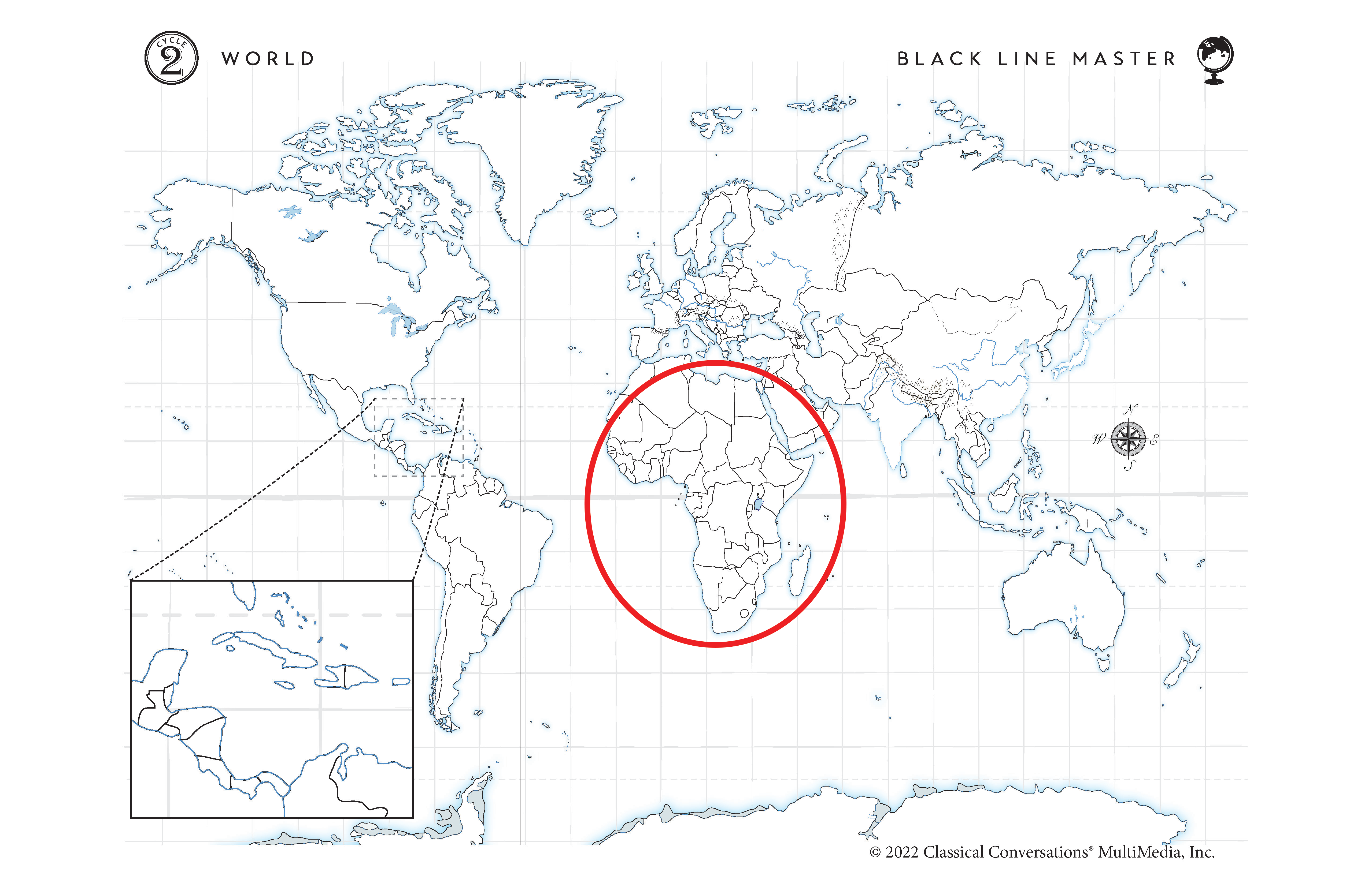
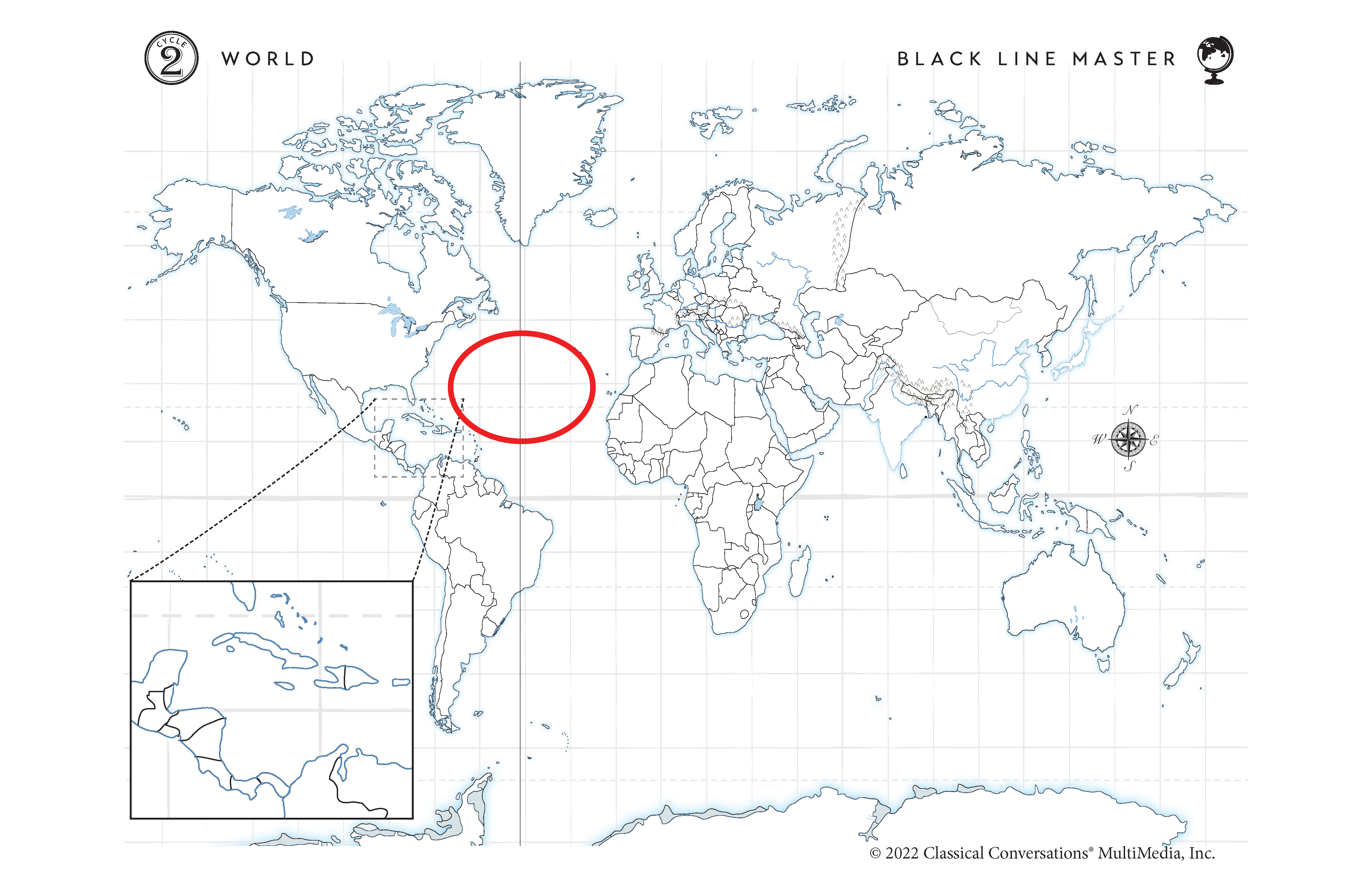
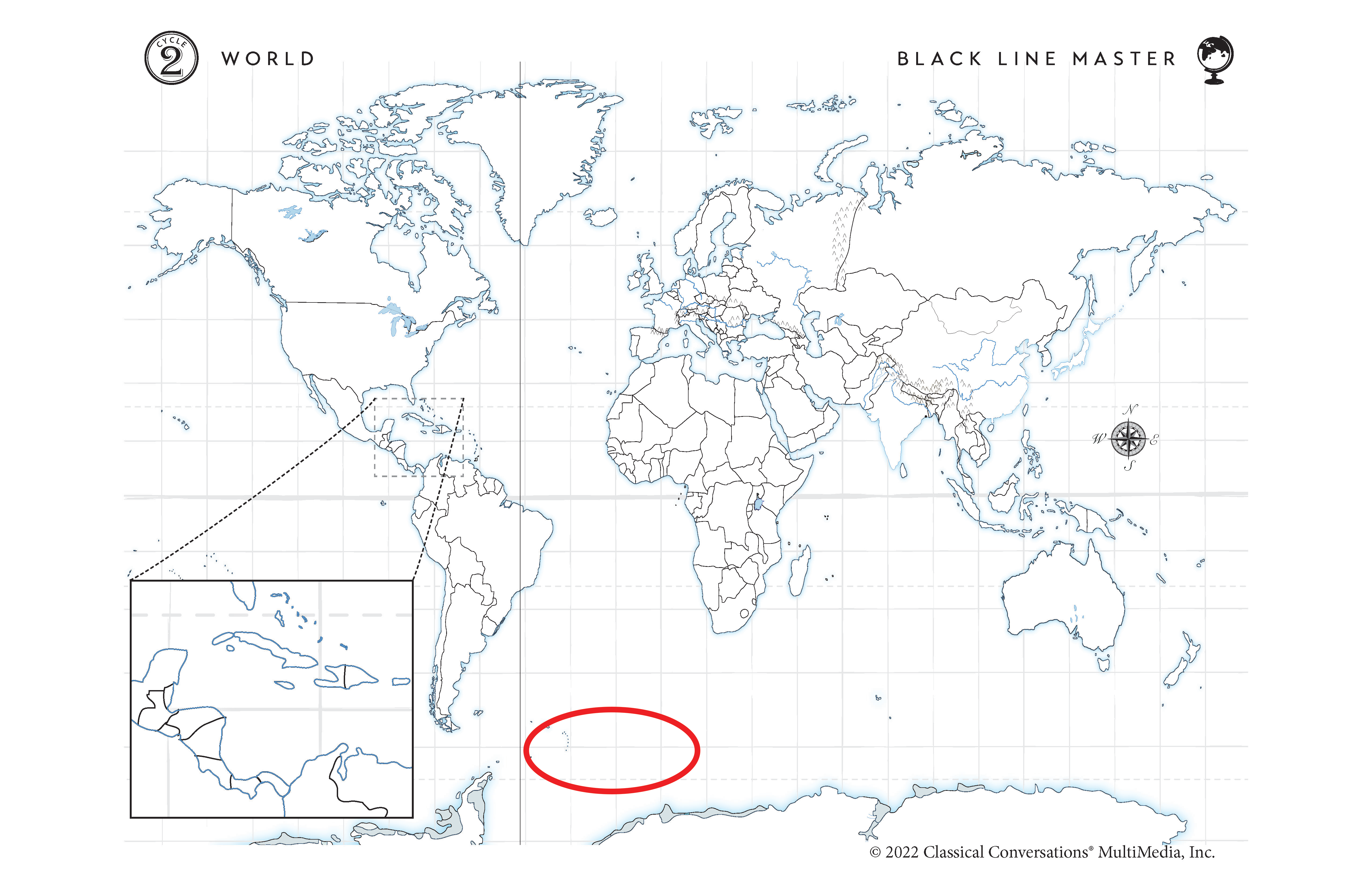
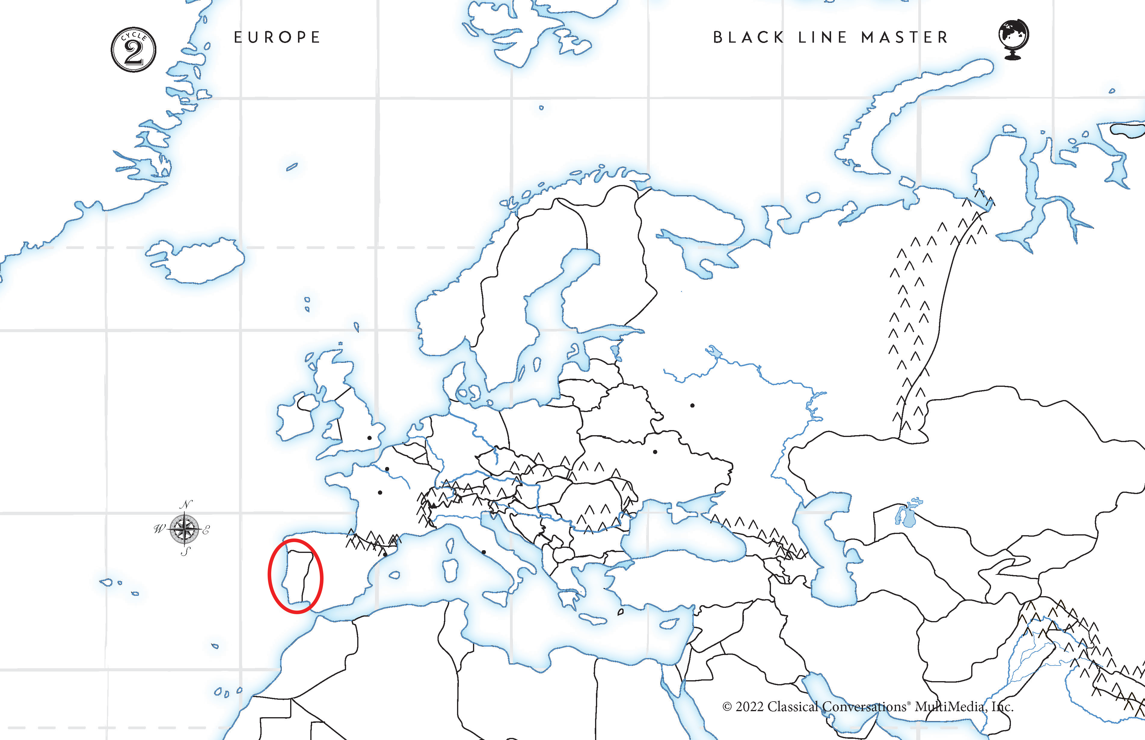
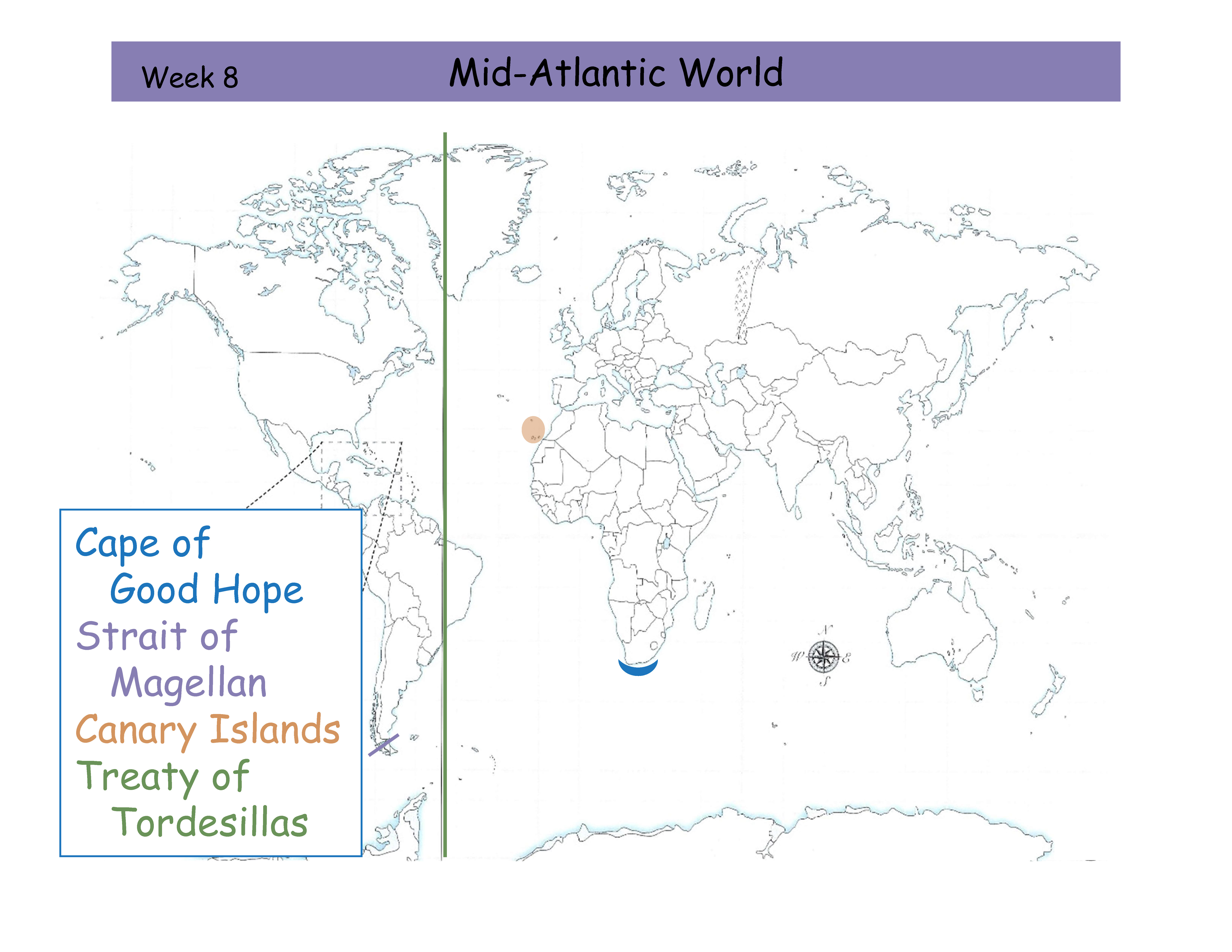
W8 Mid-Atlantic World Review Card
Cape of Good Hope
Strait of Magellan
Canary Islands
Treaty of Tordesillas
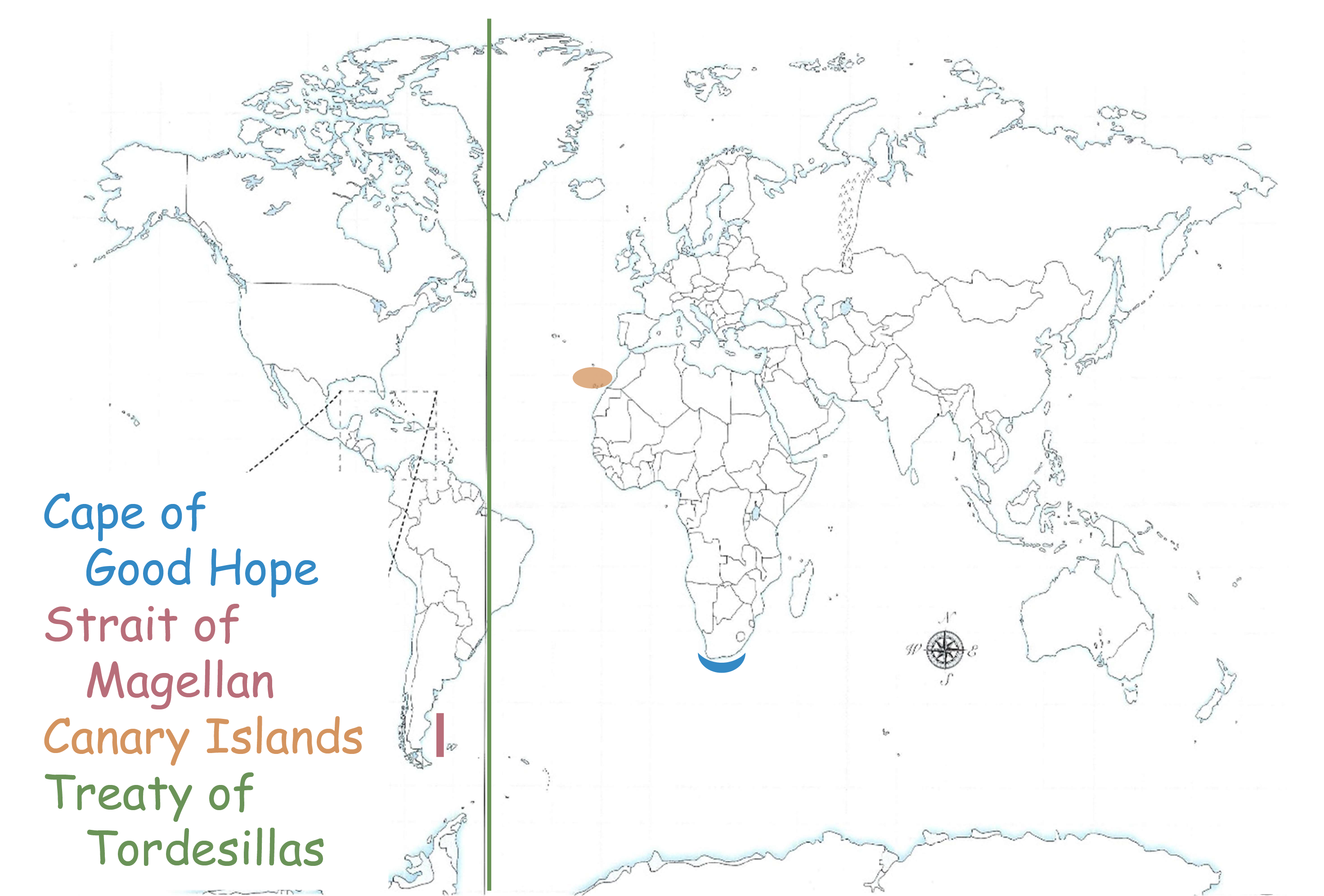
Tell me the area of the Mid-Atlantic World
Canary Islands. Orange outline. Off the coast of West Africa.

Tell me the area of the Mid-Atlantic World
Cape of Good Hope. Blue outline. Southernmost part of Africa.

Tell me the area of the Mid-Atlantic World
Treaty of Tordesillas. Green outline. Line dividing Brazil in South America and Greenland in North America.


Tell me the area of the Mid-Atlantic World
Strait of Magellan. Purple outline. Small section of water that cuts through the souther tip of South America.
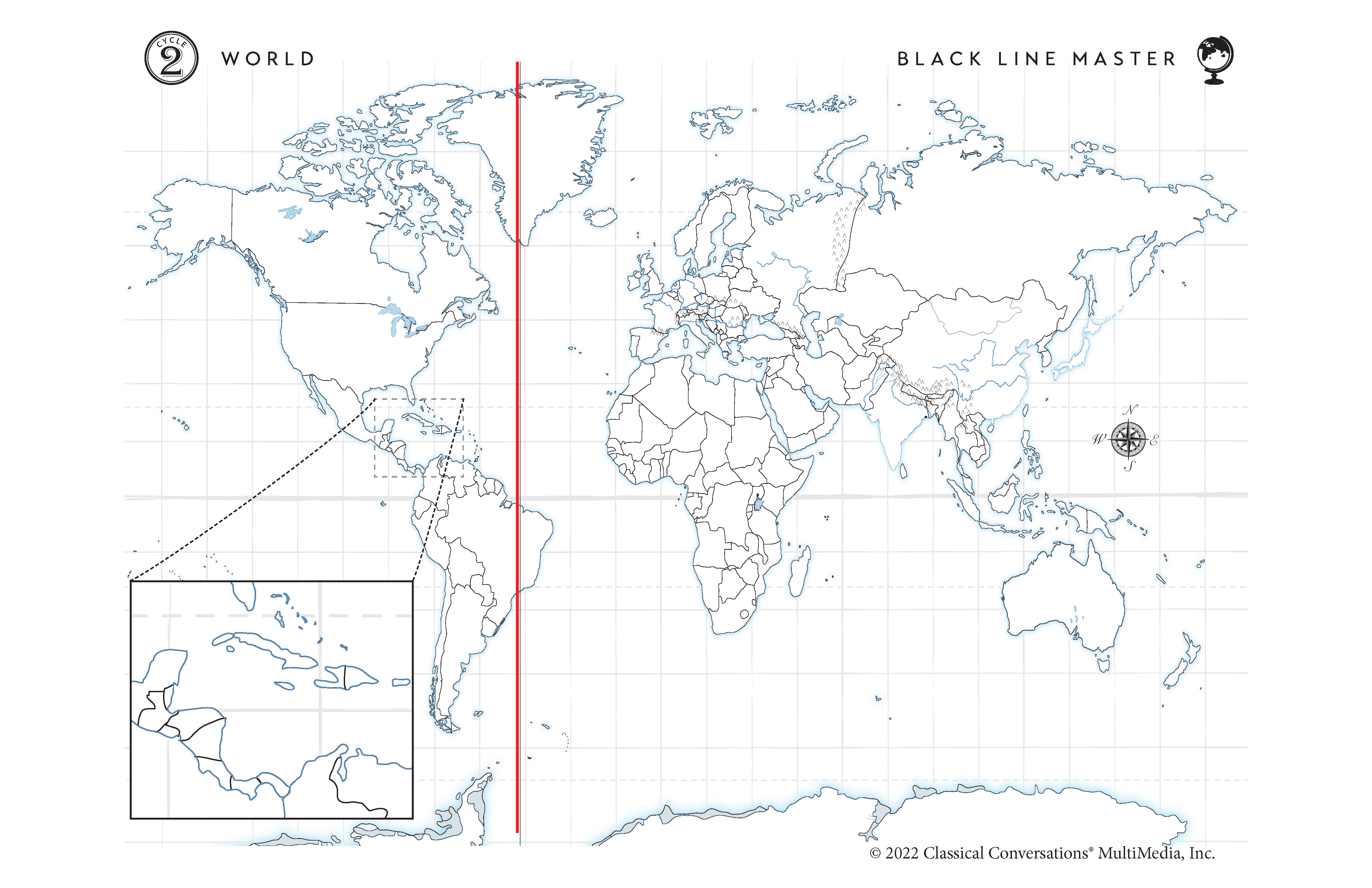
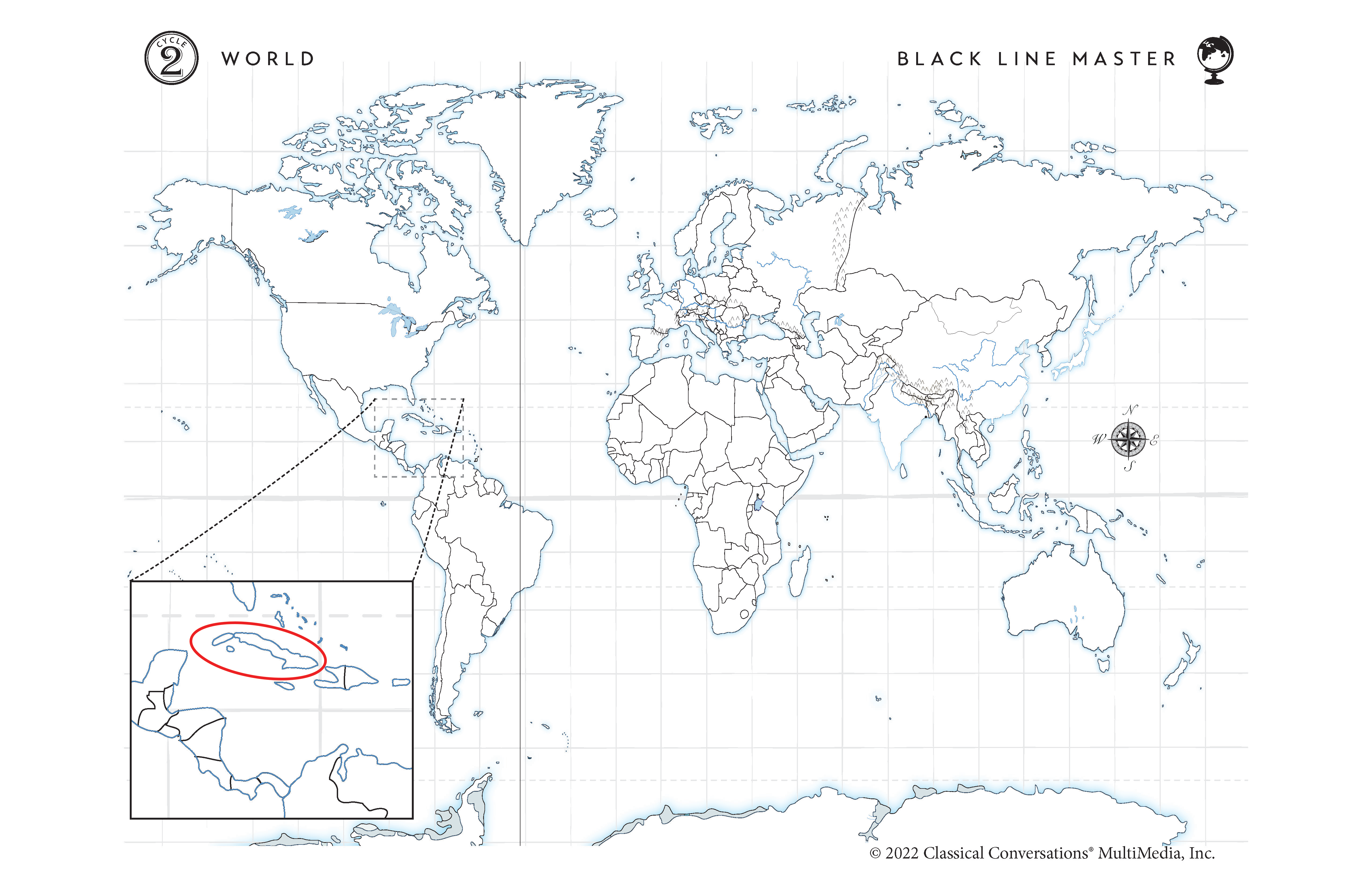
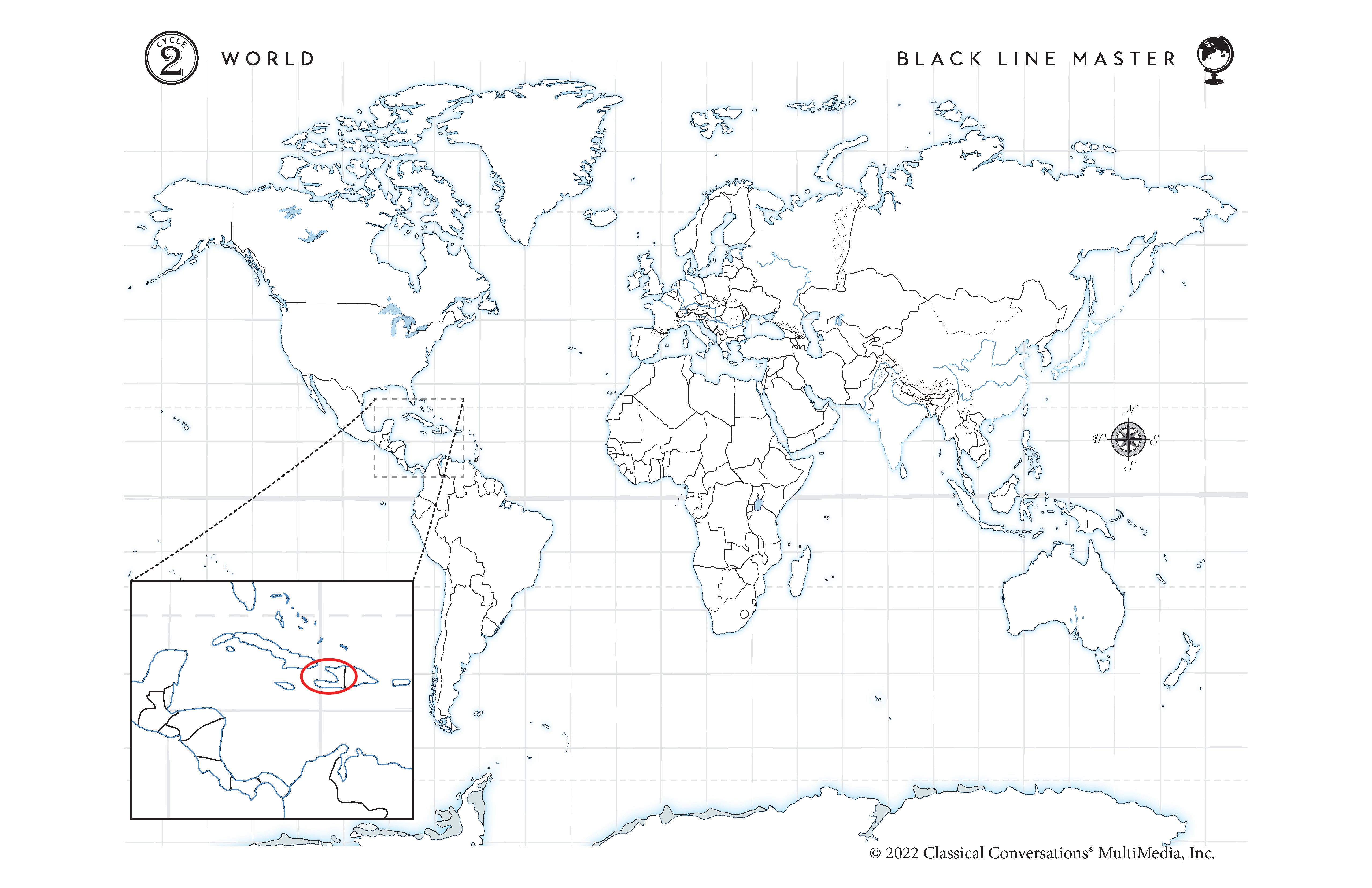
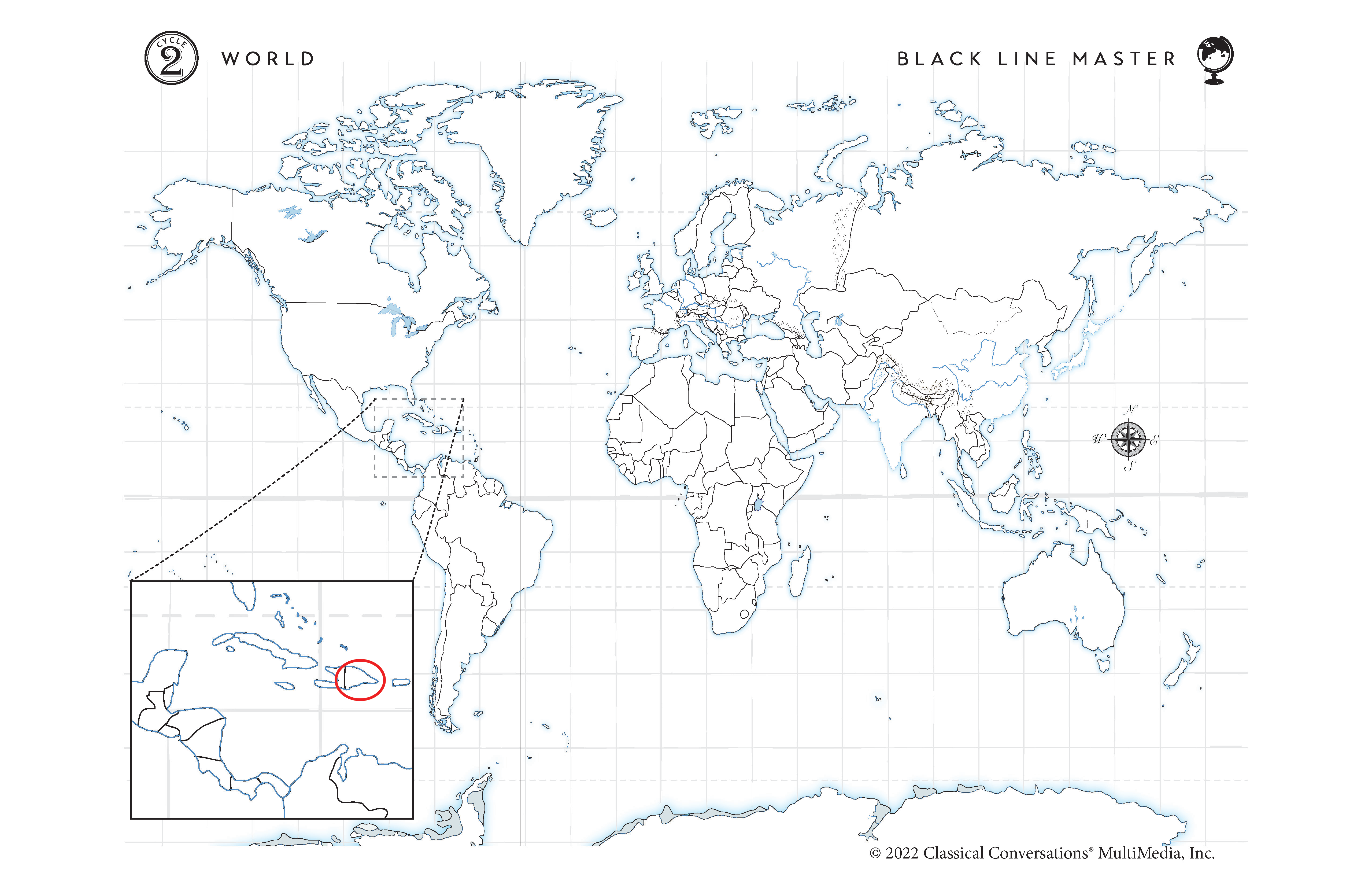
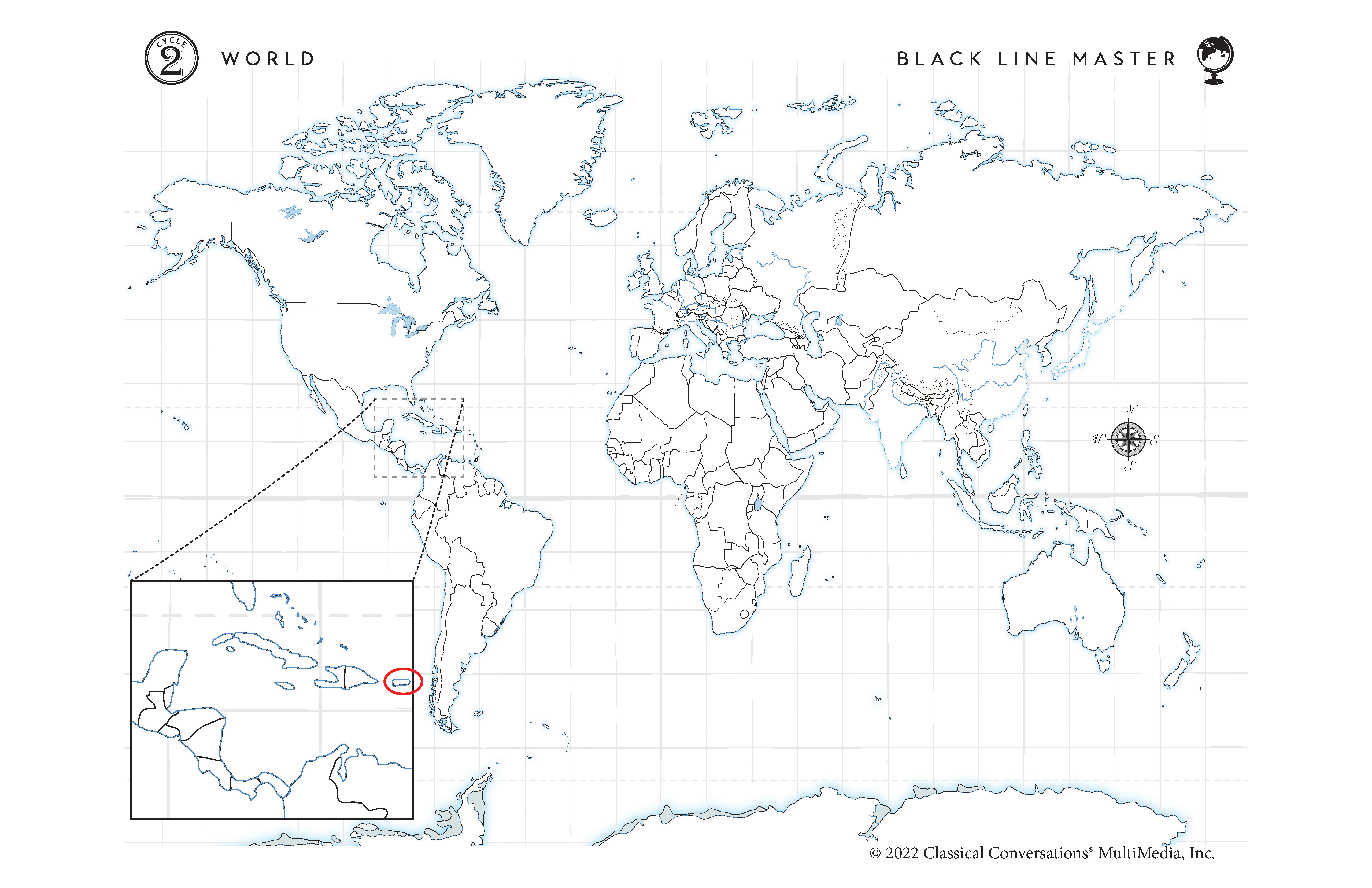
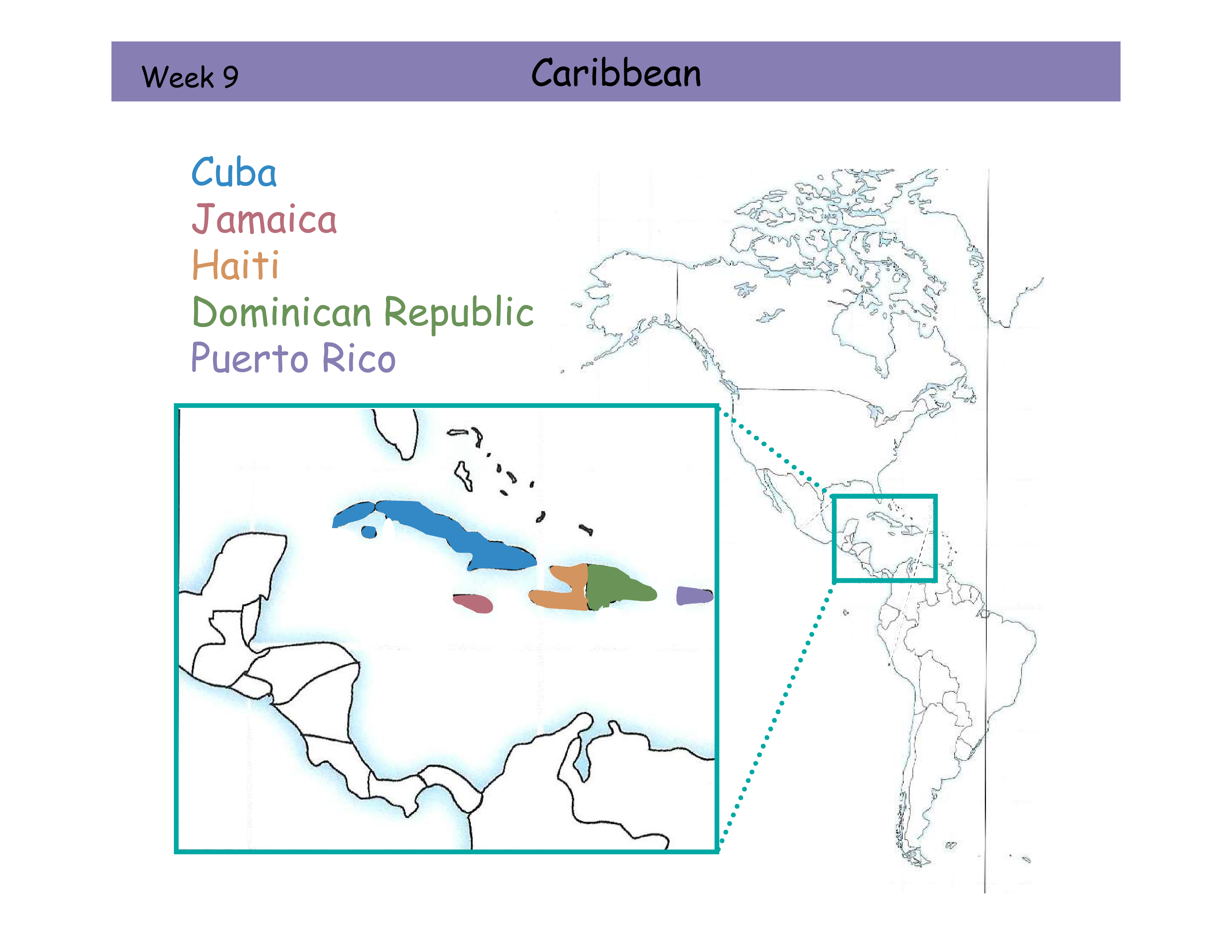
W9 Caribbean Review Card
Cuba
Jamaica
Haiti
Dominican Republic
Puerto Rico
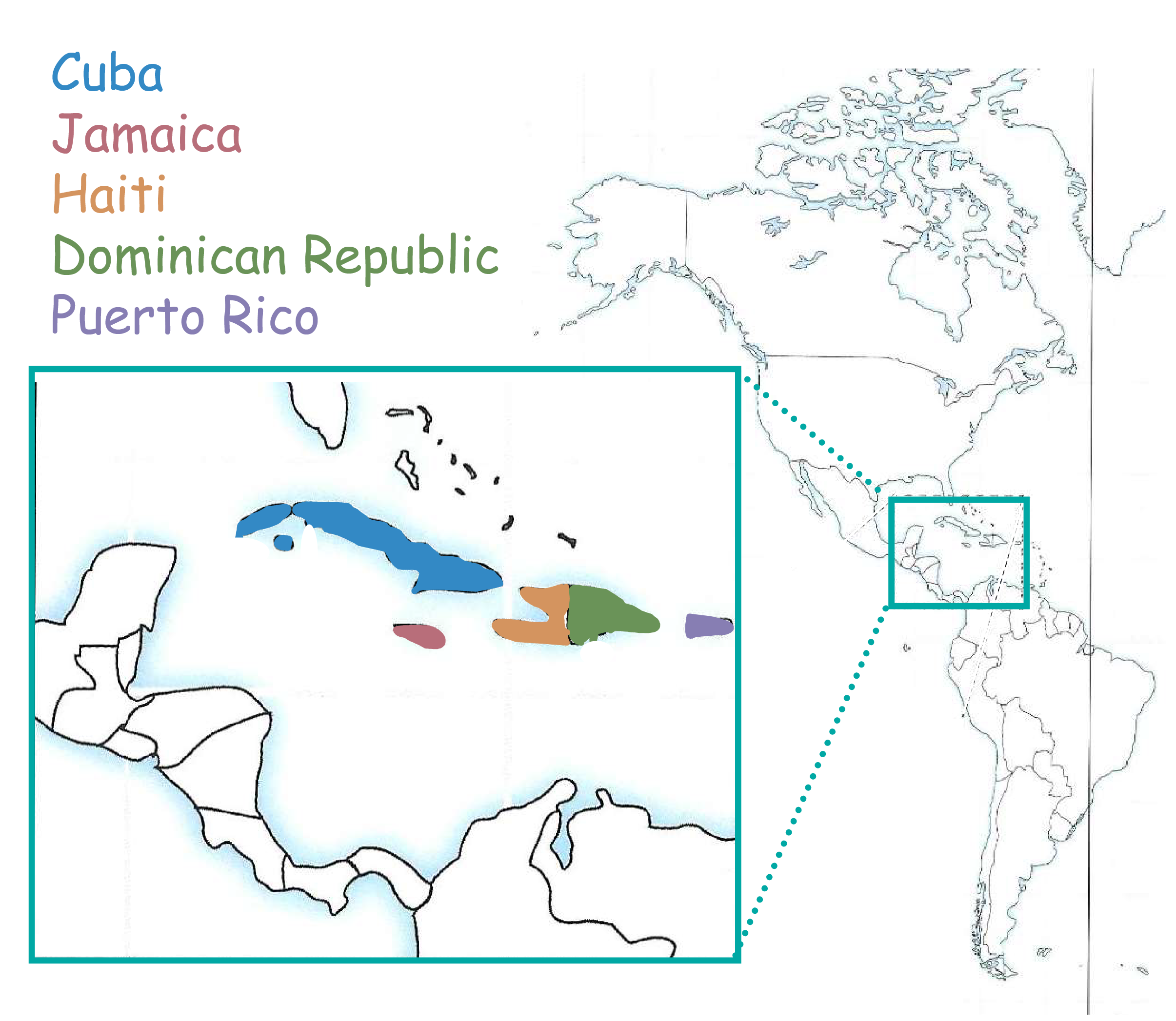
Tell me the country of the Caribbean
Cuba. Blue Island. Closest to Florida


Tell me the country of the Caribbean
Jamaica. Red Island. South of Cuba

Tell me the country of the Caribbean
Haiti. Orange Outline. Split with Dominican Republic. East of Cuba

Tell me the country of the Caribbean
Dominican Republic. Green Outline. Splits with Haiti

Tell me the country of the Caribbean
Puerto Rico. Purple Island to the East
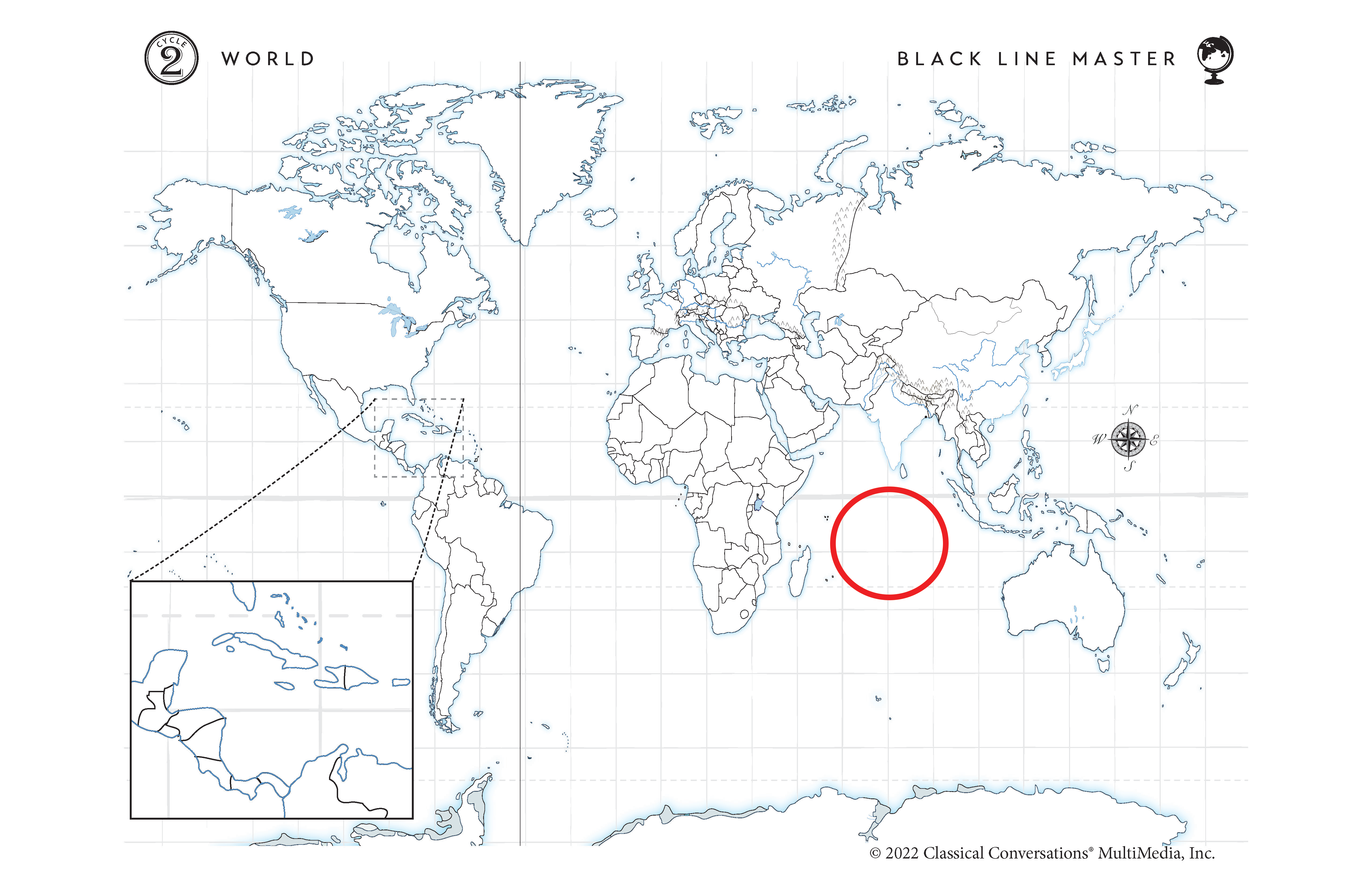
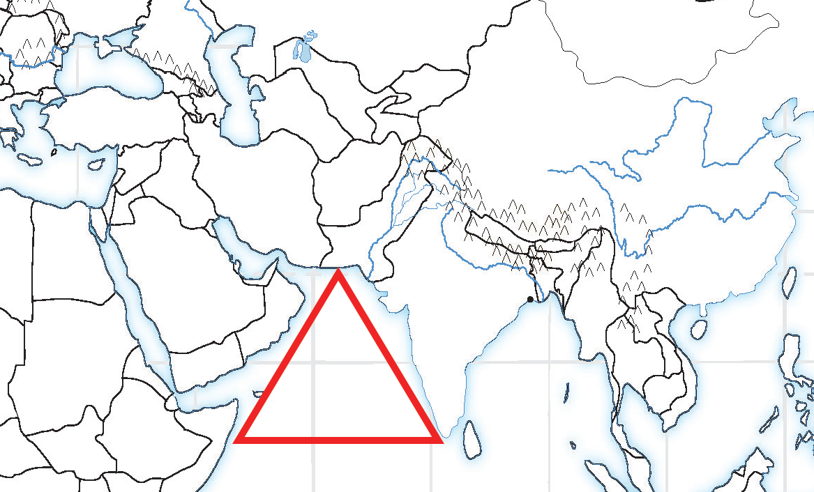
W10 Southwest Asia Review Card
Afghanistan
Pakistan
India
Kolkata
Arabian Sea
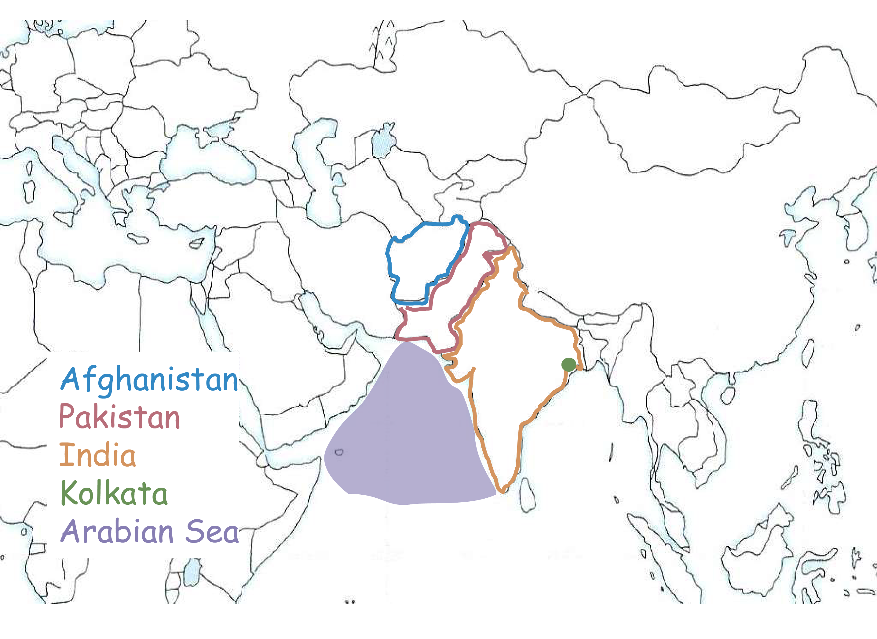
Tell me the area in Southwest Asia.
India. Orange Outline. Looks like a sharks tooth sticking out in the Indian Ocean.

Tell me the area in Southwest Asia.
Kolkata. Green Dot. City in India on Eastern side by the Bay of Bengal.
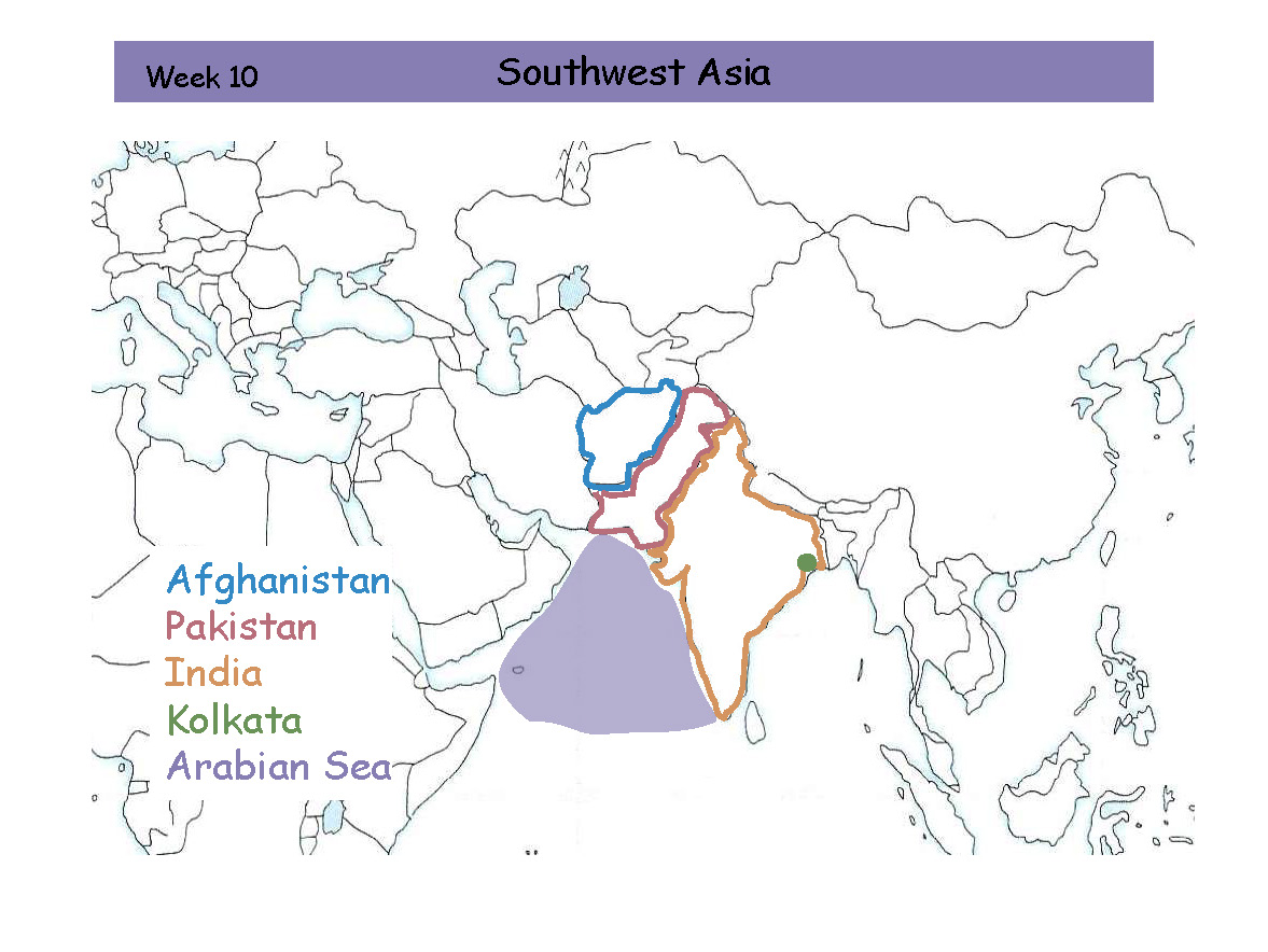
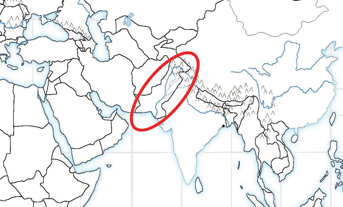
Tell me the area in Southwest Asia.
Pakistan. Red Outline. Northwest of India.

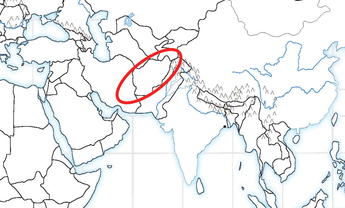
Tell me the area in Southwest Asia.
Afghanistan. Blue Outline. Northwest of Pakistan.

Tell me the area in Southwest Asia.
Arabian Sea. Purple Outline. Sea on the West side of India

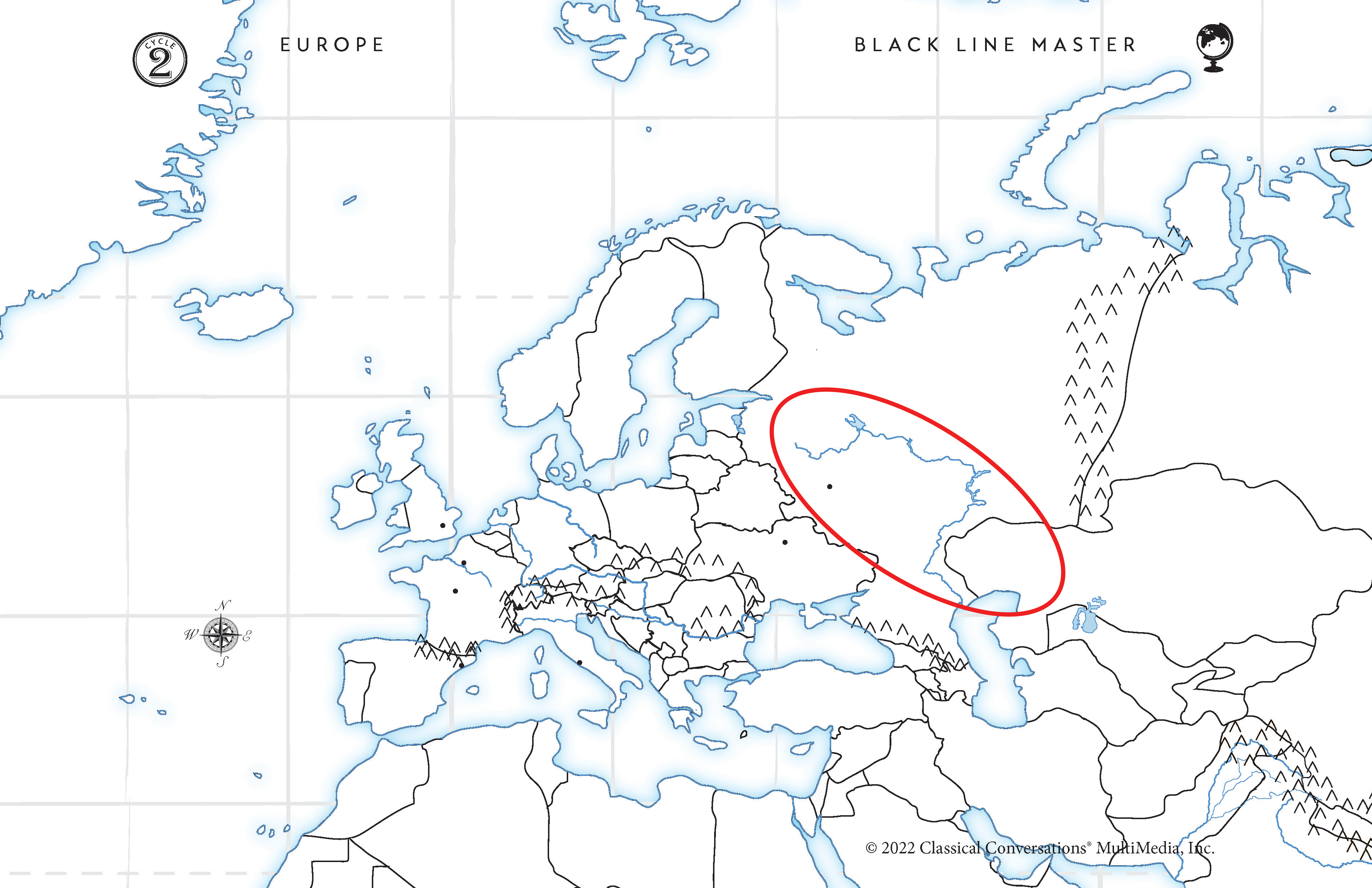
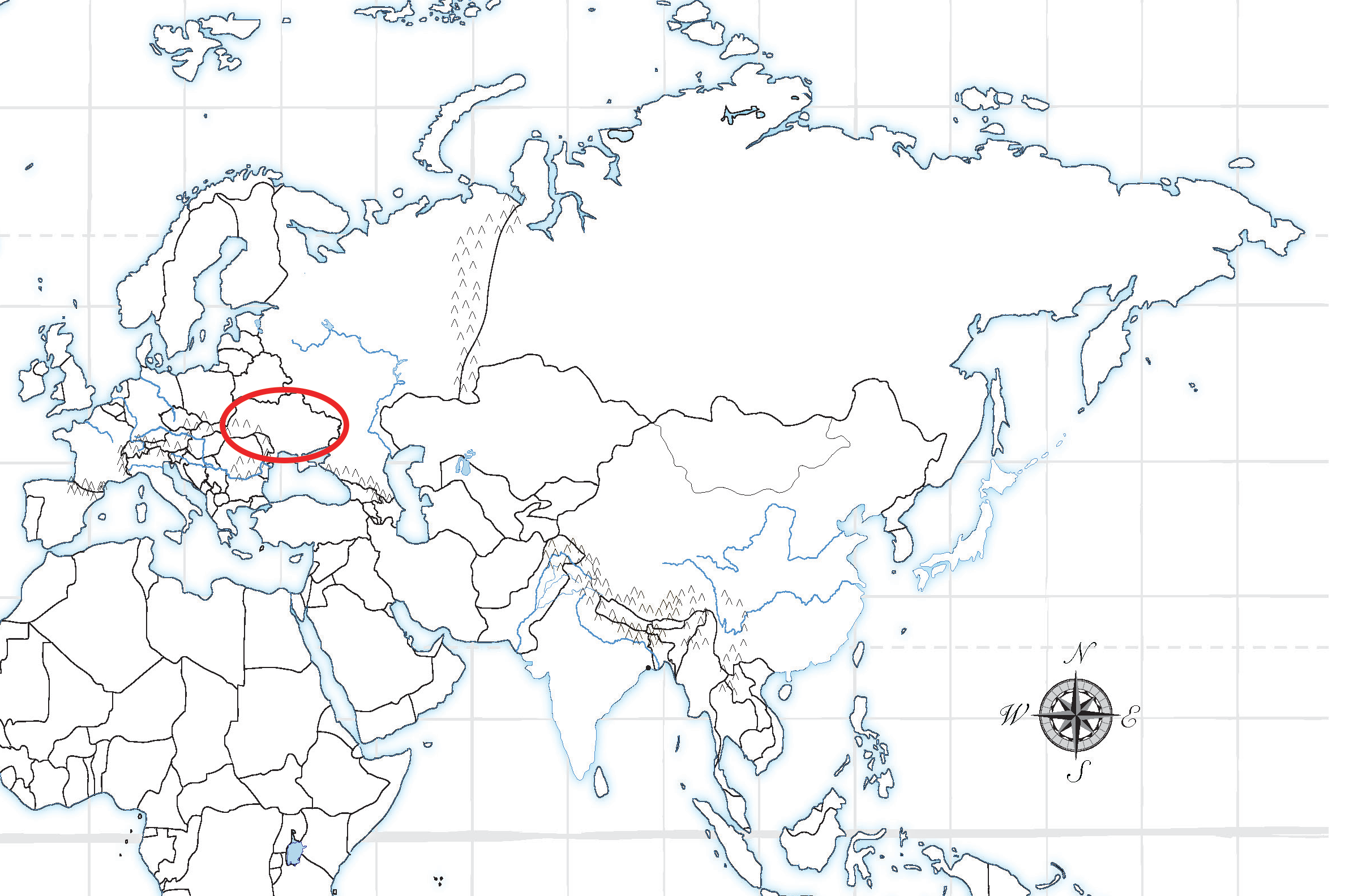
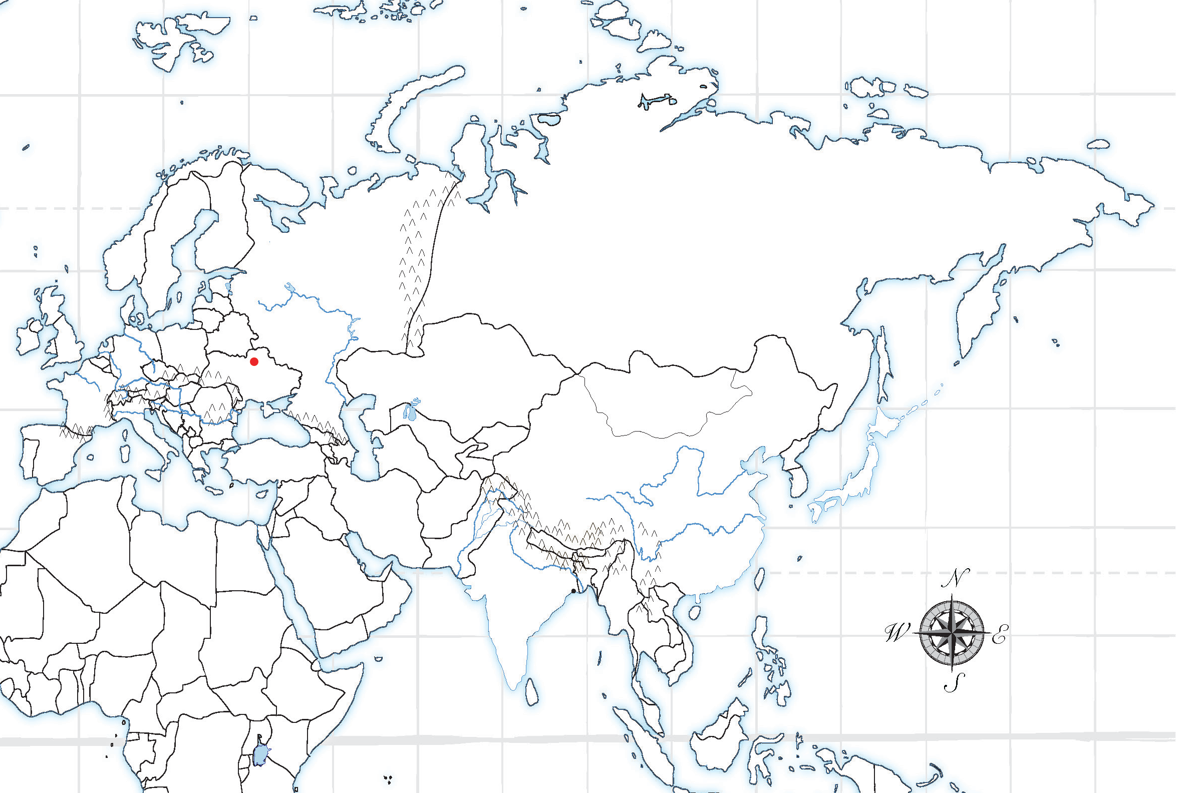
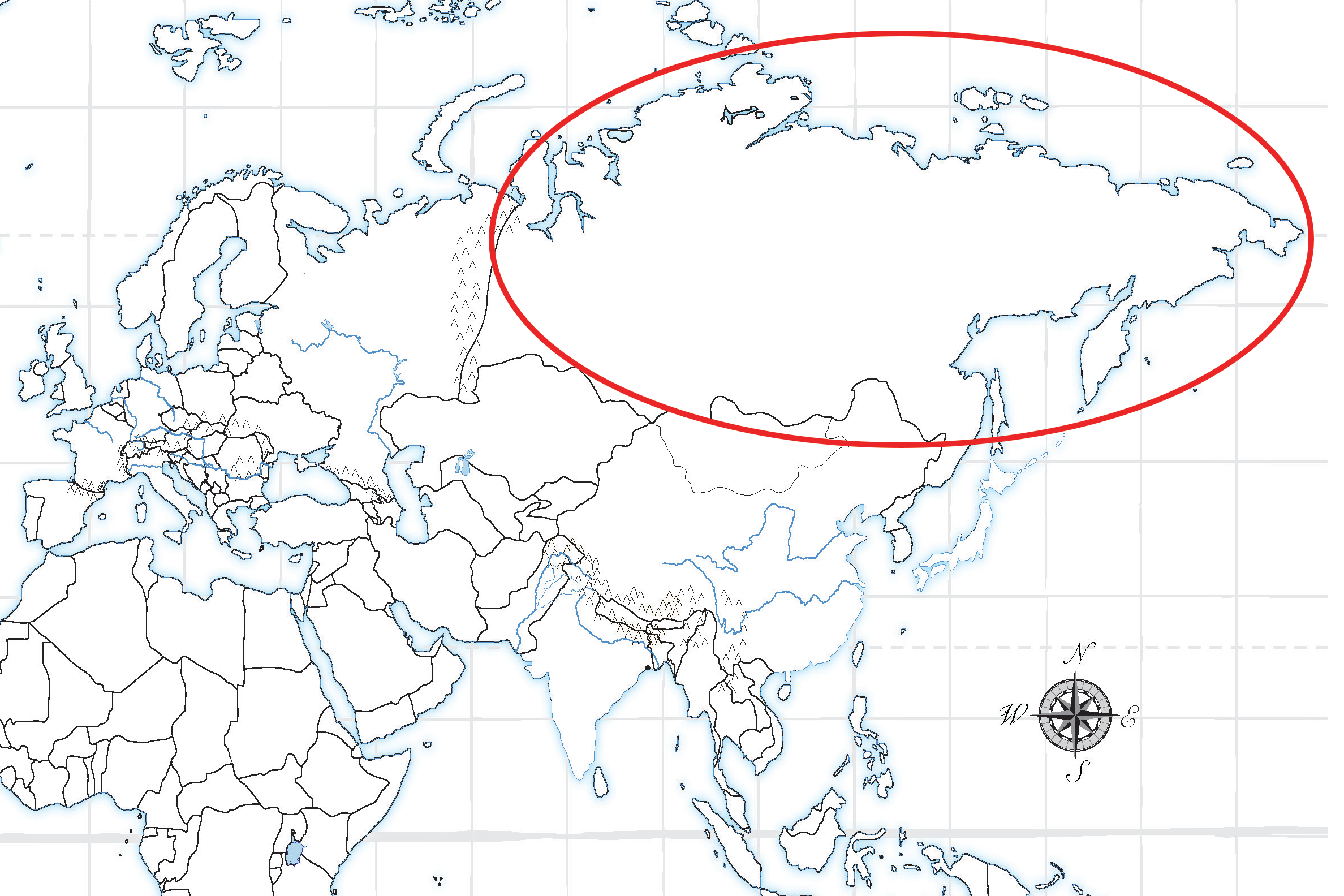
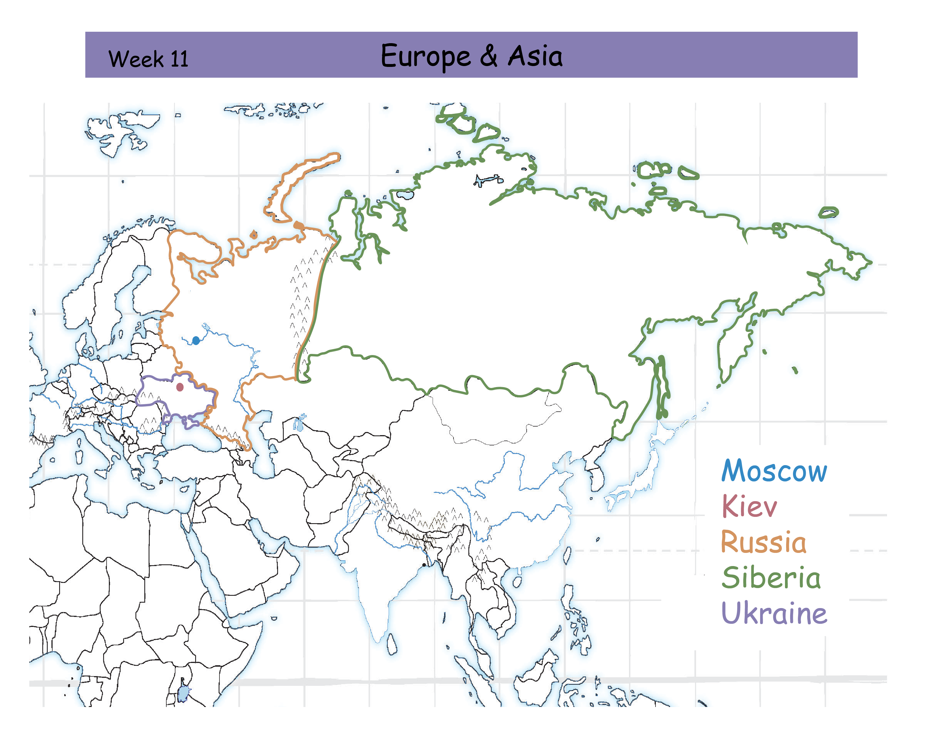
W11 Europe and Asia Review Ca
Moscow
Kiev
Russia
Siberia
Ukraine

Tell me the area in Europe and Asia
Russia. Orange outline. East of Europe and West of the Ural Mountains.


Tell me the area in Europe and Asia
Moscow. Blue dot. Capital city of Russia.

Tell me the area in Europe and Asia
Ukraine. Purple outline. North of the Black Sea "boot".

Tell me the area in Europe and Asia
Kiev. Red dot. Capital city of Ukraine.

Tell me the area in Europe and Asia
Siberia. Green outline. East of the Ural Mountains and part of the continent of Asia
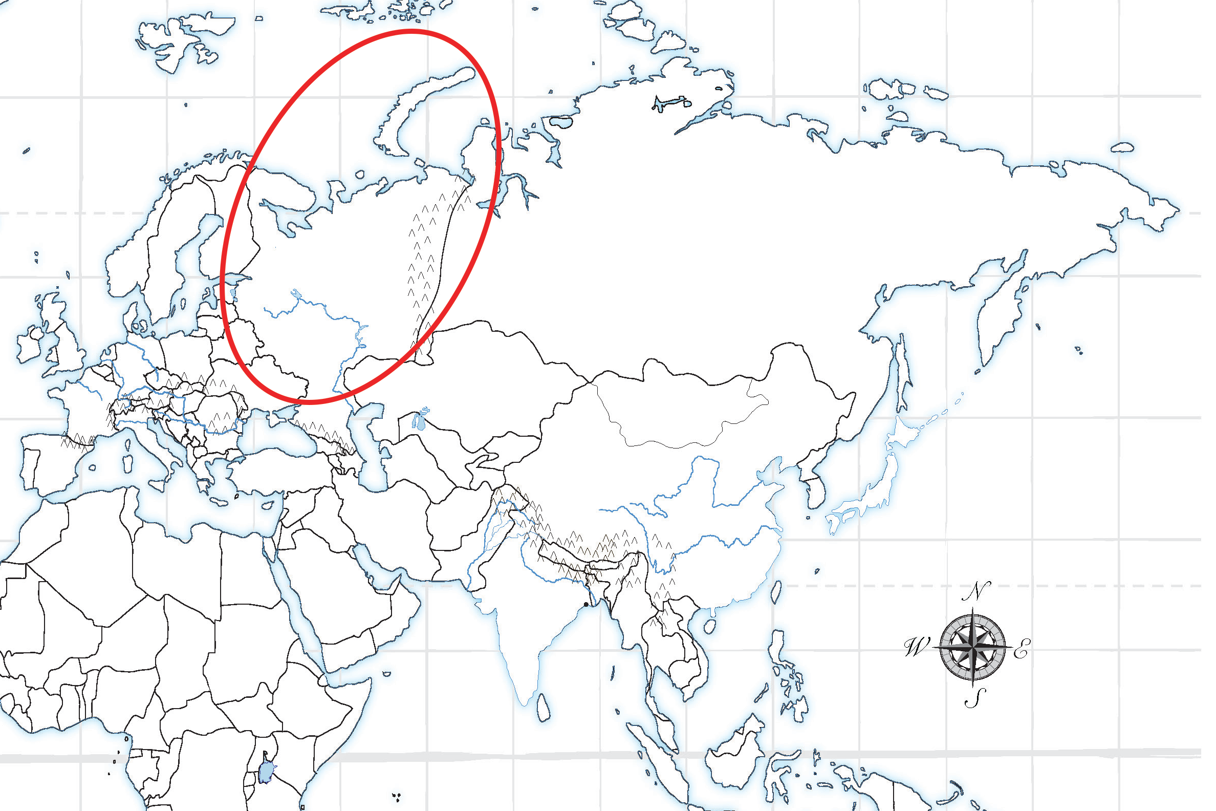
W12 Eastern European Seas Review Card
White Sea
Barents Sea
Black Sea
Caspian Sea
Aral Sea
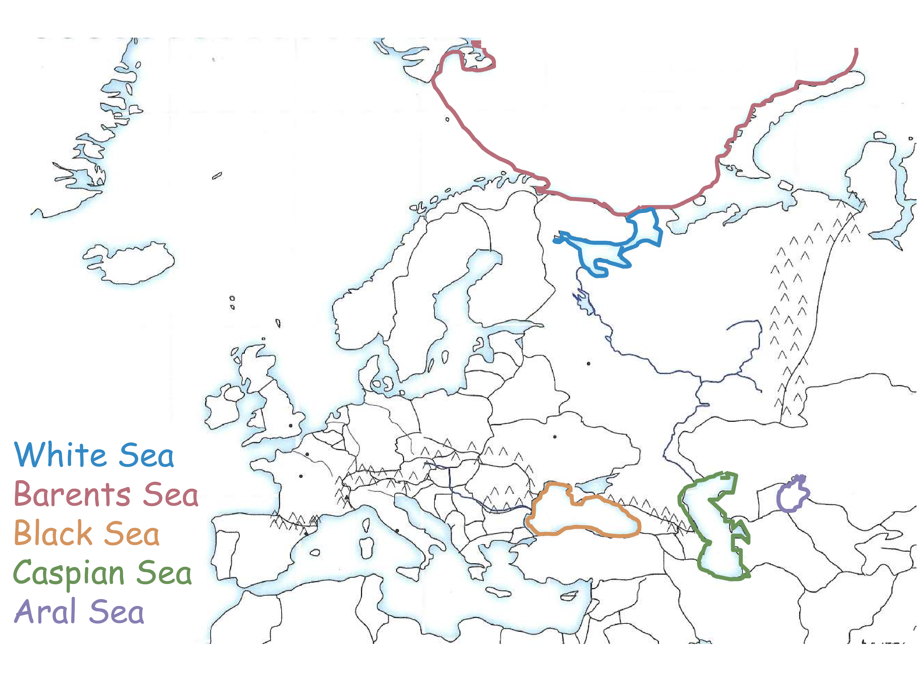

Tell me the Eastern European Sea.
Barents Sea. Red outline. Looks like a bowl atop of Russia.
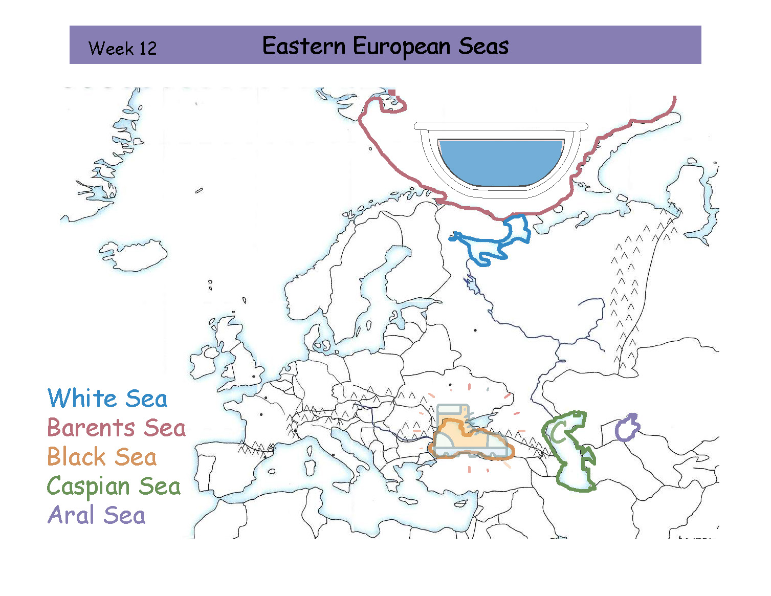
Tell me the Eastern European Sea.
White Sea. Blue oultine. East of the Baltic Sea.


Tell me the Eastern European Sea.
Aral Sea. Purple outline. Small circle and farthest East.


Tell me the Eastern European Sea.
Caspian Sea. Green outline. Makes a "C".


Tell me the Eastern European Sea.
Black Sea. Orange outline. Looks like a hiking boot


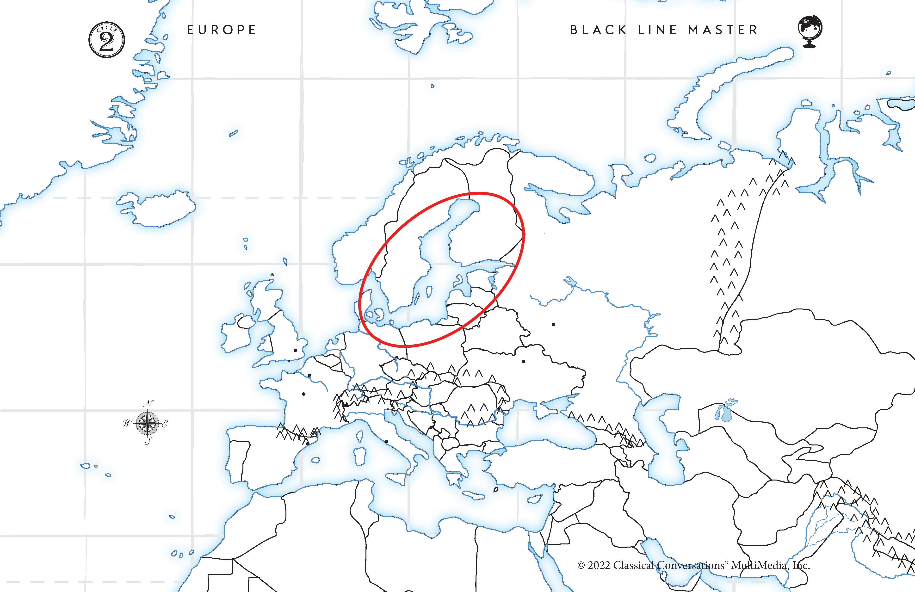
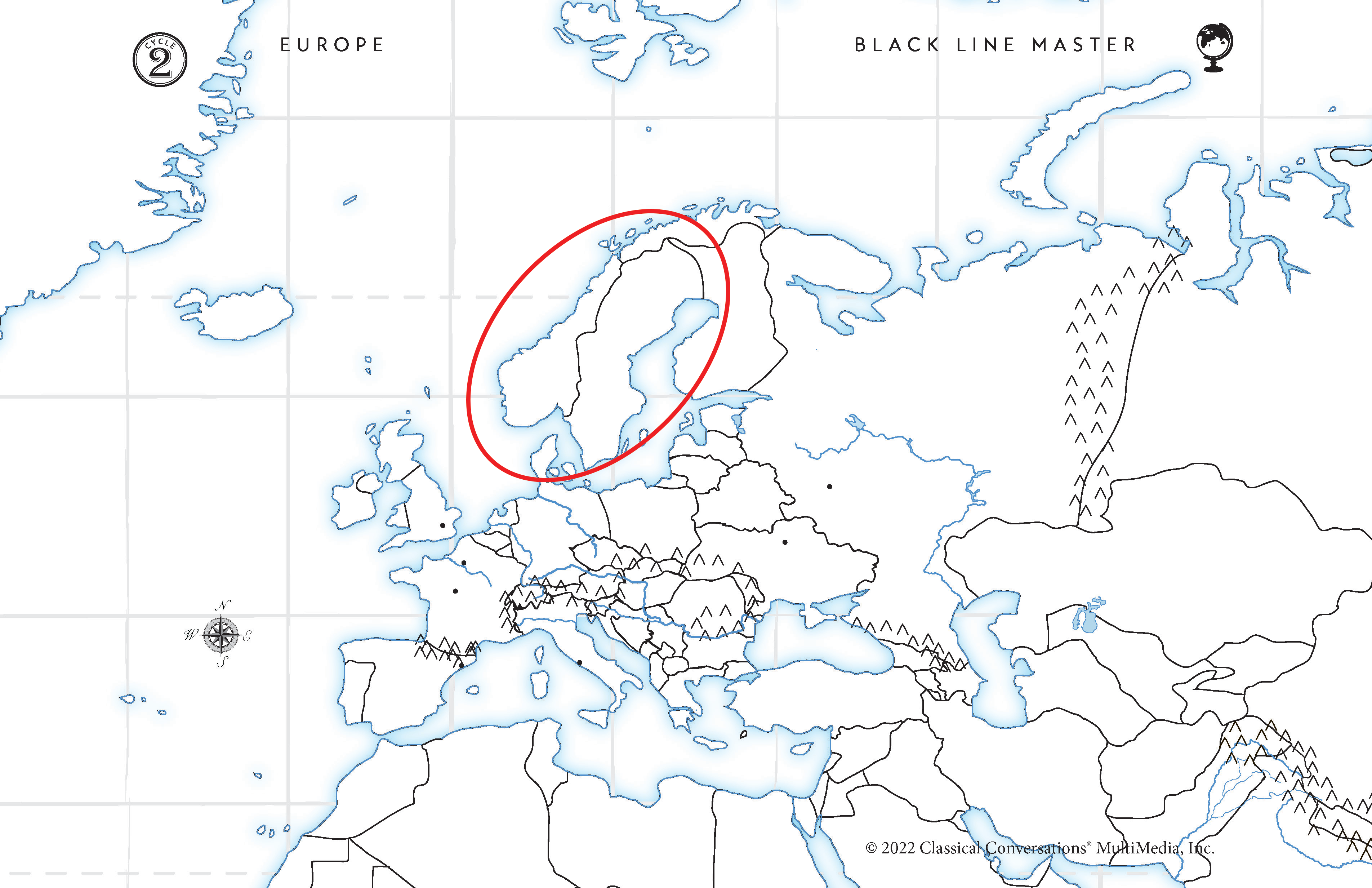
Week 13: Northern European Countries Review
Norway
Sweden
Finland
Denmark

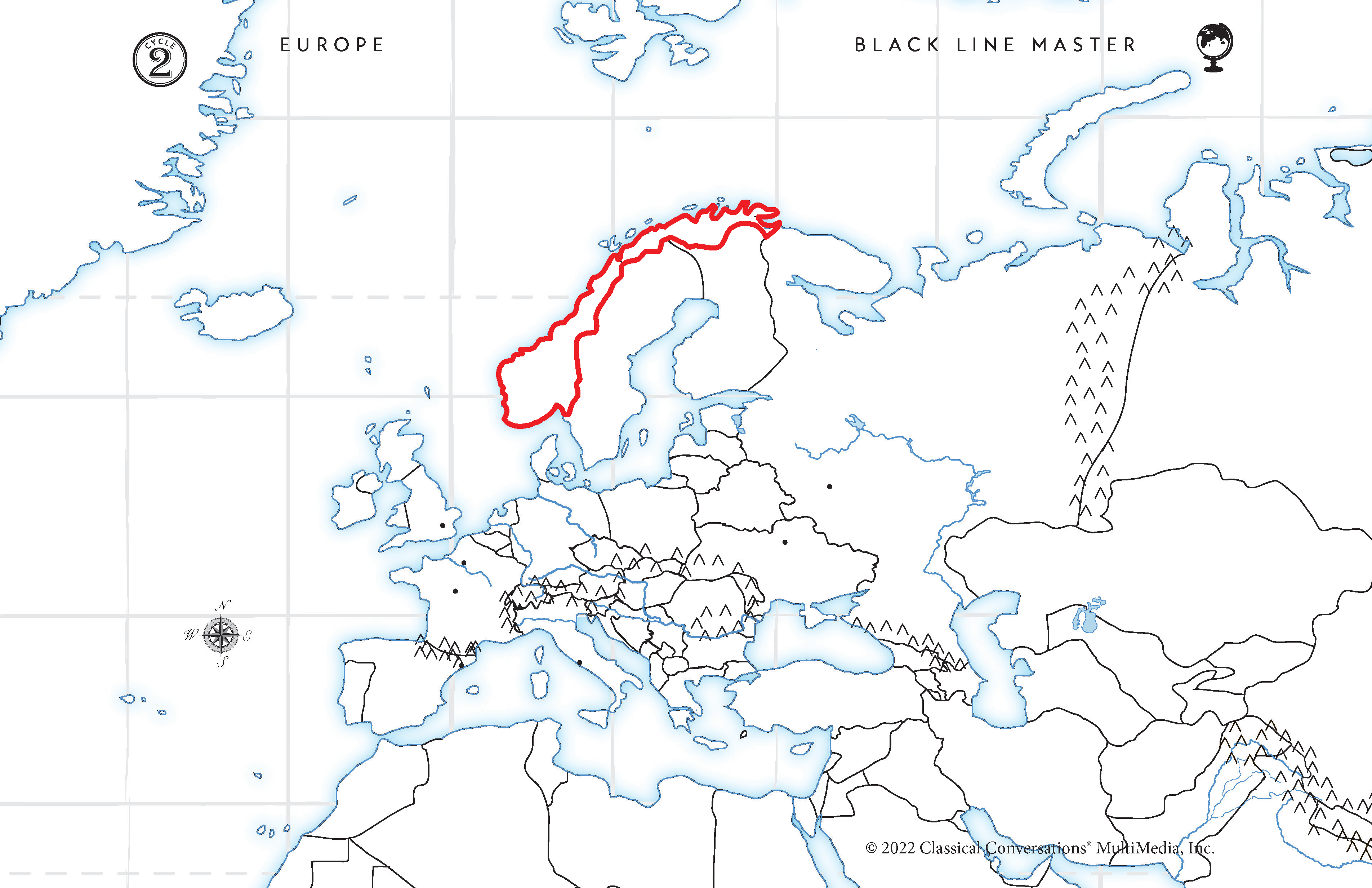
Tell me the Northern European Country.
Norway. Blue outline. Norway is the northernmost country by the North Sea. Put 3 fingers on the map and name them left to right:
Norway
Sweden
and Finland
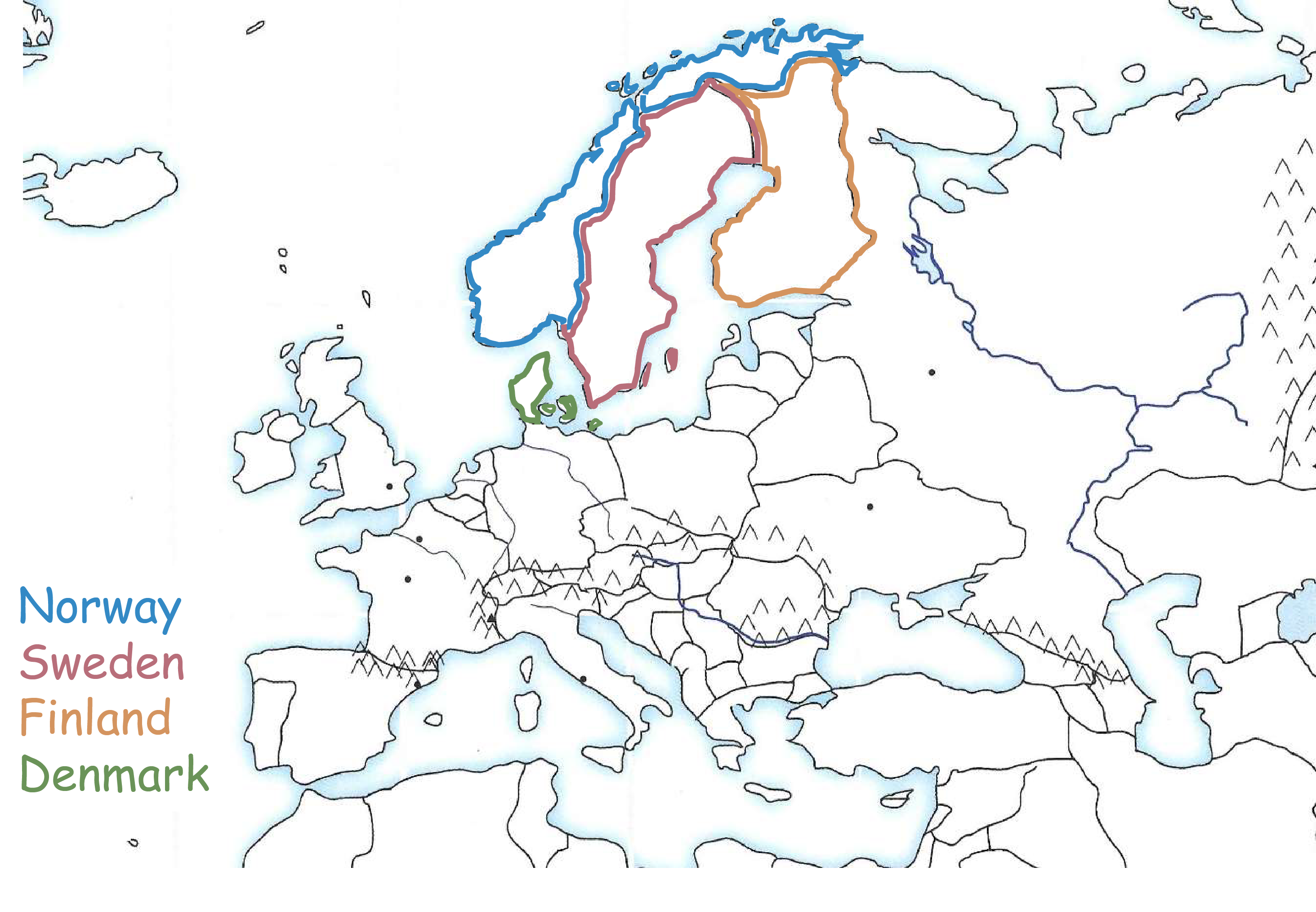
Tell me the Northern European Country.
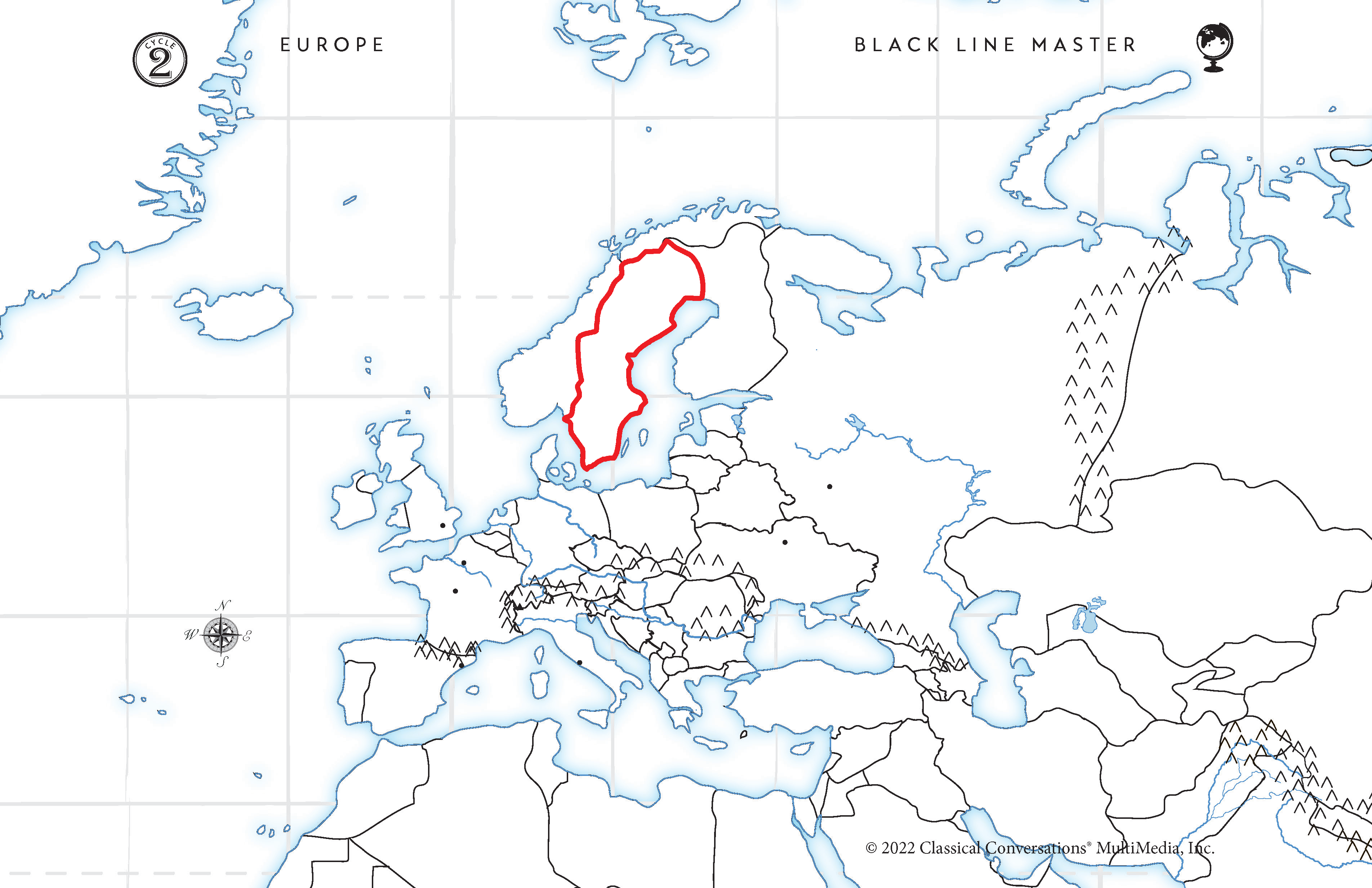
Sweden. Red outline. Squeezed between Norway and Finland

Tell me the Northern European Country.
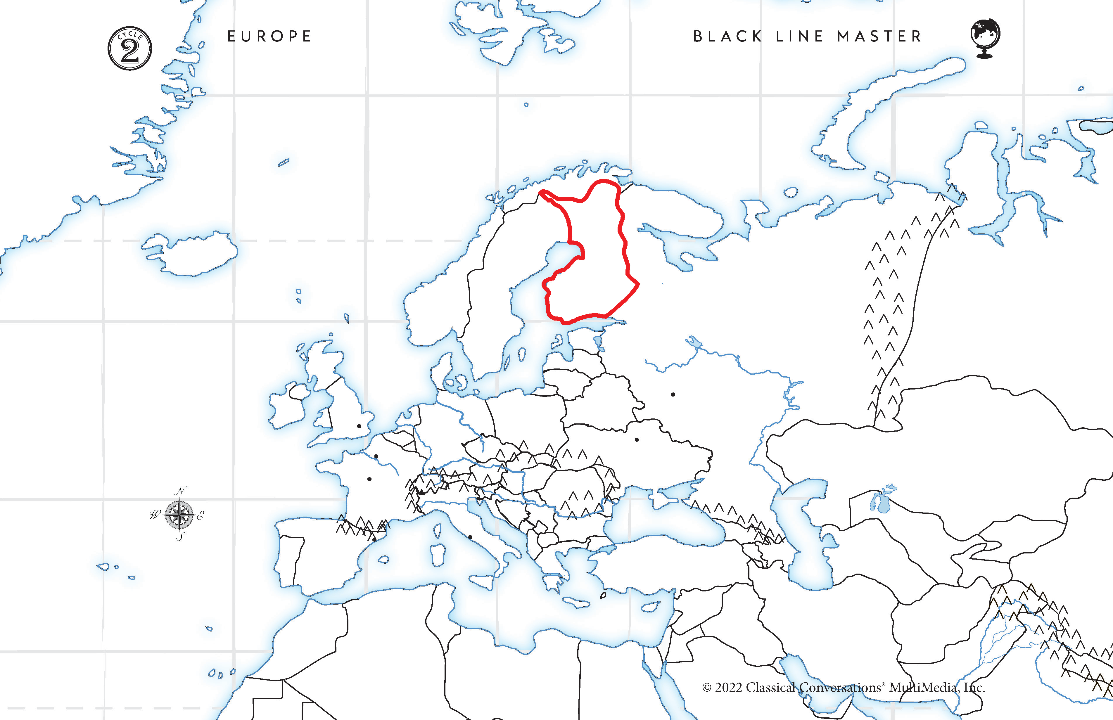
Finland. Orange outline. Finland is the most inland and the Baltic Sea takes a bite of Finland


Tell me the Northern European Country.
Denmark. Green outline. Denmark sticks up below Norway and has an endmark


Week 14: Baltic Europe Review
Estonia
Latvia
Lithuania
Poland
Belarus
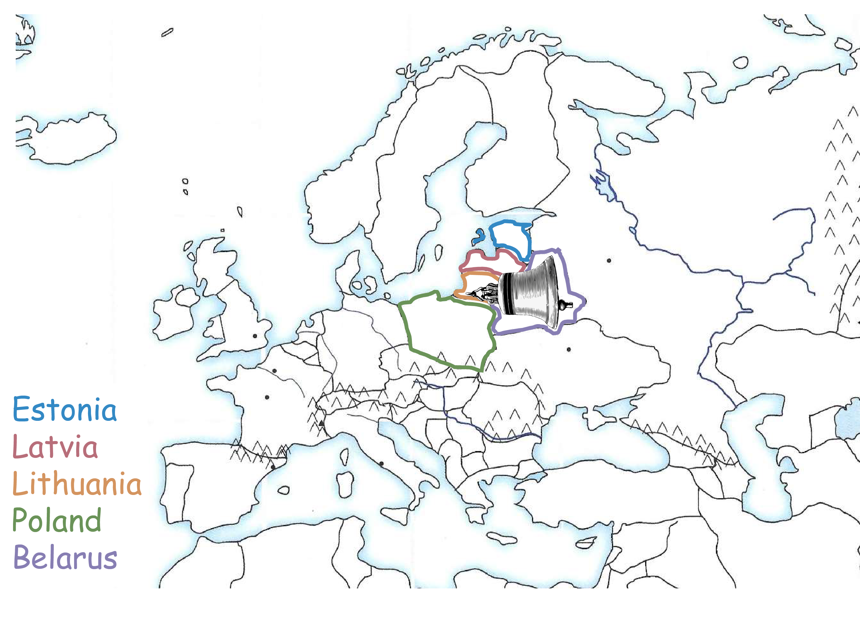

Tell me the Baltic European Country.
Estonia. Blue outine. South of Finland. The first country falling from the "Baltic Sea's bite".


Tell me the Baltic European Country.
Latvia. Red outline. South of Estonia. Has a horizontal southern border like "latitude" and has a "V" shaped cut in the top.


Tell me the Baltic European Country.
Lithuania. Orange Outline. South of Latvia. Has a "U" shaped cut in the side.


Tell me the Baltic European Country.
Belarus. Purple outline. Looks like a bell on it's side.


Tell me the Baltic European Country.
Poland. Green Outline. West of Belarus and looks like a snowball at the bottom of the Baltic Sea


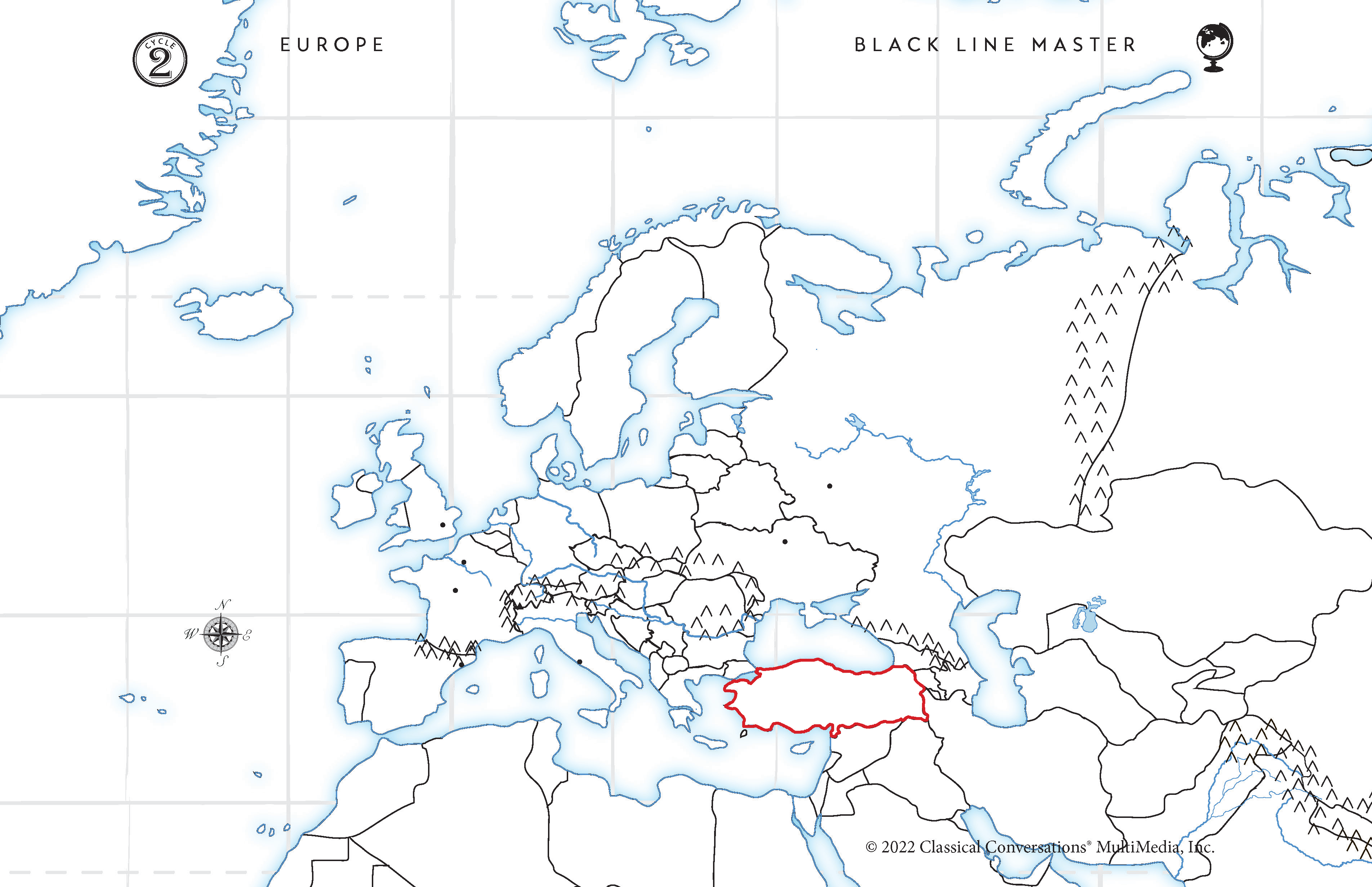
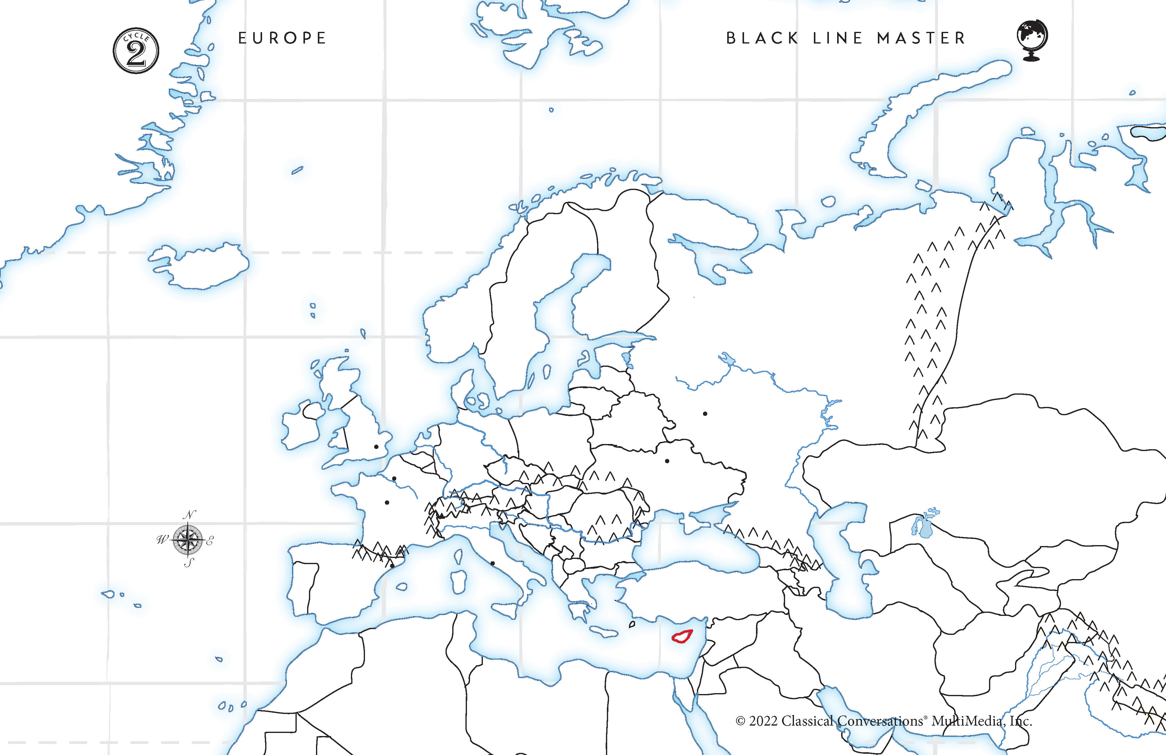
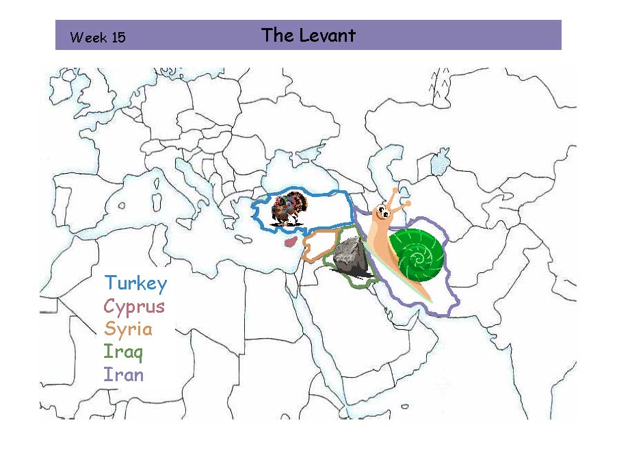
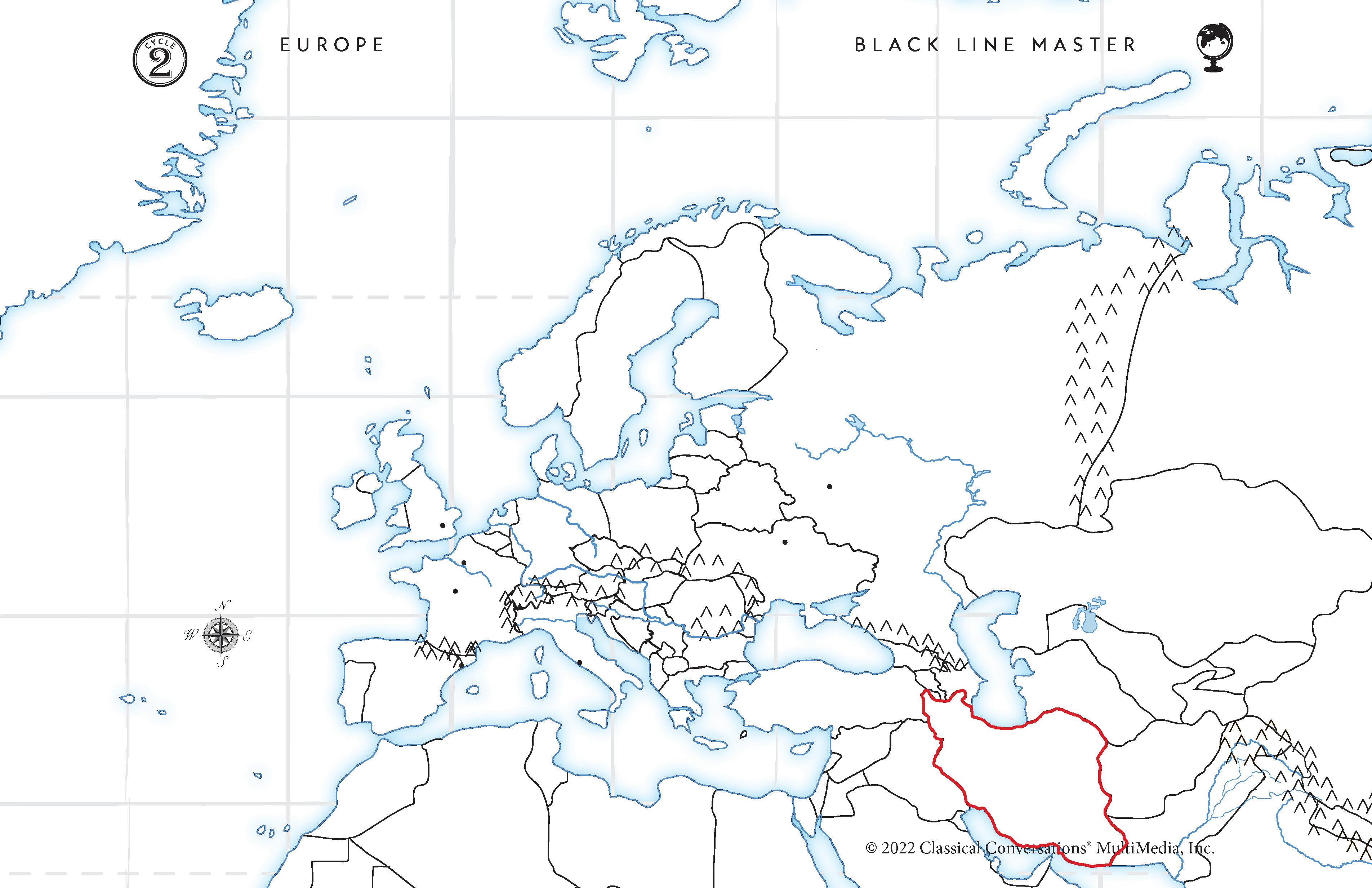
W15 The Levant Review
The Levant
Turkey
Cyprus
Syria
Iraq
Iran

Tell me the Levant Country.
Turkey. Blue Outline. The Black Sea "boot" is stepping on Turkey.

Tell me the Levant Country.
Cyprus. Red Island. Pointy Island in the Meditrranean Sea that points to Syria.


Tell me the Levant Country.
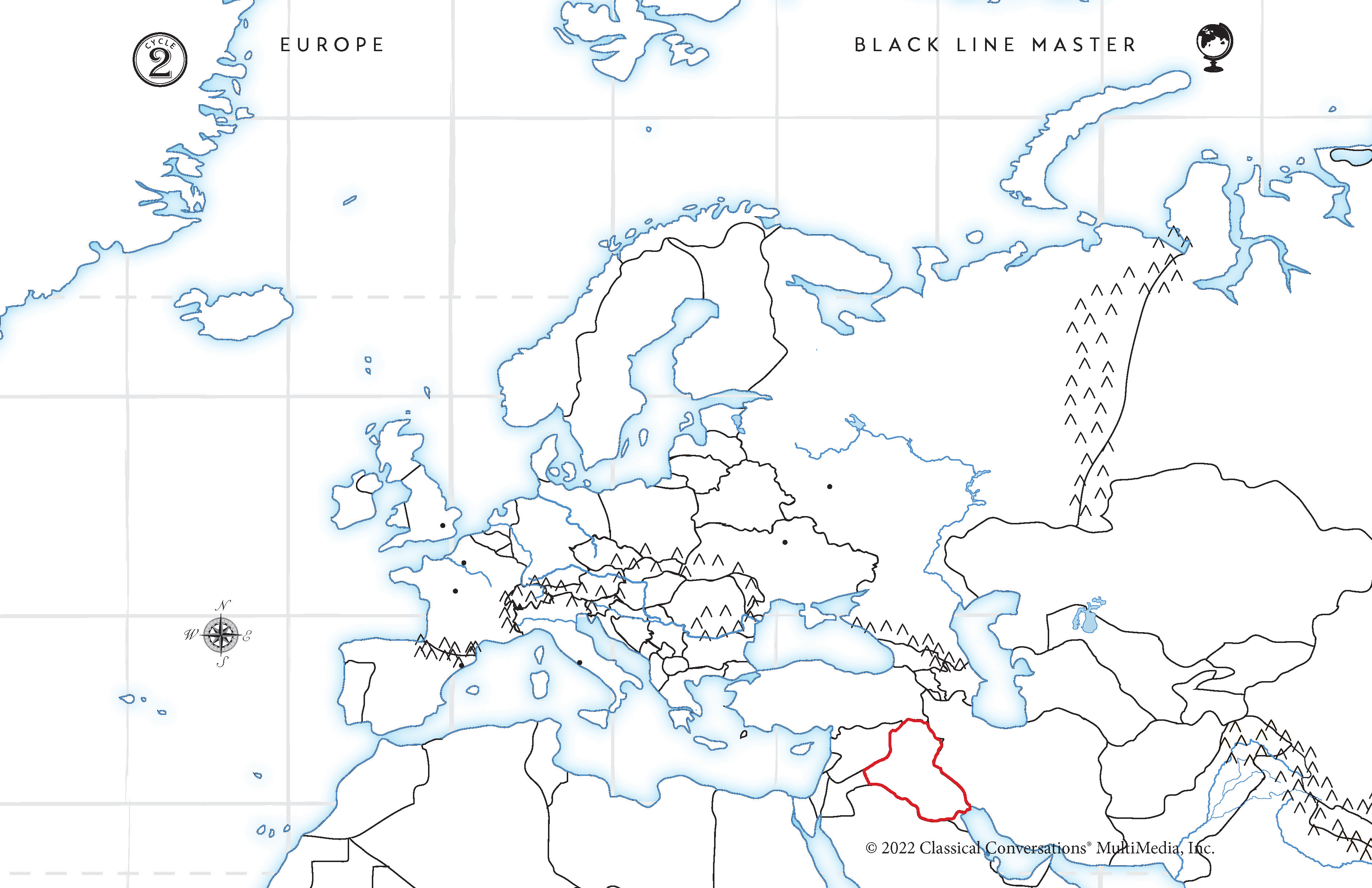
Syria. Orange Outline. South of Turkey.
Tell me the Levant Country.
Iran. Purple Outline. Shaped like a snail about to get poked so "he ran"

Tell me the Levant Country.
Iraq. Green Outline. Between Syria and Iran. "So he ran to a rock"

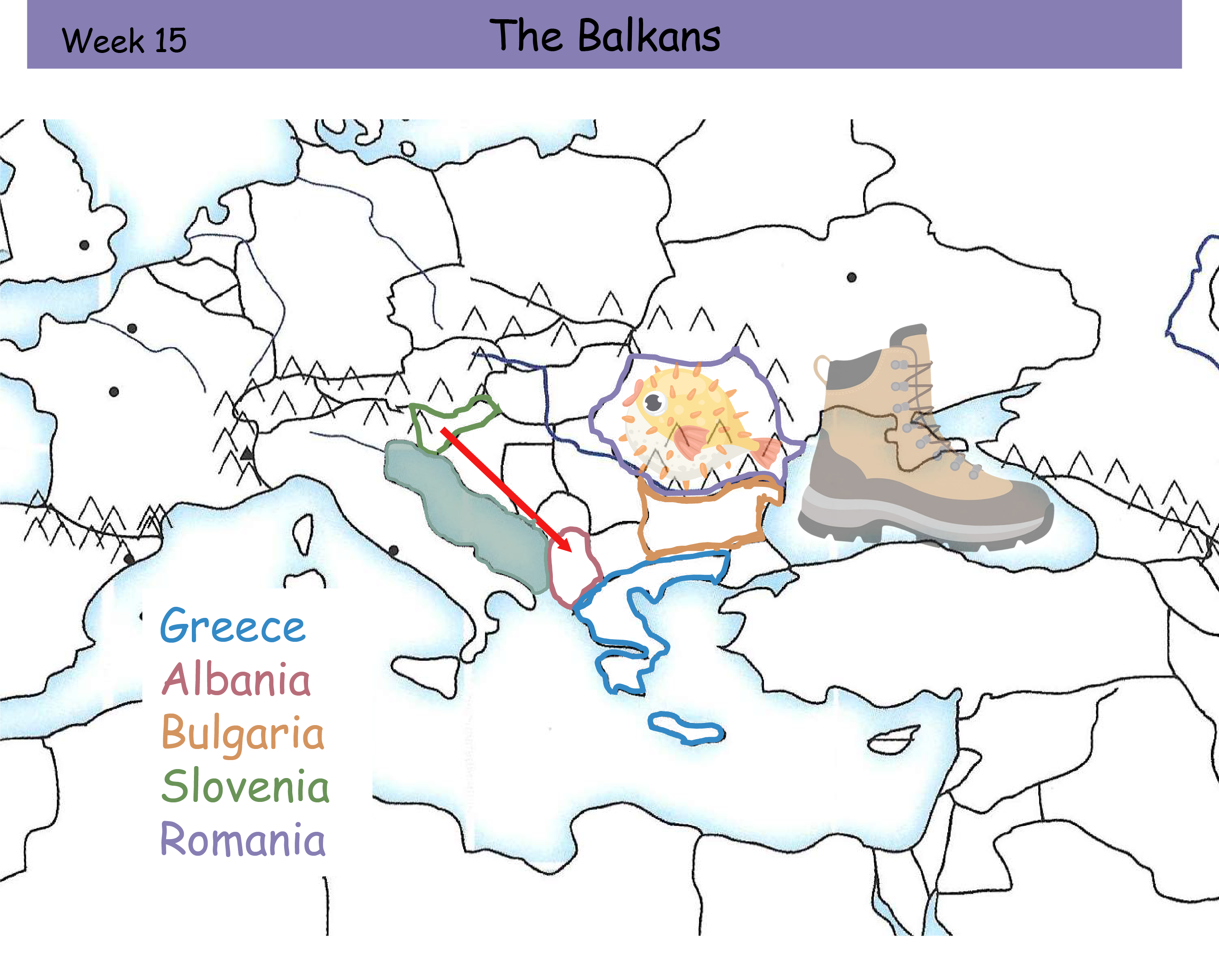
W16 The Balkans Review Card
The Balkans
Greece
Albania
Bulgaria
Slovenia
Romania

Tell me the Balkan country.
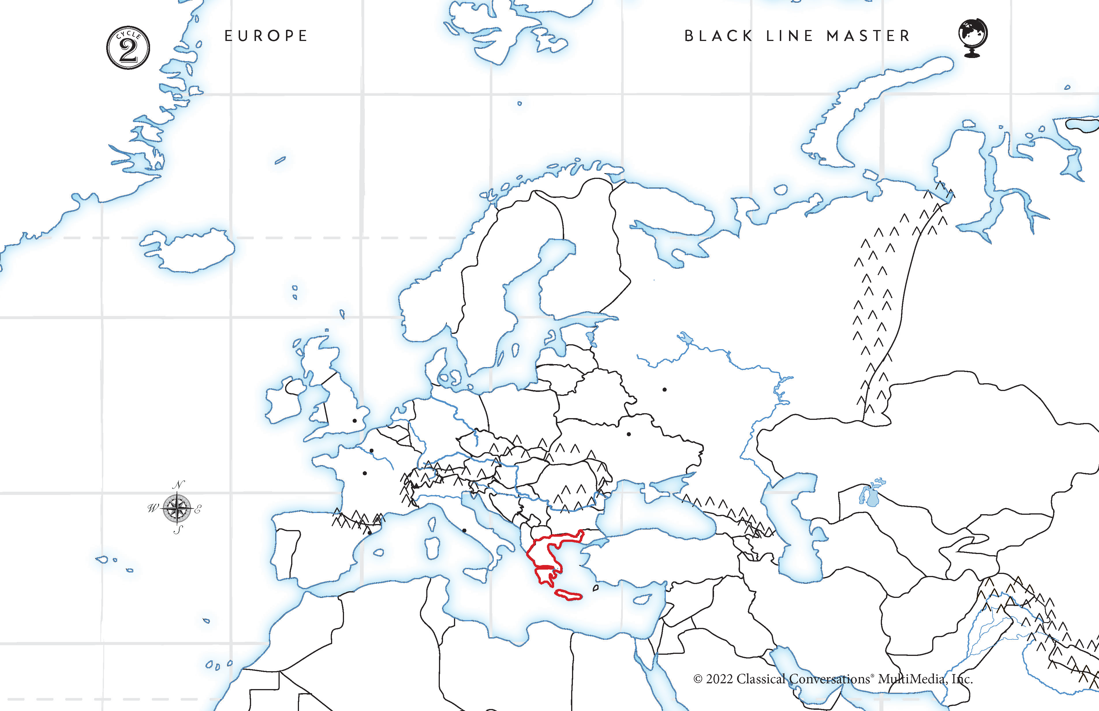
Greece. Blue Outline. Sticks out into the Mediterranean Sea.


Tell me the Balkan country.
Romania. Purple Outline. Behind the Black Sea "boot".
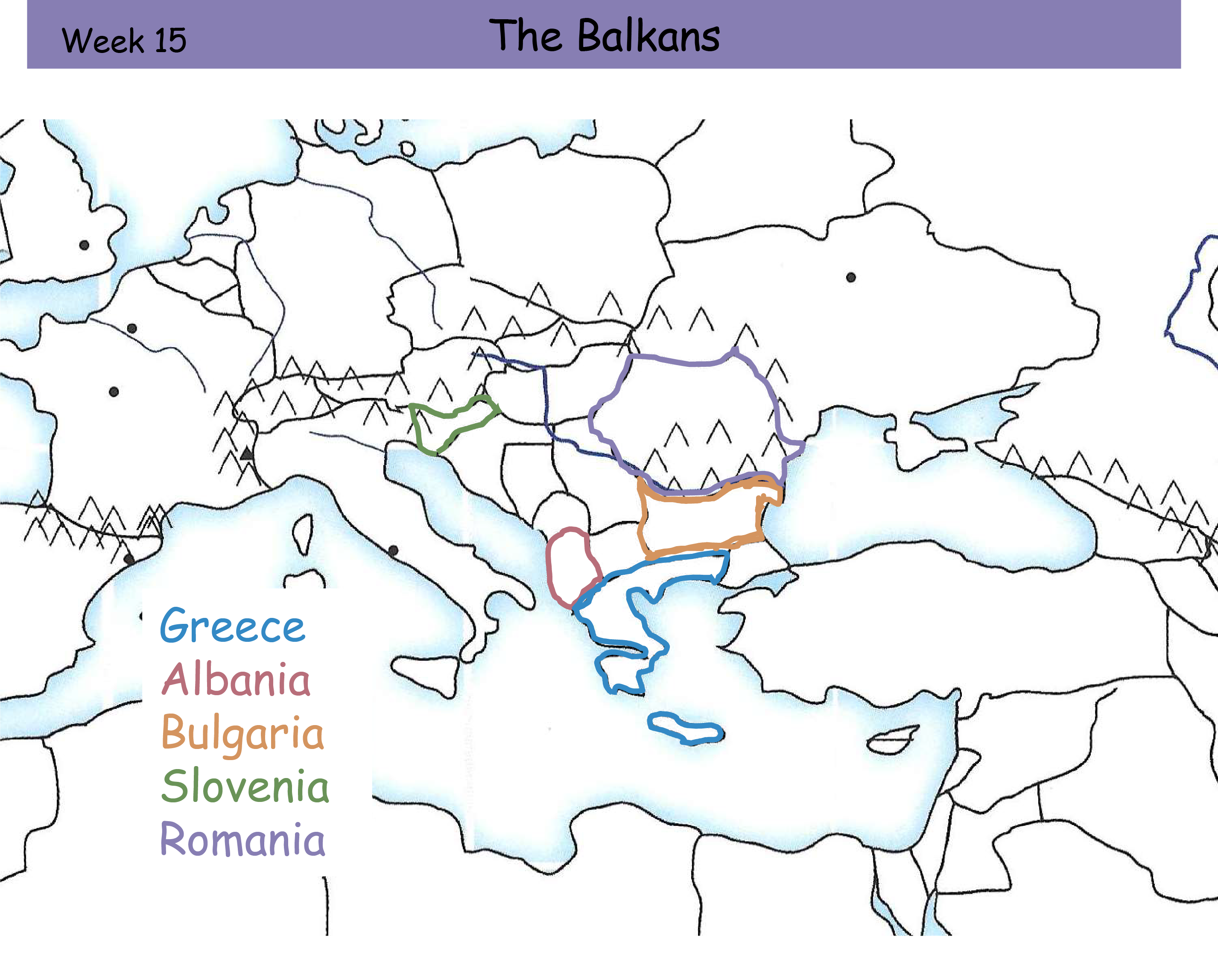

Tell me the Balkan country.
Bulgaria. Orange Outline. Looks like a fish bowl for Romania.
