Wolett
1/18
There's no tags or description
Looks like no tags are added yet.
Name | Mastery | Learn | Test | Matching | Spaced | Call with Kai |
|---|
No analytics yet
Send a link to your students to track their progress
19 Terms
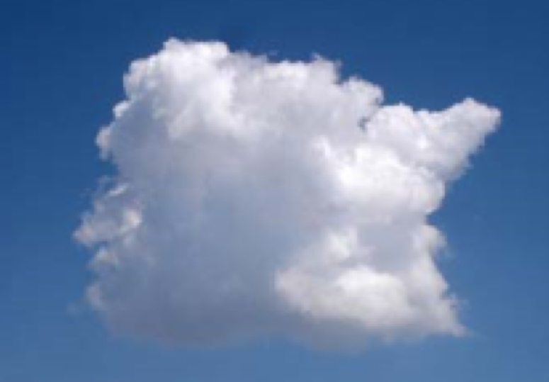
white cotton ball clouds. so long as they look this way good weather. they can turn into cumulonimbus clouds (vertical growth)
anvil like shape because its so tall it hits tropopause which is warmer and does not allow the cloud to grow further up. anvil shows the direction of the storms movement. bring rain, hail, tornadoes and lightning. Formation: through some trigger like the ground heating air, fronts or mountains, a strong updraft lifts warm, moist, unstable air upwards until it condenses and becomes a cumulus cloud. because the air is unstable (air parcel still warmer than surroundings) this cloud keeps growing upwards (vertical growth) turning into a cumulus congestus and then a cumulonimbus cloud.
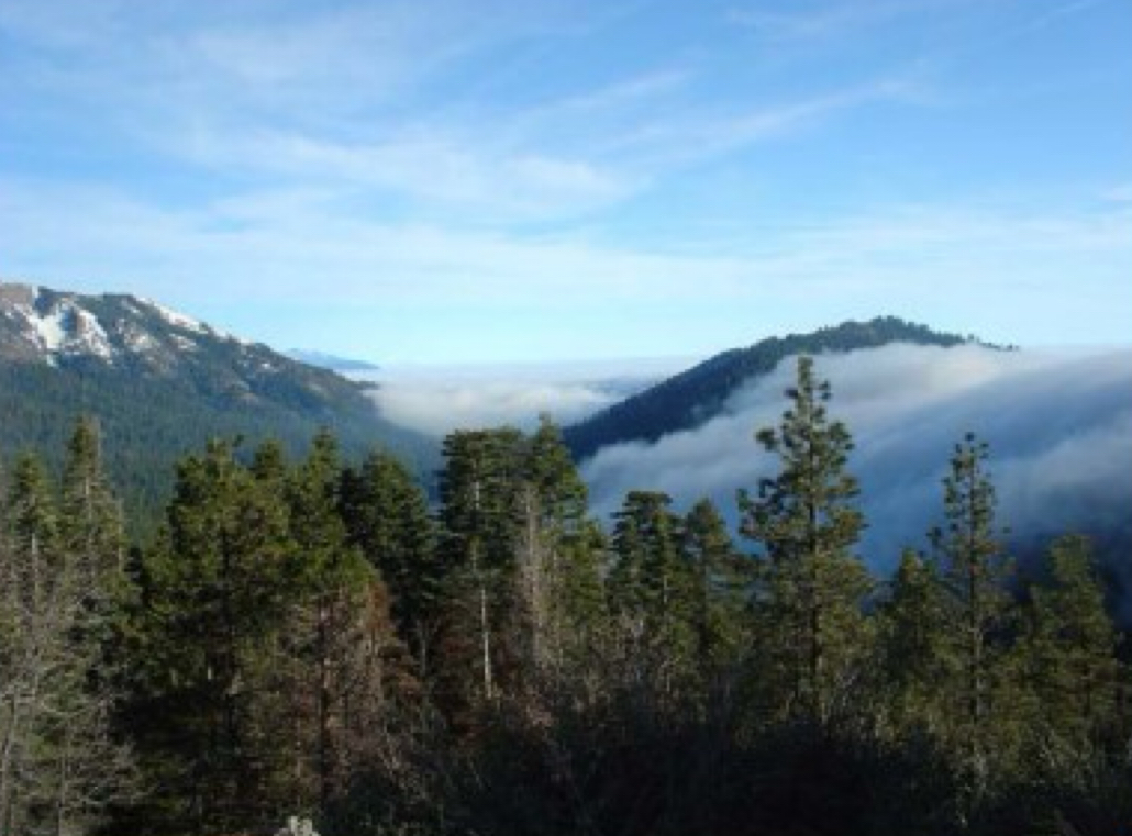
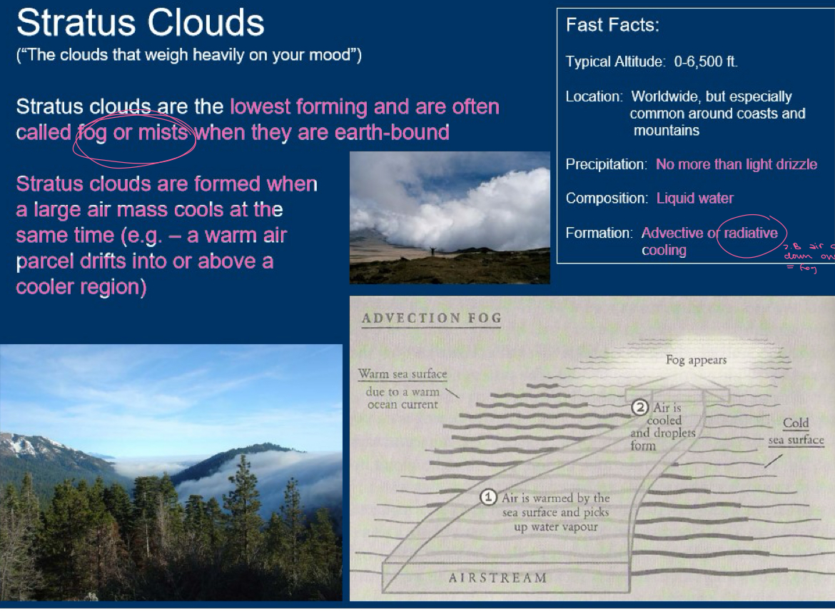
solid clouds. often formed when fog lifts off of the ground. often bring drizzle or light snow. imagine a very gentle sheet covering you when you go to sleep. no wild weather just a little rain or snow. Formation: (reference: picture) advective or radioactive cooling. advective cooling means that warm moist air meets cold air and clouds are formed on that boundary. radioactive cooling just means that the warm and moist air cools overnight and condenses to fog.

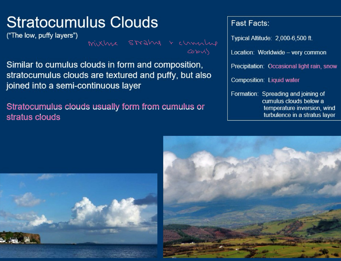
grey. do not bring precipitation. do not cover entire sky, bumpy. tend to come in rows and patches. good weather now but can develop? THEY ARE NOT CUMULUS OR STRATUS MERGED. they form from EITHER cumulus OR stratus clouds.
Large fluffy sheets A LOT OF CONTRAST LIGHT AND DARK DH YK WASSER DRINN → if you see them in the morning: maybe thunderstorm in the afternoon, but in the morning itself nice weather with maybe a teensy drizzle. sunlight does not pass through, but you can see a bit of sky between the different cloud heaps, that all in all stretch over big portion of the sky.
grey and or blue, cover whole sky. right now they only produce light drizzle, they were formed from descending and thickening cirrostratus clouds (high clouds now middle). LATER when they descend further to become nimbostratus (low clouds) they produce continous rain or snow. THEY ARE A SIGNAL: WEATHER CHANGE SOON WHEN THEY LOWER THEMSELVES.
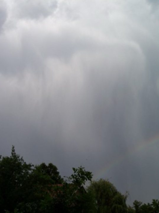
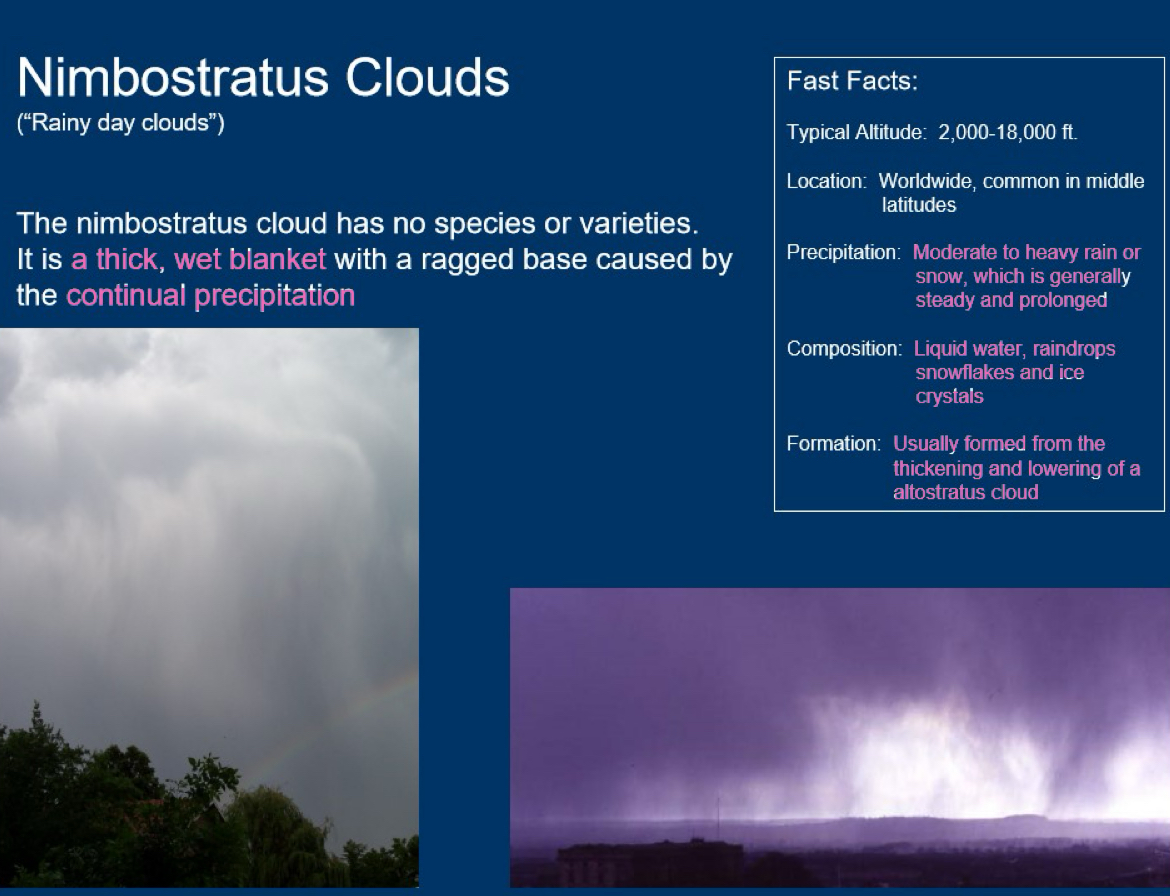
nimbostratus have this wishy washy back because of the active rain coming from them. nimbostratus MEANS rain. large flat grey sheet with a little differentiation. its raining RIGHT NOW. low level. NIMBOSTRATUS ARE MADE OF EVERYTHING, LOOK CRAZY, HAVE A CRAZY COMPOSITION (ice, water, raindrops, snow). they are the last step of the cirrostratus to altostratus to nimbostratus lowering
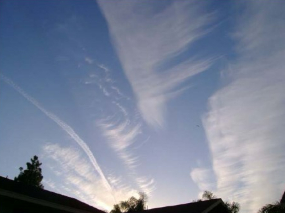
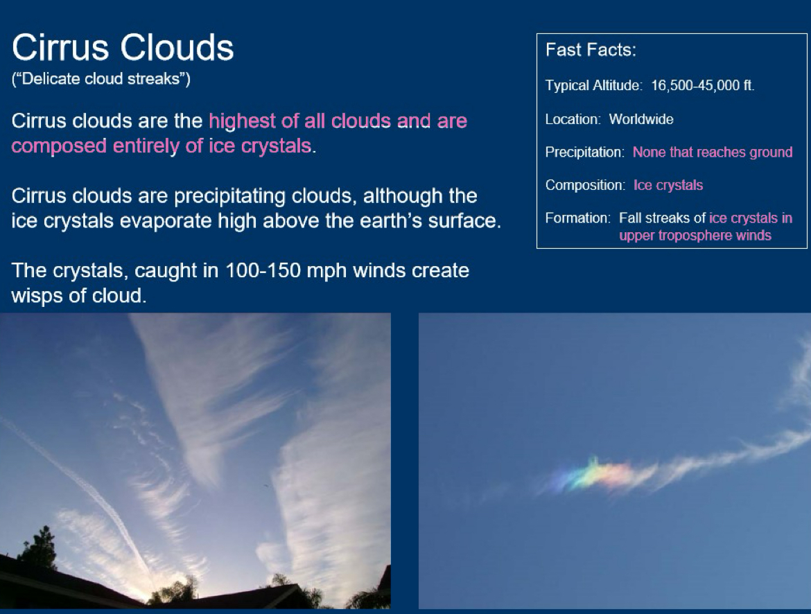
Good weather now, (change of weather soon). formed through ice crystals being caught in super fast upper troposphere winds. they are the highest clouds!
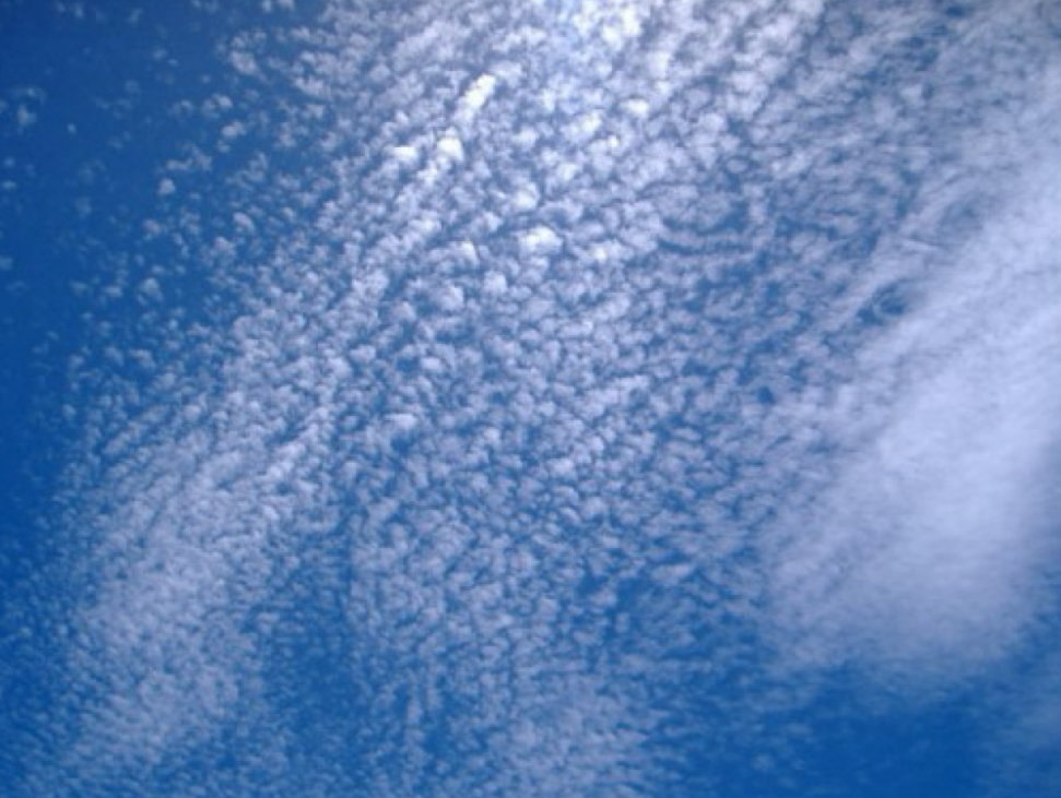
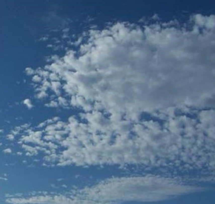
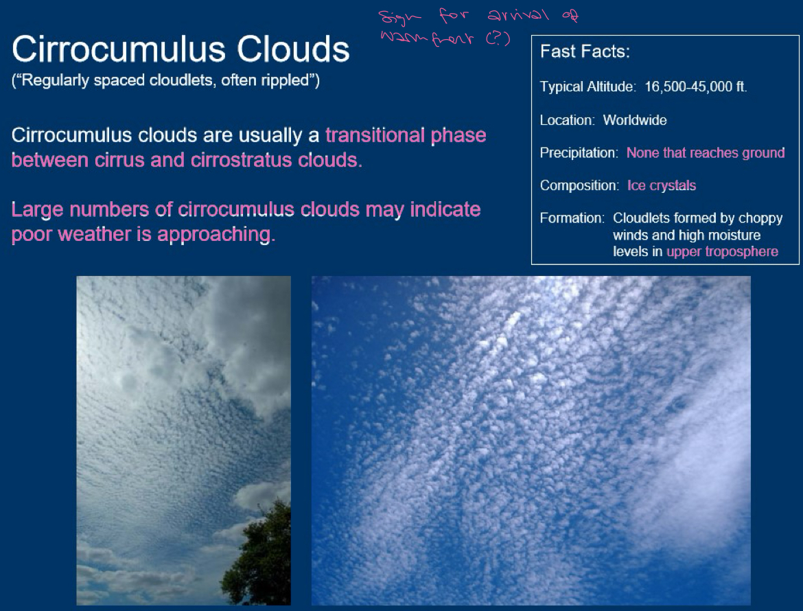
neatly arranged. if you have a lit of cloudlets it might mean bad weather soon. in tropics cirrocumulus clouds mean approaching storm or hurricane. TRANSITIONAL PHASE BETWEEN CIRRUS AND CIRROSTRATUS (also kette: cirrus becomes cirrocumulus becomes cirrostratus lowers and thickens to altostratus lowers and thickens to nimbostratus). formed in upper troposphere because of choppy wind and moisture
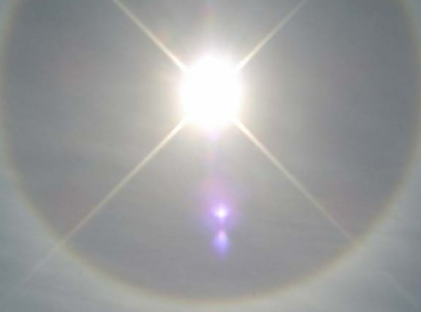
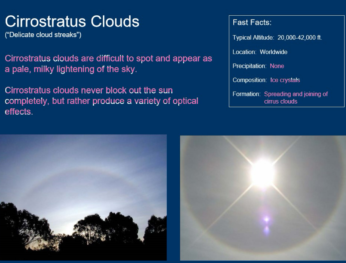
can see sun/moon through it because it is made of ice crystals that do not block sunlight, like milky sheet. produce optical effects bc ice reflects in cool ways! moist weather in 12-24h.
directly created from cirrus (so cirrocumulus zwischenphase isn’t necessarily the case) spreading and joining. threadlike to sheetlike. unlike other cirrus clouds it produces NO precipitation. the others’ just doesnt reach the ground
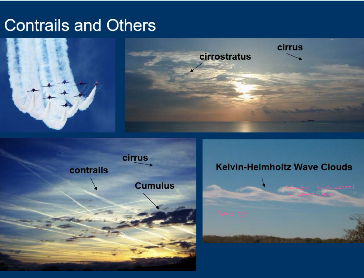
Contrails and others
Upper Layer Infos
Do not block sunlight, ice crystals. do not mean rain
Middle Layers Infos
Often block sunlight, because usually water but if cold enough can be comprised of ice. both called alto-. both rarely rain themselves but can predict weather changes and even thunderstorms in the future
Low Cloud Info
Tend to contain water or snow if cold enough. block sunlight. can bring precipitation and wind. they all have strato in their name: stratus which is the mild rain/snow cover, stratocumulus that dont bring rain, nimbostratus RAIN.
Vertical Growth
base veery low and top veeery high. cumulus and cumulonimbus. cumulus grows into cumulonimbus
No clouds?
Weather’s fine!
Thick clouds?
chance of poor weather one or two days in the future. middle or low altitude.
When will the storm arrive? (thick, non uppermost layer (dh can see sun or moon through them) clouds
clouds are stationary: SLOW MOVING WEATHER FRONT storm will not arrive for over a day
clouds are moving: fast change in weather.
storm is travelling in direction the clouds are pointing to
How to differentiate low and middle clouds? and cumulus ig
covering entire sky: MIDDLE ALTITUDE → rain within half a day
→ grey with blue tint: altostratus
→ fluffy white grey strong contrast: altocumulus.
so middle easiest to tell with colour
low, engulf mountains and buildings: LOW ALTITUDE
→ lifted up grey fog: stratus, drizzle now or soon.
→ low dark lumpy clouds in rows: stratocumulus? SO THEY ARE FLUFFY BUT BIGGER AND GREYER THAN CUMULUS.
low dark grey sheet and raining (or will in like 5 mins): nimbostratus