Map Projections
1/3
There's no tags or description
Looks like no tags are added yet.
Name | Mastery | Learn | Test | Matching | Spaced | Call with Kai |
|---|
No analytics yet
Send a link to your students to track their progress
4 Terms
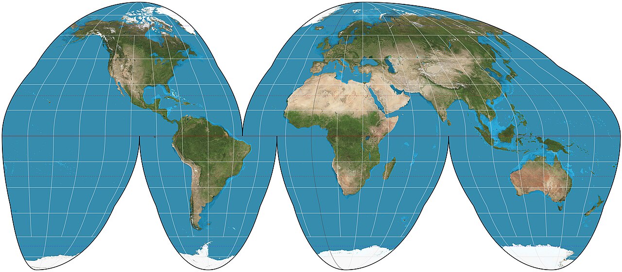
Good Homolosine
equal-area map projection designed to show the entire world with minimal distortion to both shape and size.
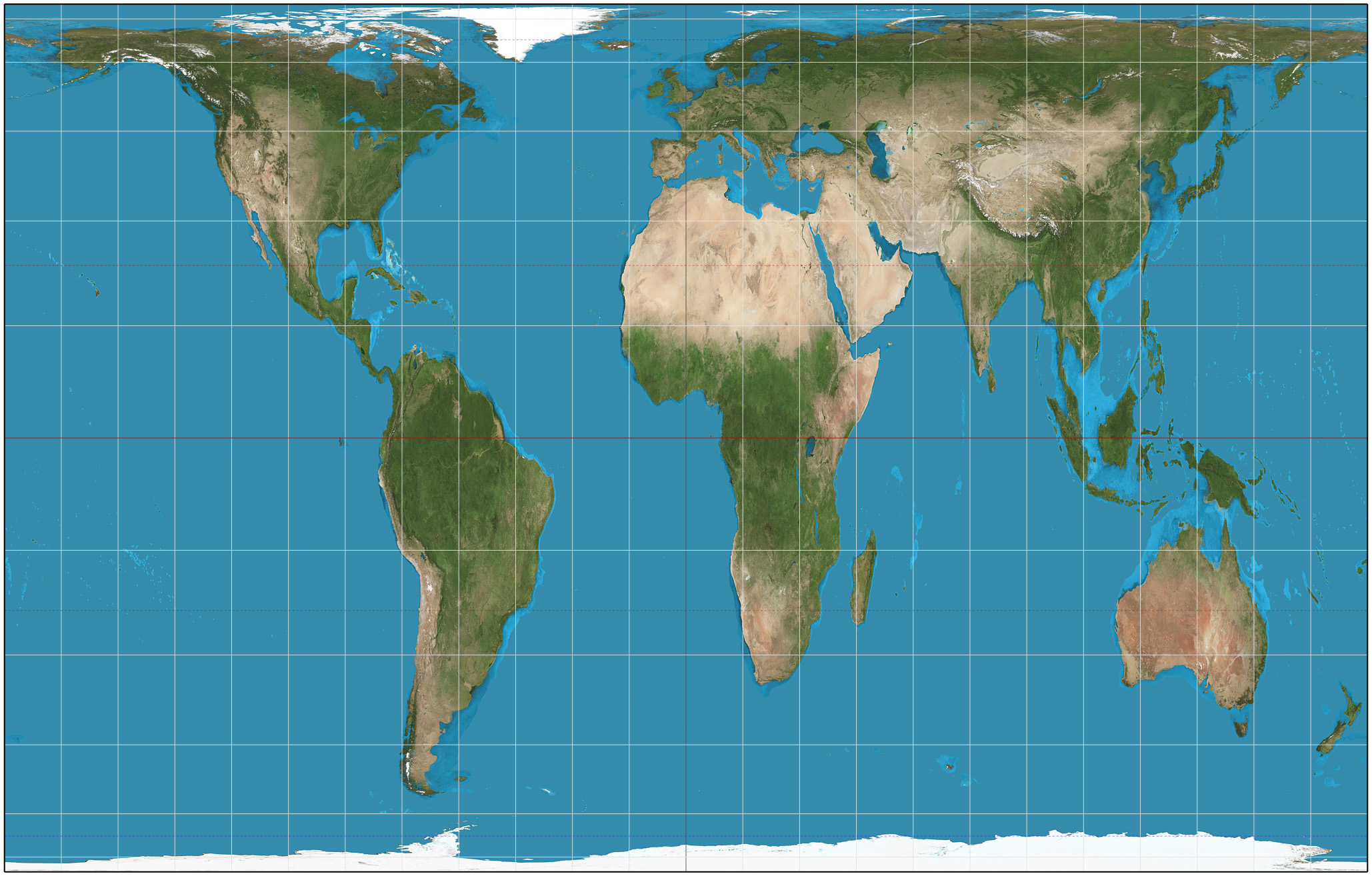
Mercator Projection
It is highly valued for navigation because it preserves shapes and angles (conformal), allowing sailors to plot straight-line courses (rhumb lines) of constant direction. However, it distorts size, especially near the poles, making landmasses appear larger than they actually are.
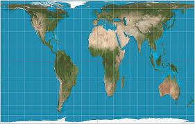
Gall-Peters Projection
a rectangular, equal-area world map that displays the correct relative sizes of countries and continents, but significantly distorts the shapes of landmasses, stretching them near the equator and squishing them at the poles.
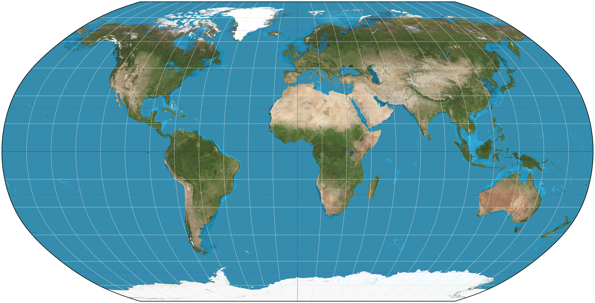
Robinson Projection
a "compromise" map projection designed in 1963 to show the entire world at once by balancing distortions of size, shape, distance, and direction.