Geo Lecture 11
1/42
There's no tags or description
Looks like no tags are added yet.
Name | Mastery | Learn | Test | Matching | Spaced | Call with Kai |
|---|
No analytics yet
Send a link to your students to track their progress
43 Terms
When examining glacial processes, what is a glacier vs a snowline?
Glacier - a large mass of ice on land or extending outward from land over sea
Snowline - a line of elevation, usually on a mountain, where snow remains year-round
What is the cryosphere?
The land in the world covered by glaciers (approx 11%). Most of this ice is on Greenland and Antarctica.
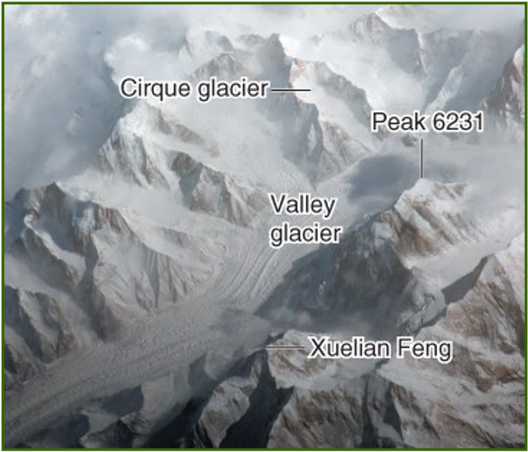
What are the four types of glaciers? (VCPT)
Valley glacier - a glacier confined to a valley of a mountainous area
Cirque glacier - a glacier on the side of a mountain
Piedmont glacier - a glacier formed by a coalescence of several valley glaciers in a mountain range.
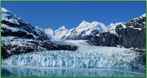
Tidewater glacier - a glacier that flows all the way down to the ocean
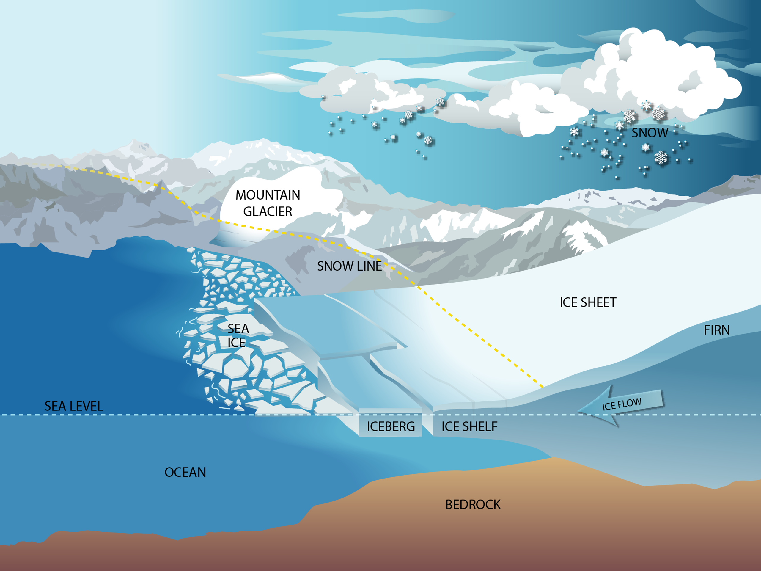
What are continental glaciers and what are their two forms? (SC)
Large continuous masses of ice that can be found in either mountainous or non-mountainous regions; may exist in two norms:
Ice sheet - an expanse of continental ice larger than 50k²
Ice cap - an expanse of ice smaller than an ice sheet; are circular in shape.
What is the Athabasca Glacier?
The most well-known glacier in the Columbia Ice Field.
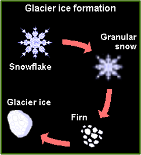
How do glaciers form?
Through layers of snow accumulating resulting in increased pressure, density, and thickness.
Over many years snow responds to these changes by crystallizing into firn and consolidating to form a mass of glacial ice.
Glaciers are built by years and years of snow not melting.
What type of systems are glaciers?
Glaciers are open systems, meaning they exchange both energy and matter with their surroundings.
Input: snow
Output: meltwater and evaporation
Variations in snowfall and temperature result in changes in ice volume and glacial movement.
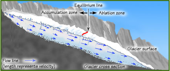
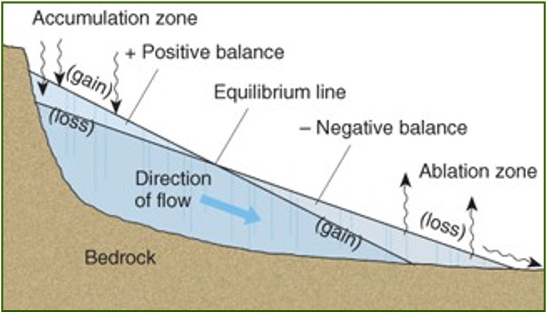
What is Glacial mass balance?
The relationship between the accumulation and ablation zones of a glacier.
Accumulation zone - the upper end of a glacier where ice is gained by snowfall.
Ablation zone (wastage zone) - the lower end of a glacier where ice is lost by melting or calving.
When is a glacier in a state of equilibrium?
Equillibrium line separates the accumulation and ablation zones on a glacier. Glaciers are always on a slope.
if Gain = Loss the glacier is in equillibrium (ice is still flowing forward but the endpoint doesn’t move)
gain < loss = retreat (shrink)
gain > loss = advance (enlarge)
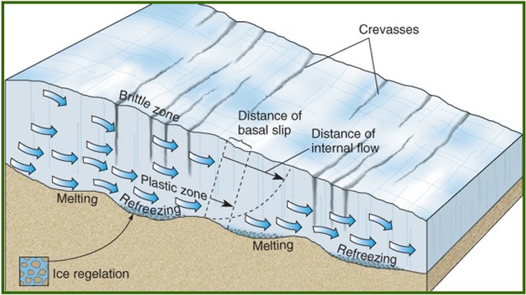
What is glacial movement?
When the underlying portion of a glacier distorts and flows in response to the weight and pressure of overlying snow and the slope gradient below.
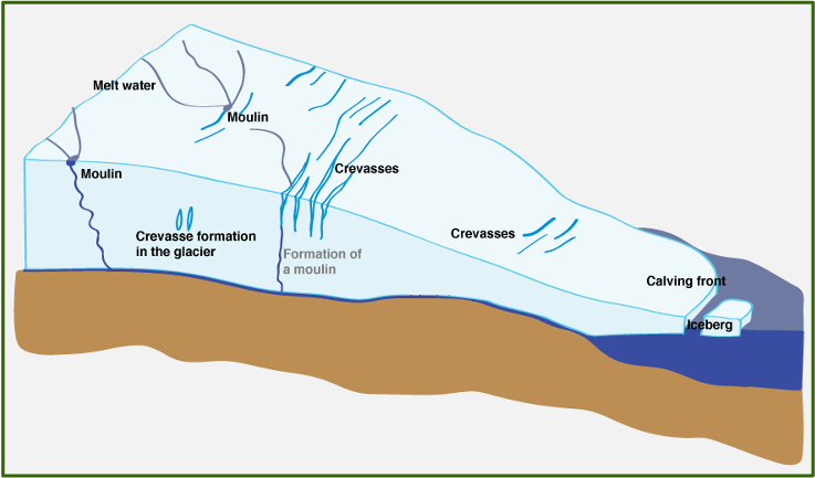
A moving glacier can develop crevasses (vertical cracks) due to stretching or compression as the glacier moves over uneven slopes.
How do glaciers erode material?
By plucking and then transporting material englacially before depositing it elsewhere.
Glacial abrasion - the grinding away of bedrock caused by materials embedded in glacial ice
Abrasion can produce glacial polish (smooth surface on exposed rock visible after the glacier retreats).
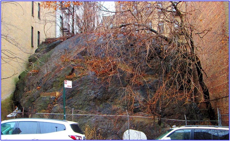
What are erratics?
large boulders that were plucked by a glacier. Glaciers can leave them behind after they retreat.
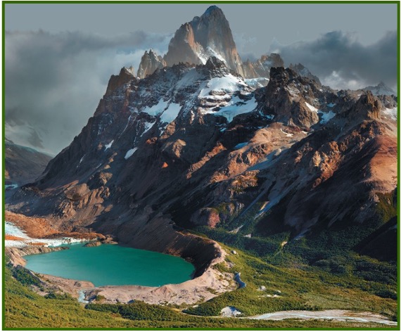
Define these postglacial features: Cirque, Arete, and Col
Cirque - a circular-shaped depression on the side of a mountain peak
Arete - a sharp ridge that separates two cirques
Col - a former Arete that has been impacted by the erosion of two cirques, resulting in a less defined ridge.
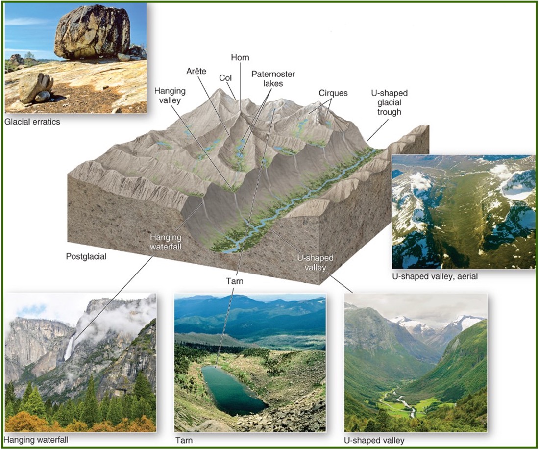
Define these postglacial features: Horn, Tarn, and Paternoster lakes
Horn - a sharp mountain peak formed when glaciers wear away the mountain from multiple sides.
Tarn - a small lake located in a mountainous area where ice has gouged a deep depression.
Paternoster lakes - a chain of lakes aligned in a glacial valley; may form by damming caused by glacial deposits
Identify these glacial features: Bergschrund, Hanging valley, Fjord
Bergshrund - a wide crack that separates flowing ice from stagnant ice in a cirque
Hanging valley - a valley that forms where a tributary glacier joined the main glacier. They are often the site of waterfalls.
Fjord - a coastal valley or inlet that formerly housed a glacier.
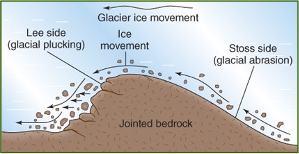
What is a Roche Moutonée?
Feature caused by both abrasion and glacial plucking.
The upstream side is polished (due to abrasion), and the downstream side is abrupt and steep (due to plucking).
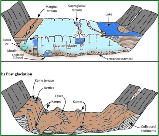
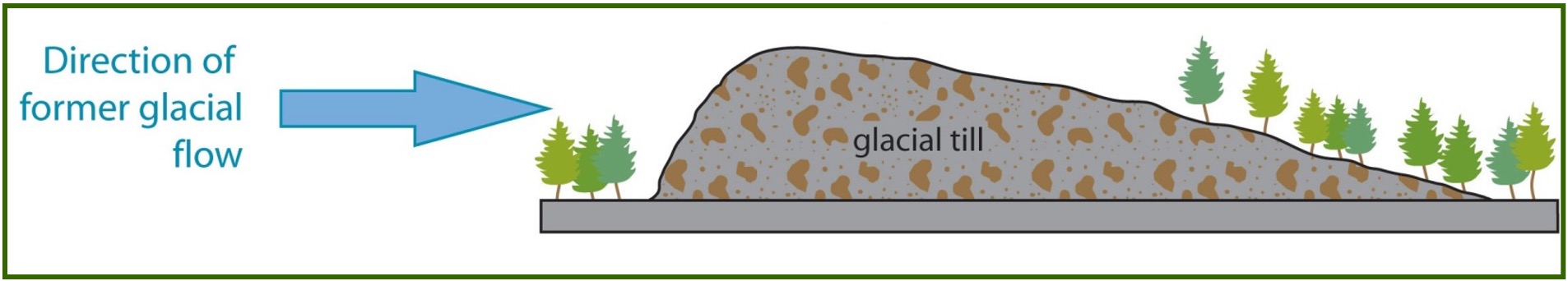
What is glacial drift and what are till’s and moraine’s?
when a glacier melts or retreats, it deposits materials at its terminus or along its sides.
Till - a specific type of glacial drift composed of unsorted or unstratified material (messy drift)
Moraine - a common landform composed of glacial drift
What are moraines and their 3 types? (LME)
Lateral moraine - a ridge of till along the side of a glacier
Medial moraine - till that has accumulated in the middle of a large glacier due to the merging of two lateral moraines.
End moraine - an accumulation of till at the glacier’s terminus. These can be recessional, ground, or terminal moraines.
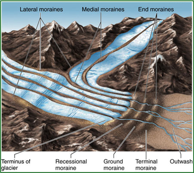
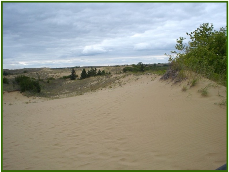
What is an outwash plain?
Sorted glacial debris deposited by meltwater beyond a terminal moraine.
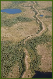
What is an Esker?
A curving, narrow deposit of coarse material that forms along the channel of a meltwater stream that flows beneath a glacier.
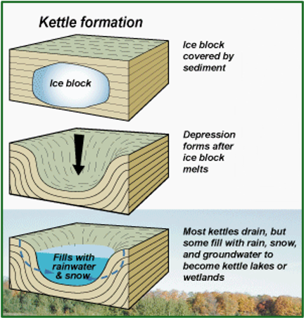
What is a kettle?
Forms when a large, isolated block of ice remains after a glacier retreats. After the block finally melts. A hole is left behind that then fills with water.
What is a Kame?
A mound of material that accumulates within a depression of a retreating glacier.
What is a Drumlin?
Hill composed of till where the blunt end indicates the upstream movement of ice, and the tapered end indicates the downstream movement
There are over 6k drumlins.
What are periglacial landscapes?
Periglacial environment - consists of landforms and topographic features along the margins of glaciers which either exist today or had existed in the past.
Periglacial regions - occupy over 20% of the Earth’s surface; found in the subarctic and polar climate zones.
What are the two features of periglacial environments?
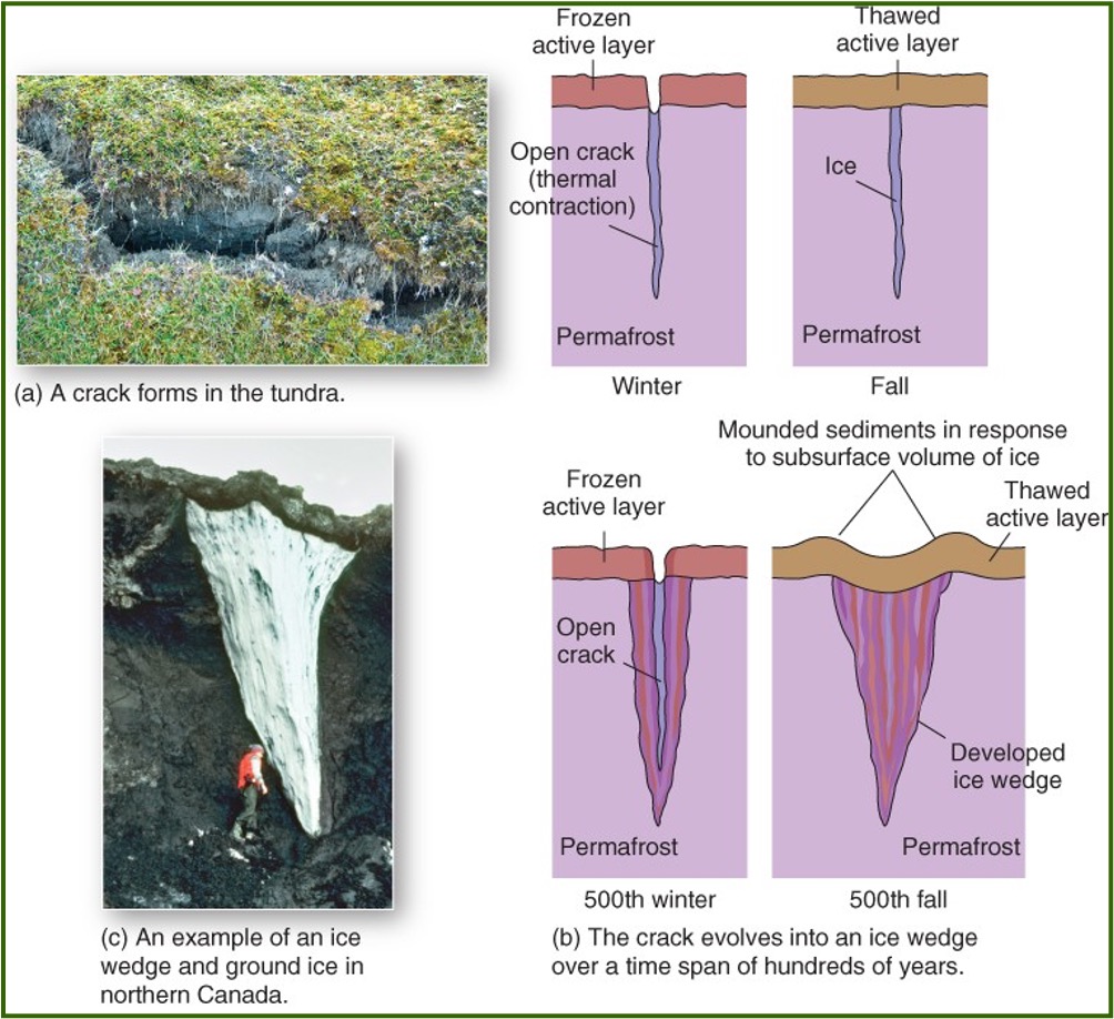
Ice wedge - crack in the ground that fills with water, freezes, and slowly gets bigger as it repeatedly freezes and thaws.
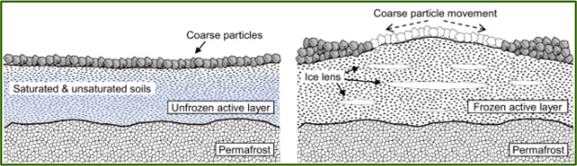
Patterned ground - ground arranged in shapes (like polygons) formed by freezing water pushing rocks and soil into patterns.
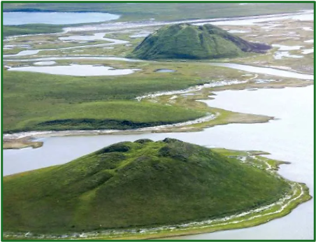
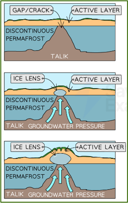
What is a Pingo?
Periglacial landscape; A dome-shaped large heave of soil-covered ice that increases in size from the expansion of water upon freezing and can remain for nearly a year.
They can be up to 70m in height and 600m in diameter.
What is Palsa?
Periglacial landscape; a lens-shaped heave of soil-covered ice that can form in groups in areas of discontinuous permafrost.
Much smaller and short-lasting than Pingos.
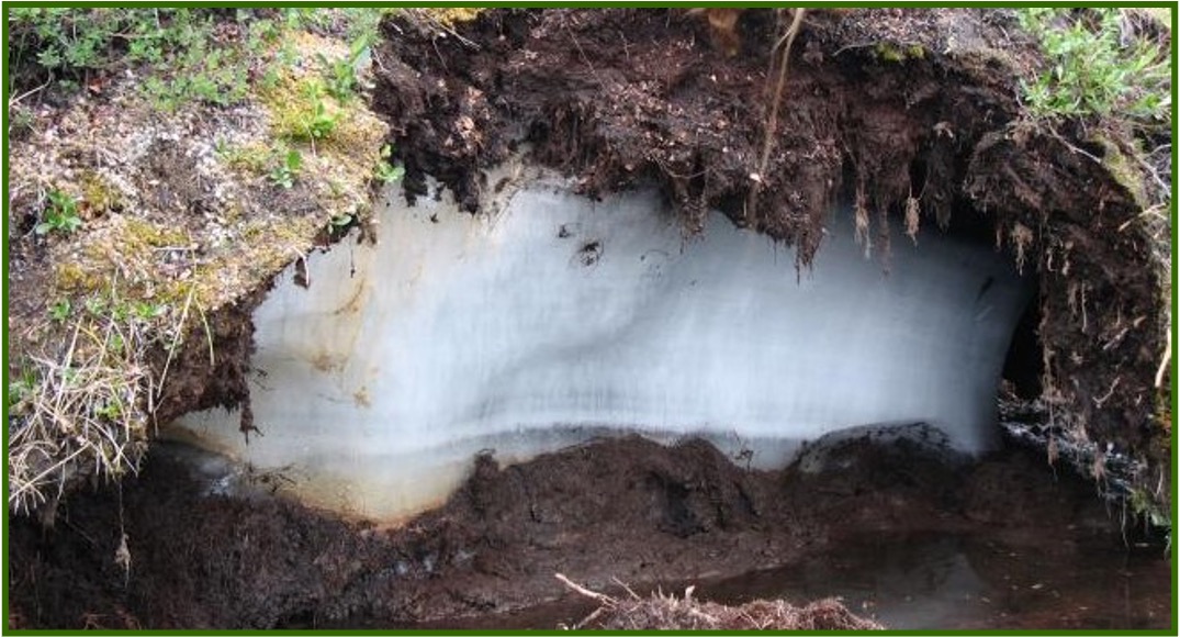
How are pingos and palsas formed?
In areas of discontinuous permafrost where groundwater is forced upward by pressure and then freezes.
What is the Laurentide ice sheet?
An ice sheet that covered most of Canada and the Northern United States; altered the landscape by creating major rivers and forming the great lakes.
It completely melted 5000 years ago
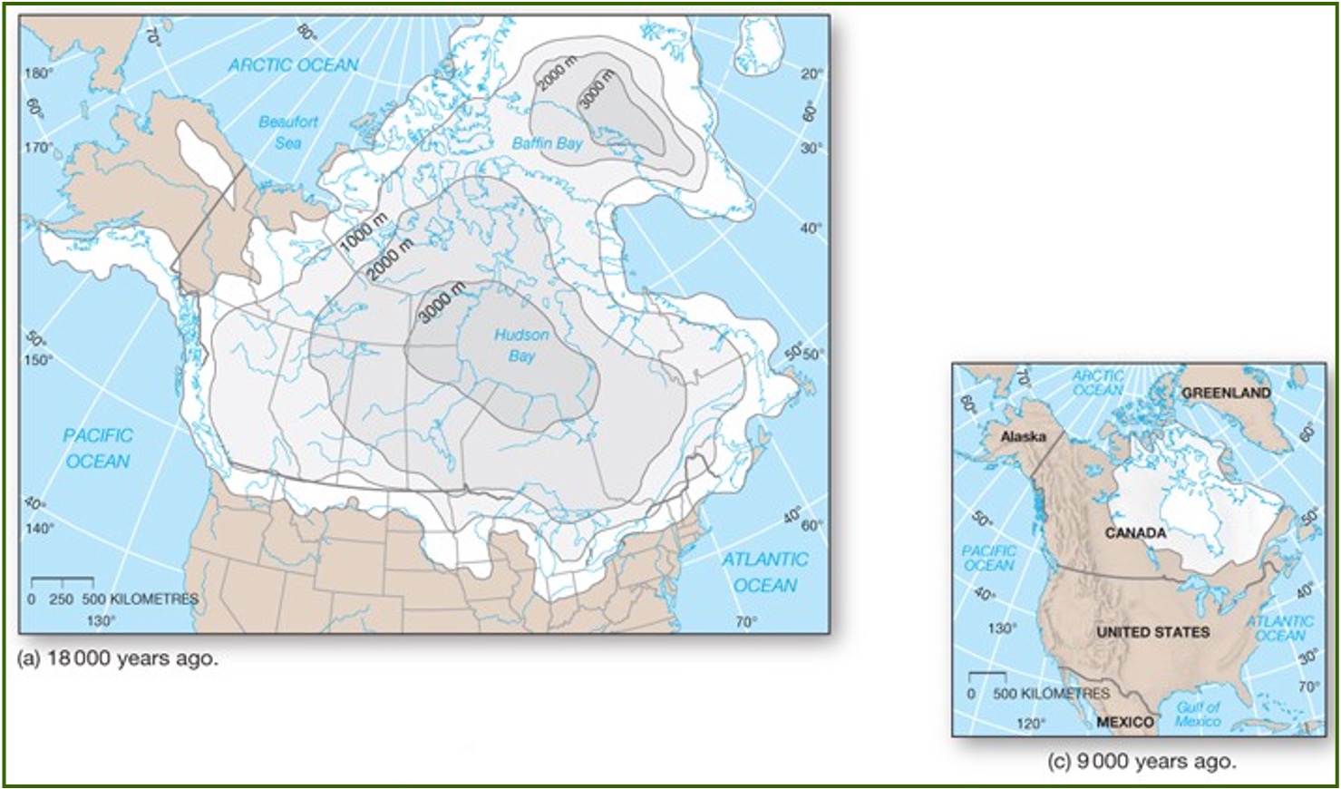
What is glaciation?
Major shaping force in Canada; the advance and retreat of ice that alters the appearance of landscapes.
Most of Canada’s lakes were formed through glaciation (the melting of a continental glacier).
What were the bottom of the great lakes formed by?
By glacial scouring and then filled with water from the melting ice
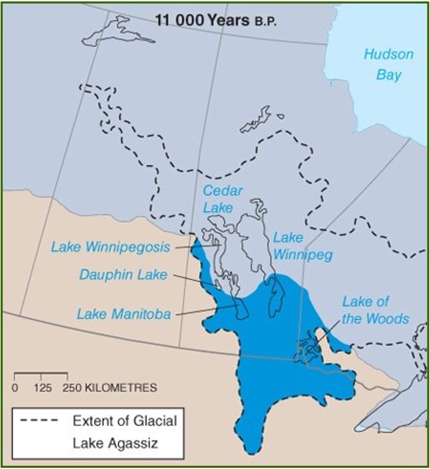
What is Lake Agassiz?
Formed along the southern margin of Ontario as the Laurentide Ice sheet melted.
lake Winnipeg is a modern relic of Lake Agassiz.
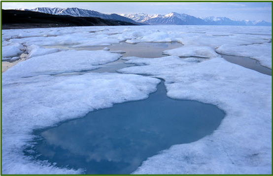
What are melt ponds?
Pools of water which form on glaciers, ice shelves, and sea ice as the ice melts.
Melting water can form streams, which lead to the formation of moulins.
What is a moulin?
Drainage channel of meltwater that can reach the base of a glacier
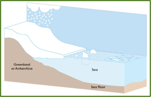
What is an ice shelf?
A platform of ice where an ice sheet flows over a coastline onto an ocean surface.
Several major ice shelves in Antarctica have collapsed since 2000 resulting in the loss of over 8k of ice during that time.
What is the arctic region vs the Antarctic region?
Arctic region - A region delineated by the 10 degrees C July isotherm. It coincides with the tree line (boundary between forest and tundra).
Antarctic region - region defined by the antarctic convergence (boundary between colder and warmer waters at 60 degrees south). The coldest temperatures recorded on Earth have been in this region.
Why does the antarctic region experience colder temperatures than the arctic region?
The Antarctic is a landmass surrounded by an ocean, whereas the Arctic is an ocean surrounded by land.
An ice sheet covers 98% of antarctica; the average thickness of that ice sheet is 1.3 km.
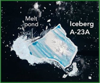
What is iceberg A23A?
The longest-lasting iceberg in recorded history; calved from antarctica in 1986 and became grounded on the seafloor until 2011, then started drifting northward through warmer waters.
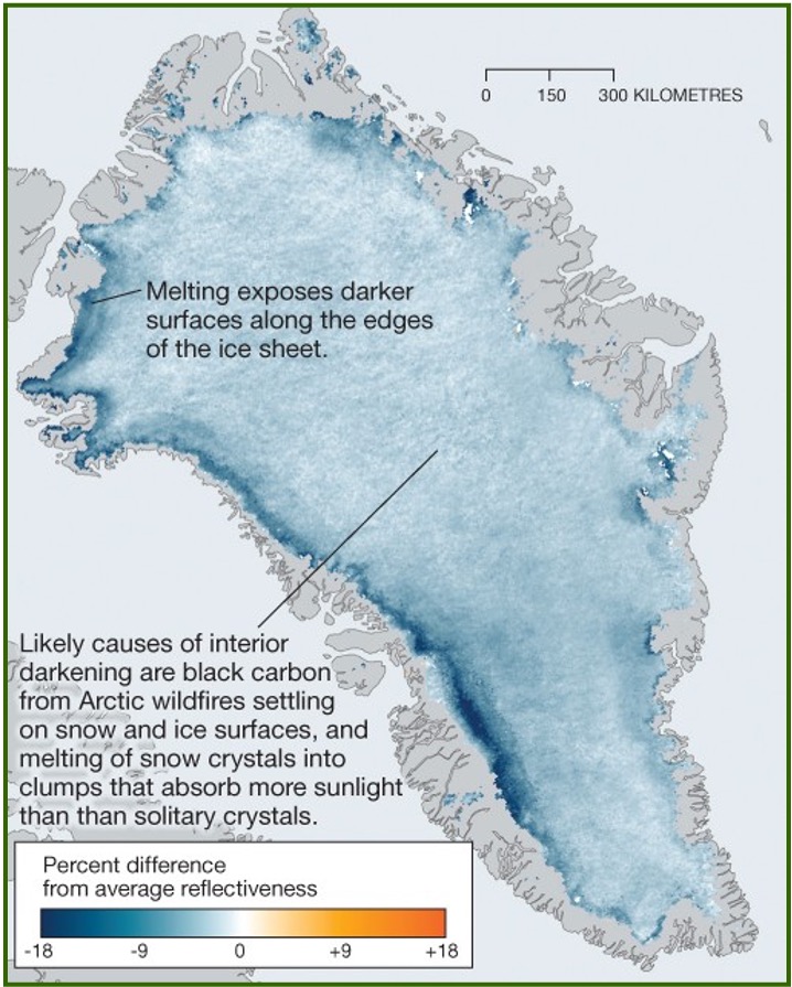
What is happening to Greenland’s ice sheet?
Is darkening as it continues to slowly decrease in size.
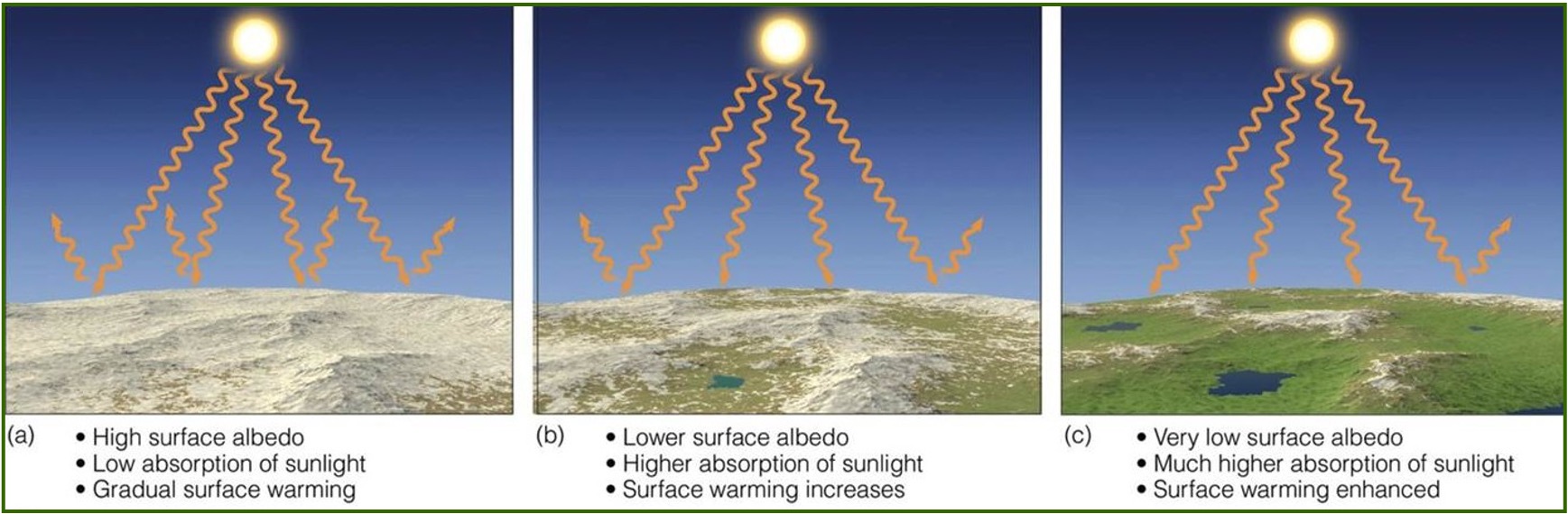
Its melting lowers the albedo of the ice sheet, which leads to more absorption of shortwave radiation which then leads to more melting (positive feedback).
How does positive feedback contribute to polar regions warming?
It is the reason as to why polar regions are warming the fastest.
In the coming decades, the polar areas are expected to warm faster than any other areas on Earth.
By 2050, the only remaining Arctic sea ice in summer is expected to be around Ellesmere Island and Northern Greenland.
What is the Northwest Passage?
Early European explorers continually searched for a route to Asia by sea; it was finally discovered in 1851.
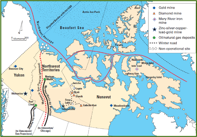
What are the politics behind Arctic sovereignty?
National boundaries have yet to be determined in much of the Arctic Ocean basin. There is an increased urgency for Canada to acquire territory and declare sovereignty of it as the ice sheet continues to melt.
Multiple countries bordering the Arctic ocean have made a claim to a portion.
