SOUND ECO - MIDTERM
1/30
There's no tags or description
Looks like no tags are added yet.
Name | Mastery | Learn | Test | Matching | Spaced | Call with Kai |
|---|
No analytics yet
Send a link to your students to track their progress
31 Terms
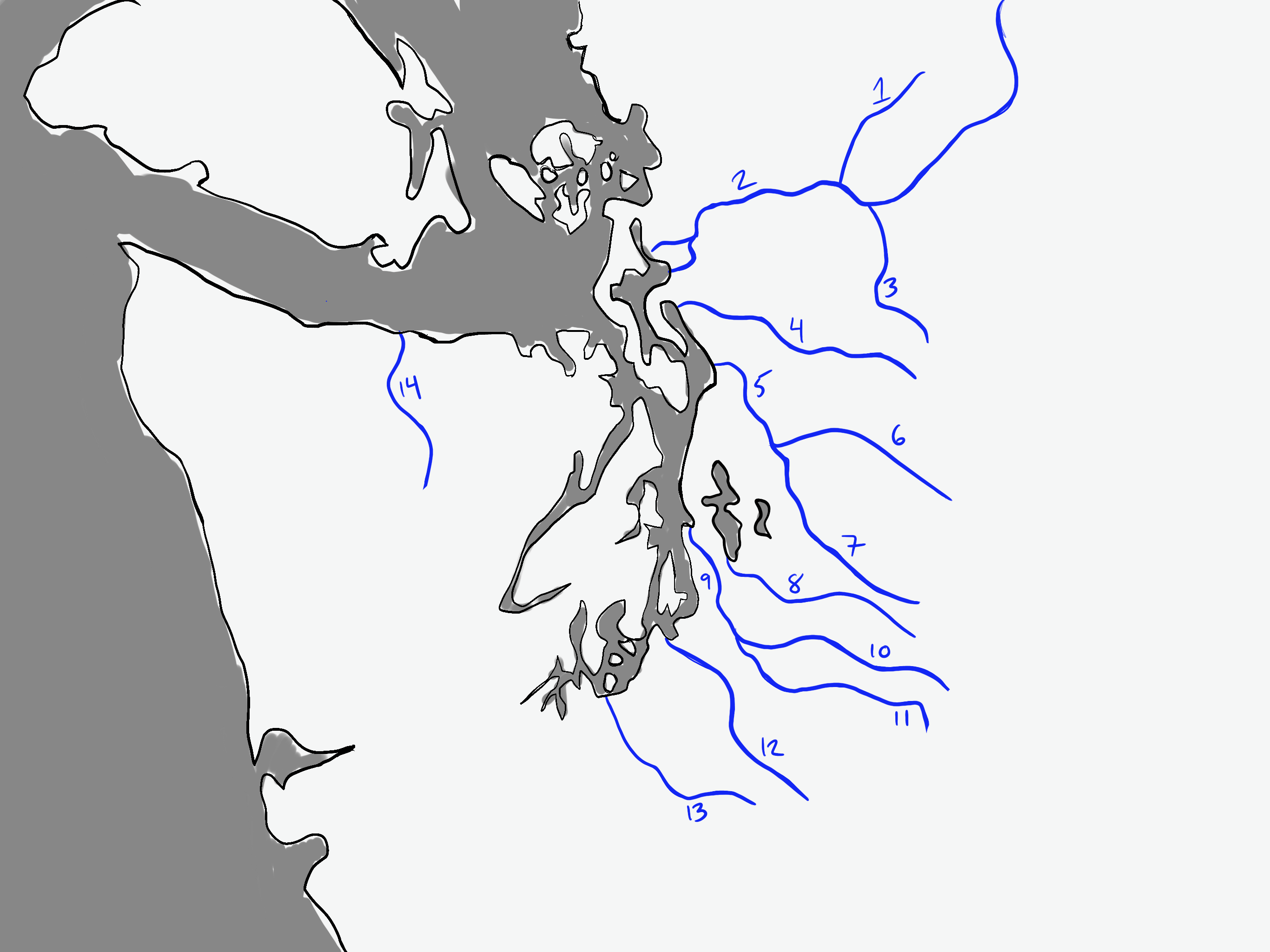
Baker River
Skaggit River
Suak River
Stillaguamish River
Snohomish River
Skykomish River
Snoqualmie River
Cedar River
Duwamish River
Green River
White River
Puyallup River
Nisqually River
Elwha River
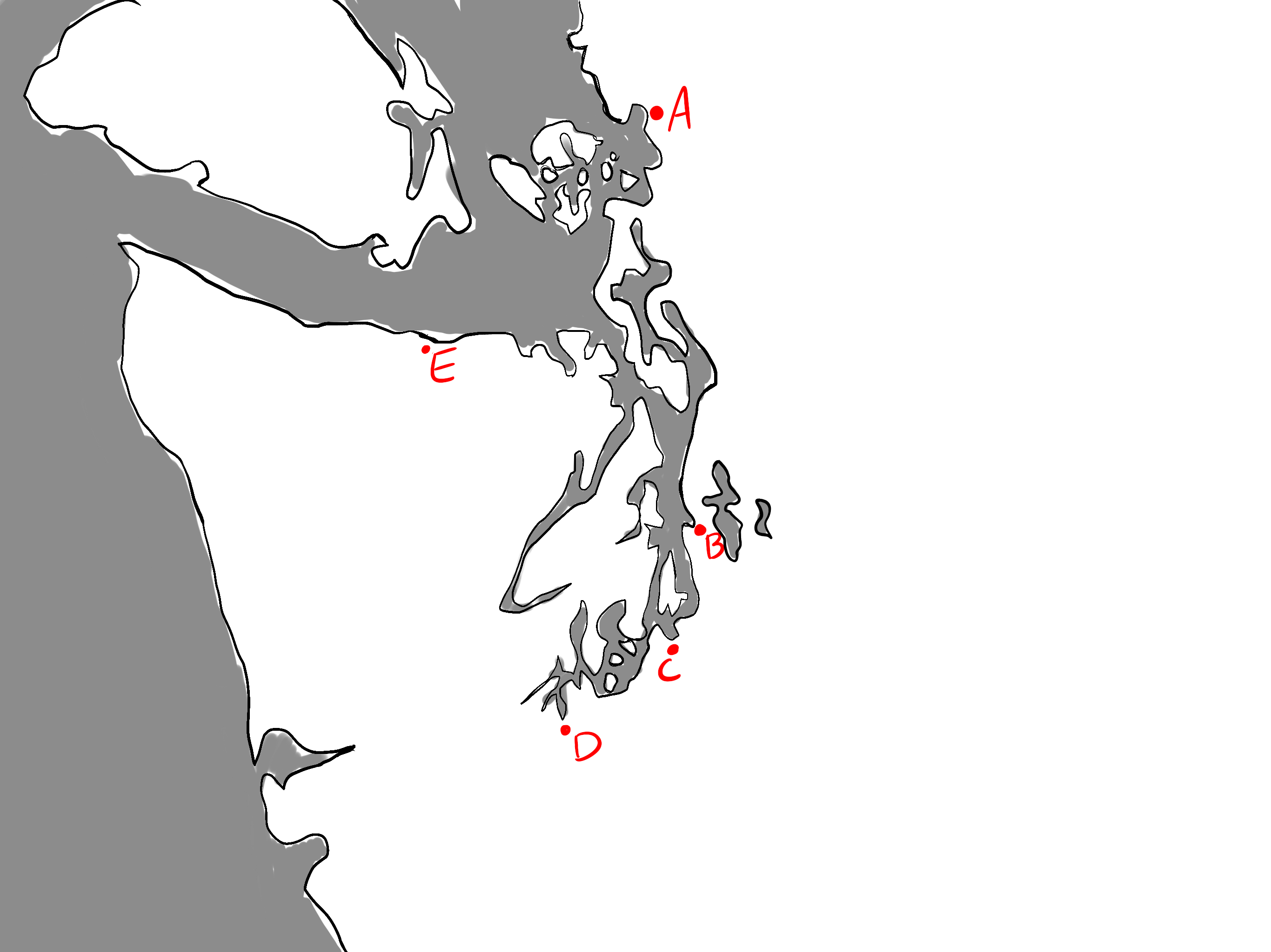
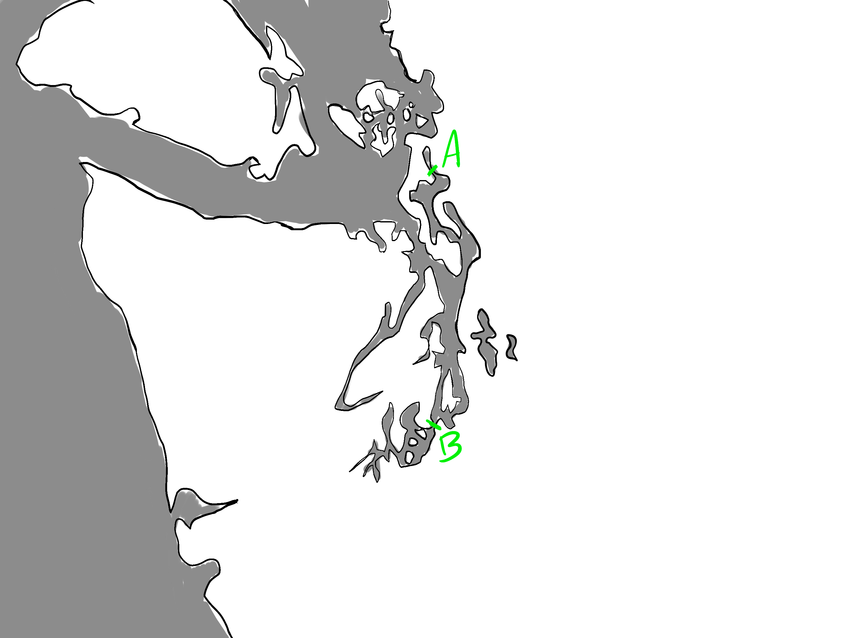
A: Bellingham
B: Seattle
C: Tacoma
D : Olympia
E: Port Angeles
Cascade Mountains
Mt. Rainier
Olympic Mountains
Admirality Inlet
Hood Canal
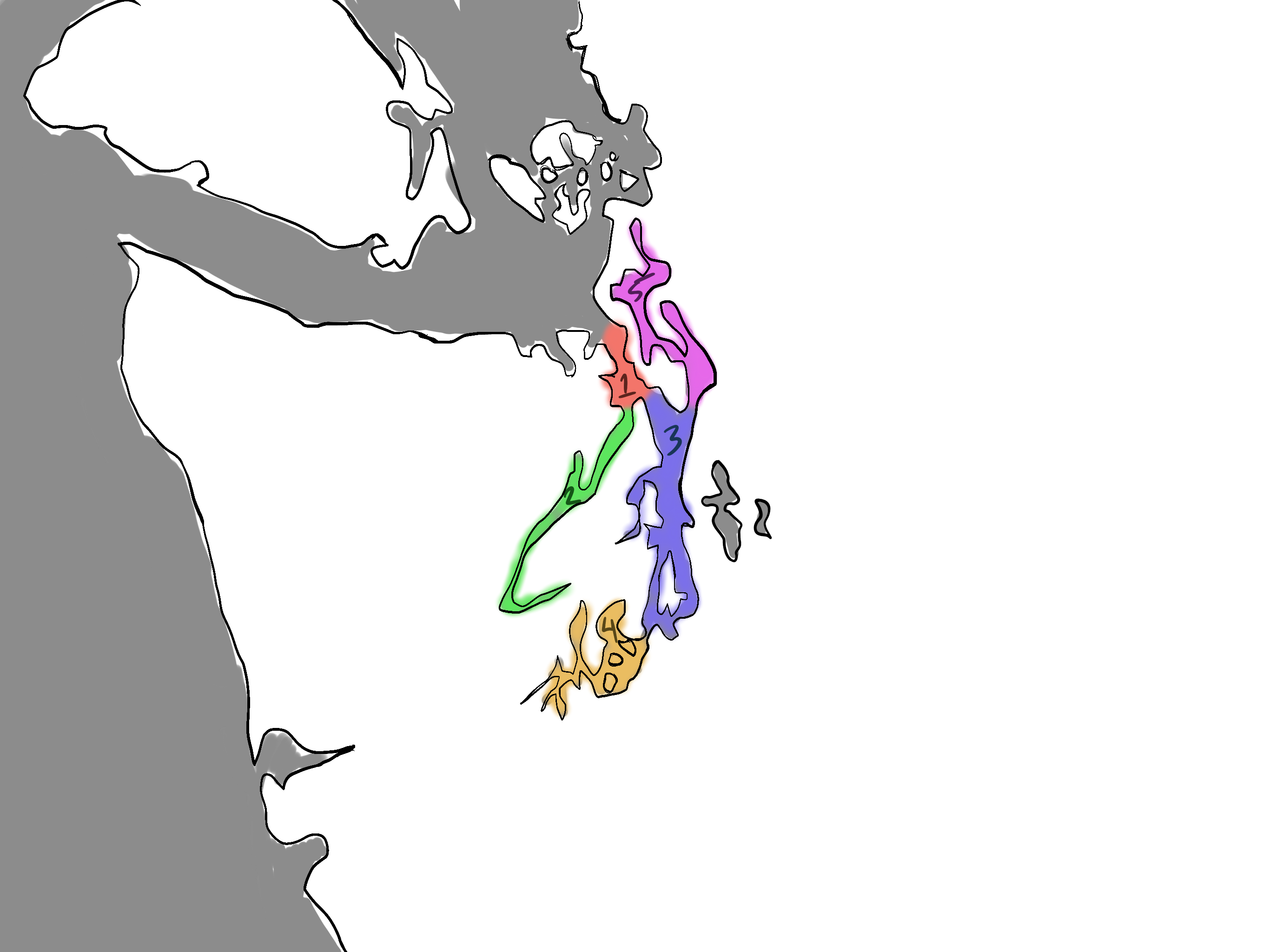
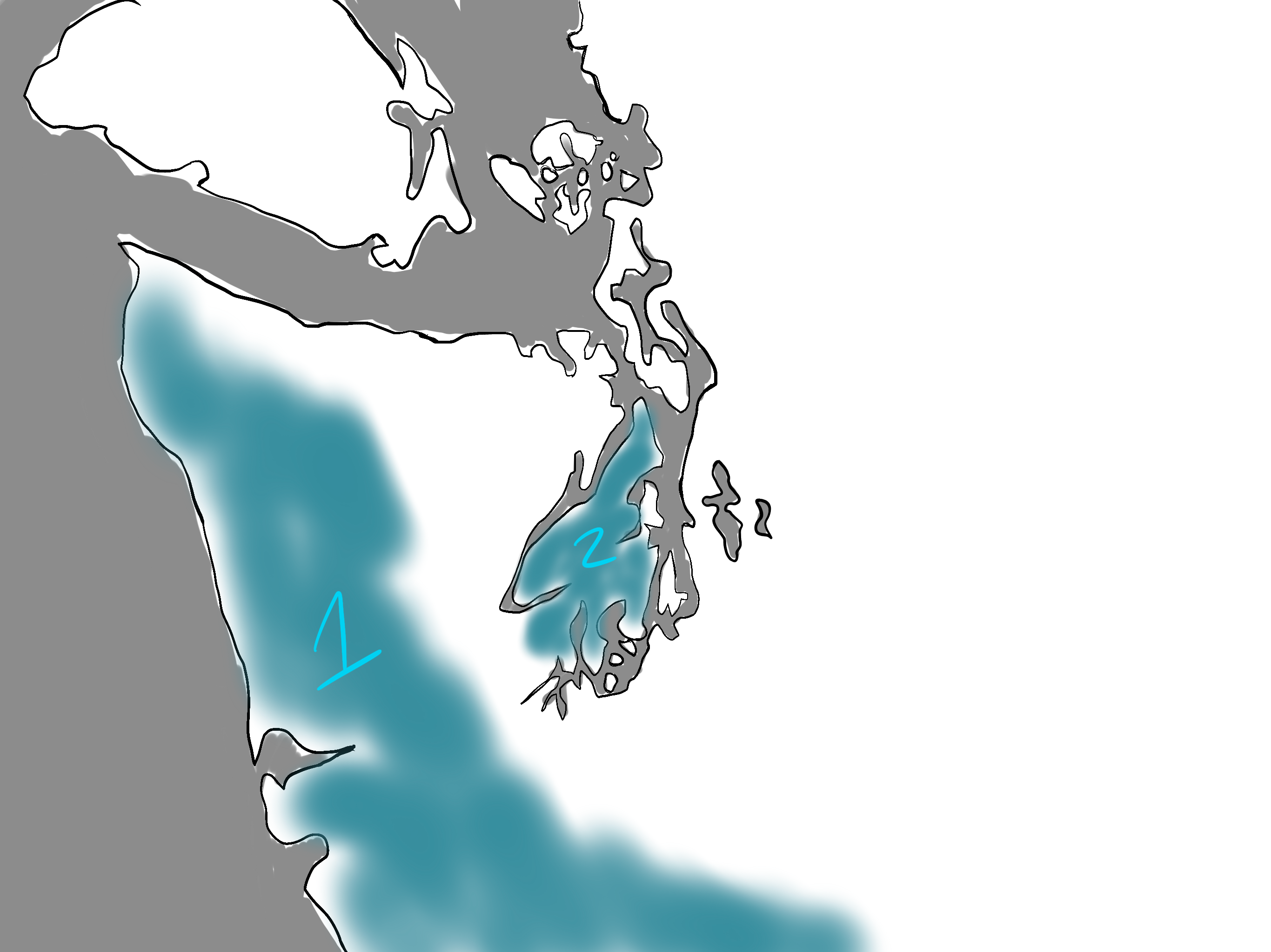
Central Basin
South Basin
Whidbey Basin
A: Deception Pass
B: Narrow Bridge
Olympic Penninsula
Kitsap Penninsula
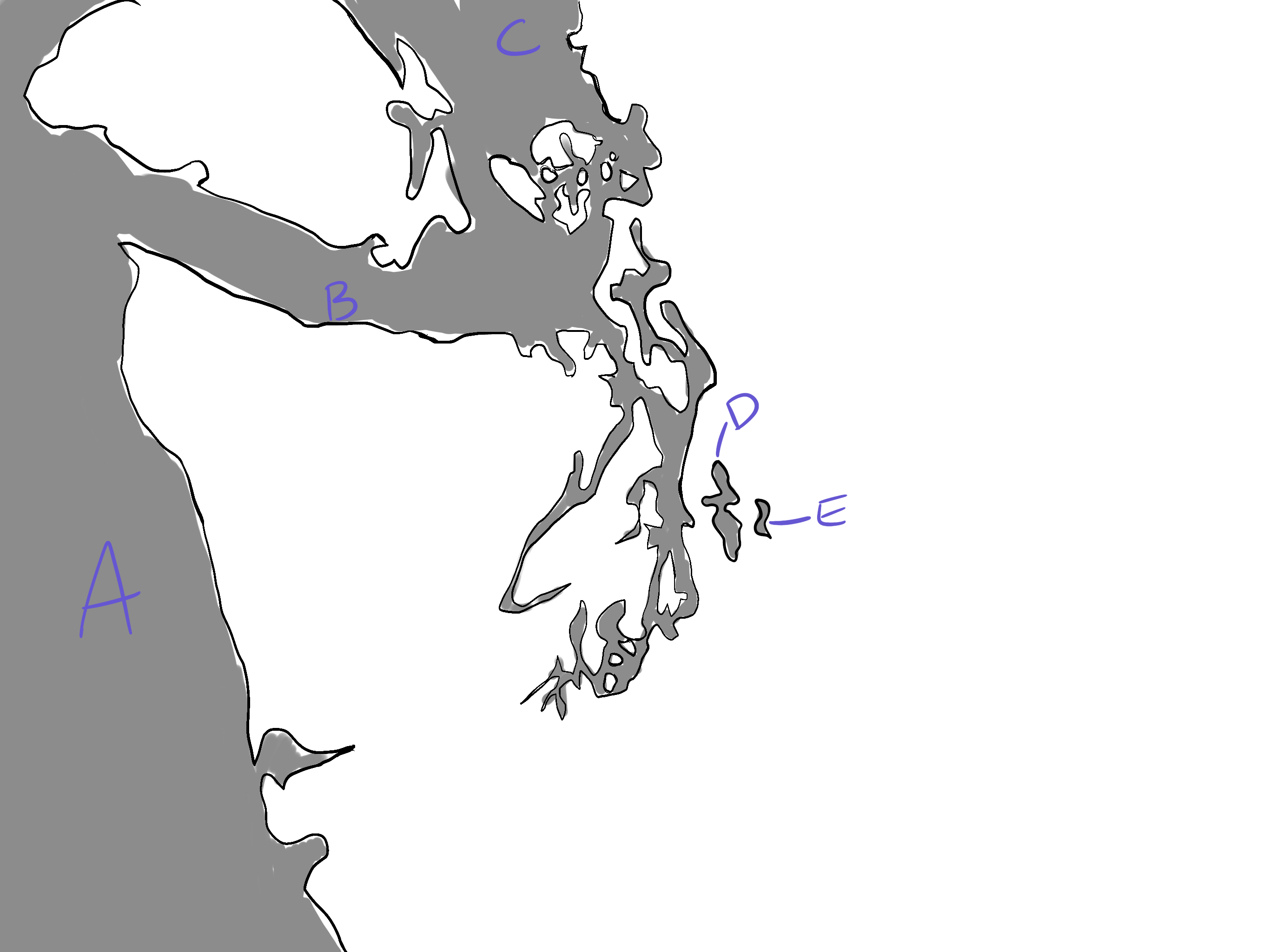
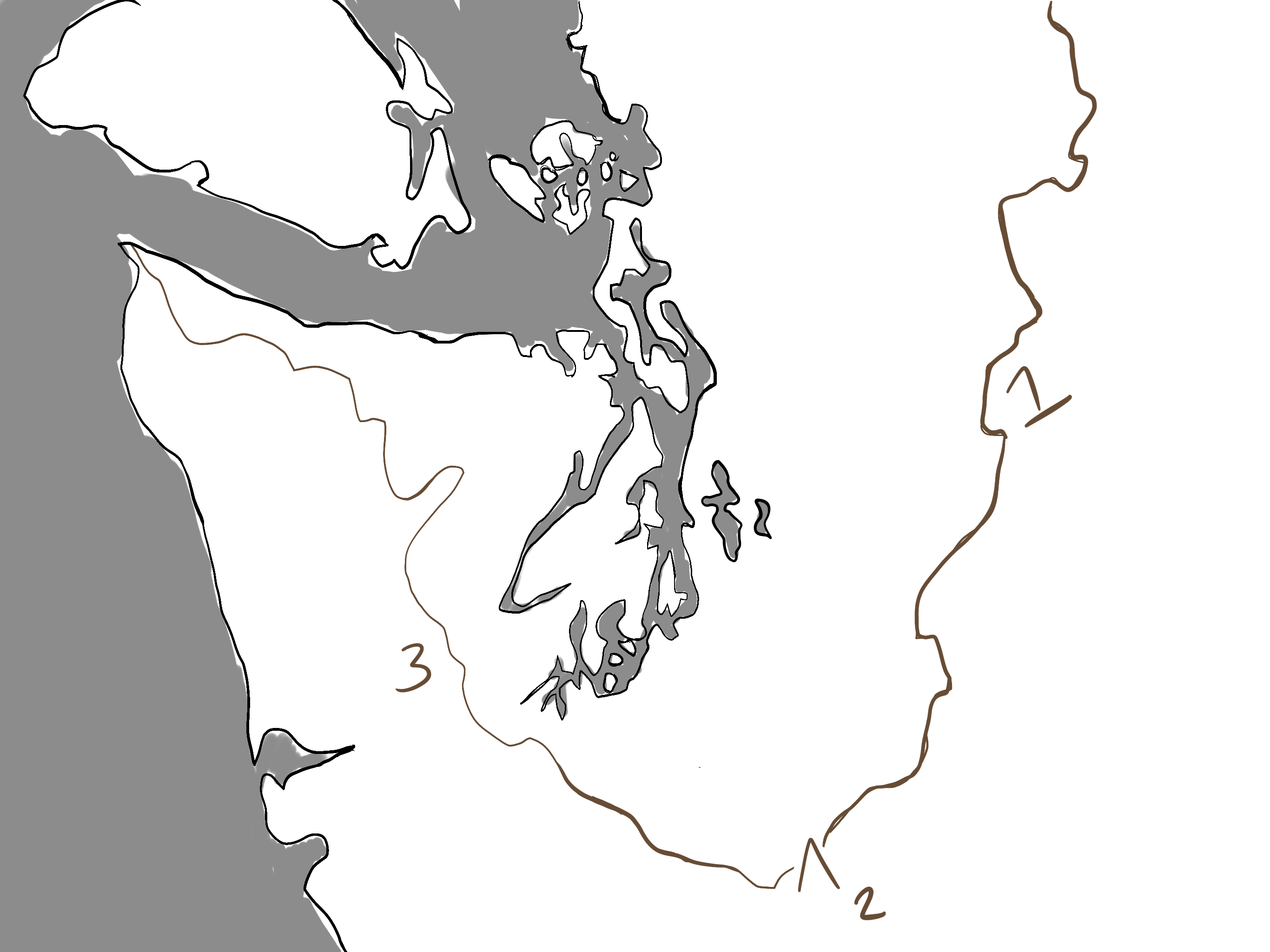
A: Pacific Ocean
B: Strait of Juan de Fuca
C: Strait of Georgia
D : Lake Washington
E: Lake Sammamish
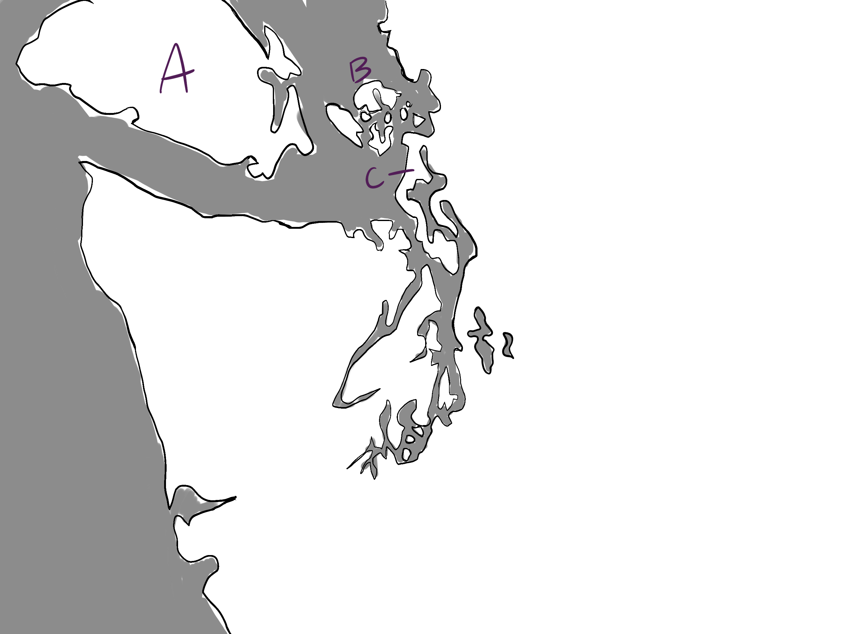
A: Vancouver Island
B: San Juan Island
C: Whidbey Island
How was the Puget Sound formed?
Glacier movement - a type of moving ice formation
Vashon Glacier - formed P.S. during Pleistocene Epoch
Tectonic plates - Earth plates that move against each other
2 types: Continental and Oceanic (oceanic is heavier)
Juan de Fuca plates (oceanic) went under North American plate (continental) = subduction
How did the Olympic and Cascade mountains form?
The ‘Juan de Fuca’ Plate collided w/ the North American Plate and subjected
What was the height of the Vashon Glacier? When was it formed?
6k ft at the highest point, 3k at the lowest/front of the glacier (Seattle area)
Formed 20k years ago but retreated back North about 16k years ago
In what order was the Puget Sound formed?
Olympic Mountains formed
Cascade Mountains formed
Vashon glacier coveres the area
What evidence do we have that a glacier ever covered the Puget Sound? Name 3.
Erratics - foreign boulders that were found with Canadian origin
Drumlines - egg-shaped mounds/hills that are parallel to glacier movements
Stiations - scratches in the bedrock caused by glacier abrasions
What alternative evidence is there to glacier presence in the Puget Sound?
Glacier deposits - formed by Glacial Till
Glacial Till - unsorted sediment
Glacier Outwash - sorted material
Both are a type of glacier movement that displaces sediment
What is a Moraine? What type of mineral is present?
An accumulation of glacial till deposited by glacial activity
Sedimentary rock
What is a long narrow lake, formed by a glacial trough?
Ribbon Lakes
Lake Washington and Sammamish
What sequence of events followed the Great Fires of Seattle in 1889?
Used the Cedar River and built the Mansory Dam to intake pressurized water in 1915
Moncton town (1906-1915) was located farther down from the Dam and flooded in 1915 → became Rattlesnake Lake
Edgewick town flooded due to a failure at Cedar Reservoir in December. 23, 1918
Why did the Masonry Dam flood Monston Town? How could it have been prevented?
Since the Dam was situated on a moraine, the water seeped through it and went down the hill, eventually flooding the town.
This can be prevented by adding a layer of clay between the moraine and water to prevent seepage. Clay is very fine and dense; the water won’t leak through it.
What are the 3 types of rock? Give 1 example each.
Sedimentary - accumulation of sediment, and where fossils form (limestone)
Igneous - magma cools and hardens
Intrusive - magma cools inside the earth (granite)
Extrusive - magma cools outside the Earth (basalt)
Metamorphic - formed under the surface of the earth due to heat and pressure
Foliated - pressure from 1 direction (slate)
Non-foliated - pressure from multiple directions (marble)
What is the difference between a ‘sound’ and an estuary?
Sound - a large sea/ocean inlet
Estuary - where freshwater and saltwater meet
1 or more rivers meet the sea
What is a fjord?
An estuary carved by a glacier
This makes Puget Sound a fjord estuary
It’s long, deep, narrow and has a U shape from glacial movement
What is a strait?
Naturally formed, narrow waterway that connects 2 large bodies of water
What is the deepest point in the Puget Sound?
Point Jefferson
What is a sill?
An underwater dam that rises in the seabed to separate basins. Forces fresh + salt water to mix at the top of the Sills and accelerates saltwater coming down from the Sills.
Admirality Inlet
Hood Canal
Tacoma Narrow
What is the downside of sills?
Due to little sunlight in deep water, plants can’t photosynthesize, so there's no oxygen at the bottom. When saltwater at the bottom is driven up, it brings polluted oxygen back down, making it harder to flush out pollution.
What is Puget Sound circulation driven by?
Freshwater from rivers
Tidal currents
Inflow of saltwater from the ocean
Wind strength and direction
What is the residence time for water in the Puget Sound?
6 months before the water gets cycled out
The Hood Canal takes 1 year since it’s so much more narrow
What are the 2 types of denisty structures?
Stratified: warm + freshwater/ cold + saltwater — the layers are sperated, with saltwater on the bottom due to it being heavier
Hood Canal
Mixed: water types mix — this is healthier
Why is the Hood Canal so contaminated with low oxygen levels? List 3 reasons
Slow circulation - water has a long residence time and is only filtered once per year
Strong stratification - distinct water layers between salt + fresh
High productivity - high organic load from human involvement
What is the formula to calculate MPH? What about converting Knots to MPH?
MPH = mile (distance) / hr (time)
1 knot = 1.15 MPH → XKnots x 1.15 MPH / 1 knot
What are the 3 main climate controls for the Puget Sound area?
Pacific Ocean - thermostate + moisture generator
Topography - alters air flow patterns
High & low pressure regions located over the North Pacific Ocean