1,2 Introduction & Map functions and types
1/23
Earn XP
Name | Mastery | Learn | Test | Matching | Spaced | Call with Kai |
|---|
No analytics yet
Send a link to your students to track their progress
24 Terms
Buch LZ
Thematic map vs general reference map:
Definition
Examples of map types
Examples of displayed variables
Thematic:
Maps used to emphasize the spatial pattern of one or more geographic attributes (variables)
Map type: choropleth
population density
family income
daily temperature maxima
General-reference:
Maps used to emphasize the location of spatial phenomena
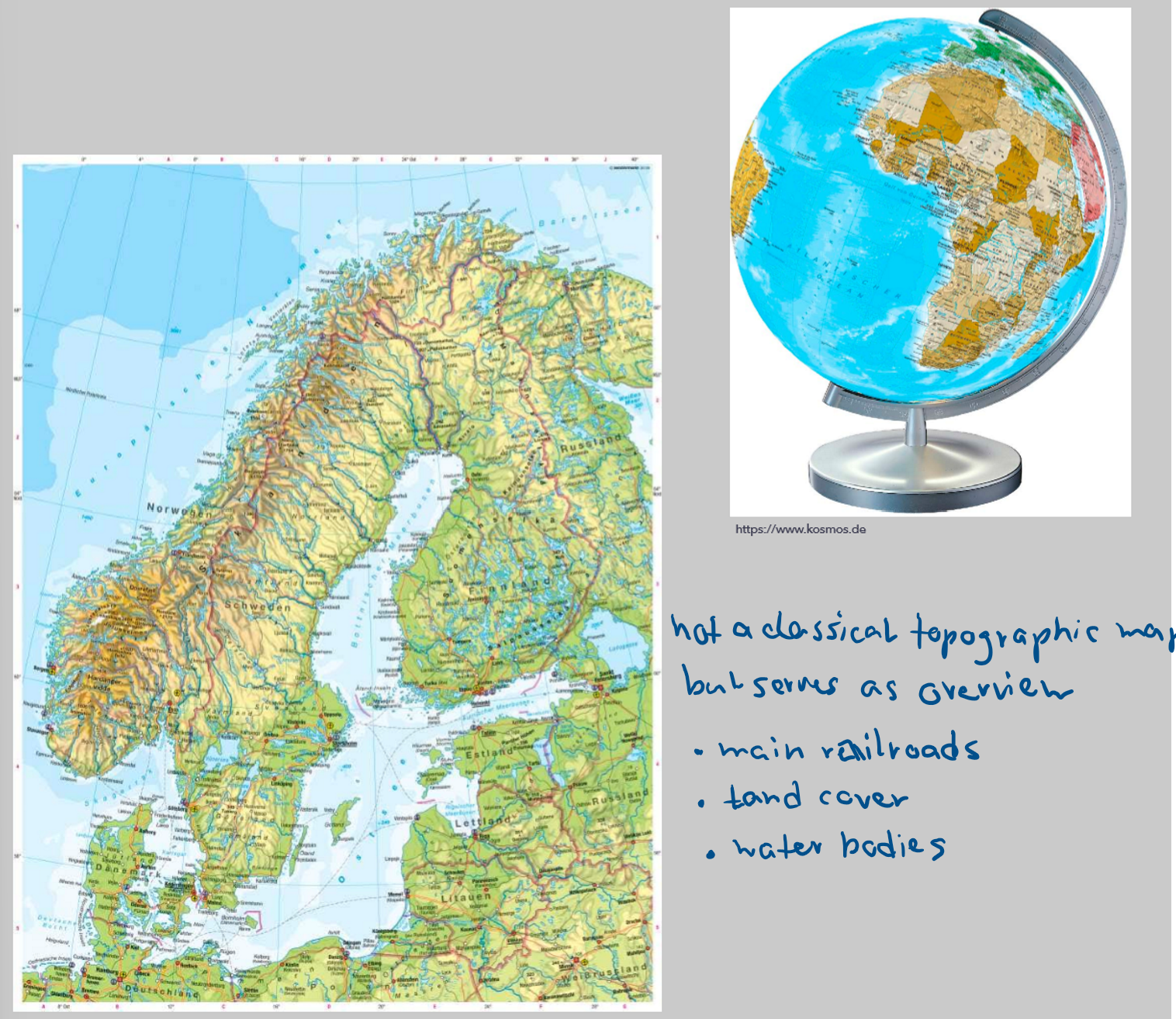
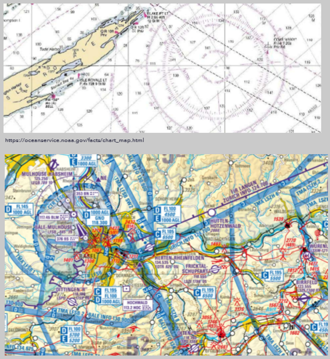
Map type: topographic
location of streams
roads
houses
oher natural and cultural features
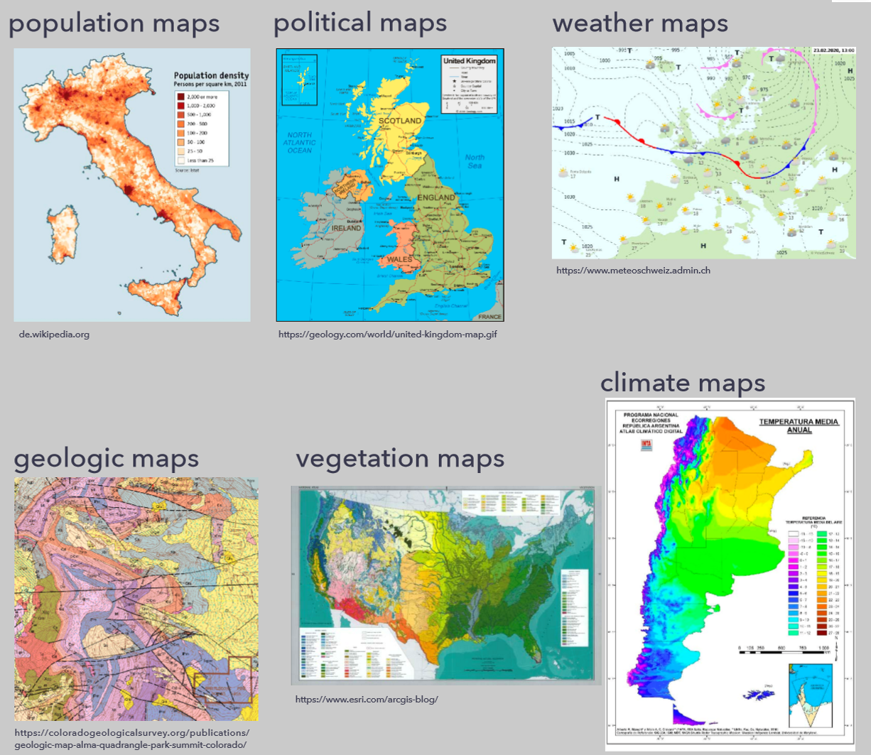
Other thematic map types?
Choropleth
proportional symbols
isarhythmic
dot
flow (e.g. flight routes)
What are thematic maps used for, which information do they provide?
provide specific information about particular locations
provide general information about spatial patterns
compare patterns of different maps
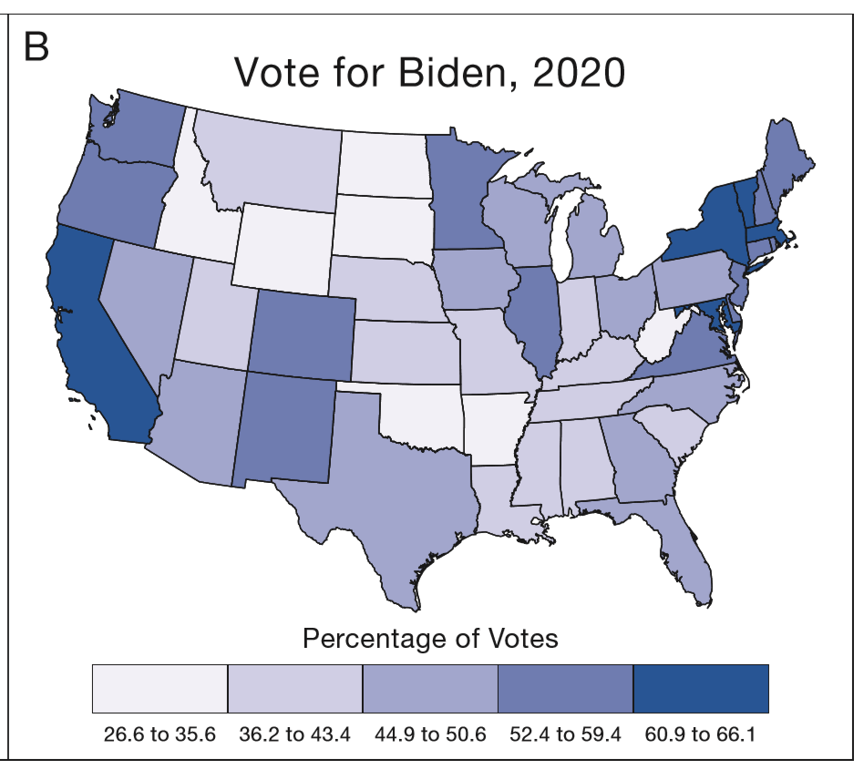
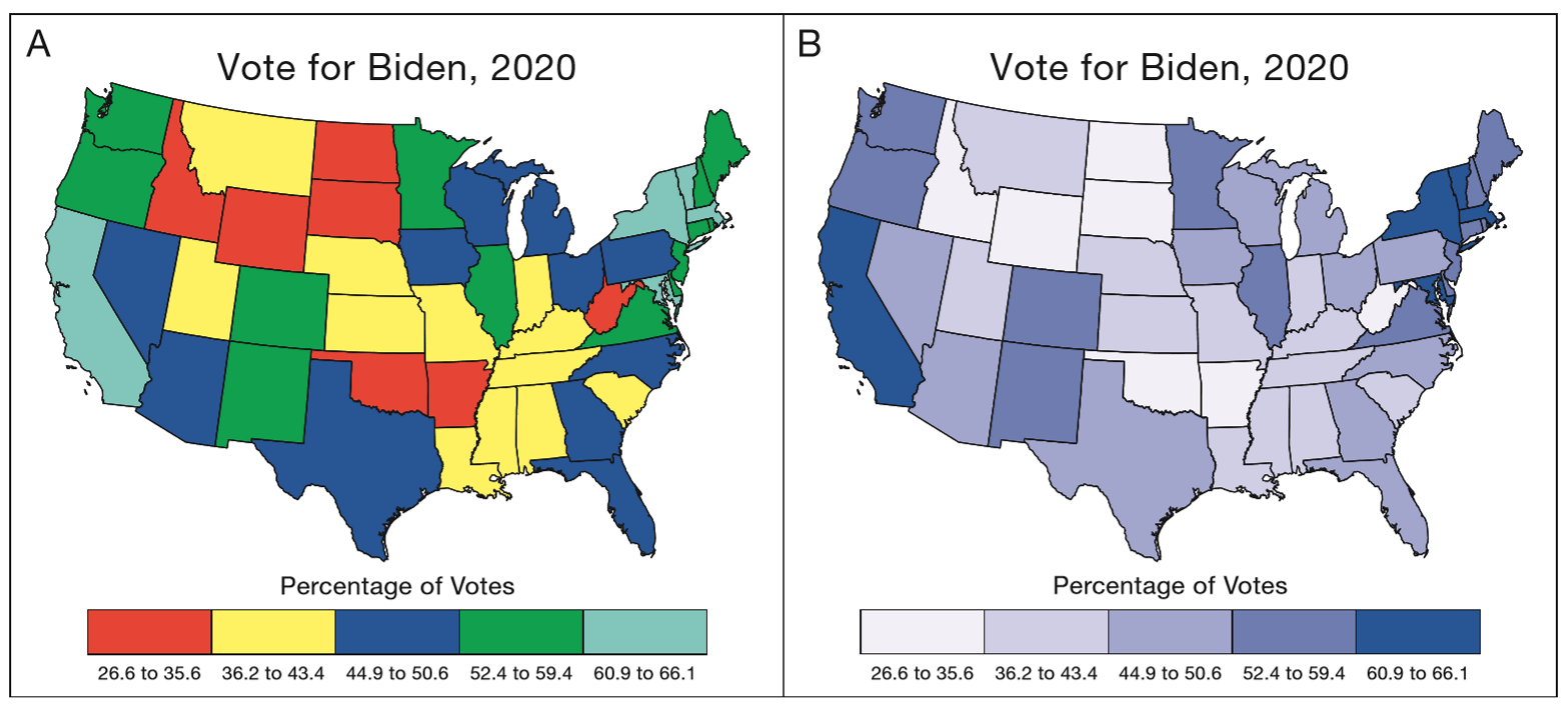
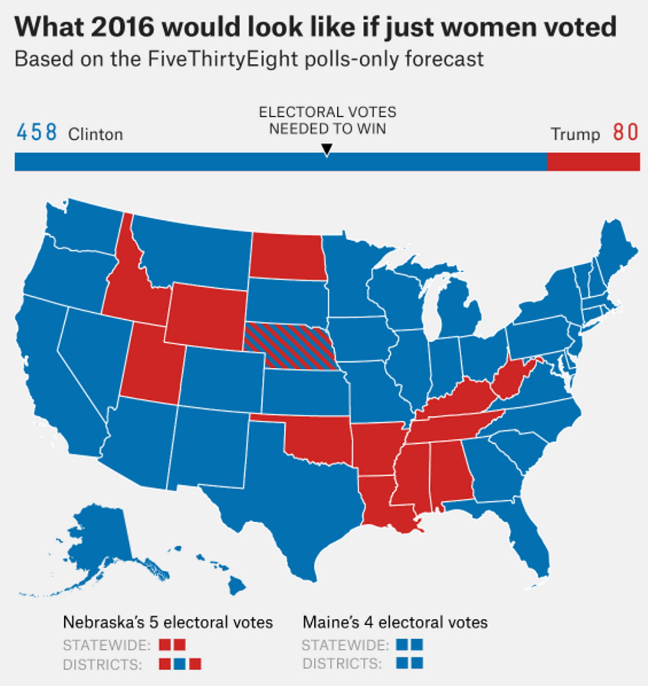
Example: Who in which state voted for Biden? → particular
Overview of voting behaviour in US 2020 → general
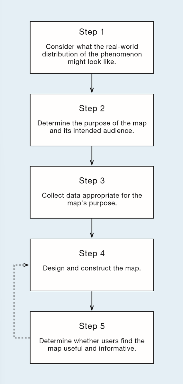
List the five basic steps for communicating map information and indicate why it is important to consider these steps
Steps (picture)
Important because of following problems:
emphasis on specific information is not always helpful for displaying the map → only focusing on percentage of votes makes it difficult to see the political party
the memory of the viewer impacts how the symbolization is perceived → wrong associations can be created
What technological changes have influenced cartography?
Crowdsourcing: collective knowledge of users is put into a product
→ contributed geographic information (CGI), e.g. OpenStreetMap
Lightweight programming models: easy creation of
→ map mashups can be created from data from different sources
Social media: facebook, twitter
→ e.g. geotagged tweets can be mapped
Internet is public: Google earth
→ available locational and attribute data, maps, software, teaching material
Discuss four consequences of technological change in cartography
map production is accessible → more mapmakers (+), inaccuracies (-)
expert systems → reduced inaccuracies (+), not always incorporated (-),
complex maps → classed, animated
interactive maps → fast data exploration (+)
3D environment → exploration of research area without field trip (+)
Define geographic visualization and contrast it with map communication
Geovisualization:
Private activity, in which unknowns are revealed in a highly interactive environment
Map communication:
Public activity, in which knowns are presented in a noninteractive environment
Explain why the term geographic visualization fails to cover the breadth of potential mapping approaches and consider the alternative term cybercartography
Geovisualization focused on the sense of vision
→ cartographers are starting to include other senses into maps
→ maps should become more inclusive
Cybercartography
multisensory
multimedia
interactive
creators from other fields
new research
VL LZ (Week2)
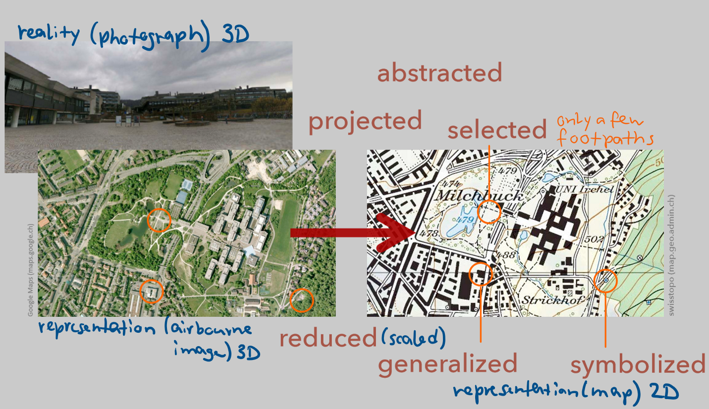
Definition: map
symbolized representation of geographical reality, which represents selected features
always an abstraction of reality and (geographic) representation, a model
Definition: cartography
discipline dealing with the art, science and technology of making and using maps
Definition: GIS
scientific context of spatial information processing and management
includes technology, data analysis and visualization
includes commercial, social and environmental implications
Functions of a map
storage medium for information
depiciton of the world
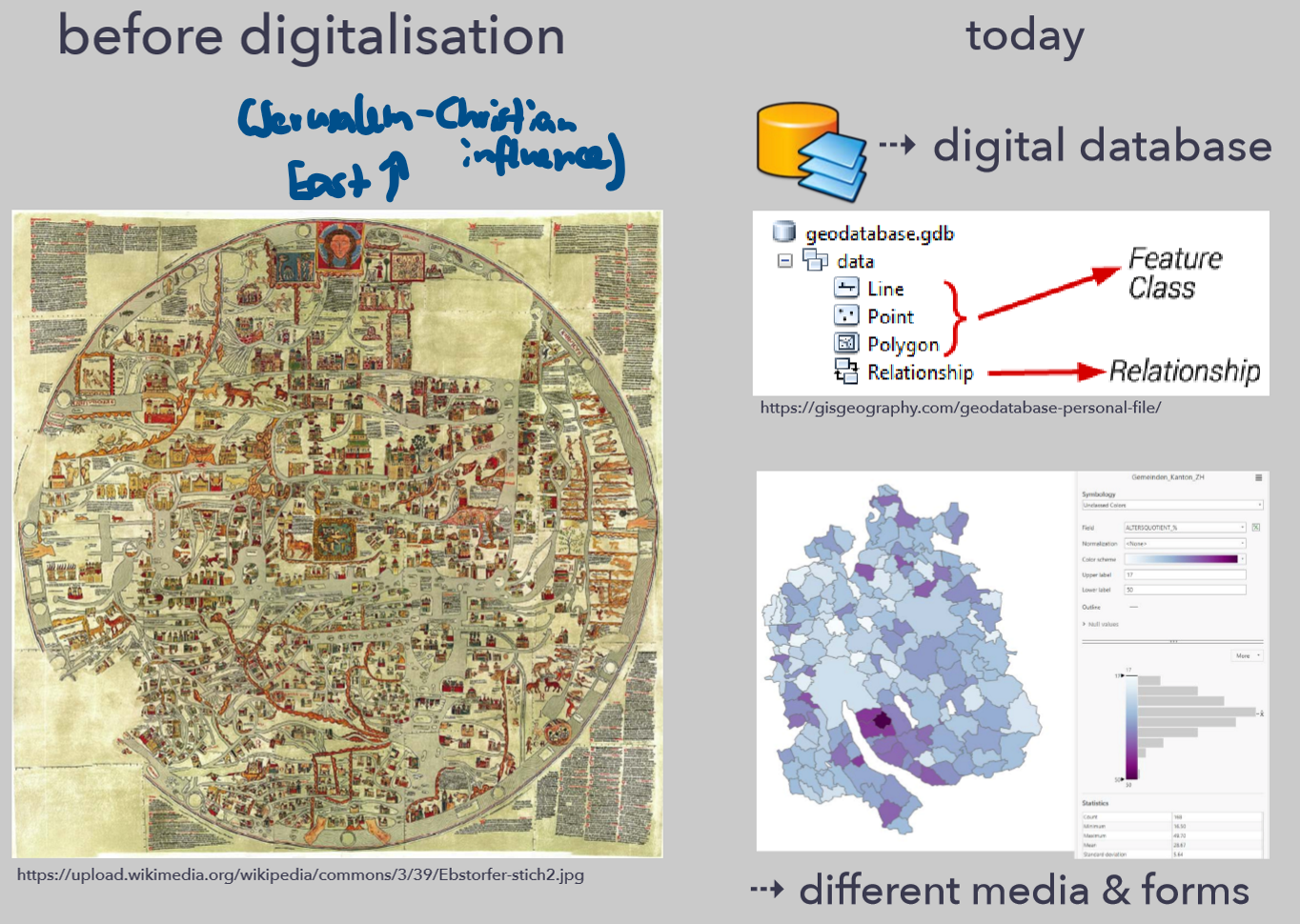
How did mapping change? Before digitalization vs today
before: expensive, influenced by people in power
today: cheap, “objective”, different media and forms
Why is mapping fundamental for cartography?
“language of geography”
Geographic thought is inevitably linked to maps, if you cannot map a thought you do not have a geographic thought
data organisation & contextualisation
documentation & archive
external memory
navigation aid
model
perspective-taking
analysis tool
communication across language barriers, story telling
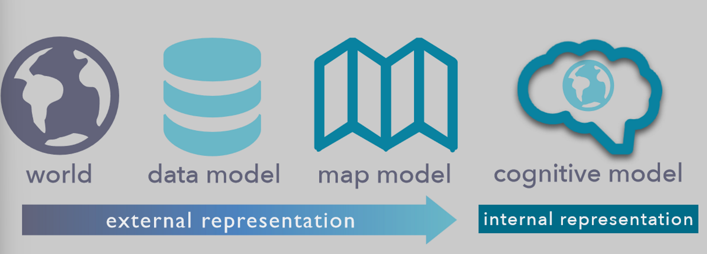
What kind of spaces can be represented with maps?
Geographical spaces
non-geographical spaces (brain activity, political movements
Mental spaces
Planetary spaces (planets, space missions)
(spaces belong to “world” in picture)
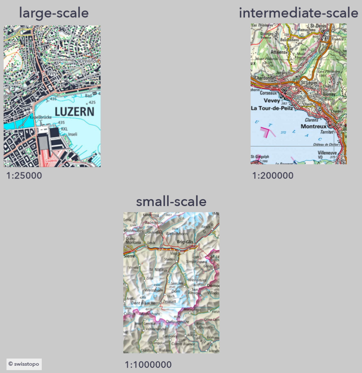
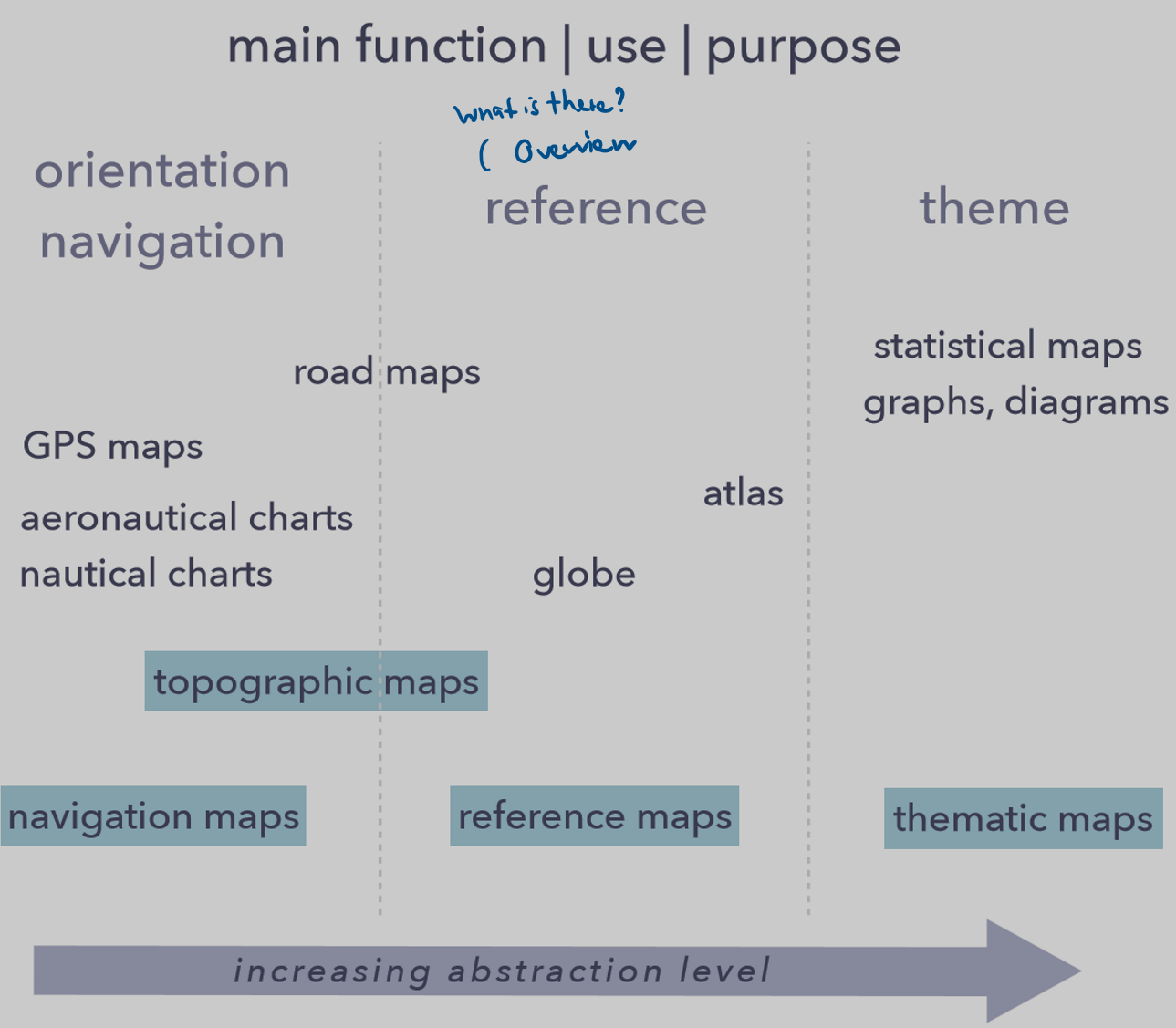
How can maps be classified by scale?
How can maps be classified by function?
topographic
thematic
reference
navigational
mobile
Thematic map: definition and qualitative + quantitative attributes
Depiction of a distribution of an attribute over space, designed for a specific purpose, illustration of spatial patterns
Qualitative: distribution map, what, when and where? Category membership
Quantitative: statistical map, what when, where and how much? Sequences, ranks and magnitude
Reference map: Definition
gives overview of an area
stores spatial information
Tangible features in the environment
location, type and variety of the feature
General purpose dictionary:
Geographical features, e.g. coastlines, rivers, mountains, lakes, …
Landmarks à Where? What? When?
Navigational map
Difference btw. mapmaking, cartography and geovisualization
Mapmaking is the process of creating a map, cartography the science and art behind it, geovisualization the activity of visualizing unknown facts
?
Why is Web GIS used for collaborative map making and sharing?
easy distribution
web services
various clients and applications
efficient
digital, cloudbased
collaborative
re-use of work