APHUG Chapter 1 Map Projections
1/5
There's no tags or description
Looks like no tags are added yet.
Name | Mastery | Learn | Test | Matching | Spaced | Call with Kai |
|---|
No analytics yet
Send a link to your students to track their progress
6 Terms
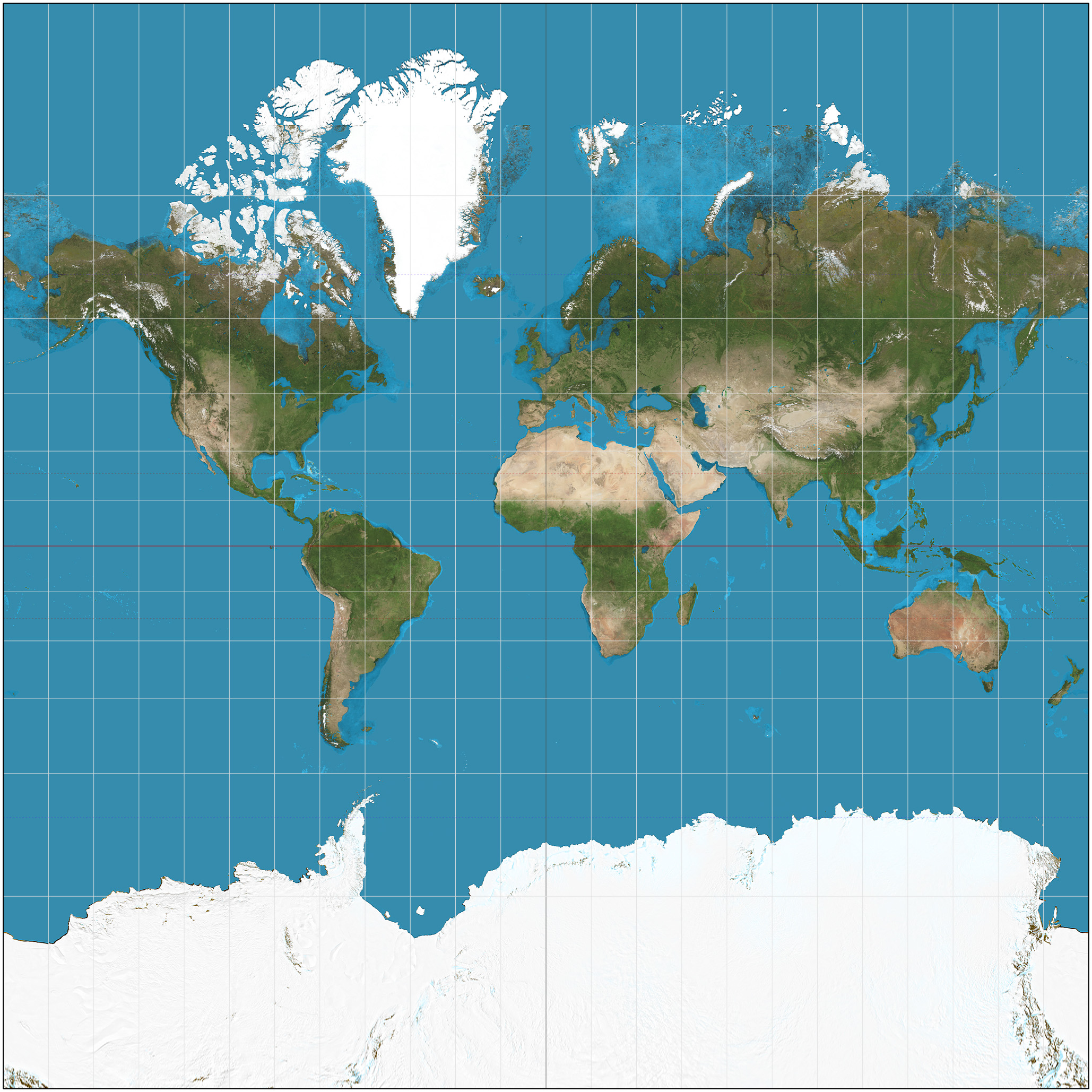
Mercator Projection
Mercator Projection
Primarily deisnged for navigation, its allowed sailors to draw straight lines between two points
Distortion is minimal near the equator
The main drawback is that it exxagertates the size of objects as the approach the poles
Eurocentrism- Critics say that it favorizes the countries in the Northern Hemisphere by exaggerating their size, while minimizing those near the equator
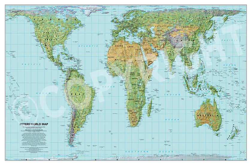
Gall-Peters Projecton
Shows true relative size of landmasses, but distorts shapes making them look stretched over the equator
Cylindrical equal-area map
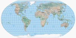
Robinson Projection
Aesthetic, used most in class
Rounded edges and slightly oval shape, which helps reduce the harsh visual distortion of polar regions
Compromises between area and shape, it does not preserve any one perfectly but keeps all distortions relatively low.
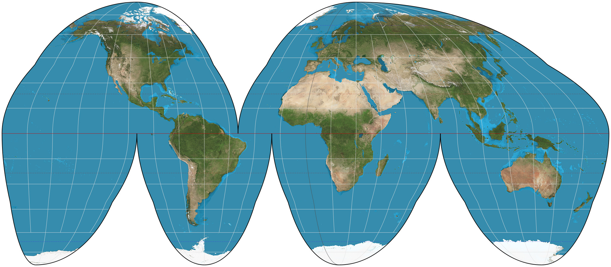
Goodes Homolosine Projections
Equal Area- it preserves the relative sizes of landmasses
Interrupted map preserves landmasses to show true spatial distribution
The splits in the map break the continuity of the oceans (in land-based versions) or continents, which can make global navigation or understanding of ocean connectivity difficult.

Polar/Azimuthal Projection
A planar map created by projecting the Earth’s surface onto a flat plane tangent to one of the poles
Shows true directions from the central pole
Distortion increases toward the edges, while the center remains highly accurate
Doesn’t show all of the world
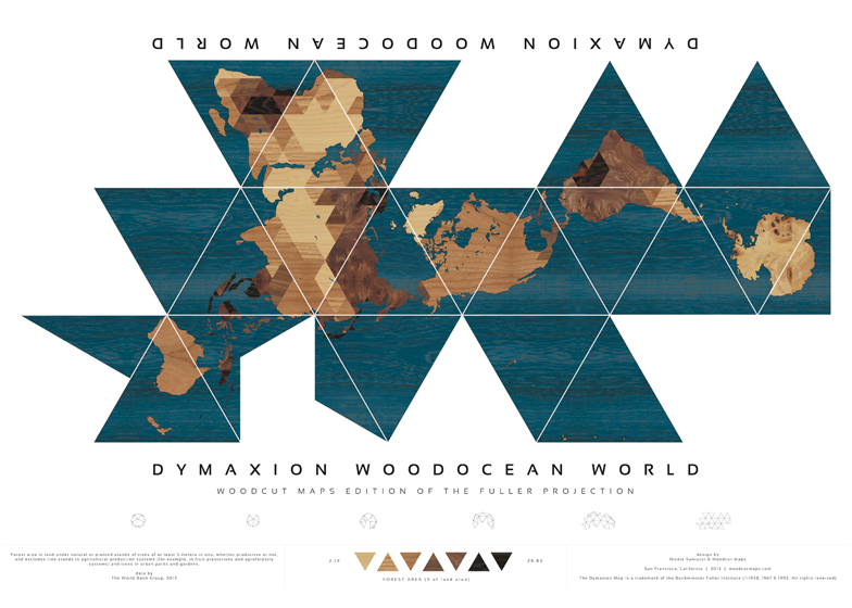
Fuller-Dymaxion Projection
A unique interrupted map projection that displays the Earths continents contiguous landmass
It breaks the oceans rather than the land, allowing for a between view of global relationships, migration patterns and resource distribution
It is intended for visualizng global patterns and connections rather than navigating or measuring cardinal directions.