S/S Test 2
 Call Kai
 Learn
 Practice Test
 Spaced Repetition
 Match
 Flashcards
 Knowt Play
1/84

There's no tags or description
Looks like no tags are added yet.
85 Terms
Moraine
accumulations of till formed directly at the margins of a glacier
End moraine (broad)
Includes both terminal moraines and recessional moraines - marks the limit of glacial advance and typically ridges that lie across the valley
Terminal moraine (specific)
Represents the single outermost limit of a given glacial advance - any other inner ridges are from an advance and recession
Recessional moraine
Lateral moraine
If a glacier retreats the melting releases the detritus, which has accumulated at the sides of the glacier and is called this
Medial moraine
Where two glaciers in tributary valleys converge detritus from the sides of each is trapped in the centre of the amalgamated glacier, the resulting deposit is called this
Drumlin
Smoothed mounds of lodgement tills deposited from beneath a glacier
Till
a general term for all deposits directly deposited by ice
Tillite
When material deposited by ice is unconsolidated (loose)
Diamict
Diamictite
a term used to describe unlithified and lithified deposits of poorly sorted material in an objective way without implying origin or specific processes
Esker
when streams of glacial meltwater flow through ice-walled tunnels beneath or within glaciers, or occasionally in channels on top of the ice that results in long, winding ridges
Kames
mounds or ridges of sediment formed by the collapse of crevasse fills, the sediment formed in lakes lying on the top of the glacier or the products of the collapse of the edge of a glacier
Kettles
a pit or depression in a glacial landscape formed when a detached block of stagnant glacial ice becomes buried in sediment and eventually melts
Jokulhlaups
a sudden, high-discharge glacial outburst flood caused by the rapid release of water stored beneath, within, or dammed by a glacier
Outwash plain
a broad, flat, or gently sloping plain located in front of a melting glacier, formed by stratified sediments deposited by glacial meltwater streams
Loess
accumulations of wild-blown silt of Quaternary age
Mass balance
the accounting of mass entering, leaving, and stored within a defined system or reservoir over time, based on the conservation of mass
Ice sheet
a massive body of glacial land ice covering more than 50,000 square kilometers (about 19,000–20,000 square miles) and burying underlying terrain
Ice cap
a dome-shaped mass of glacial ice (covering less than 50,000 square kilometers) that radiates outward from a central high point, leaving behind a distinct sequence of glaciogenic sediments and erosional surfaces in the rock record
Valley/Alpine
the sedimentary processes and stratigraphic records created by confined mountain glaciers flowing down pre-existing valleys
Zones within
a distinct body or interval of rock or sediment defined by a shared characteristic—such as fossil content, depositional setting, diagenetic alteration, or physical/chemical properties—that may not follow formal lithostratigraphic boundaries
*When were there glaciers in the past?
Glaciers have occurred during several major periods throughout Earth's history, including the Huronian (2.4–2.1 billion years ago), Cryogenian (720–635 million years ago), Andean-Saharan (approximately 460–430 million years ago), Karoo (360–260 million years ago), and Late Cenozoic (34 million years ago to present) glaciations. The most recent major period of glaciation began during the Pleistocene, approximately 2.6 million years ago, and consisted of repeated glacial advances and retreats. The most recent glacial period ended approximately 11,700 years ago, and Earth is currently in an interglacial period within the larger Cenozoic ice age.
*What is meant by glaciolacustrine, glaciomarine, or periglacial?
Glaciolacustrine, glaciomarine, and periglacial describe different environments associated with glaciers and cold climates. Glaciolacustrine refers to sediments deposited in lakes influenced by glaciers, commonly producing fine-grained sediments and seasonal layers called varves. Glaciomarine refers to sediments deposited in ocean environments influenced by glaciers, where melting icebergs can release sediment and create dropstones. Periglacial refers to cold environments outside or around glaciated areas where freeze-thaw processes, permafrost, and frost-related sediment movement shape the landscape.
TL;DR
Lacustrine = Lake
Marine = Ocean
Periglacial = Cold environment around glaciers, not necessarily covered by ice
Ventifact
a rock or stone that has been abraded, faceted, grooved, or polished by wind-driven particles—most commonly sand via saltation, or ice crystals in cold environments
Erg
a broad, flat area of desert covered with wind-swept sand with little or no vegetative cover
Aeolian dunes
mounds, ridges, or hills of wind-blown sand shaped by wind erosion, transport, and deposition
Ripple field
this refers to a collection of ripple marks covering a bed of gravel, sand, or silt across scale ranges of cm to hundreds of ft
Dune field
a geographic area covered by a collection of sand dunes that form and organize through wind processes, sand supply, and local wind patterns
Draa field
A large area of giant aeolian dunes (draas), often with smaller dunes migrating across their surfaces
a “draa” is a very elongate dune
Barchan dunes
Crescent-shaped dunes formed by one dominant wind direction and limited sand supply; horns point downwind

Transverse dunes
Long ridges of sand oriented perpendicular to prevailing winds; form with abundant sand and consistent wind direction

Linear dunes
Long, narrow sand ridges oriented parallel to prevailing winds, commonly formed by winds from two dominant directions

Star dunes
Large, pyramid-shaped dunes with radiating arms, formed by winds blowing from multiple directions
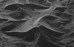
Wadi
a desert river valley or dry riverbed that usually holds water only after heavy rain, though some have year-round water flow or springs
Alluvial fans
Fan-shaped sediment deposits formed where streams exit steep mountain valleys onto flatter plains. Decreased slope and flow velocity cause sediment deposition, with coarse gravel and sand near the apex and finer sediment toward the outer edges. Channels spread and migrate across the fan, commonly during episodic flooding
Fan apex
Highest point on the alluvial fan
Fan head
The proximal (upper) portion of the fan, closest to the apex, where coarse sediment is commonly deposited
Mid-fan
The middle portion of the fan, where channels spread out and migrate, depositing sand, gravel, and finer sediment
Fan toe
The outermost, lowest portion of the fan, where the fan gradually becomes less steep and finer sediment is deposited
Distributary channels
Channels that branch outward from the main stream and distribute water and sediment across the fan surface
Proximal zone
The area closest to the apex; typically characterized by coarser sediment, including gravel and boulders
Medial zone
The intermediate area of the fan, where sediment size generally decreases and channel migration is common
Distal zone
The outermost area of the fan, generally characterized by finer sediment such as sand, silt, and mud
Fan surface
The sloping depositional surface across which water and sediment move away from the apex
Sheet floods
Shallow, widespread flows of unconfined water that transport and deposit sediment across relatively flat surfaces. Common in arid environments during intense rainfall and contribute to thin, laterally extensive sand and gravel deposits on alluvial fans
The main deposition on an alluvial fan is through subaerial debris flow and this deposition
Debris flows
Rapid flows of water-saturated sediment containing mud, sand, gravel, and boulders. Commonly triggered by intense rainfall on steep slopes. They transport large particles and deposit poorly sorted sediment, often forming thick, lobate deposits near the apex of alluvial fans
*What are the parts and processes of an alluvial fans?
An alluvial fan is a fan-shaped sedimentary deposit that forms where a stream exits a steep, confined mountain valley and enters a flatter plain. It consists of three general zones: the proximal zone (fan head) near the apex, the medial zone (mid-fan), and the distal zone (fan toe) at the outer edge. As water flows away from the apex, the slope and flow velocity generally decrease, causing sediment to be deposited. Coarse sediment, such as gravel and boulders, is typically deposited near the apex, while finer sand, silt, and mud are transported farther toward the fan toe. Two major depositional processes are sheet floods, in which shallow, widespread flows of water transport and deposit sediment across the fan surface, and debris flows, in which dense mixtures of water and sediment transport large particles, depositing poorly sorted material. Water and sediment are distributed through branching distributary channels, which can migrate or shift position over time, continually changing the shape and deposits of the fan.
TL;DR
Formation: Stream exits mountain valley onto flat plain.
Anatomy: Apex → proximal → medial → distal → toe.
Energy: Slope and velocity decrease.
Sedimentation: Coarse → fine as distance from apex increases.
Processes: Sheet floods and debris flows deposit sediment; distributary channels shift.
Thalweg
The line connecting the deepest points along a river or stream channel; generally follows the main flow path and shifts as erosion and deposition change the channel
Catchment area (drainage basin)
The area of ground of land that supplies water to a river
Tributaries
a stream or smaller river that flows into a larger river (the mainstem) or a lake rather than directly into a sea or ocean
Distributaries
a stream or river channel that branches off and flows away from a main river channel, carrying a portion of its water and sediment
Collecting
this refers to a river gathering water and sediment from surface runoff and tributaries within its catchment area and transporting them downstream
Transporting
this refers to the movement of sediment downstream by flowing water. Sediment moves as bed load (traction and saltation), suspended load, or dissolved load
Dispersing
this refers to the spreading and distribution of water and sediment across a wider area, often as a river loses confinement and deposits sediment
*Characteristics and processes of braided river deposits?
Braided rivers are characterized by multiple shallow, interconnected channels that split apart and rejoin around temporary or relatively stable sediment bars and islands. They commonly form where rivers have a high sediment load, variable discharge, and relatively steep gradients. As water flows through the system, it transports large amounts of sediment, including sand and gravel. When flow velocity decreases, sediment is deposited, forming bars that divide the river into multiple channels. During periods of increased discharge, the river can erode these bars, transport sediment, and shift or create new channels. This continuous process of erosion, transportation, and deposition causes braided rivers to be highly dynamic. Braided river deposits typically contain coarse sand and gravel, are often poorly sorted, and show cross-bedding and channel-fill structures created by migrating sediment bars and shifting channels.
TL;DR
Multiple channels: Channels split and rejoin around sediment bars.
Sediment bars: Accumulations of sand and gravel that divide the flow.
High sediment load: Large quantities of sediment are transported and deposited.
Coarse sediment: Commonly gravel and sand.
Channel migration: Channels frequently shift as bars build up and erode.
Cross-bedding: Forms as sediment bars migrate through the channels.
Poor sorting: Deposits can contain a mixture of different grain sizes.
Important processes
Erosion: Fast-moving water erodes the riverbed and sediment bars.
Transportation: Water carries sediment downstream through traction, saltation, and suspension.
Deposition: Decreasing flow velocity causes sediment to settle and form bars.
Channel shifting: Channels split, merge, and migrate as sediment bars develop and erode.
*Characteristics and process of meandering rivers?
Meandering rivers are characterized by a single, winding channel with pronounced bends called meanders. They commonly develop on relatively flat floodplains with lower gradients and are associated with finer sediment, such as sand, silt, and mud. As water flows through a bend, it generally moves faster along the outer bank, causing erosion and forming a cut bank. Water moves more slowly along the inner bank, allowing sediment to accumulate and form a point bar. This process of erosion on the outer bank and deposition on the inner bank causes the meander to migrate laterally over time. As bends become more pronounced, they may eventually be cut off from the main channel, forming an oxbow lake. Meandering rivers also periodically overflow their banks during floods, depositing fine sediment across the surrounding floodplain and forming natural levees.
TL;DR
Key characteristics to remember
Single channel: One main channel with winding bends.
Meanders: Curved bends in the river channel.
Cut bank: Erosional feature along the outer bank of a meander.
Point bar: Depositional feature along the inner bank of a meander.
Floodplain: Flat area surrounding the river that may be covered during floods.
Oxbow lake: Crescent-shaped lake formed when a meander bend is cut off.
Natural levees: Raised sediment deposits along riverbanks formed during floods.
Important processes
Erosion: Faster-moving water along the outer bend erodes the cut bank.
Transportation: Flowing water carries sediment downstream.
Deposition: Slower-moving water along the inner bend deposits sediment, building a point bar.
Lateral migration: Continued erosion and deposition cause the meander to move across the floodplain.
Cutoff: A river may eventually cut through the narrow neck of a meander, abandoning the old bend and forming an oxbow lake.
Overbank deposition: Floodwater spills onto the floodplain and deposits fine sediment, sometimes building natural levees.
Differences between braided and meandering rivers
Braided vs. meandering — quick comparison
Braided rivers | Meandering rivers |
|---|---|
Multiple interconnected channels | Usually one main channel |
Abundant sediment bars | Point bars |
Commonly coarse sand and gravel | Commonly sand, silt, and mud |
Channels frequently split and rejoin | Channel bends migrate laterally |
Bar formation and erosion | Outer-bank erosion and inner-bank deposition |
Exam tip: If you remember only one process for meandering rivers, remember cut bank = erosion; point bar = deposition.
*Point bar sequences and epsilon cross bedding
Point bars form along the inside bends of meandering rivers where water velocity decreases and sediment is deposited. As the river migrates laterally, the point bar gradually builds outward through repeated episodes of deposition. This produces a characteristic point bar sequence, in which sediment commonly becomes finer upward (a fining-upward sequence). Coarser sand is typically deposited near the base, while finer sand and silt accumulate toward the top as the depositional environment becomes shallower. Epsilon cross-bedding is a large-scale sedimentary structure associated with lateral accretion of point bars. It forms as sediment is deposited in inclined layers along the sides of a migrating river channel, recording the sideways movement of the meander bend.
TL;DR
Point bar sequence = sediment builds up on the inside of a meander, commonly producing a fining-upward deposit.
Epsilon cross-bedding = inclined layers that record the lateral (sideways) migration of the river channel.
*Describe characteristics, processes, and deposits on floodplain/overbank areas
Floodplains are relatively flat areas of land adjacent to a river channel that are periodically flooded when river discharge exceeds the channel's capacity. During floods, water spills over the riverbanks and spreads across the surrounding floodplain, losing velocity as it moves away from the main channel. This decrease in flow energy causes suspended sediment to settle and accumulate. Coarser sediment, such as sand, is typically deposited closer to the river channel, while finer sediment, such as silt and clay, travels farther across the floodplain before settling. Repeated flooding can build natural levees, which are raised ridges of sediment along the riverbanks. Other common floodplain deposits include fine-grained overbank deposits, crevasse splays formed when floodwater breaks through a natural levee, and organic-rich deposits from vegetation and soil development. Floodplains are therefore important depositional environments where repeated flooding produces layers of sediment over time.
TL;DR
Remember the three major deposits: natural levees, crevasse splays, and fine-grained overbank deposits.
*Paleosols - what are they, how do you recognize them and where do they occur within what portion of the river environment?
Paleosols are ancient, buried soils that formed when sediment surfaces were exposed to the atmosphere and remained stable long enough for soil development to occur. They are recognized by features such as root traces, soil horizons, color changes, mottling, and carbonate nodules, which indicate processes of weathering, biological activity, and soil formation. Paleosols commonly occur within floodplain and overbank deposits, where periods between floods allow sediment surfaces to become exposed and develop into soils. They are especially common in areas away from the main river channel, where sediment deposition may be less frequent. Paleosols provide evidence of periods of landscape stability and can help geologists interpret past environmental and climatic conditions.
TL;DR
Paleosols = ancient soils that indicate periods of stability between flooding and sediment deposition.
Remember three things:
What: Buried ancient soils.
Recognition: Root traces, soil horizons, mottling, and carbonate nodules.
Location: Floodplain/overbank deposits, particularly areas away from active channels.
*Describe the divisions of the marine realm
The marine realm is divided into several zones based on water depth, distance from shore, and position relative to the continental shelf and slope. The netritic is the water on the shelf before it drops off. The epipelagic is still somewhat shallow, but off shelf. Then, the mesopelagic is between in epipelagic and bathylpelagic. Beyond the continental shelf is the bathyal zone, which covers the continental slope and has greater water depths. The abyssal zone occurs on the deep ocean floor, generally at depths of approximately 3,000–6,000 meters. The deepest areas, including ocean trenches, are called the hadal zone. Marine environments can also be divided by distance from shore into nearshore, offshore, and deep-marine environments.
TL;DR
Make sure you can distinguish the continental shelf (sublittoral) from the continental slope (bathyal). The shelf break marks the transition between them.

*Describe a hummocky and swaley cross stratification sequence and what it results from
Hummocky cross-stratification (HCS) and swaley cross-stratification (SCS) are sedimentary structures commonly found in shallow-marine environments, particularly offshore-transition and lower shoreface deposits. They form primarily from powerful storm waves that generate combined-flow conditions (oscillatory wave motion combined with unidirectional currents), which transport and deposit sand on the seafloor. Hummocky cross-stratification consists of low-angle, undulating layers with convex-up hummocks and concave-up swales. Swaley cross-stratification consists of broader, deeper concave-up depressions called swales, with less prominent hummocks. These structures commonly occur in storm-generated deposits, sometimes forming a sequence in which hummocky and swaley structures record changing storm-flow conditions and subsequent deposition as energy decreases.
TL;DR
Hummocky and swaley cross-stratification = storm-generated sedimentary structures.
Hummocky = smaller, gentler undulations.
Swaley = broader, deeper depressions.
Both result from strong storm waves and combined-flow conditions that transport and deposit sand.
*Describe the two ways trace fossils are classified
Trace fossils (ichnofossils) are evidence of the activity of organisms preserved in sediment or sedimentary rock, rather than the preserved remains of the organisms themselves. They can be classified in two main ways: by the behavior of the organism that created them (behavioral classification) and by their physical appearance or morphology (morphological classification). Behavioral classification groups trace fossils according to what the organism was doing, such as moving, feeding, resting, or dwelling. Morphological classification groups them according to their shape, structure, and physical characteristics, such as burrows, tracks, trails, and borings. These classifications help geologists interpret the behavior of ancient organisms and the environments in which they lived.
TL;DR
Behavioral = What was the organism doing?
Morphological = What does the trace look like?
Exam tip: Remember that trace fossils preserve evidence of an organism's activity, not necessarily its body. A burrow, for example, can be classified morphologically as a burrow and behaviorally as a dwelling trace (domichnia).
*What do we mean by trace fossil assemblages and what are they?
A trace fossil assemblage is a group or association of different trace fossils found together within a particular sedimentary layer or depositional environment. These assemblages represent the combined activities of organisms that lived in or interacted with the sediment under similar environmental conditions. They may include burrows, tracks, trails, and feeding structures produced by different organisms. Geologists study trace fossil assemblages to interpret past environmental conditions, including water depth, oxygen availability, salinity, sediment consistency, food availability, and energy levels. Because different organisms prefer different environmental conditions, trace fossil assemblages can help identify and interpret ancient depositional environments.
TL;DR
Trace fossil assemblages = groups of trace fossils found together that help reconstruct ancient environments.
Know the genera of trace fossils shown in class and lab
Stromatolites | Layered or domal microbial structures |
Microbial mats | Microorganisms binding sediment |
MISS | Wrinkles, cracks, and mat-related textures |
Chondrites | Branching burrows |
Helminthopsis | Winding feeding trails |
Gordia | Looping trails |
Palaeophycus | Horizontal lined burrows |
What is a crevasse splay?
a low cone of sediment formed by water flowing through a breach in the bank and out onto the floodplain
Epsilon cross-stratification
large scale cross bedding that is caused by the lateral accretion of the point bar that shows a fining upward succession of a river deposit
Avulsion
The process whereby a river will change or shift its course on the floodplain by cutting through a bank and abandoning part of the channel
Horizontation
The development of layering in a soil
Continental shelf
The relatively shallow, submerged area extending from the shoreline to approximately 200 m depth
Spring tides
Highest high tides and lowest low tides, occurring when the Sun, Moon, and Earth are aligned
Neap tides
The smallest tidal ranges, occurring when the Sun and Moon are at right angles relative to Earth
Epicontinental seas
Shallow marine environments that cover portions of a continent
Shelf edge / shelf break
The transition between the continental shelf and continental slope
Tempestite
A sedimentary deposit formed by a storm; may contain hummocky cross-stratification (HCS)
FWWB (Fair-Weather Wave Base)
The average depth that waves reach during normal weather conditions
Tidal bulge
The mass of water on the Earth pulled upwards because of the gravitational attraction of the moon and sun
Offshore zone
The area on the continental shelf deeper than the SWB
Ebb tide
the outgoing tidal current as water drains away from shore and bays
Herringbone cross-stratification
A sedimentary structure formed by alternating current directions, typically from reversing tidal currents
Reactivation surface
A minor erosional surface that forms because of alternating directions of currents caused by tides
Ichnofauna
The collection of trace fossils in an environment
Condensed section
Strata that is deposited at very slow sedimentation rates results in a very thin section called this
Glauconite
K & Fe rich phyllosilicate mineral that is dark green and can precipitate in the sedimentary environment and may be concentrated in fecal pellets