UAS-Airports and Airspace (Week 4)
 Call Kai
 Learn
 Practice Test
 Spaced Repetition
 Match
 Flashcards
 Knowt Play
1/64

Earn XP
Description and Tags
For Hocking College NRM-1128, Intro Unmanned Aerial Systems. Originally created by Luke Gilkey.
65 Terms
What is AGL?
Above Ground Level
What is MSL?
Mean Sea Level (Altitude above sea level)
What are the two main types of airports?
Towered and un-towered
What are the three sub-types of airports?
1. Civil Airports (open to the public)
2. Military/Federal Government Airports (not open to the public)
3. Private Airport (Requires permission from the owner)
What are the characteristics of a towered airport?
Has an operating control tower (Referred to as Air Traffic Control ATC)
What is Air Traffic Control responsible for?
They are responsible for the orderly and safe flow of air traffic (preventing air collisions).
Communication with ATC is required for all aircraft.
What are the characteristics of a non-towered airport?
No operating control tower.
Smaller airports.
How is radio communication handled for non-towered airports?
Radio communication is NOT required at non-towered airports.
Radio calls are recommended on the Common Traffic Advisory Frequency (CTAF) or Universal Integrate Community (UNICOM)
What is True North?
The earth's physical north pole.
(Maps are oriented in relation to True North)
What is Magnetic North
Location of the Earth's magnetic field's magnetic field.
Not the same as the North Pole
Changes over time.
Magnetic compasses align with this, as well as aircraft instruments.
How can you distinguish the difference between magnetic and true north?
The difference is measured in degrees (called Variations).
It varies on your location on earth and is identified as East or West.
How do you convert True to Magnetic earth?
Add/Subtract variation.
East is least, West is best (Subtract East, Add West).
How do aeronautical maps show variations?
They show lines of variation called Isogonic lines.

What does Traffic Pattern mean?
Patterns are used by pilots to make an organized approach to landing.
Most legs of the pattern are between the surface and 1,000 ft. above ground level.
When do pilots call into the airports to request entry in the traffic pattern?
Approximately 10 miles away from the airport.
What are NOTAMs?
Notices To Airmen.
Used to to send mostly temporary information critical to flight that could not be published in time.
How should you handle NOTAMs?
You should check NOTAMs before every flight.
They are contained in NTAP (Notices to Airmen Publication).
Can be found online on at pilotweb.nas.faa.gov or using a flight service such as www.fltplan.com
What kind of information does NOTAMs contain?
Info on
Hazards, airshows, parachute jumps, etc.
Flights by VIPs
Military exercises (with resulting restrictions).
ETC.
What is ATIS?
Automated Terminal Information Service
Provides information on current local weather condition at the airport.
Normally updated once per hour.
When is the sky condition and visibility not reported in ATIS
When the ceiling is above 5,000 ft
AND
Visibility is 5 statute miles or more.
What is class B airspace?
Setup around the busiest airports in the nation.
Remember B for busy.
What is Class B's dimensions?
Looks like an upside down wedding cake in a 3D perspective.
Solid blue circles.
Generally from the surface to 10,000 ft. MSL.

Do you need prior approval before you can operate a UAS in class B airspace?
Yes.
BUSY airports.
What is the Mode C Veil?
Mode C Veil surrounds the class B airspace.
It is NOT considered an airspace.
Solid magenta line.

What is Class D Airspace?
Class D airports that are busy enough to warrant a control tower.
When the control towers are not staffed at night, the airspace reverts to class E or G.

What is Class D's dimensions?
Single cylinder from surface to 2,500 ft. AGL.
Radius varies depending on the airport. Based on the instrument procedures available at the airport.
Do you need prior approval before you can operate a UAS in Class D airspace?
Yes.
What is Class E airspace?
Everything that is controlled that IS NOT A,B,C, or D.
Most confusing to pilots.
Represents most airspace in the National Airspace System.

Class E airspace characteristics
Starts at 1,200 ft. AGL UNLESS otherwise directed.
Around certain airports, it starts at 700 ft. AGL or the surface.
Depicted by zipper lines.
What are the different types of class E airspace?
E1: Class E at or above 14,500 ft. MSL
E2: Designated as a surface area of an airport.
E3: Designated as an extension to a class C surface area.
E4: Designated as an extension to class D or class E surface area.
E5: Extending upward from 700 ft or more above the surface of the earth.
Does you need prior authorization to operate your UAS in class E airspace?
Only if it starts at the surface/below 400 Ft. AGL
What is Class G airspace?
Uncontrolled Airspace.
Everything that is not A,B,C,D, or E
Generally below class E airspace.
Not represented on sectional charts.
Does you need prior authorization to operate your UAS in class G airspace?
No.
What is the chart symbology of Class B Airspace?
Solid blue line.
Marked as 100/40 on the map.
Depicted on chart as MSL.

What is the chart symbology of Class C Airspace?
Solid magenta line (be careful not to confuse with the Mode C Veil).
Marked as 50/SFC
Depicted on chart as MSL

What is the chart symbology of Class D Airspace?
Blue 'zipper' lines.
Marked with a boxed 40 icon
Depicted on chart as MSL.

What is the chart symbology of Class E Airspace (starting at the surface)?
Magenta 'zipper' line.

What is the chart symbology of Class E Airspace (starting at 700 ft AGL)?
Faded magenta line.
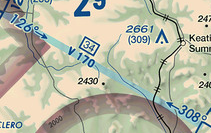
What is the chart symbology of Class E Airspace (starting at 1,200 ft and 14,500 ft. AGL)?
Blue faded line.
What is LAANC?
Low Altitude Authorization and Notification Capability
What does LAANC do?
They provide maximum altitudes at which the FAA may be able to authorize an operation.
THEY DO NOT GIVE PERMISSION.
You must request approval before flying in these areas.

What are MOAs?
Military Operation Areas
Established to separate civilian and military traffic.
When MOAs are active, civilian traffic is routed away from the area.

Can you fly your UAS in a MOA?
Yes.
USE EXTREME CAUTION when doing so and yield the right of way to any and all other aircraft.
What are CFAs?
Controlled Firing Areas.
Contains activities which could be hazardous to to non-participating aircraft (will be stopped if they are spotted).
They are NOT charted.
Are you allowed to fly in a Prohibited airspace if you request approval?
No flights period.
Can you fly in a Restricted Permission Airspace?
Only if you get the controlling agency's permission due to the presence of hazards inside.
Can you fly in the Warning Airspace.
Due to the fact this airspace extends ≥ 3 nautical miles out to sea, there's no sole jurisdiction
Can you fly in a MOA?
Yes,
but exercise caution.
Can you fly in an Alert Area?
Higher training volume.
Shared collision avoidance.
Can you fly in a CFA?
Yes, but all activity ceases when an aircraft approaches.
What is FL?
Flight level.
Above 18,000 ft. MSL, Altitudes are measured in flight level.
If someone is at 24,000 ft MSL, they are at FL240.
What are VFRs?
Visual Flight Rules.
Pilots fly by reference to the clouds, while staying away from the clouds, fog, and reduced visibility.
What are IFRs?
Instrument Flight Rules.
Pilots fly by reference to the instruments in the cockpit.
What is VMC?
Visual Meteorological Conditions
When VFR and IFR flights are possible. (Drones can fly in this.)
What is IMC?
Instrument Meteorological Conditions
Conditions where only IFR flights are possible.
Drones are not allowed to fly in this due to the loss of VLOS.
What are TFRs?
Temporary Flight Restrictions
These are established around VIPs (President, VP, etc.)
Disaster sites to enable disaster response.
ETC.
Can you fly in TFRs?
NO
TFRs are issued on NOTAMs and can also be found at tfr.faa.gov
Check for TFRs before each flight.
Can you fly in/around a stadium during a game?
No.
Stadiums are protected by Stadium TFRs which are 3 NM in radius, and up to 3,000 ft. AGL.
They are active from 1 hour before and after the event.
They exist for any stadium with a seating capacity of 30,000 people or more.
What is a parachute jump area?
Any area that is designated for parachute jumps.
Depicted on sectional charts using the symbol on the attached photo.
More info can be found on the Chart Supplement.

What should you do when you notice a parachute jump area in your flight path?
Contact the local airport to see if its active.
STAY AWAY if active.
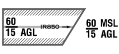
What is Special Military Activity?
Areas involving periodic use of military unmanned aircraft systems.
These UASs are usually followed by manned aircraft.
Depicted by using the symbols shown in the photo attached.
What are NSAs?
National Security Areas
Setup at locations where there is a requirement for increased security and safety of ground facilities.
Flight in NSAs may be temporarily prohibited by the issuance of a NOTAM.
Pilots are requested to voluntarily avoid these areas.
What are FRZs?
Flight Restricted Zones
Established within the vicinity of the Capital and the White House.
No flights period.

Are you permitted to fly your UAS in a wilderness area/national park without permission?
No.
Areas are setup to protect people/wildlife from unnecessary noise and disturbances.
Drones are considered motor vehicles and are prohibited from from operation. Violation could result in fines.
What is the danger of tethered balloons?
The main danger is the tether which could damage/destroy the rotors of your drone.
Maps will notify you of a balloon's existence, but wont display the location.