(Oct 21) Urban Form, Land Use, and Transportation Planning
 Call Kai
 Learn
 Practice Test
 Spaced Repetition
 Match
 Flashcards
 Knowt Play
1/35

Earn XP
Description and Tags
Practice vocabulary flashcards covering urban density, housing types, transportation planning paradoxes, and the history and impacts of automobility.
36 Terms
Benefits of Density
per capita energy, space, GHG etc. all lower in urban areas (compared to suburban and rural)
costs of supplying roads, power, sewage systems, mail etc. is lower at higher population densities
Missing Middle Housing
A range of multi-unit or clustered house-scale residential buildings compatible with single-family neighborhoods—such as duplexes, triplexes, fourplexes, courtyard apartments, bungalow courts, townhouses, multiplexes, and live/work units—that bridge the gap between detached single-family homes and mid-rise structures
Urban Transect
An urban planning model that organizes environments along an ecological gradient of human settlement, spanning T1 (Natural Zone), T2 (Rural Zone), T3 (Sub-Urban Zone), T4 (General Urban Zone), T5 (Urban Center Zone), and T6 (Urban Core Zone), alongside Special Districts (SD).
Factors to consider for sustainability
Zoning
Land-use
Variation in Land-use
Cost of building materials
Climate (impacts of heating and cooling)
Source of electricity
Local and Regional accessibility
Household size
Income
Vehicle ownership
Location
T1 Natural Zone, Sustainable (bc little to no human impact / infrastructure)
Identify the Urban Transect Zone and determine if it is Sustainable or not:

T2 Rural zone, Not Sustainable (infrastructure and transportation sprawl, low walkability, missing middle housing)
Identify the Urban Transect Zone and determine if it is Sustainable or not:

T3 Sub-Urban zone, Not Sustainable (infrastructure and transportation sprawl, low walkability, missing middle housing)
Identify the Urban Transect Zone and determine if it is Sustainable or not:

T4 General Urban zone, Sustainable (infrastructure and transportation density, high walkability, includes missing middle housing)
Identify the Urban Transect Zone and determine if it is Sustainable or not:

T5 Urban Center zone, Sustainable (infrastructure and transportation density, high walkability, includes missing middle housing, anti-sprawl)
Identify the Urban Transect Zone and determine if it is Sustainable or not:

T6 Urban Core zone, Sustainable (Infrastructure and transportation density, high walkability, but missing middle housing)
Identify the Urban Transect Zone and determine if it is Sustainable or not:

SD special district, Not Sustainable (poor land use, ex: big Target with parking lots)
Identify the Urban Transect Zone and determine if it is Sustainable or not:
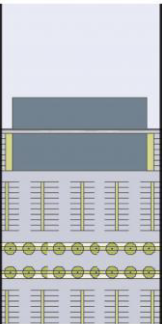
car dependency, redundancy of infrastructure, and single family homes are less efficient to heat than apartments
Sustainability issues from sprawling land-use:
land use policy, street infrastructure, density/ height, amount of parking, tax breaks / economic incentives, transport policy
How can cities / Urban planners address issues related to energy, environmental damage etc.
relax maximum density restrictions
solution
relaxing stringent density regulations → more compact and less car-dependent cities
these cities can also provide more affordable and cost- effective housing and public services
streamline land-use taxation
solution
allowing the tax system to account for the social cost of various land uses → promote more desirable development patterns
removing tax incentives for the development of land on the outskirts of cities can prevent conversion of farmland and forests into urban land
motor fuel taxes
solutions
align motor fuel taxes with the external costs of fuel consumption
low motor fuel taxes cause excessive car use and may fuel urban sprawl by promoting the dispersion of jobs, residences etc.
Invest in more sustainable forms of transport infrastructure
solution
investing less in new urban highways and more in public transport, cycling paths, sidewalks etc.
reduce car dependency and deter further urban sprawl
Lewis Mumford
author of the Highway and the City
critic of sprawl
“forget the damned motor car and build the cities for lovers and friends”
“whats transportation for?”
The Highway and the City
response to the 1956 federal highway program ($26 billion)
the car’s promise of freedom disappears once everyone drives
congestion moved to the highway; suburbs sprawl into more suburbs
urban expressways repeat the mistakes of railways and elevated lines
argued that transportation should connect people rather than maximize driving
advocated that expressways should bypass city centers rather than cut through them
“what is transportation for?”
to bring people and goods together (not to maximize driving)
“a good transportation system minimized unnecessary transportation”
diff trips need diff modes and speeds
in dense urban areas, the pedestrian is the most efficient mode of transpo
the National Highway Users Conference
influence federal transportation policy
created in the 1930s by general motors, AAA, and other industry groups
included Highway Engineers
dominated the decision making
trained to design without consideration for the how the highways might impact urban fabric
interested in most efficient way to move ppl from pt A to B
made highways cut directly THROUGH the core of every major city in order to bring commuters from newly growing suburbs in and out
did NOT included Urban Planners
had to convince the public (and politicians) of the necessity of roads as a public good
cities either forced to agree/ conform or be left out
Accessibility
The ease of reaching desired destinations within a transport system
evaluated using population-based metrics (such as the percentage of residents within a five-minute walk of transit)
or location-based metrics (such as the number of jobs reachable within a 30-minute drive)
ex) Manhattan: slow speeds, high number of destinations
prioritizes humans

Mobility
The ease and speed of traveling through a transport network
typically quantified through throughput indicators such as vehicles per hour or average travel time lost to congestion
ex) Manitoba (fast speeds, few destinations)
prioritizes the location

Transport-Land Use Cycle
A continuous feedback process wherein highway expansion temporarily alleviates traffic, unlocks outlying land for development, raises land values, prompts residential and commercial rezoning, increases trip distances, and ultimately reproduces traffic congestion.

Generated Traffic
Additional peak-period vehicle travel resulting from roadway expansion until a new equilibrium is reached
Induced Travel
The portion of generated traffic consisting of absolute increases in total vehicle travel, rather than shifts in route or departure time
Triple convergence, Braess’s paradox, Induced demand
Consequences of building Highways (building more highways bc think it will cure congestion):
Triple Convergence / Downs-Thompson paradox
highway expansions that draw users away from transit, actually degrade overall network speeds
Anthony Downs's concept explaining why highway widening fails to alleviate congestion long-term due to three simultaneous commuter responses:
spatial convergence
time convergence
modal convergence.
Spatial Convergence
Drivers diverting from alternate routes onto a newly expanded highway during peak hours
Time Convergence
Drivers shifting from off-peak travel to driving during peak-hours following highway expansion.
Modal Convergence
Commuters shifting from public transit to driving, during peak hours following highway expansion
Braess's Paradox
The phenomenon where adding road capacity worsens overall traffic flow, while closing or removing roads can improve it
ex) Washington square park, times square, cars banned on one of Manhattans busiest streets
shutting down busy intersections, highways etc. makes ppl expect a lot of traffic so they avoid it but because of this avoidance it actually doesn’t have bad traffic or improves traffic flow
Automobility
The systemic framework that reshaped urban spaces, laws, and cultural norms to prioritize car travel over all other street uses
streets used to be:
for all modes:
delivery
utilities
children to play in
streets used to be for human interaction (for the ppl NOT cars)
at first drivers were perceived by society as intruders in urban spaces
automotive companies launched propaganda campaigns to change this and succeeded
Jaywalking
A 1920s legal and social campaign by automotive interests/ companies to restrict pedestrians to designated street crossings
forcing the people off the streets to make way for cars
when the streets used to be for the people
1st case in which propaganda actually led to laws being made
Cincinnati Speed Governor Referendum (1923)
A 1923 ballot initiative mandating 25mph vehicle speed limits, prompting automakers to shift traffic safety responsibility from cars to pedestrians
Mono-transportation
Lewis Mumford's term for transport planning that focused exclusively on private cars over multi-modal networks
prioritized cars over public transpo, walkability etc.