Lecture 1, Chapter 51 - Ecology & The Biosphere
 Call Kai
 Learn
Learn Practice Test
 Spaced Repetition
 Match
Match Flashcards
 Knowt Play
1/34

There's no tags or description
Looks like no tags are added yet.
Name | Mastery | Learn | Test | Matching | Spaced | Call with Kai | Chat |
|---|
No analytics yet
Send a link to your students to track their progress
35 Terms
Ecology
the scientific study of interactions between organisms + their environment
Terrestrial Ecosystems
characterized by temperature and precipitation
has the strongest effect on terrestrial (warm + wet, hot + dry)
Aquatic Ecosystems
nutrient supply and light availability
strongly shape where aquatic organisms live (dark, chemically rich vent)
Population
same species living in the same area
Community
population of different species in an area
Landscape
a mosaic (connected pieces) of connected ecosystems
Biosphere
the global ecosystem
Why do temperature + precipitation vary globally? (3 reasons)
light spreading causes temperature to decrease at higher latitudes (perpendicular vs oblique)
absorption from air molecules/clouds cause temperature to decrease at high latitudes
similar reason to #1, the tilt creates season (vernal + autumnal)

Precipitation Light
direct, less surface area to heat so it’s easier to heat (is hotter)
Oblique light
tilted, more surface area = harder because there is more area (less hotter)
Adiabatic cooling
a decrease in temperature without actual loss of heat energy


Tropical Seasonal Forest/Savana
same temperatures but demonstrate strong seasonality, of wet seasons and dry seasons (small leaved leaves scatter the landscape b/c fires happen easily; grass grow fast to cover the land)
animals: giraffes, elephants, zebras
location: equator and down of Africa, some South America)

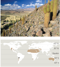
Subtropical Desert
same + CONSISTENT temperatures but low precipitation (limits growth); low density, scattered vegetation
animals: camels, fennec foxes, coyotes
location: Northern Africa; deserts around 30 degree line on the map


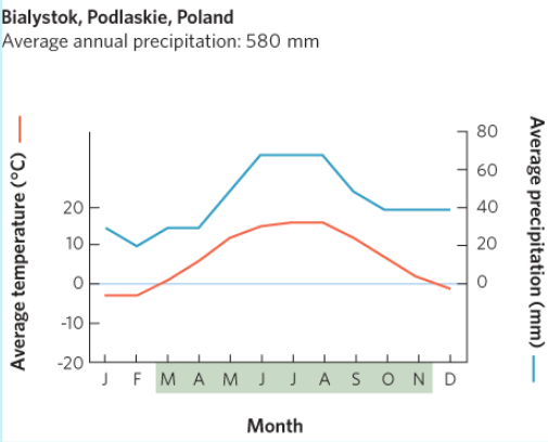
Temperate Seasonal (Broafleaf) Forest
This is New York! Deciduous trees dominant = drop leaves in the winter. Temperature is generally the limiting resource. High competition (for sunlight, soil, etc)
animals: black bears, red foxes, raccoons, squirrels
location: Eastern United States & West Europe

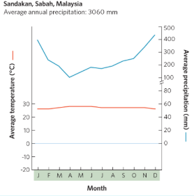
Tropical Rainforest
high but consistent temperatures and high precipitation’ most limited by nutrients (water/temperature are NOT limiting)
animals: highest diversity among across all biomes (frogs, jaguars, sloth, toucan, etc)
location: South + Central America, Africa, some Southeast Asia/the Pacific

Tundra
severe polar climate; extremely cold temperatures and lack of trees
animal: polar bears, artic foxes, artic hare
location: encircling North Pole


Temperate Rainforest
high annual precipitation (often over 55 inches) and mild temperatures (39-54 degrees)
location: coastal regions (such as Pacific Northwest)
animals/plants: tall evergreen trees, abundant mosses, ferns, and lichens

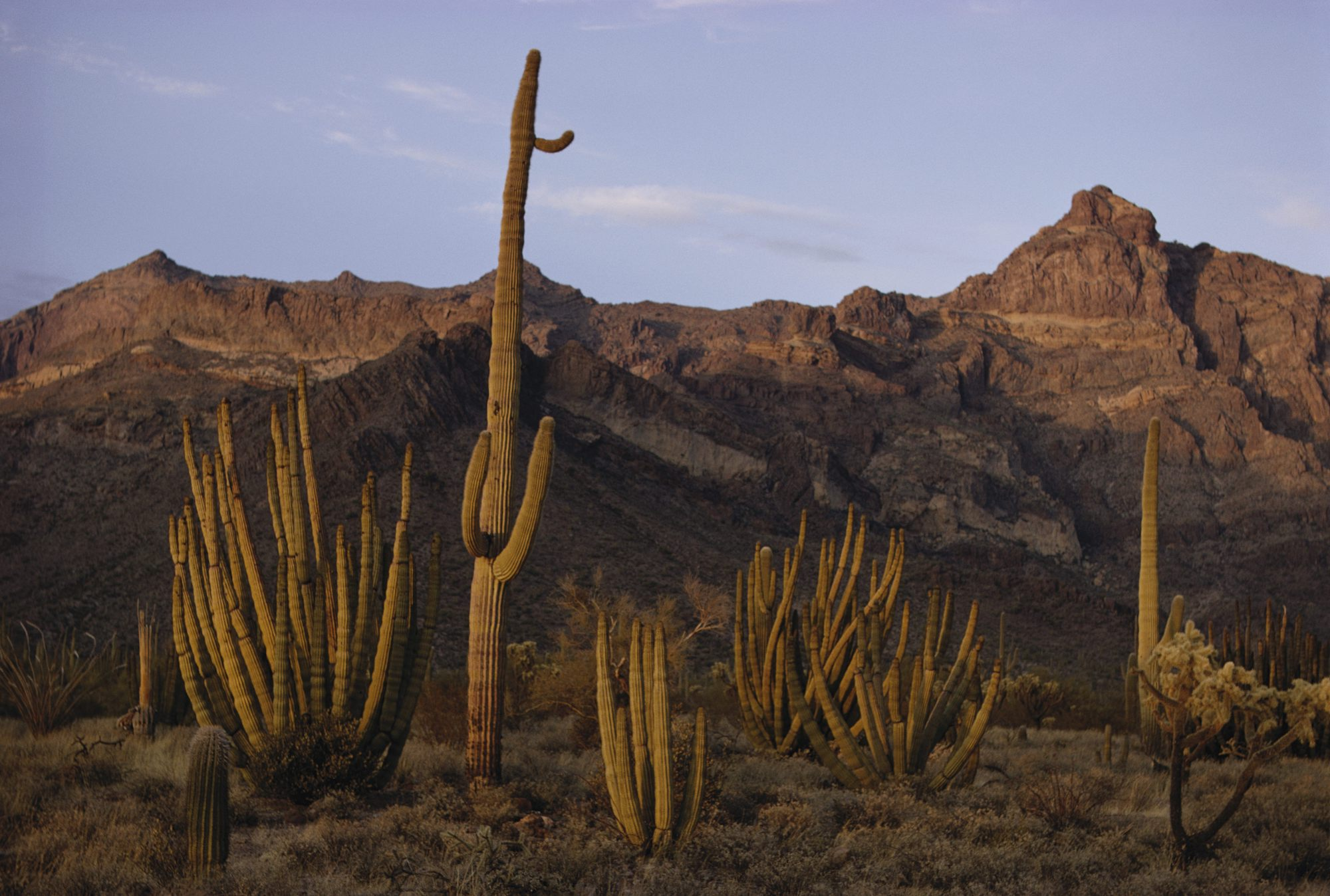
Desert
extremely dry areas w/ minimal precipitation, featuring extreme temperature shifts)
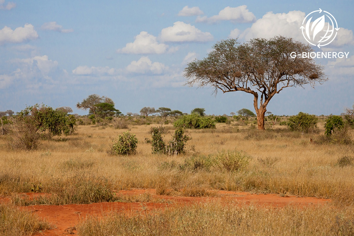
Savanna
grasslands w/ scattered individual trees, experiencing distinct wet and dry seasons

Chaparral (Shrubland)
hot, dry summers and mild, rainy winters w/ dense-leaved shrugs and high fire risk
Freshwater Wetlands
characterized by nonflowing fresh water, shallow enough to have emergent vegetation
i.e. - swamps, marshes, bogs
Marine habitats
divided by light penetration and distance from shore
Salt Marshes + Mangrove Swamps
characterized by intertidal, estuarine waters w/ emergent vegetation
**estuarine waters = coastal regions where seawater mixes w/ fresh waters from rivers, streams, etc
Rocky Intertidal Zone
characterized by intertidal marine waters, on a step rocky coastline
coral reefs, seagrass beds, kelp forests are found in the neritic zone (shallow region of the ocean)
Open Ocean + Aphotic Zone
Earth’s largest biome (“garbage path”); includes microorganisms (bacteria + fungi) and larger invertebrates (crustaceans + polychaetae worms)
located in the benthic zone: the bottom surface of an aquatic zone → “marine snow”
True or False: ponds and lakes are characterized by nonflowing fresh water with areas too deep for emergent vegetation
True
NYC is a _____________ type of biome based on the average temperature and precipitation.
Temperate Seasonal Forest
Aquatic habitats are characterized by ____________ and _________ because of primary production
nutrients and light availability
Name some nutrients that would be a limiting factor in marine ecosystems
nitrogen
phosphorus/phosphate
carbon
sulfur
iron

Photic Zone
upper layer in the ocean that receives sunlight and supports photosynthesis

Aphotic zone
this layer lies beneath the photic zone and extends to the ocean floor, in deep darkness where photosynthesis does not happen

Pelagic Province
the water
Benthic Province
the bottom sediments

What does the pelagic province include?
neritic one - shallow water above the continental shelves
oceanic zone - deep water beyond them
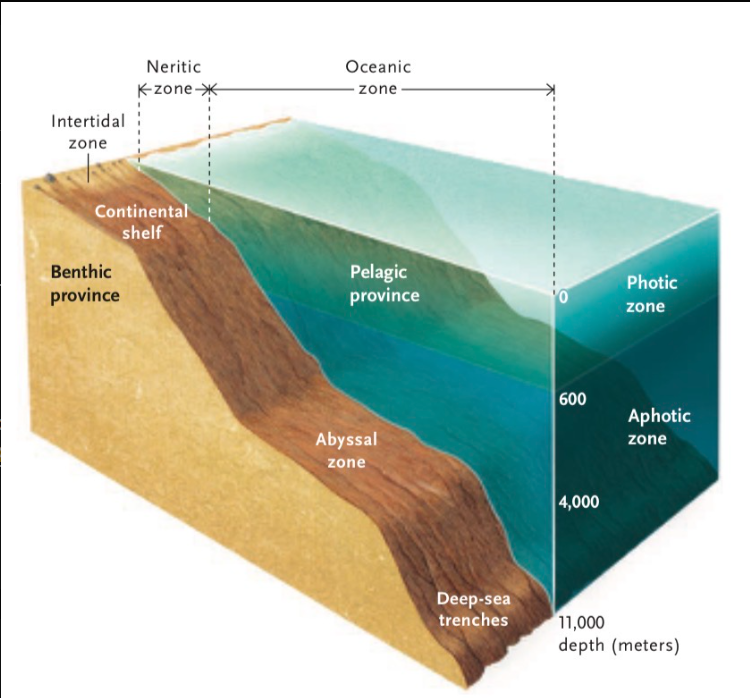
What does the benthic zone province include?
intertidal zone - shoreline that is submerged and exposed by tides
abyssal zone - the bottom sediments that lie permanently below deeper water