Meteorology Exam 3 Quizzes/I Clickers
 Call Kai
 Learn
 Practice Test
 Spaced Repetition
 Match
 Flashcards
 Knowt Play
1/54

There's no tags or description
Looks like no tags are added yet.
55 Terms
The equation that demonstrates pressure, temp, and density are related is the?
Equation of state
In an aneroid barometer, a general rule is that the higher the reading, the more likely ___ weather will occur, and the lower the reading. the better the chances are for ___ weather
clear; inclement
Lines of equal pressure on a weather map are called?
isobars
g
Choose ALL of the following activities that must be concerned with the effect of Coriolis force.
An ICBM (Intercontinental Ballistic Missle)Flight - Missles will fly "high" and "long." Thus, creating a path that will veer to the left or right from it's original path (depending on which hemisphere you are in). Coriolis force plays a huge role here.
A Southwest Airlines flight from Seattle, Washington to New York, New York. - This distance is roughly 2,400 miles from Seattle to New York. Obviously, this is a much larger distance, so the Coriolis force will be much larger.
The unit of pressure most commonly found on a surface weather map is
millibars or hectopascals.
On an upper-level chart, normally we find warm air associated with [ Select ] ["low", "high"] pressure, and cold air associated with [ Select ] ["high", "low"] pressure.
high
low
A rapid change in pressure over a relatively short distance is called a ____ pressure gradient.
steep
The amount of pressure change that occurs over a given horizontal distance is called the
pressure gradient.
The contour lines drawn on a 500 mb chart are lines of constant
pressure.
Where is the effect of the Coriolis force the greatest?
At the poles
The Coriolis force acts at a ____ degree angle to the wind.
90
The scale on an altimeter indicates altitude, but an altimeter actually measures:
pressure
If Earth did not rotate, the wind would blow directly from regions of [ Select ] ["high", "low"] pressure toward regions of [ Select ] ["low", "high"] pressure.
high
low
Storms rank in size from largest to smallest, as follows: middle-latitude cyclonic storm, hurricane, thunderstorm, tornado.
True
The winter monsoon in eastern and southern Asia is characterized by
dry weather and winds blowing from land to sea.
Wind direction and speed can be determined with an aerovane.
True
On the eastern side of the Rocky Mountains, chinook winds are driest when
clouds form and precipitation falls on the upwind side of the mountains.
An example of microscale motion is:
winds blowing through Jerseyville, Illinois.
Most people associate a monsoon with heavy rain and wind. While that is true (somewhat), the term monsoon actually refers to what?
The United States has a monsoon season. Where is it located?
A wind system that changes direction, seasonally.
The desert southwest.
Coastal areas can have strong waves on a clear, non-stormy day.
True
An upper wind direction is reported as 315°. From what compass direction is the wind blowing?
northwest
The howling of wind on a blustery night is believed to be caused by
air flowing past obstructions.
Friction is not restricted to solid objects; it occurs in moving fluids as well.
True
At any given time, only one jet stream can be found in the atmosphere.
False
The general circulation of the atmosphere represents the actual air flow around the world and not just an average.
False
The name given to the current of warm water that replaces cold surface water along the coast of Peru and Ecuador during December is
El Niño.
Which statement describes the polar front jet stream?
It forms near the boundary called the polar front.
The majority of the United States lies within this wind belt
westerlies
Weather in the middle latitudes tends to move from east to west.
True
The low-level jet that forms over the Central Plains of the United States in the summer appears to be responsible for
nighttime thunderstorms.
The position of the Pacific high over the North Pacific Ocean shifts ____ in winter and ____ in summer.
southward; northward
Occluded fronts may form when
a cold front overtakes a warm front.
A good air mass source region is generally flat and of uniform composition with light surface winds.
True
The lake effect occurs when a(n) ____ air mass moves over a ____ body of water.
cP; warm
A(n) ___________________ front has essentially no movement.
stationary
Occluded fronts are colored purple on a surface weather map.
purple
What type of air mass would be responsible for hot, muggy summer weather in the eastern half of the United States?
mT
A good source region for an air mass would be:
generally flat areas of uniform composition with light surface winds
The coldest of all air masses is
cA.
Cold fronts are colored purple on a weather map.
False
What type of air mass would be responsible for persistent cold, damp weather with drizzle along the east coast of North America?
mP

Which diagram is most correct as it relates to air pressure?
B
A ridge on an upper level chart indicates
higher than average heights
Which statement is true regarding low pressure?
rotates counter-clockwise and has unsettled weather
if you were located to the WEST of an area of LOW pressure, what would the wind direction be at your location?
north
if you were located to the SOUTH of an area of HIGH pressure, what would the wind direction be at your location?
east
What phenomenon is depicted in this picture?
sea breeze
which of the following best describes the general circulation of the atmosphere?
long term average wind patters over the globe
what is the main force that prevents the single cell model of atmopsheric circulation from occuring in the real world
coriolis
Which jet stream typically will ihe weather in the US during the fall and winter months?
Polar Jetstram
What happens when the polar and subtropical jet streams merge
increased changes for severe weather
where do low-level jet streams (LLJs) typically form when they are strongest?
over the central plains; at night
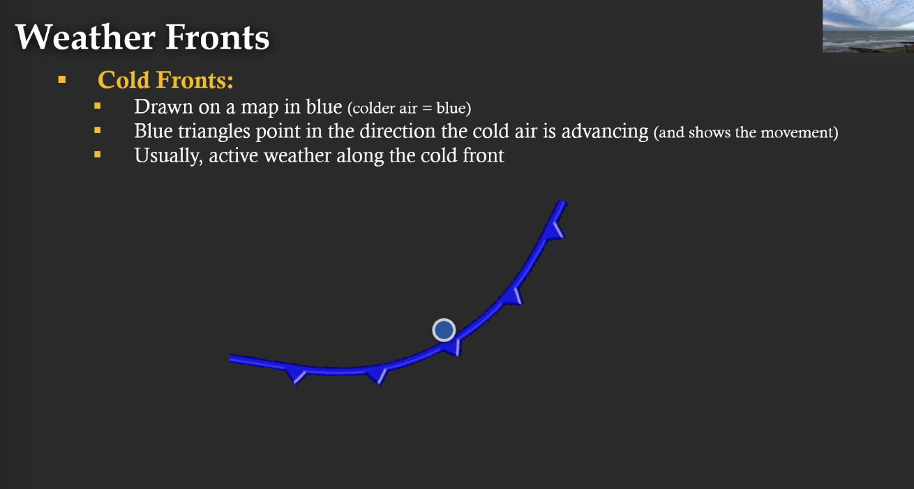
What direction does cold wind come from?
behind

What direction does the warm wind come from?
behind