Great Zimbabwe I
 Call Kai
 Learn
 Practice Test
 Spaced Repetition
 Match
 Flashcards
 Knowt Play
1/53

There's no tags or description
Looks like no tags are added yet.
54 Terms
Great Zimbabwe location
Western Zimbabwe
Largest of several sites on the Zimbabwe Plateau
Great Zimbabwe timeline
500/600 CE - 1700/1800 CE
Great Zimbabwe peak era
1200-1500 CE
Late 13th - mid 14th century (Pikirayi)
Great Zimbabwe peak size
Population up to 10,000
720 ha
“Zimbabwe” etymology
From Shona (a Bantu language)
“Large houses of stone”/ “venerated hosues
Court, home, or grave of a chief
Suggests habitation and seat of power
Power may be political, religious, ancestral
Zimbabwe culture
Stone architecture
Many sites, including Great Zimbabwe
Primarily on the Zimbabwe plateau
Bordered by Zambezi and Limpopo rivers, Indian Ocean, and Kalahari desert
Connected to Swahili-speaking trade along the Indian Ocean
Zimbabwe plateau
~1000 meters above sea level
Mostly in modern Zimbabwe

Great Zimbabwe geographic features (Pikirayi)
Surrounded by granite kopjes and outcrops, level plains, and stream valleys
Great Zimbabwe climate (Pikirayi)
Rains and/or some mist throughout the year
Thick vegetation cover
Good for livestock
Great Zimbabwe chronology
Agricultural community by 500-600 CE
10th century CE: Leopard’s Kopje farmers spread into the area (Pikirayi)
Small-scale farmers
Kept cattle
Attached importance to ritual (figurines found)
~1000 CE, regional politics led to new forms of organization
12th century CE: Connection to and control over Indian Ocean trade (Pikirayi)
First substantial stone houses built at Great Zimbabwe and Chivowa
Ceramic design changed
More imports
13th century CE: Stone walls raised (Pikirayi)
By 1270, wealthy elites laid the foundations of the urban complex
For 6-700 years after, a sequence of small states characterized by stone architecture
~200 known sites ranging in size

Mapungubwe
Center of an earlier state than Great Zimbabwe
Kingdom ruled from K2 in the 11th and 12th century CE
Moved to Mapungubwe, ruled from there from the 12th to the 13th century cE
Now a national park, but not well-preserved
Rise of Great Zimbabwe (Pikirayi)
Mapungubwe declined in the late 13th c. CE
Political centralization shifted to South-Central Zimbabwe
Elite controlled by Leopard’s Kopje farmers at Chivowa, Gumanye, and Great Zimbabwe Hill
Based in strong agricultural base, heightened trade with the Indian Ocean
Trade routes through the Save Valley
Theories/ factors for the rise of Great Zimbabwe (Pikirayi)
Long-distance trade
Must have collected trade taxes
May have had more of a regulatory role than an actual trading role
Access to long-distance trade as a status marker
Land kept in kin-based corporations
Strongest bonds found within descent groups
Cattle as personal standing
Used to develop a social network
Religion
Not a prime motivator, but might have been helpful for political union
Migration?

Zimbabwe architecture
Stone is rare in Southern Africa
Granite was locally quarried
Naturally splits into even slabs
Can be portable
Does not require a lot of later masonry
Walls have no mortar
Stones are layered to create a stabilizing inward force
Could be up to 4m thick (Pikirayi)
There are different styles between sites
Decorations could get elaborate
Also, temporal differences - use for relative dating
Foundations: either earthen or rock (Pikirayi)
Decline of Great Zimbabwe (Pikirayi)
Possibly due to shifting trade routes
Possibly environmental factors?
Not much evidence
The area could probably not support a heavy population without eroding agricultural and grazing lands - reliance on hinterlands
Mutapa and Torwa became cultural and commercial successors

Khami
Home of the Torwa dynasty
Occupied until the mid-1800s
On top of an Inselberg hill
Earthen houses with stone walls
King at the top of a stone hill
Torwa dynasty timeline
ca. 1450-1680
Arose after Great Zimbabwe collapsed
Appears to have gained control over trade
Ingombe Hede (Pikirayi)
On the Zambezi River
1300-1500 CE timeline
Mutapa outpost
Site of very wealthy elite burials
Nalatale
Extreme example of stonework
Checkered and herringbone patterns

Daga
a.k.a. dhaka (Pikirayi)
Earthen
Mud-brick, then plastered
Moreso for commoners, dwellings of the vast majority of people
Stone was for elites
Clay floors, seats, benches
May have been painted at the time of Great Zimbabwe
Does not preserve well - even GPR is difficult
Lack of houses leads to underestimating population density

Agriculture on the Zimbabwe Plateau
Good for agriculture
Cereal crops:
Millet
Sorghum
Beans
Peas
No evidence for intensive/ large-scale agriculture (i.e. irrigation)
Reliance on rainfalls and river floods (alluvial sediments)
Some argue that agriculture was part of tribute to rulers
Labour as a form of tribute
Herding on the Zimbabwe Plateau
Cattle
Not main source of protein
Sanga breed of cattle - cross of Bos indicus and Bos taurus
Sheep and goats also eaten (and wild game)
Higher proportion of cattle in elite sectors
Possibly significant as a source of wealth in lean years
Tsetse flies
Elevation of the plateau means no tsetse flies
Cause sleeping sickness in humans and cattle
Great Zimbabwe research data
Understanding varies based on sources
No known written texts
16th and 17th century CE: Portuguese explorers and traders wrote about the successors to Great Zimbabwe
Mwene Mutapa
Used this to make inferences about Great Zimbabwe
A lot of second-hand Swahili accounts (Pikirayi)
Depict Great Zimbabwe as very ancient (Pikirayi)
Ethnographics of the Shona by 19th and 20th century travelers
Indicate Shona ancestors built Great Zimbabwe
Oral histories from contemporary Shona (20th and 21st century CE)
Give organizational and cosmology information
Archaeology
Site was “found” by Europeans, covered in brush, occupied by Shona chief Mugabe

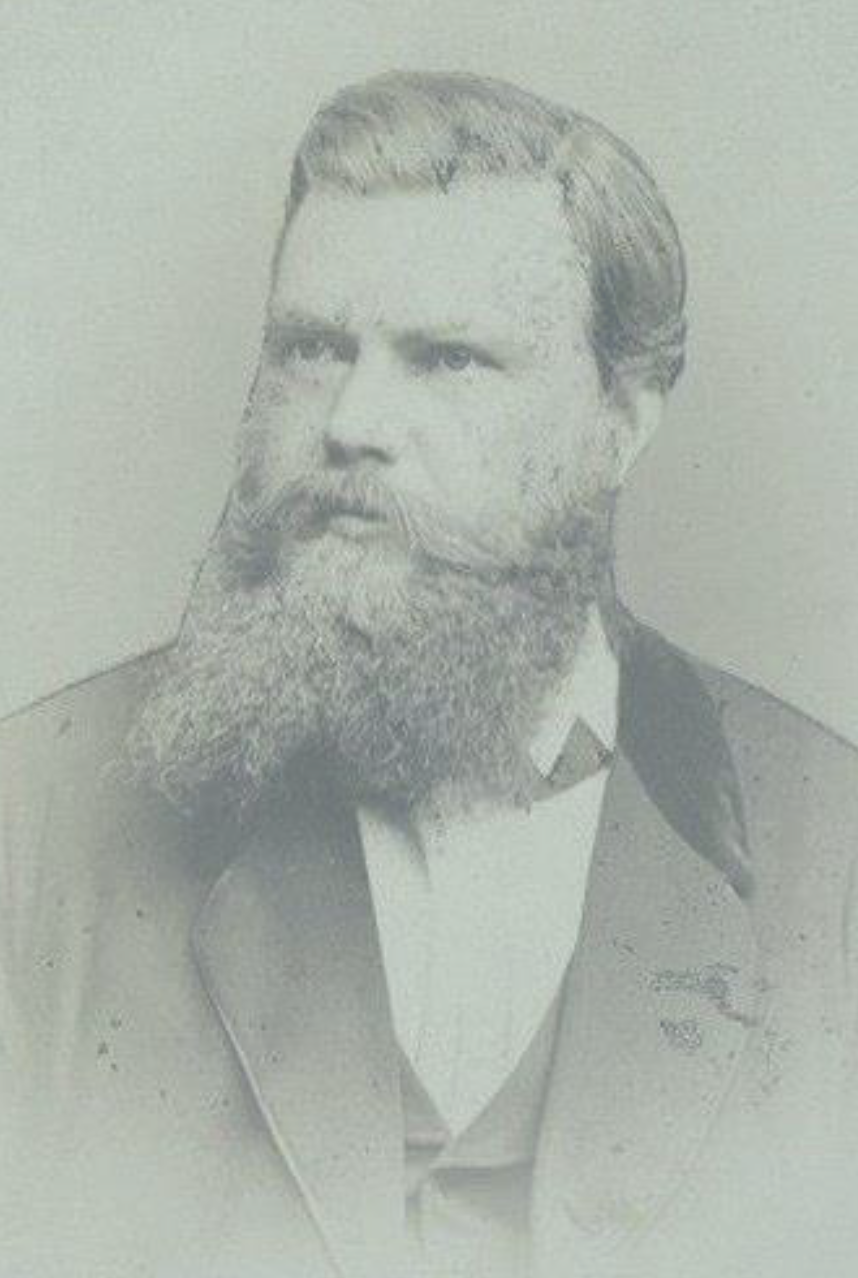
Carl Mauch (1837-1875)
First European to visit Great Zimbabwe in 1871, did extensive excavations
Attributed its construction to King Solomon and the Queen of Sheba
Like his contemporaries, he denied the site’s connection to its current inhabitants
Obsessed with Biblical accounts
Beginning of decades of problematic depictions and research
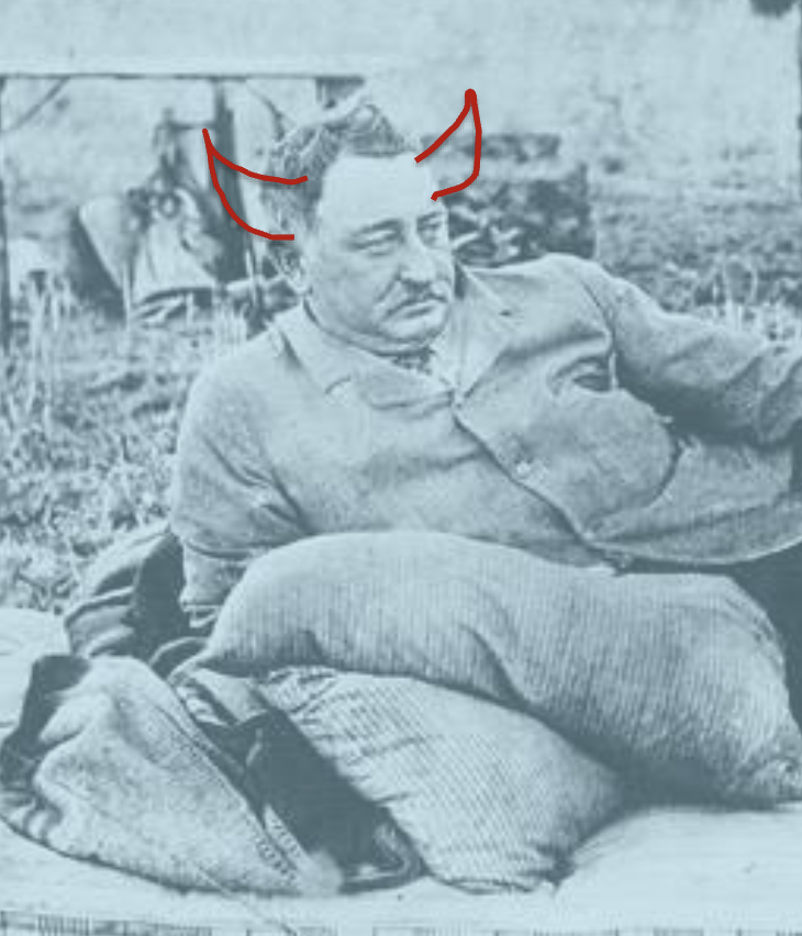
Cecil Rhodes (1853-1902)
Genuinely the devil
Controlled this colonial area in the late 19th century
“Southern Rhodesia”
Made money with gold and diamond mines
Obsessed with Great Zimbabwe
Hired Theodore Bent, then Richard Hall to excavate it
Massive looting of the site (and Zimbabwe in general) - materials sold on the open market
Bent suggested Arab builders
Egyptians also proposed as possible builders (Pikirayi)
Rhodesia Ancient Ruins Limited had exclusive access to the site
Hall tore down swaths of the site (fuck him (and Vere, too (unrelated, just needed to get that in there)))
Bent, Hall, and the Rhodesian Public Works Department destroyed vital evidence through poor work (Pikirayi)
Hill Complex
Great Enclosure
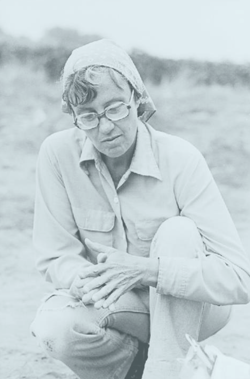
Getrude Caton Thompson
Trained at UCL and in Egypt
Invited by the British Academy of Sciences in 1929
Used stratigraphy and ceramic analysis to connect the site to the Shona
Builders = Karanga (Pikirayi)
Found a site Rhodes had missed
Revealed daga house locations (Pikirayi)
Vilified by Hall, Bent, and others when she made her case, but eventually won out

The Republic of Zimbabwe
1982 - Independence
Flag incorporated soapstone bird from the site
Some archaeological research, but slowed down by the 1980s
Excavations of residential areas in the 1970s, but not well-published

Recent Zimbabwean archaeology
Last 20 years
Shadrek Chirikure
Metallurgy and mining
Innocent Pikirayi
Geophysical stuff
Both concerned with decolonizing archaelogical practice and involving the communities living around sites
Attention to Shona history

Basis of Chirikure’s study of class at Great Zimbabwe (Chirikure)
Archival evidence
New excavation/ survey information
Shona anthropology and linguistics

Mapping Great Zimbabwe
Hill complex and Valley complex
Perimeter walls
One at the base of the hill complex
One goes North/ South
Contain a large central sector
Appear culturally significant
Walled enclosures (i.e. the Great Enclose, Hill Complex (has 2 enclosures))
9th century enclosures in the Hill Complex
Mauch ruins, Renders ruins are other enclosures
Earthen buildings would have surrounded the exterior, too
Described in unpublished 1970s survey
Most would have lived here
Lots of surface evidence - production, ceramics, iron, textile
Residential areas on the hill slope descents
Great Zimbabwe peak population (Pikirayi)
14,000-18,000 people
Most living in houses outside enclosures
Valley complexes
Would have been clusters
“Gap” between complexes creates the illusion of sloppy work
I.e. earthen arch (might have been there?)
Great Zimbabwe Chronology
5 periods
Only the last three are continuous
I, II, and III are the formative stages (Chirikure)
I: 300-900 CE
Early farming (Pikirayi)
II: 900-1000 CE
Gumanye culture: daga houses, imported glass beads (Pikirayi)
III: 1000-1200
Construction of substantial daga houses, hill walls (Pikirayi)
Enclosures constructed (Chirikure)
IV: 1200- ~1700
Peak development - stone wall built around outlying areas (Pikirayi)
Enclosures constructed (Chirikure)
V:
Wall style deteriorates (Pikirayi)
Only 23 uncontested radiocarbon dates from the site
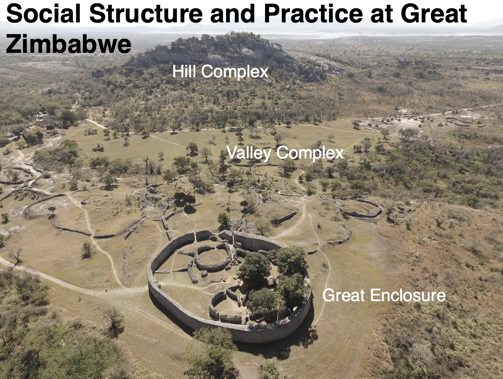
Great Zimbabwe Social Structure and Practice
Enclosures once interpreted as defensive
Now seen as symbols of authority - but there is some critique
Larger enclosures considered noble residences
Walls interpreted as status symbols
Within enclosures, nobles also lived in daga structures
Daga alone was not an indicator of status - location mattered
Walls created physical barriers
Small passageways
In the valley, stone wall complexes were surrounded by daga as well
Various attempts have been made to identify differences between enclosures and other houses
Different enclosures represent different chronological rulers?
Builder kings?
The Great Enclosure is later
Same kinds of artifacts found in all 3 enclosures - no status differences
But there is also no much of a difference outside vs inside enclosures
Therefore, political power may not be economic power
Radiocarbon dating supports the chronological theory
Shona oral history proposes the enclosures as reflection of political tensions
Layout represents worldview (cosmogram) (Pikirayi)
Traditional layouts of South Bantu-speaking people have binaries: i.e. elites on the hill, commoner below
Cattle byre in the centre of settlements
Previous interpretations of enclosures (Chirikure)
Associated with elites
Based on Childean thinking (fuck you, Vere)
Monumental architecture and “prestige goods”
Site looting and bad early work confound statistics of material culture
Assumptions for dichotomy interpretation of enclosures (Chirikure)
That intra- and intermural areas were occupied simultaneously
That types of material culture within and without the wall demonstrate differences based on social inequality

The Hill Complex
Oldest part of the settlement (Pikirayi)
First king of Great Zimbabwe likely resided here
Ritual spearheads and other symbols of power suggest the permanent residence of kings
West and East Enclosures and balcony area
A series of smaller stone enclosures separated by narrow passages and boulders
Repeated Daga architectural constructions inside
Terraces
Potentially for agriculture
Potentially for stability
Possibly houses of elites or court officials - commoners would have lived at the foot of the hill (Pikirayi)
Stone walls create distinct experiential spaces
Emphasis on secluded, enclosed spaces
Probably intended to enhance restriction/ separation
Steep staircase passages - most likely not protection, used to create liminal space
Truly monumental identity in walls on a hill
2 routes up (Pikirayi)
Used to have a perimeter wall (Pikirayi)
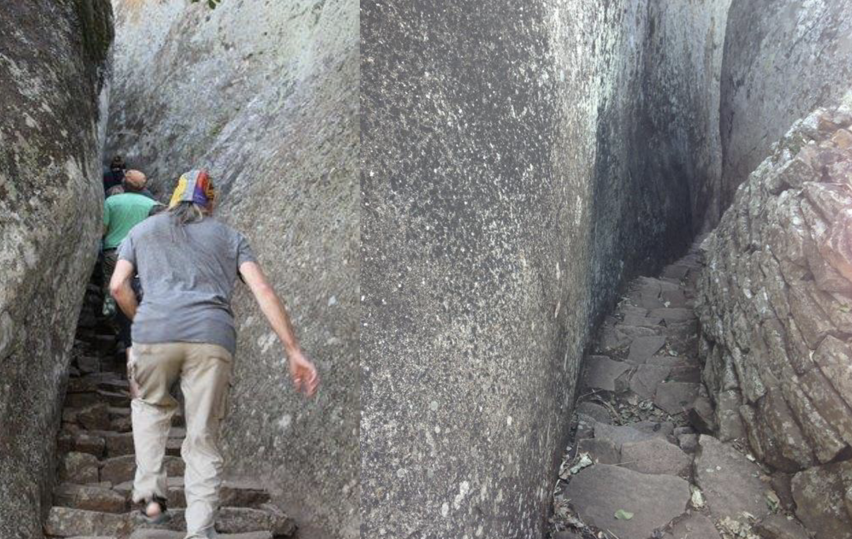

East Enclosure
Also had daga
Stone platforms and monoliths
Soapstone birds found here
Walls are very fluid, include environmental features
Make boulders part of architecture
Site of rituals and ceremonies (Pikirayi)
Bronze spearhead, iron gongs, soapstone birds, and caves all point to this

Soapstone birds
Only found at the Great Zimbabwe site
8 recovered
7 from Hill complex
1 from Philip’s ruins
40 cm high, on 1m pedestals
Depict African eagles
Associated with kingly power
First recorded by Mauch
Thought to be in a circle around an altar?
Would have stood on the balcony area

West Enclosure (Pikirayi)
Interpreted as where the ruling elite lived
House remains found
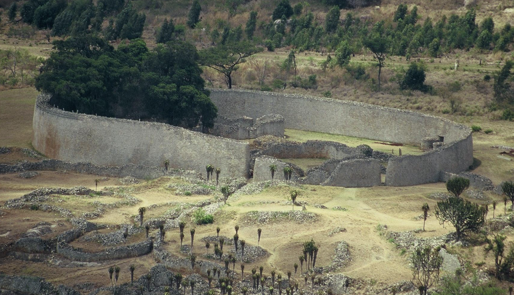
Great Enclosure vibes
Largest single stone-built structure in southern Africa (Pikirayi)
Over 1 million stone blocks used
Built on flat-top granite
Surrounded by smaller enclosures
3 entrances to the north/ north-west (Pikirayi)
Many enclosures in the interior are not well-preserved
Early investigators destroyed over 1 meter of cultural deposits (Pikirayi)
But there is still ample suggestion that royalty lived here
Walls throughout made small courtyards
Some for servants? (If the enclosure was actually for kings)
Ceramic evidence shows no cooking wares


Great Enclosure outer walls
Walls 5m thick, 10m high
Outer wall was a late period addition

Great Enclosure dimensions
250m long

Great Enclosure inner passageways
Very narrow passageways - double wall
Conical tower at the end of a passage
Small open area, potentially for storage


Traditional idea about the Great Enclosure
Palace for women in seclusion
Chronology disputes this

Enclosure 1 of the Great Enclosure
Space for 5 daga dwellings
Valley Enclosures (Pikirayi)
5 complexes
300+ commoner houses clustered around walls
Houses on the inside would have been more spacious
More elaborate consumption habits inside
More foreign imports
Interpretation of other valley complexes
Homes of nobility, not royals
Maund Ruin
In the Valley Complex
Gertrude Caton Thompson looked at the walls, determined there were daga structures in between
10-15m diameter
Little architectural work has been done on daga away from the walls

Peripheral settlements of Great Zimbabwe (Pikirayi)
Not much known
Economic basis of the Great Zimbabwe state (Pikirayi)
Hierarchical elite controlled agriculture, regulated trade, organized the general lifeway
Regular spacing of Great Zimbabwe to landforms, trade routes
Status of outlying zimbabwe (Pikirayi)
Some outside of the borders of Great Zimbabwe’s control
Some associated with the decline in power of Great Zimbabwe and rise of Mutapa
Expansion of Karanga into previously non-Shona territories
Some claimed Mutapa origin, reflected civil wars
Evidence for long-distance trade
Great Zimbabwe was connected to the Indian Ocean trade
Indian glass beads, porcelain from China and India
