Geography Terms
 Call Kai
 Learn
 Practice Test
 Spaced Repetition
 Match
 Flashcards
 Knowt Play
1/25

There's no tags or description
Looks like no tags are added yet.
26 Terms

Map Title
Tells you what the map is about.
Compass Rose
Show direction


Cardinal
N,E,S,W


Intermediate
Middle NE,SE,NW,SW

Scale
Measures distance

Legend/key
tells us what symbols mean

Inset map
Zooms out so you can see area around map

Degrees
Units of latitude or longitude

Equator
An imaginary line that runs east and west around the center of Earth at 0 degrees
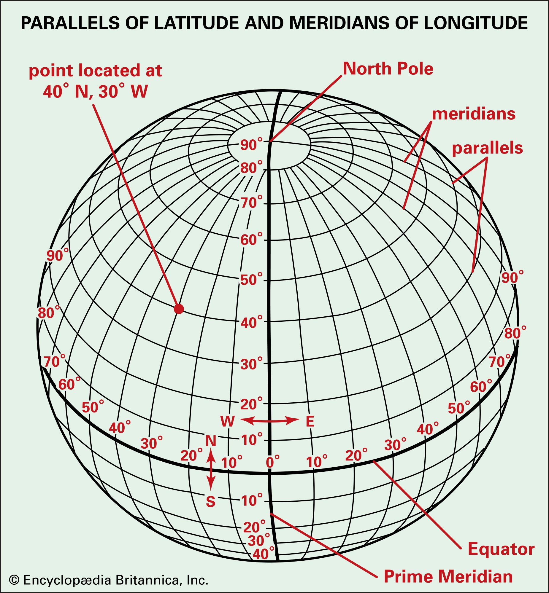
meridians/lines of longitude
Imaginary lines on Earth that run between the North and South poles

Parallels/lines of latitude
imaginary lines on Earth that run east and west like the equator
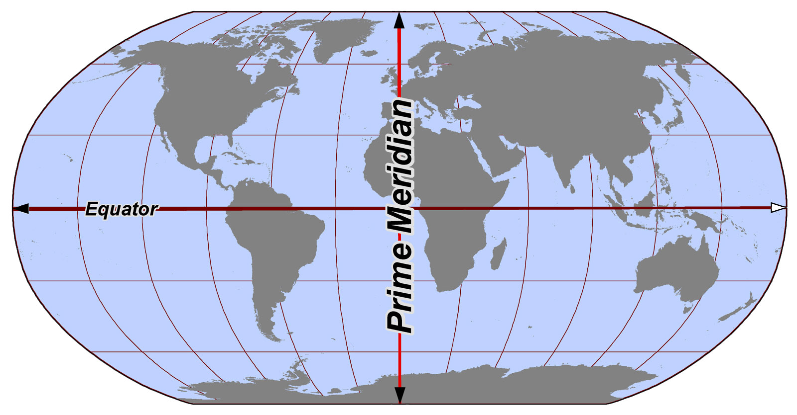
Prime Meridian
An imaginary line that run from the North Pole to the S. Pole at 0 degrees
S. Pole
the point on Earth located at 90 degrees South


N. Pole
the point on Earth located at 90 degrees North

Cartographer
Mapmaker

Hemisphere
Half of the earth split by either the prime meridian or the equator

Northern Hemisphere
area North of equator that includes
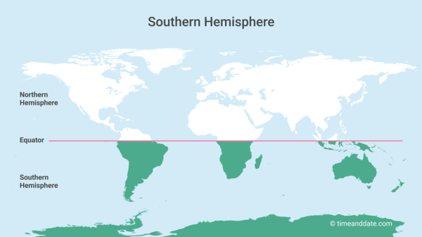
Southern Hemisphere
The area south is south America, Africa, Australia,Arctic

Eastern Hemisphere
Area East from the prime meridian South America, Asia, Africa, Australia, Europe, Arctic

Western Hemisphere
Area West from prime meridian North America, South America, Africa

Geographic Grid
A pattern of lines that form squares

Index
An ABC listing of place names on a map and the grid squares in which they are found example: B6 or C7
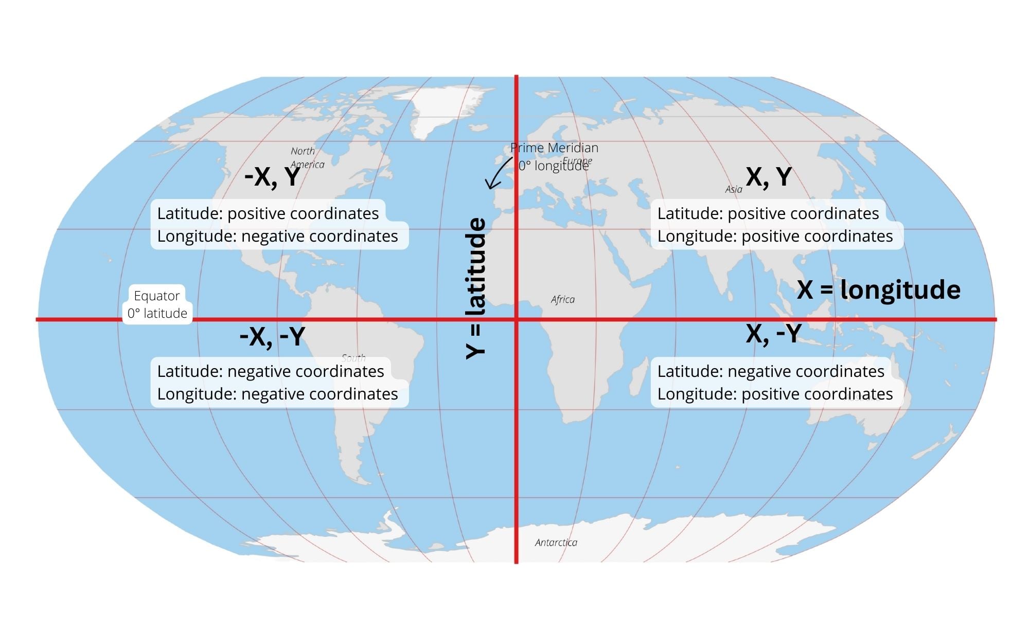
Relative location
Where a place is located by comparing it to other landmarks, place, or areas around it

Absolute location
Uses latitude and longitude coordinates to determine the exact location of a place

Projection
A system for mapping the round earth on a flat surface.
Robinson Projection Map
Oval shaped projection that shows shape and size accurately but water and land near the poles is distorted.
