BJU Cultural Geography Chapter 1
 Call Kai
 Learn
Learn Practice Test
 Spaced Repetition
 Match
Match Flashcards
 Knowt Play
1/63

There's no tags or description
Looks like no tags are added yet.
Name | Mastery | Learn | Test | Matching | Spaced | Call with Kai | Chat |
|---|
No analytics yet
Send a link to your students to track their progress
64 Terms
geography
The study of the earth and how people relate to the earth and one another
Creation Mandate
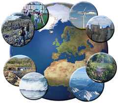
The unique calling of God to humankind to exercise dominion over the earth; based on Genesis 1:28
Prime Meridian
the line of 0 degrees longitude that passes through Greenwich, England
Great Circle
the circle created by the time meridian and the 180 meridian which cuts the earth into two equal hemispheres
cartography
the art of *mapmaking*

(Gerhardus) Mercator
*published a map that became the standard of his day*; his system is still used today

topography
detailed land features, including their elevations

thematic map(s)
maps designed to communicate info on particular topics

hemisphere
half of the earth

equator
the line that *divides the earth into the Northern & Southern Hemispheres*

latitude
distance north or south of the equator measured in degrees. Parallels of latitude run east to west

parallel(s)
circles that are parallel to the equator

longitude
imaginary lines that *run north and south* around the earth. They measure the distance east or west of the prime meridian

meridian(s)
imaginary lines that run *north and south* that have numbers of degree

map projection
method used to show the earth's round surface on a flat map

cylindrical projection
based on tracing shadows cast when a paper is wrapped around a wire globe in the shape of a cylinder
interrupted projection
map projection that is interrupted with gaps or cuts
GIS
Geographic Information System technology used to make modern maps
remote sensing
geographic information gathered by aircraft or satellites
distortion(s)
*area, shape, distance, directon*; happens when a globe is transferred onto a flat map

gore(s)
twelve strips that make up a globe

cylindrical (projection)
a projection when a mapmaker rolls a sheet of paper into the shape of a cylinder to make a flat map

Mercator's (Projection)
*first important cylindrical projection*

Goode's (Interrupted Projection)
a projection that cuts and flattens the earth like an orange peel

Robinson's (Projection)
a projection that is *popular for text books*; combines the best elements from other projections

planar/azimuthal (projection)
- a projection that uses a flat plane instead of a cylinder
- most accurate in the center
- useful for compact areas where land is surrounded by water

conic (projection)
- mapmaker places a cone-shaped piece of paper on an image (projection)
- most useful for showing wide regions

legend
usually located in a corner of a map and displays the meaning of the symbols on the map

compass rose
tool on a map showing the orientation of a map

scale
Calibrated line that indicate distance ( 1in = 200 mile )

GPS (global positioning system)
A system that determines the precise position of something on Earth through a series of satellites, tracking stations, and receivers. ( created by us department of defense)

relief map
maps that show specific changes in elevation
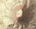
contour lines
lines that separate colors on a relief map

location, place, interaction, movement, region
What are the 5 themes of geography ?
Location
Either specific ( latitude and longitude) or relative ( east, west, north, south ) to the surrounding environment
Place
Physical characteristics ( mountains, rivers, etc ) and human characteristics ( road, building, etc )
interaction
Both among people and between people and there environment
Movement
Of goods, ideas, people, diseases, etc
Region
Defined by formal boundaries and functions
Christopher Columbus
Tried to sail west for the orient, but instead reached the Americas
Europeans
Who sought riches from the orient
minutes and seconds
Latitude and Longitude are subdivided into ?
Greenwich, England
What city does the prime meridian extends through ?
Prime Meridian and 180 degrees
What is the great circle formed with ?
Cylindrical, planar( azimuthal ), conic
What are three types of projections ?
Direction and shape
What is accurate about the Mercator projection ?
Area and shape
What is accurate about the Goode's projection ?
Distances and N/S directions
What is distorted about the goode's projection ?
Robinson Projection
- Minimizes ( but doesn't eliminate ) all 4 type of distortions
- most common for textbooks
Mental Maps
- a person's perception of the world or a part of it based on available knowledge
Political maps
Indicate state or national boundaries, capitals and major cities
Physical maps
- Show mountains, rivers, lakes elevation, etc
- color used to indicate water different elevations, etc
Topographic maps
Use special lines to indicate shape and elevation of landforms
Road maps
- traveling
- show primarily and secondary transportation routes
Climate map
Provides info. About weather patterns
Economic/resource map
Show natural resource or economic activities of a place
Point symbols
Indicate cities or more specific objects ( buildings, mountains etc )
Line symbols
Represent features such as roads, rivers, railroad, and water / power lines
Area symbols
Indicate bodies of water, swamps/ marshes, glaciers, and other physical features
culture
system of customs and traditions and habits that a group of people uses to make something of their world
multiculturalism
view that all cultures are equally valid and no culture is better than another
Two branches of geography
physical geography and human geography
Five Themes of Geography
Location, Place, Human-Environment Interaction, Movement, Region
contour
lines of separate colors on a relief map to indicate altitude