Intro to Remote Sensing- Satellite Orbit and Swath
 Call Kai
 Learn
Learn Practice Test
 Spaced Repetition
 Match
Match Flashcards
 Knowt Play
1/17

There's no tags or description
Looks like no tags are added yet.
Name | Mastery | Learn | Test | Matching | Spaced | Call with Kai | Chat |
|---|
No analytics yet
Send a link to your students to track their progress
18 Terms
RS Sensors
Instruments used to collect RS data (red)
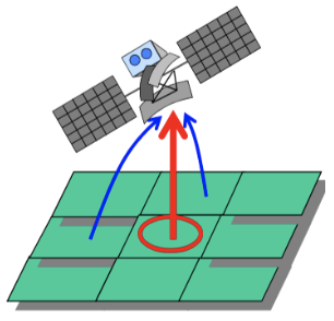
RS Platforms
Vehicles used to carry sensors (blue)
Ground-based
Airborne
Space-borne
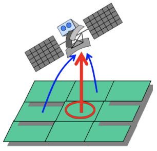
Ground-based Platforms
Use ground vehicles (e.g. trucks designed for RS)
Advantages
Record detailed info (e.g. higher spatial resolutions)
Better characterize the target
Better understand the info in the imagery
Disadvantages
Only small area project practical

Airborne Platforms
Platforms that are operating within the Earth’s atmosphere (e.g. aircrafts, drones, balloons, etc.)

Space-borne Platforms
Platforms operating at high altitudes (e.g. Landsat 8&9 = 705km, SPOT 6&7 = 694km)
Satellites- revolve around the Earth
Particularly important
Repetitive coverage over large areas
Provide huge amounts of RS data

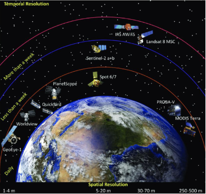
Several Major Satellite RS Systems Currently in Operation
Need to understand the key parameters describing satellites and sensors they carry
Landsat Series Satellites
Initiated by NASA (The National Aeronautics and Space Administration) in 1967
Landsat 1 launched in 1972
Landsat 8 launched in 2013
Landsat 9 launched Sept 27, 2021 (lastest)
NASA and USGS currently share the responsibility of Landsat 9 operations, etc.
Satellite Characteristics
Two characteristics of satellites are particularly important to understanding how satellites work
Orbits- the path followed by a satellite
Swaths- the width of a ground track imaged by a sensor
Key Parameters Used to Describe Orbits
Altitude
Period
Cycle
Inclination
Altitude
Height of the platform above earth’s surface
Landsat 9 is in orbit at 705 km above the earth
Period
Time a satellite needs to complete one orbit
Landsat 9 orbits earth once every 99 min
How many orbits does Landsat 9 go around the earth every day?
# orbits per day = (24 x 60)/99 = 14.545

Cycle
Time needed for the satellite to retrace its path
= the time needed for a satellite to pass over the same point on the earth’s surface directly for a second time
Varies with each satellite
Landsat 9 orbit cycle is 16 days- the satellite comes directly over same point every 16 days
How many orbits does one complete cycle of Landsat 9 have?
# orbits per cycle = (16 x 14.545) = 233
Inclination
Angle a satellite crosses the equator at
= the angle b/w the equatorial plane and the orbital plane
Landsat 9 has an inclination close to 90° (98.2°)

Types of Satellite Orbits
Based on the altitude, direction, and speed of satellite movement; 2 most common types:
Geostationary Orbits
Near-Polar, Sun Synchronous Orbits
Geostationary Orbits
The position of the satellite relative to the earth’s surface remains the same
If a satellite follows an orbit parallel to the equator and in the same direction and speed as the earth’s rotation, then the satellite will appear stationary (“static”) with respect to the earth surface
Satellites in the geostationary orbits are located at very high altitudes (ca. 36,000 km)
Advantages- collect info over the same portion of the earth’s surface at all times
Exs. Weather satellites, communications satellites
GOES (Geostationary Operational Environmental Satellites) Satellites
36,000 km above the equator
GOES can see an entire hemispherical disk of the earth
GOES images are distributed in near real time for use in local weather forecasting
Near-Polar Orbit
The orbital plane inclined at a small angle with respect to the earth’s rotation axis
Basically N-S orbit (constant E-W position) + the earth’s W-E rotation → allows complete coverage of the earth’s surface after one complete cycle of orbits
Most RS satellite platforms are in this orbit
Ex. Landsat 9 has an inclination of 98.2 degrees
This means it is at an angle of 8.2 degrees from the earth’s rotation axis (N-S poles)
Sun Synchronous Orbit
The orbital plane processes around the earth at the same angular rate at which earth moves around the sun
The satellite will always pass over a given location at the same local solar time (i.e. constant local time of day)
Most earth observation satellites usually follow the sun synchronous orbits
Advantages
Ensure consistent illumination conditions
Important for monitoring changes b/w images or for mosaicing adjacent images together
Swath
The width of a ground track imaged by a sensor
Vary b/w tens and hundreds of km wide (for space-borne sensors)
Landsat 9 swath width = 185 km
A full scene is defined as 185 km x 185 km
Also note that the distance between ground tracks of consecutive orbits is 2875 km at equator because of the earth’s rotation
In near-polar orbits, areas at high latitudes will be imaged more frequently than the equatorial zone due to the increasing overlap in adjacent swaths near the poles
