Marine Geology Exam #2
 Call Kai
 Learn
Learn Practice Test
 Spaced Repetition
 Match
Match Flashcards
 Knowt Play
1/107

There's no tags or description
Looks like no tags are added yet.
Name | Mastery | Learn | Test | Matching | Spaced | Call with Kai | Chat |
|---|
No analytics yet
Send a link to your students to track their progress
108 Terms
How does water get into the crust? What happens once it enters?
Faulting allows for the water to get into the crust, conduction occurs heating the water.
What is the significance of Chlorine being in magma
evidence that sea water has infiltrated magma (hydrothermal circulation is occurring)
Define “V, F, PB” for Faulting and Fissuring at Spreading Centers
V: Volcanism (at edge of spreading center)
F: Zone of Active Fissuring
PB: Plate Boundary
What happens between the PB
between them there is faulting and movement importantly deformation - active zone
Only Extensional Faults
Fault Initiation
Consecutive faults
Fissures
Vertical at surface
Absolute tensile strength
Average length: 170 m (30-650m) on EPR @ 9N
Depth is estimated at 400+-100m
Widths typically 0.2-3m
Mark where the deformation is beginning

Growth faults
layers grow as the faulting is occurring (thicker on down drop side)
Faulting and Grabens at Fast Spreading
Growth Faults
Normal faults closer to plate boundaries
Generating faulted crust @ mid ocean ridge -> once they hit PB turn into Abyssal Hills 80% seafloor (slower spreading rate generates high, wider and longer hills), decay with time
“Domes”
Made of Serpentine -> mantle rock that is brought to the surface, not symmetrical w/ spread "Asymmetric spreading” 50% of oceanic crust along slow spreading ridges is asymmetrical more earthquakes
Faulting and Grabens at Fast Spreading Formation
No volcanism = detachment zone
Volcanism = core complexes (heat melts and weakens the mantle)
Not at Fast -> AMC
MORs: Cracks and Crevices
MOR magma supply occurs along vertical magma conduits through which buoyant magma rises to form new oceanic crust
The thin lines to left/right of the rising magma are extinct magma conduits (not connected to an active magma source) but that are still fractures in oceanic crust
Extinct conduits, alongside cracks forming due to cooling/accretion of newborn crust, causes the oceanic crust at MOR systems to be highly porous
Sub-seafloor Crustal Aquifer
At such high pressures, seawater has no choice but to fill every available space and thus fills these cracks and crevices to comprise the sub-seafloor ocean crustal aquifer
Water not only moves vertically toward the seafloor surface but also horizontally, especially along ridge axes.
Horizontal flow is actually faster than vertical flow, in many cases
1-2% of ocean seawater is flowing through the crust at any given time
In the sub-seafloor crustal aquifer, seawater is closer to heat source and thus warms compared to seawater
Hydrothermal Fluids
Hot and thus buoyant (low density), causing them to rise
Formed from chemically modified seawater, due to hot interactions with rocks, so that they have low oxygen and high metal content
Hydrothermal Vent Formation
Hydrothermal fluids do not physically contact the magma. Instead, they react with hot oceanic crust
“Black Smoke”
Black color forms when anoxic vent fluid is mixed with oxygenated seawater, causing some of the dissolved iron to precipitate into solid minerals that are black colored
What makes up the chimney material, through which the vent fluid flows?
Sulfide minerals that also precipitate from vent fluid solution upon meeting seawater
Hydrothermal Vents at MORs
Within the sub-seafloor crustal aquifer, large-scale seawater convection cells are formed that support the production of many hydrothermal vent sites along a single section of ridge axis with favorable heat supply and porosity
Cold seawater penetrates DEEP (here, 2-3 km!) and returns to surface heated
The spacing of these cells affected by MOR segmentation/discontinuities
One hydrothermal vent per ~10 km of MOR axis (on Avg)
only 10% of the MOR mountain chain has been explored
Volcanic arc vents
At oceanic-oceanic subduction zones, oceanic crust is subducted and melted, which produces a volcanic arc.
Potential for shallow magma sources to be present to heat water
Need fractures in these volcanic arcs to percolate seawater!

Back-arc spreading centers
At subduction zones, the subducting slab “pulls on the edge of the overlying plate until it splits open” to form a zone of expansion, a back-arc spreading center
This spreading center is on the other side of a volcanic arc from the trench
Caused by the convection of melted crustal material

Oceanic hotspot vents
Hotspot volcanoes also bring the ingredients of hydrothermal vents together: shallow heat source and fractured crust
Many hotspot-associated hydrothermal vents have lower temperature vent fluids (<100ºC)
These volcanic vent systems can be particularly important because they are so shallow, so it is easier for them to affect the critical surface ocean
Terrestrial hotspots
Hotspots are intraplate features, but they can form under continental crust as well (think yellow stone)
Microbiology of Vents
vents are microbial oases, with 107-109 cells g-1 rock on the outside of active and inactive vent structures
home to many hyperthermophilic Bacteria and Archaea, as well as acidophiles. hottest growing microbes on record both from marine vents
controlling factors on what microbes appear where are gradients:
TEMPERATURE, CHEMISTRY and GEOLOGY/GEOCHEMISTRY
Why mine hydrothermal vents
Vents a major source of polymetallic sulphides, which contain copper, zinc, gold, silver
Different than ferromanganese nodules on abyssal plain, which contain nickel, copper, manganese, and rare earth metals
Between 1985 and 2011, there were responses to ____ suspected magmatic events; ___ found evidence for eruption.
35, 22
What is the rate of the spreading centers for the MOR eruptions
1.1 to 9.0 cm/yr.
1986 MOR eruption
Hydrothermal event plume detected along the Cleft segment of Juan de Fuca ridge. First young lavas of known age (series of pillow mounds)
Event Plumes (megaplumes)
Large discharges of chemically distinct fluids that rise 100’s of meters to form discrete, stable eddies. Range in volume from ~1–150 km3.
1986 Event Plume dissipated in ~60 days. Heat output equaled annual output of ≤2000 high-temperature vents.
1991 MOR eruption
In March, divers in Alvin at 9°50’N found newly dead, charred tubeworms and new hydrothermal vents. 210Po age dating suggests 2–4 weeks before arrival. (Uranium has a ½ life of 4.5 million years)
What was used to date the MOR eruption of 1991 and why?
Time scales return to secular equilibrium after 5x half-life of the daughter nuclide
PO 210 to Pb 206 = 2 years (roughly) per ½ life
Helps determine if there are multiple lava flows within a shorter time period (where seds may not be present between)
1993 MOR eruption
Earthquake swarm detected on CoAxial segment of Juan de Fuca ridge. First “response” expedition found event plumes, new hydrothermal vents, and still-cooling lava. In the first month of real-time acoustic monitoring using the U.S. Navy Sound Surveillance System (SOSUS)
1998 MOR eruption
Eruption at Axial seamount and along Juan de Fuca ridge segment partially buried pressure-temperature sensor. First in situ record of lava emplacement. Pressure tells you the height of the sea floor (water pressure) -> once on the floor can help determine sea floor movement.
2006 MOR eruption
Several Ocean Bottom Seismometers (OBS) would not release from the seafloor at 9°50’N. Response cruises found them trapped in new lava. First time a second eruption was observed at the same MOR location.
“FAMOUS”
French-American Mid-Ocean Undersea Study first ever MOR exploration by manned submersibles (71-74)
Types of Lava Flows
Pillow
Lobate Flow
Ropy Sheet Flow
Jumbled Sheet Flow
Hackly

3 main types of lava flows (range-ish)
Pillow is bulbous and Sheet is flat sheet, Lobate is in between the two of them

Pillow Lava
uniquely subaqueous (only form under water) -> waters high heat capacity causes these flows (rapid cooling) -> Fast cooling, low flow, high slope

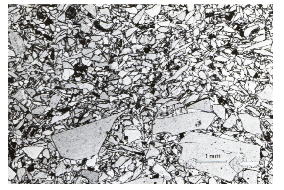
Hyaloclastite
rapid quenching by water
Seamounts vs. Islands
Seamount: submarine volcanic edifice; can range from tens of meters to several kilometers high. Commonly have steep outer slopes, relatively flat tops, and collapse pits/calderas.
Island: a topographic high that rises above sea level.
Guyot
Flat-topped submarine volcanic mountain; flat top is associated with erosion near sea level followed by subsidence
Seamount Distribution and Spreading Rate
Seamounts are not distributed evenly; the lecture shows marked asymmetry in their distribution.
The number of seamounts >400 m tall increases with spreading rate.
Faster spreading → greater magma supply → more opportunity to build large seamounts.
Seamounts near mid-ocean ridges are generally similar in composition to MORB (mid-ocean-ridge basalt).
Faster spreading is associated with greater magma supply from mantle melting beneath the ridge. More magma allows more/larger volcanic edifices to form, so the number of large seamounts increases.
Why Do Seamounts Form?
Hypothesis 1 — “Leaks” from the large melting region:
• Small volcanic eruptions may occur within/near the large melting region associated with a mid-ocean ridge.
• Explains their MORB-like composition and increase with spreading rate.
• Does not fully explain why some seamounts form linear chains.
Hypothesis 2 — Small-scale hot spots:
• Some researchers propose that seamounts are small-scale hot spots, which helps explain linear chains.
Mid-Ocean Ridge Mantle Melting Mechanism
Decompression melting
Mantle rises → pressure decreases → partial melting
Ocean-island hot spot Mantle Melting Mechanism
Hot/upwelling mantle + decompression
Hot plume rises and produces melting beneath the plate
Island Arc Mantle Melting Mechanism
Water-assisted melting
Slab dehydration releases H2O → lowers mantle-wedge solidus
Hot Spot Plumes and Volcanic Chains
• A hot spot plume is a region of anomalously hot mantle rising toward the surface.
• The Hawaii model treats the hot spot as relatively stationary while the tectonic plate moves over it.
• New volcanoes form over the active hot spot; older volcanoes are carried away as the plate moves.
• Therefore, volcanic age generally increases with distance from the active volcanic center.
Hawaii Model — Ocean Island Evolution
Pre-shield: early volcanic activity; alkali basalt.
• Shield-building: major construction stage; very large volcanic volume; dominated by tholeiitic basalt.
• Post-shield: volcanic activity decreases; erosion and subsidence become increasingly important; more
alkaline/differentiated lavas occur.
• Post-erosional / rejuvenation: volcanism can restart after a long inactive interval; the lecture gives ~0.5–3 million
years for some Hawaiian volcanoes.
• Rejuvenation-stage lavas are highly alkalic and geochemically indicate a deep source; some deposits contain garnet-bearing xenoliths.
Pre-shield → Shield → Post-shield → Rejuvenation/post-erosional
Deviations from the Hawaii Model
Not every ocean-island chain behaves exactly like the simple Hawaii model.
age of onset of magmatism does not correlate simply with plate motion.
Do not automatically assume every volcanic chain is a perfect stationary hot spot with constant plate
velocity.
Basic Island-Arc Cross Section
Oceanic plate → trench → forearc → volcanic arc → backarc.
• Trench = major topographic low.
• Volcanic arc = topographic high.
• Forearc lies between trench and volcanic arc.
• Backarc lies behind the volcanic arc and may contain a backarc basin.
Why Does an Island Arc Form?
Subduction → dehydration → H■O enters mantle wedge → solidus decreases → partial melting → magma rises → volcanic arc
• Subducting oceanic crust contains hydrous minerals.
• With increasing pressure and temperature, hydrous phases break down.
• Water is released into the mantle wedge.
• Water lowers the melting temperature (solidus) of the mantle.
• Partial melting produces magma, which rises to form the volcanic arc.
Volcanic Arc Location
• The volcanic arc is NOT directly above the trench.
• There is a forearc region between the trench and the volcanic arc.
• The slab reaches the depths/conditions where dehydration and mantle melting occur farther beneath the overriding plate.
Subduction Angle vs. Volcanic-Arc Width
• Steeper slab → narrower volcanic arc.
• Shallower slab → wider volcanic arc.
• A steep slab reaches the relevant depth over a shorter horizontal distance.
• A shallow slab travels farther horizontally before reaching the same depth.
Earthquakes and the Subducting Slab
• Earthquake locations can trace the geometry of a descending slab.
• A dipping zone of earthquakes can therefore reveal the position and angle of the subducting plate.
Topography Across an Island Arc
• Trench: deep topographic low.• Forearc: relatively low region between trench and arc.
• Forearc: relatively low region between trench and arc.
• Volcanic arc: topographic high.
• Backarc: can become lower where a backarc basin develops.
Gravity Anomaly Across an Island Arc
• A strong negative gravity anomaly is associated with the deep trench.
• Gravity anomaly can become positive around/near the volcanic arc.
• The gravity pattern changes across the trench–arc–backarc system
Heat Flow Across an Island Arc
• Heat flow is relatively low near the trench/forearc.
• Heat flow is higher toward the volcanic arc/backarc region.
• The forearc is associated with relatively cool material and the subducting slab, while the arc/backarc is associated with hotter mantle and magma generation.
low near trench → increasing toward volcanic arc/backarc.
Backarc Basins
• Backarc basins form behind volcanic arcs through extension.
• A volcanic arc can undergo rifting.
• Rifting can progress to seafloor spreading.
• A spreading center can develop, producing a backarc basin and separating a remnant arc from the active arc.
Sequence: Arc → rifting → spreading → backarc basin + remnant arc
Accreting Margins
Sediment is scraped from the subducting plate. Builds an accretionary prism.
Non-Accreting Margins
More sediment is carried down with the subducting plate. Sediment subduction/bypass dominates.
Hydrothermal Systems and Massive Sulfide Deposits
• Cold seawater enters permeable oceanic crust and moves downward.
• The fluid is progressively heated as it moves deeper.
• Fluid–rock reactions alter the chemistry; the lecture shows loss of Mg, O, and sulfate and enrichment in metals and
magmatic gases at depth.
• Very hot fluid becomes buoyant and rises through focused conduits.
• When hot fluid mixes with cold seawater, metals precipitate and can form massive sulfide deposits.
Black smoker
Very hot; lecture diagram shows >350°C focused discharge. Metal-rich fluids; dark sulfide precipitates.
White smoker
Cooler; lecture diagram shows <300°C.
Different fluid chemistry and mineral precipitation.