Resolutions
 Call Kai
 Learn
 Practice Test
 Spaced Repetition
 Match
 Flashcards
 Knowt Play
1/13

There's no tags or description
Looks like no tags are added yet.
14 Terms
What is spatial resolution
The ability to discern objects on ground. With it, the smallest size of an object that can be picked out from its surrounding objects or features (typically expressed in km, meters, cm etc)
What is the correlation between spatial resolution and image detail
Higher the spatial resolution the more detailed image (able to resolve smaller features)

What is spectral resolution
The number and dimension of specific wavelength interval of the EMR that a sensor is capable of measuring (the width and number of spectral bands).
What are wavebands
The portions (ranges) of the spectrum to which an instrument is sensitive
How do waveband widths vary in spectral bands
A sensor can have multiple wavebands bands of varying widths, within each band no spectral variation can be resolved. The width of each spectral band determines its spectral resolution

What are the three types of spectral resolution
-Panchromatic
-Multispectral
-Hyperspectral

What is panchromatic resolution
Consist of one wide band that encompasses a large spectral range (often the entire visible spectrum)
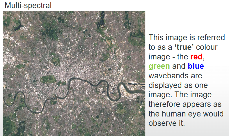
What is multispectral resolution
Consists of relatively narrower several bands of which two or three bands in the visible range and also have a few near-infrared or middle infrared bands.
What is hyperspectral resolution
Consists of large number of narrower bands spread across the EMR
What is radiometric resolution
The number of unique values that can be recorded by a sensor when measuring reflected or emitted EMR (signal precision)
How is radiometric resolution quantified/expressed
Quantified as a number (e.g., 256, 1024, etc.) and express in bits, the higher the radiometric resolution, the better the data quality
How are bits expressed
As power of 2, and numbers start from 0
▪ 1 bit = 21 = 2 values (0 and 1)
▪ 2 bit = 22 = 4 values (0,1,2 and 3)
▪ 8 bit = 28 = 256 values (0 to 255)

What is temporal resolution
Shortest period of time that a sensor will revisit/ pass over the same spot on the Earth surface (the sensor revisit frequency)
Why are some areas re-imagined more frequently
Due to some degree of overlap in the imaging swaths of adjacent orbits for most satellites and the increase in this overlap with increasing latitude