Natural Hazards Exam 2
 Call Kai
 Learn
 Practice Test
 Spaced Repetition
 Match
 Flashcards
 Knowt Play
1/112

There's no tags or description
Looks like no tags are added yet.
113 Terms
Secondary Quake Hazards: 1995 Kobe Earthquake
January 1995 a major earthquake struck near the city of Kobe, Japan, killing more than 6000 and displacing more than 45,000 people.
Kobe quake was linked to an east-west strike-slip fault in a region where the Eurasian and Philippine plates interact.
Magnitude of 6.9 and cost more than $100 billions in damages.

Secondary Quake Hazards: 1995 Kobe Earthquake (Government Work)
Most people killed in earthquake were killed by houses and buildings falling on top of them.
After quake, government offered nationwide subsidies to promote quake-proof work on houses built pre 1980’s.
Only 82% of houses in the nation had been made quad resistant as of 2013, failing their goal of reaching 95% by 2022.

Soil Liquefaction
Waterlogged / saturated soils act like fluids when shaken.
Usually happens in quakes of magnitude 4.5 to 5 or higher.
Most common in loose sand and silt, floodplains, deltas, and filled-in areas near the coast.
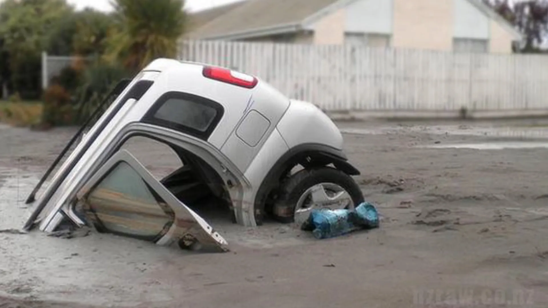
Soil Liquefaction: Consequences
Minor:
Ground oscillation: Can produce cracks but usually no significant displacement.
Minor:
Lateral spread: Later/horizontal movement, 0.3-3 degrees sloop. CAN damage pipelines.
Loss of bearing strength: Building foundations are weak. Buildings can tilt and tip.
Flow failure: Surface and deeper parts of slope fail, ground settlement. Ground settlement or displacements are significant.
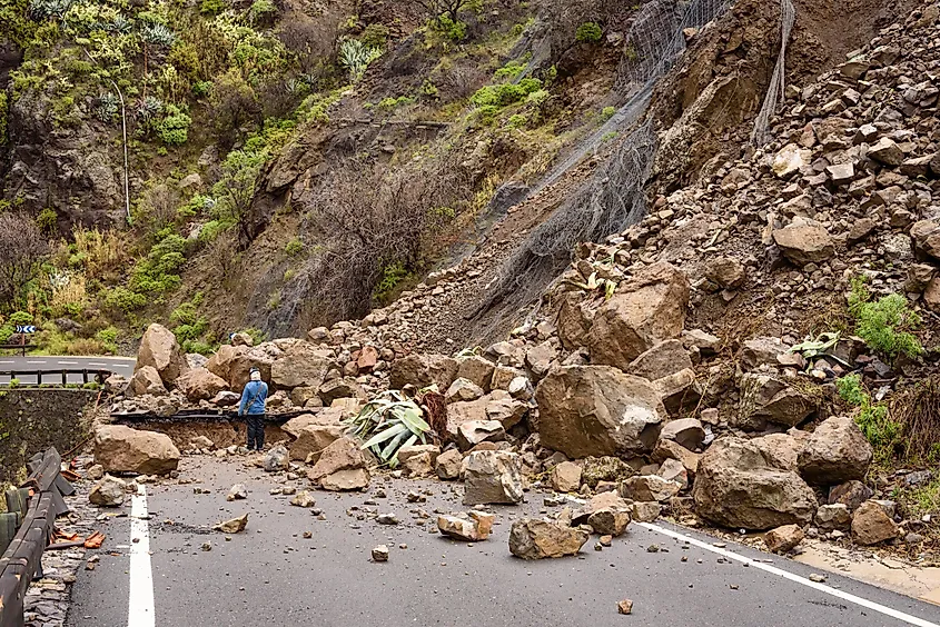
Landslides and Avalanches
Slope failures.
More common in quakes of magnitude 4.0 or higher.
Includes rock and snow avalanches.
Tsunamis
Series of ocean waves carrying large volumes of water.
Caused by quakes, volcanic eruptions, and landslides.
Destructive force: Water + debris.
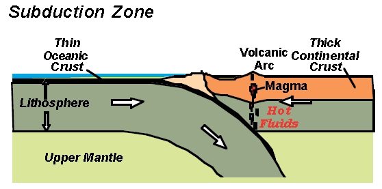
More common in Pacific Ocean and subduction zones.
Quack Related Tsunamis
Also called seismic sea waves.
From Japanese: tsu = port/harbor , name = wave.
Fault rupture happens under the ocean or coastal zone.
More likely to form when the hypocenter is shallow and the seabed has significant vertical displacement
Evolution of tsunami waves as they approach the coast
Wave speed = square root of (gravity X depth of sea)
The higher the speed and depth of the sea, the shorter the wave height and the longer the wavelength.
Deeper parts of sea: Faster but short waves
Shallower areas near the coast: Slower but taller waves

Tsunamis: Micro Protection
Protection at the scale of a single building or property
Examples:
Wood-frame homes: bolted to their concrete foundations
Closest and heavy furniture: strapped to the walls
Brick chimney: reinforced and braced

Tsunamis: Macro Protection
Large purpose-built structures that protect against surfaces flows and flood waters (rock falls, lava flows, lahars, mudslides, avalanches, river floods, storm surge, tsunamis)
Two ways they work: hold back excess material, or divert flows away from vulnerable sites
Examples:
damns, sea walls, dams

Tsunami run-up:
Maximum height of wave at shore
Types of buildings more vulnerable OR resistant to ground shaking:
Strong, flexible and ductile (stretches, changes shape without tearing).
Steel and wood can be ductile and flexible
Avoid: weak, stiff, or brittle (easily broken without bending first)
Brickwork, glass
Glass alternatives:
Laminated glass (with plastic interlayer)
Tempered glass
Polycarbonate (a plastic)
These materials stay in place or break safely, minimizing risk of injury.
Protection and earthquakes: Seismic resistance
Single storey buildings: Weak seismic resistance. Short walls bend more easily
Multi storey buildings: Stronger but weak seismic resistance towards top of buildings.
Stepped profile: higher stability against lateral shaking

Buildings on top of Rock during shaking:
Very little deformation
Ground stays firm, so the building stays steady
Buildings on top of dense gravel during shaking:
Strong support
Ground stays firm, and building stays steady
Buildings on top of soft clay or loose soil during shaking:
Ground is compressed and packed down by building weight, so the building sinks into the ground
Protection and earthquakes: Avoid
Varied weight buildings
Angled buildings
Soft storey (building sitting on top of wood planks)

Protection and earthquakes: Reinforce
Bracing soft storey
Steel framed building
Deep foundation

Bolting structure to foundation:
Strengthens the connection between the house’s wooden frame and it’s concrete foundation
Emergency aid: Golden hour
Most lives are saved within the first hours / first day after a destructive quake
The first 3 days are the most crucial for finding survivors
Disaster aid: Phase 1
Immediate emergency response during golden hours. Find survivors, clear roads.
Then provide shelter, food and water, and treat the wounded.
Long term aid:
State or federal/national funds, or international aid.
Mitigation - Insurance
Most earthquake risk is uninsured. Potential costs are high, and it can be hard to determine places that may be affected.
Private-public insurance is common, but usually expensive. Reinsurance companies are important.
Earthquake insurance: Take-up rate
Percentage of people who sign up for insurance based on the total number of people / households that should sign up for it.
Earthquake insurance: Coverage
May pay for damages to house, personal belongings inside home, and Additional Living Expenses (ALE) or loss of use, which is the costs that live somewhere else while area is evacuated or home is repaired.
Earthquake insurance: Premium
Amount insured pays the insurance company. Usually reported as annual amount.
Earthquake insurance: Deductible
Percentage amount that needs to be paid before the insurance plan starts to pay.
A 10% deductible on a $400,000 coverage means that $40,000 must be paid first, which is a lot for homeowners.
Earthquakes: Local emergency aid
Already in the area so they can reach survivors faster
Can start searching right away, which matters during golden hour
Knows the local roads, buildings, and language
Limits: May be victims too, and roads and equipment can be damaged.
Earthquakes: Internal Emergency Aid
Nearly 17 specialist rescue teams on permanent stand-by sound the world.
Need time to travel to the disaster area, so they often arrive after golden hour.
Tend to help, but rates of rescuing survivors can be low.
Forecast: Tsunamis
Usually well established for quake-related tsunamis.
Japanese warning system includes:
Initial tsunami advisory: 3 minutes after earthquake
Maximum wave heights and arrival time: 5 minutes after quake
Continuing updates (tide heights)
Tsunami Forecast: DART systems
Deep-ocean Assessment and Reporting of Tsunamis
Used for forecasting tsunamis
Bottom pressure recorder on the sea floor detects the tsunami wave
Surface buoy sends the signal to land by satellite
Quake community preparedness: Household / individual level
Disaster recovery planning
Know what to do:
Indoors: drop under desk or table, away from windows
Outdoors: Stay in open area, away from buildings, trees, powerlines. Drop and cover.
Inspect home for seismic resistance.
Survival kit: Food, sleeping bags, sweaters, water, etc
Quake community preparedness: Community level
Machinery for heavy lifting to clear rubble.
Important buildings should be extra reinforced: schools, hospitals, fire stations, emergency facilities
Trading at community level: emergency drills (schools and government agencies)
Zoning:
intensity and fault location
Looks at soil and how well they support buildings.

Land-use planning:
The process of deciding how land in an area should be used, developed, protected, and managed to meet current human needs while considering the environment and future societies.
Involves organizing the landscape for different purposes like: parks, roads, schools, industries, mining, power generation…etc.
Quake land-use planning: Zoning by soil types (Water waves)
Waves move from a hard material like bedrocks to a soft material like mud
The waves slow down, so energy “piles up”
This results in a larger amplitude wave, so shaking is stronger on soft soil.

What are volcanoes?
Formed of molten materials called magma
Molten = liquefied by heat
Magma contains dissolved gases and crystallized minerals in suspension.
Molten rock is magma when underground, and lava once it erupts.
Volcanic eruptions:
Magma forms in areas deep down that are hot enough to melt rock.
Gas in magma expands, which creates pressure.
Magma rises due to being less dense than surrounding rock.
Magma rises towards the surface seeking pressure release.
As the pressure decreases, gases come out of solution and aggregate into bubbles.
Bubbles expand as they go up, driving magma upwards through volcanic vents.
Sometimes the magma breaks through the structural weakness and reaches and impacts the Earth’s surface. Event may be explosive.
When magma reaches the surface, it is called lava.
Volcano activity: Extinct, dormant, or active
Broadening range for extinct: 25,000 years
The Yellowstone super volcano last erupted 640,000 years ago. Scientists believe it is dormant and may erupt/ become active in the far future.
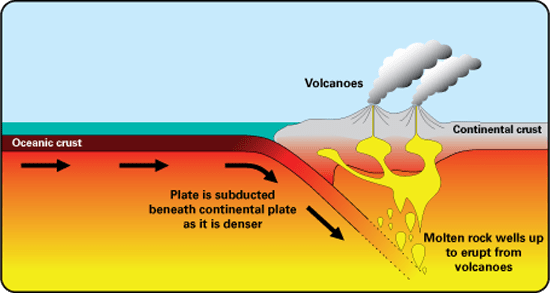
Types of volcanoes: Subduction volcanoes
Found at convergent boundaries.
One plate sinks under another plate.
The sinking plate releases water, which helps melt the rock above it
Lava is silica-rich and more viscous (thicker)
Types of volcanoes: Rift volcanoes
Usually found at divergent boundaries, or in rift areas on/near hot spots
Plates pull apart, and magma rises to fill the gap
Lava is basaltic and less vicious (runnier)
Example: East Africa, Iceland
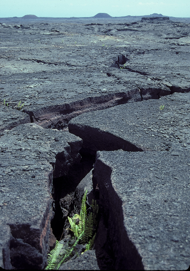
Types of volcanoes: Hotspot volcanoes
Not at plate boundaries, they sit over a hotspot in the mantle
Heat from the hotspot melts rock and magma rises
Lava is often basaltic and less viscous (runnier)
Example: Yellowstone

High viscosity Vs Low viscosity
High viscosity: Thicker
Low viscosity: Runnier
Basaltic lava
Low viscosity (runnier, flows easily)
Comes from mantle melting
Typical at divergent boundaries (and often hotspots)

Silica-rich lava
High viscosity (thicker, flows slowly)
Typical convergent boundaries
The subducting plate releases water and other compounds into mantle

Earth’s mantle:
Thick, mostly solid layer of silicate rock between the Earth’s thin outer crust and it’s super heated outer core

Types of volcano shapes: Shield volcanoes
Low and broad (like a shield).
Typical of hot spots, rift volcanic areas, and areas with lower viscosity lava and less gas.
Can be quite large, with long diameters. May have multiple vents.

Types of volcano shapes: Cinder cones
Shaped like a cone, tend to be smaller
Lower viscosity lava, more gas
Can appear in various tectonic settings

Types of volcano shapes: Composite volcanoes
Looks like a mountain
Higher viscosity lava and more gas
May have multiple vents
Common in subduction zones

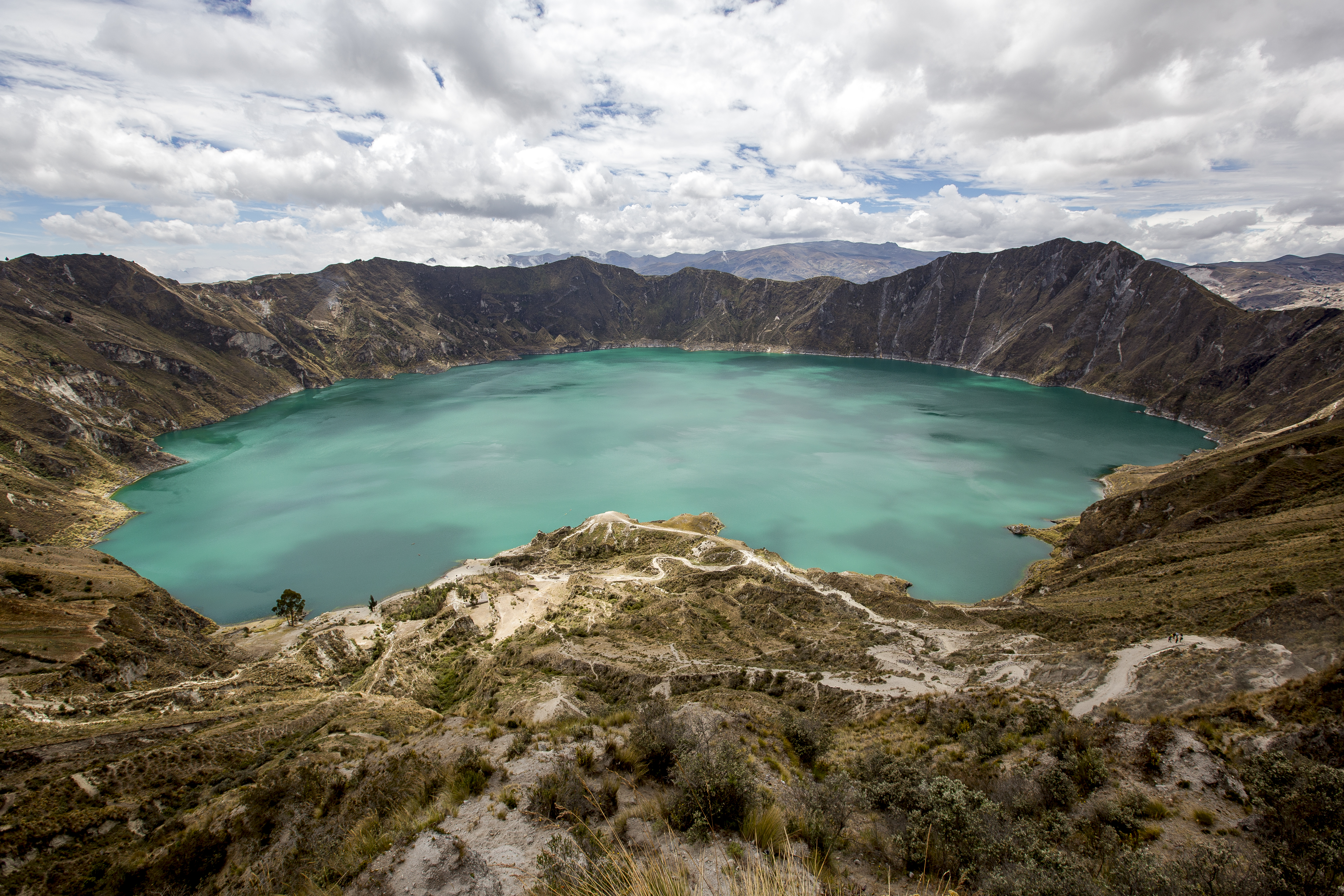
Calderas:
Depression formed when a volcano collapses after an eruption. Calderas may or may not be volcanically active.
Types of volcanic eruptions: Effusive
Nonexplosive
Low viscosity magma (runnier) and gas.
Often linked to shield volcanoes, and to lower extent composite volcanoes

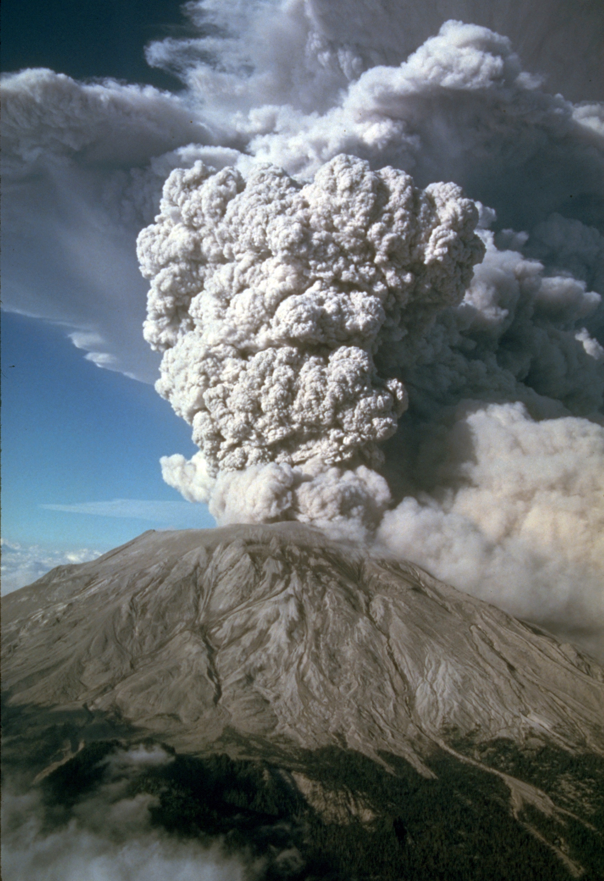
Types of volcanic eruptions: Explosive
High viscosity lava (thicker) and higher gas content.
Often linked to composite volcanoes.
Types of volcanic eruptions: Strombolian
Fountain like lava release, moderate explosions.
Low to medium viscosity lava.
Often linked to cinder cone volcanoes.

Shield volcanoes Vs Composite volcanoes
| Shield Volcanoes | Composite (Stratovolcanoes) |
Eruption | Primarily effusive (gentle, continuous flows) | Highly explosive (violent, sudden blasts). Effusive phases possible |
Lava viscosity | Lower | Higher |
Lava type | Basaltic (low silica, runny) | Andesitic/Rhyolitic (high silica, thick, sticky) |
Gas | Escapes easily | Trapped under high pressure |
Shape | Broad, gentle slopes, shield-like | Tall, steep slopes, symmetrical cones |
Primary Danger | Property damage from lava | Ash/tephra, pyroclastic flows, and lahars (mudflows) |
Examples | Mauna Loa, Kīlauea (Hawaii) | Mt. Fuji (Japan), Mt. St. Helens (USA), Mt. Vesuvius (Italy) |
Primary hazards: Volcanic eruptions
Volcanic gases
Pyroclastic flows
Lava flows
Air-fall tephra
Air fall tephra
Volcanic solid material (particles and larger pieces) suspended in or falling from air
May affect aviation (visibility) and temperature of air
May ignore fires (hot ashes)
Pyroclastic flows:
Responsible for most volcanic deaths to date.
Lava frothing near volcanic vents causes explosion that initiates pyroclastic flows.
Pyroclastic flows are hot mixes of gases and pyroclastic materials (tephra solid materials ejected in volcanic eruption).

Volcanic gases
Gases that come out of the magma as pressure decreases
Can be released during eruption or from vents
Can cause acid rain

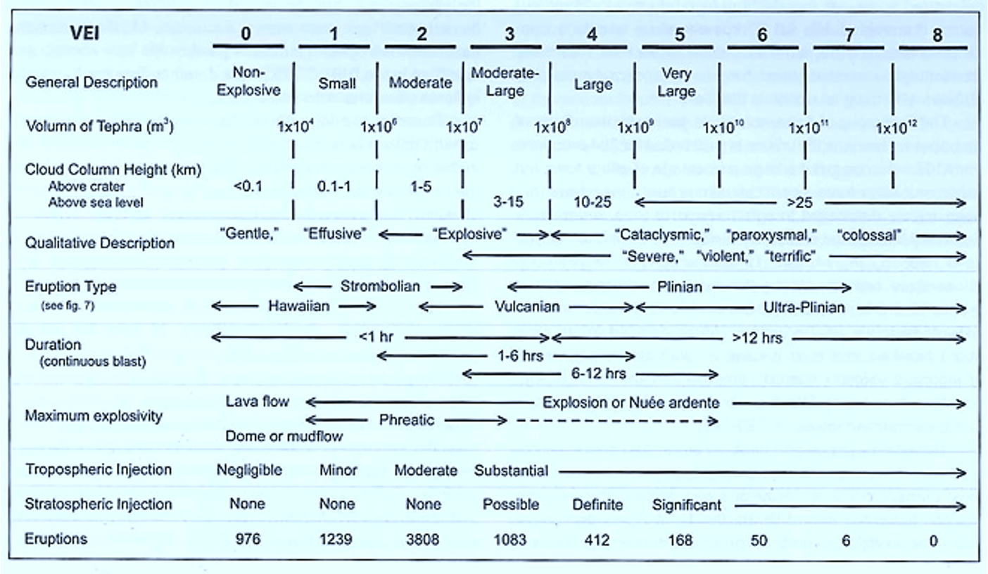
Volcanic Explosively Index (VEI):
The layers of the Atmosphere:

Secondary hazards: Lahars
Primary lahars: Freshly fallen tephra particles mixed with water.
Secondary lahars: High intensity rainfall in between eruptions
May cause landslides / avalanches

Volcanic hazards protection:
Explosives: more common for denser lava types
Barriers: more common for lighter lava types
Water spray
Volcanic hazards protection: Lahars
Engineering to make lakes shallower
Volcanic hazards protection: Roofs
Roofs can collapse from a total load of ash, so ensuring the roof’s structural strength is important.
Pitched roofs displace accumulated ash.
Imbricated roof tiles allow blown ash to accumulate and weigh down the roof.
Volcanic hazards protection: Windows
Windows with shutters may help seal them airtight and protect from gases.
Mitigation: Disaster aid
Proper food
Masks
Water
Housing
Adaptation: Community preparedness
Emergency plans
Response to alerts
Evacuation plans
Return plans
Mount St. Helens 1980 Eruption
Earthquake: A magnitude of 5.1 struck the volcano
Landslide: This triggered the massive collapse of the volcano’s north flank, causing one of the largest landslides in history
Lateral Blast: The landslide released pressurized magma, causing a powerful lateral blast of hot rock, ash, and gas to erupt.

Mass movement hazards: Risks
Rapid mass movements: Usually causes more fatalities
Slow, down-slope movements: Can cause significant economic loss
Mass movement / landslide:
Displacement of rock and / or soil along slopes
Types:
Landslides
Debris flow
Mudflow
Avalanche
Rock fall
Types of terrain most at risk of mass movement:
Uplands subject to seismic shaking.
High relief, steep slope, mountainous areas.
Areas of varying slope/relief suffering from land degradation.
Areas with high rainfall.
Foldable areas in hilly parts of the landscape.
Movement Risks: Rapid Vs Slow
Rapid mass movements: Usually causes more fatalities
Slow, down slope movement: Can cause significant economic loss
Stability of a Slope: Factor of safety
Ratio between resistance forces and driving forces
Factor of Safety (FoS) =
Resistance Forces (Strength / Capacity) / Driving Forces (Load / Demand)
Stability of a Slope: Shear or driving forces
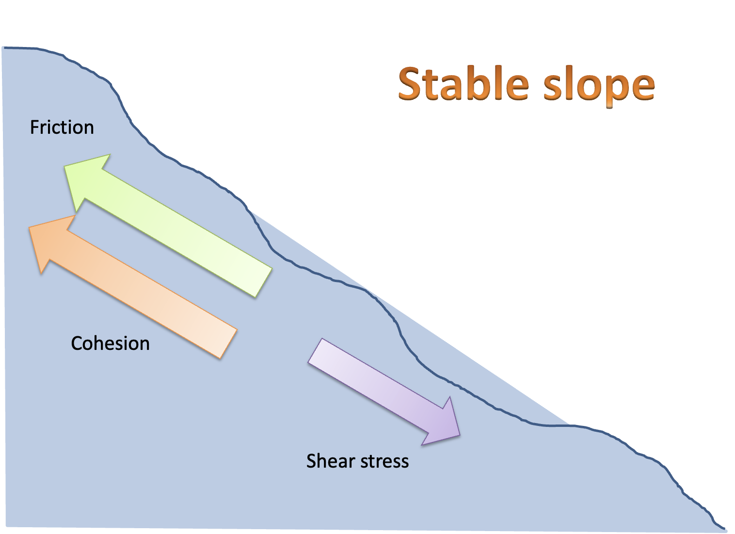
Gravity is constantly pulling mass down the slope. Weight of materials. Load of demand.
Stability of a Slope: Resistance to shear forces (Cohesion)
Cohesion: resistance to movement is linked to sickness or (electrical) bond among soil particles; cohesion keeps particles interlocked
Stability of a Slope: Resistance to shear forces (Friction)
Friction: resistance to movement linked to surfaces sliding against each other. Electrical attraction between touching surfaces is likely involved.
Factor of Safety: How to interpret the Value
FoS > 1: The system is stable because the resistance forces are greater than driving forces.
FoS = 1: The system is in a state of critical equilibrium. Any additional driving force will cause failure.
FoS < 1: The system is unstable and failure will occur (Landslides, structural collapse, or mechanical break)
Stable Slope:
A slope is stable when the resistive forces are considerably higher than shear stress
Unstable Slope:
A slope is unstable when the shear / driving forces are similar to resistive forces
Relationship between shear / driving forces changes all the time
Weathering: Weakens soil and rocks
Water:
- Reduces / increases resistance forces
- Adds weight
- Slide versus flow. Liquefaction.

Slope Stability: Slope angle variation
Steeper slope: gravity pulls more material down the slope, so the driving force increases
Angle of repose: The steepest angle a pile of loose material can keep without sliding
Steep, high-relief slopes are most at risk
Friction between grains holds it in place
Slope Stability: Earthquakes
Natural trigger of mass movements
Shaking can push an unstable slope past its limit
Landslides are more common in quakes of magnitude 4.0 or higher
Uplands subject to seismic shaking are at risk
Slope Stability: Removal of land cover
Examples: urbanization / development, agriculture expansion, forestry
Less vegetation means runoff flows faster
Faster runoff causes more erosion
This may trigger landslides, debris flows, and mudflows
Roots hold soil together, so removing them weakens the slope
Snow Avalanche: Triggers
Heavy snowfall
Quakes
Skiing or other human activity
Melting or rain (spring time)
Snow Avalanches Slopes: Steepness
Higher risk: Usually medium slopes, between 30 and 46 degrees
Steeper slopes: Snow tends to slide off before much builds up
Snow Avalanches Slope: Aspects, Northern Hemisphere
Winter: North-facing slopes get less sunlight, so the now is cold and loose
Spring: South-facing slopes get more sunlight, so melting weakens layers
Types of Snow Avalanches: Loose-snow avalanche
Less than 10% of avalanche fatalities
Dry: release of powdery snow
Wet: release of slushy snow; tends to be more destructive, more common in spring

Types of Snow Avalanches: Slab avalanche
Usually causes more fatalities than loose-snow avalanches
Slab: More cohesive layer
Weak layer: Poorly bonded crystals
More common in Winter

Types of Snow Avalanches: Powder avalanche
Very hazardous, moves fast
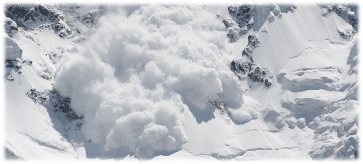
Cloud of powdery snow and air that rushes down the slope
Often starts as a loose-snow or slab avalanche with a lot of dry, fresh snow
Protection: Landslides
Drainage
Supporting structures: retaining walls
Vegetation: appropriate tree species
Covering terrain: with plastics or textiles, chemical sealers

Artificial release:
Bombing an area to cause an avalanche to release snow or ice
Snow Avalanches: Barriers / defense structures
Snow benches
Deflecting walls
Snow nets: catches snow

Mitigation:
Financial measures to modify the loss burden (Emergency aid, Insurance)
Mitigation for mass movements: Aid
Aid is immediate
Death in landslide and avalanches happen by collision
If trapped, death is by suffocation
Mitigation for mass movements: Mudflow insurance
Covered by flood insurance
Flood insurance is available from FEMA’s National Flood Insurance Program (NFIP) and some private insurance companies
Excluded from standard homeowners and business insurance policies
Coverage must be bought serparetly
Homeowner Insurance:
Covers standard perils like fire, wind, lighting, and vandalism
General protection for the home and its contents against common risks
Less customizable, standard policies are broadly similar
DIC Insurance (Difference in Conditions)
Covers perils usually excluded from homeowners policies, like earthquakes, floods, landslides, and mudslides
A companion policy that fills coverage gaps for events specific to a high risk region
Highly customizable, either named-perils or all-perils coverage
Adaptation:
Community preparedness
Forecast and warning
Land use planning
Atmospheric hazards: Severe storms
Tropical (but affect other latitudes):
Tropical cyclones
Mild altitudes:
Tornadoes
Hailstorms
Winter cyclones
Snowstorms
Regional names of tropical cyclones:
Cyclones ( Australia and nearby regions)
Hurricanes ( The Americas )
Typhoons ( Asia )
Tropical Cyclone Development: Coriolis force
Coriolis force: Earth’s spin makes moving air curve instead of going straight
This curving makes the air spin around the low-pressure center (vortex)
Needs to be significant: above 5 degrees north or south of the Equator
No Coriolis force at the Equator, so no storm forms there
Tropical Cyclone Development: Low pressure disturbance
Low pressure disturbance = an area just above the ocean where the air pressure is lower than the air around it
Air converges: air from around it flows in toward the center
Air circulates: the air moves in a circle around the center