History Of Remote Sensing
 Call Kai
 Learn
Learn Practice Test
 Spaced Repetition
 Match
Match Flashcards
 Knowt Play
1/8

There's no tags or description
Looks like no tags are added yet.
Name | Mastery | Learn | Test | Matching | Spaced | Call with Kai | Chat |
|---|
No analytics yet
Send a link to your students to track their progress
9 Terms
What is remote sensing
The process of detecting and monitoring the physical characteristics of an area by measuring its reflected and emitted radiation at a distance
Why is remote sensing used
It acquires information on our environment and is capable of gathering information over large areas (1000s Km) some of which are difficult to reach
When were the first photographs taken
1839
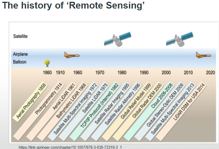
What remote sensing development took place in 1858
Gasper Felix Tournachon "Nadar" takes photograph of village of Petit Bicetre in France from a balloon
What event accelerated the development of aerial imagery
World War One
How do remote sensing instruments collect data over large areas
Instruments can be carried on different platforms, e,g, towers, aircraft, satellite
What are multiple viewing angles and why are they beneficial
-Observes the same location at different angles.
-Provides information about the hight of features (buildings, trees, etc)

What is multi-temporal remote sensing and why is it beneficial
-Shows the same object at different times
-Monitors changes occurring over time (urban growth, change in vegetation, natural disasters)

What is multi-spectral remote sensing
-Consists of relatively narrower several bands of which two or three bands in the visible range and also have a few near-infrared or middle infrared bands.
