Note
0.0(0)
Explore Top Notes Note
Note Studied by 51 peopleNoteStudied by 22545 peopleNoteStudied by 1 personNoteStudied by 3 peopleNoteStudied by 11 peopleNoteStudied by 20 people
Ch 2 - Evolution of Economic Thinking
Chapter 1: The Living World: Ecosystems
5.1-5.3 Redox reactions and Oxidation and reduction
Zuren en basen
Chapter 12 - Key Relationships
Chapter 26: Quality Assurance and Quality Control
APHG Map Projections (+ strengths n weaknesses)
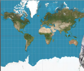
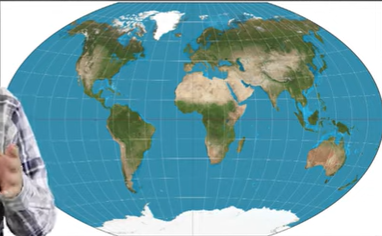
Mercator Map Projection
✅
Precise direction
❌
Size (In the poles)
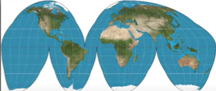
Goode Homolosine Projection
✅
Minimizes most of the distortion
Maintain size
❌
Hard to present information easily
Bad for direction
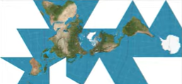
Fuller Projection
✅
Maintains size and shape of land mass
❌
Hard to present information easily
Does not use cardigal directions
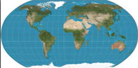
Robinson projection
✅
Minimizes by spreading distortion through every aspect
❌
Winkel Tripel Projection
✅
minimal distortion in land, distance, and direction
❌
distorted pole
longtitude and latitude is curved
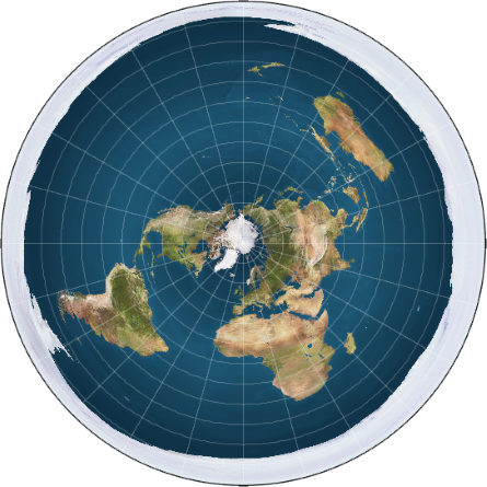
Polar/Azimuthal projection
✅
distance to and from center is correct
❌
distance between other points are distorted
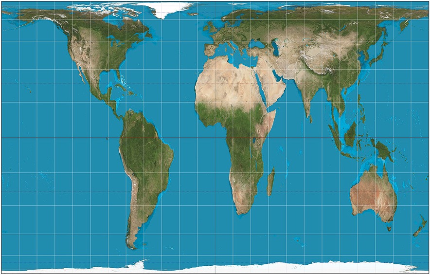
The Gall-Peters Projection
✅
more accurate at the equator, less towards the poles
❌
countries are all the correct sizes
Note
0.0(0)
Explore Top NotesNoteStudied by 51 peopleNoteStudied by 22545 peopleNoteStudied by 1 personNoteStudied by 3 peopleNoteStudied by 11 peopleNoteStudied by 20 people
Ch 2 - Evolution of Economic Thinking
Chapter 1: The Living World: Ecosystems
5.1-5.3 Redox reactions and Oxidation and reduction
Zuren en basen
Chapter 12 - Key Relationships
Chapter 26: Quality Assurance and Quality Control