Lecture 4: Spatial Analysis (Vector)
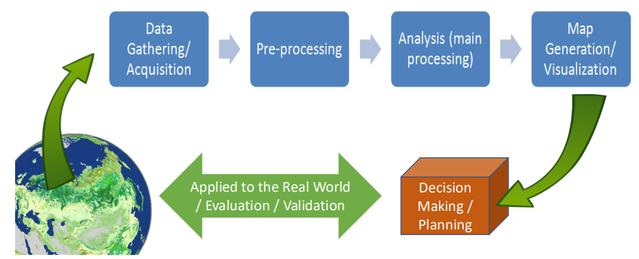
I. Spatial Analysis Workflow
Spatial Analysis
Spatial analysis is a set of techniques for analyzing spatial data
The results of spatial analysis are dependent on the locations of the objects being analyzed
Software that implements spatial analysis techniques requires access to both the locations of objects and their attributes
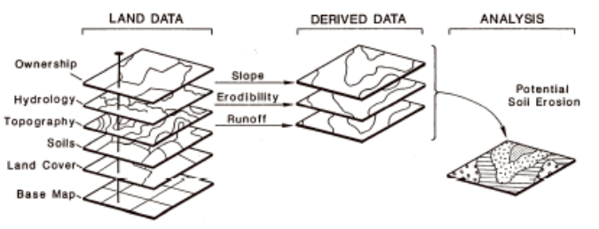
In GIS, it normally follows this sequence of operations:
II. Analytical functions for vector data
GIS Analysis Functions
Intravariable - performed on a single data set
Intervariable - performed on two or more data sets
Querying
Method of data retrieval
Can be performed either on data that are part of the GIS database or on new data produced as a result of data analysis
Distance / Proximity Analysis
Buffer
Creation of a zone of interest or new layer boundary (buffers) at specified distance from input layer
Point entity: circular buffer zone
Line entity: elongated buffer zone
Polygon entity: buffer zone has the same shape as original polygon, but larger
Point distance tool
Calculation of distance from each point in one feature class to all points given a search radius to another feature class
Ex: Crime incidence vs Police Stations
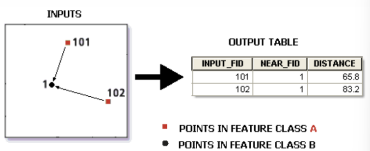
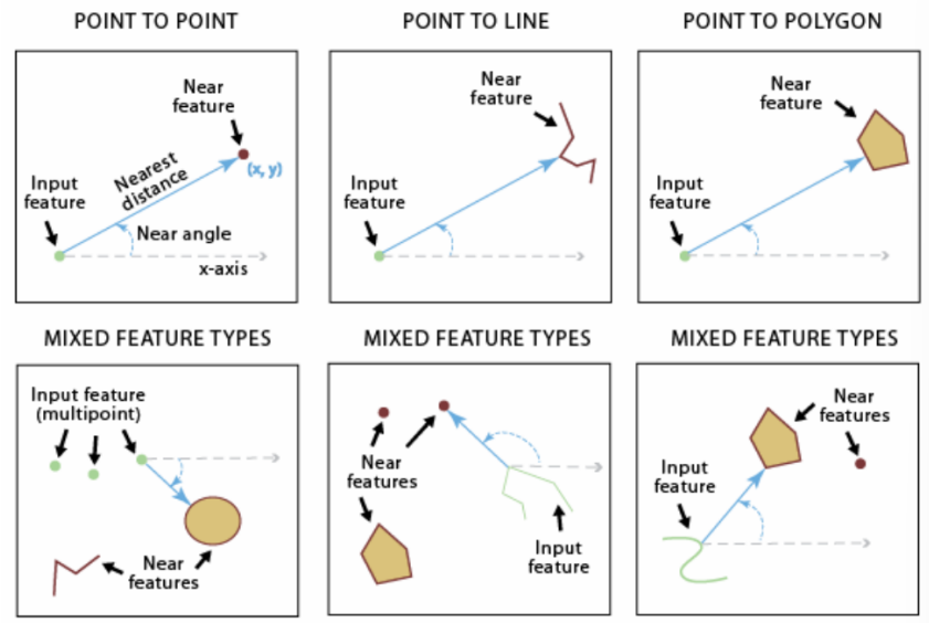
Near tool
Adds attribute fields to a point feature class containing distance, feature identifier, angle and coordinates of nearest point / line
Example: Find the closest established benchmark from the river network
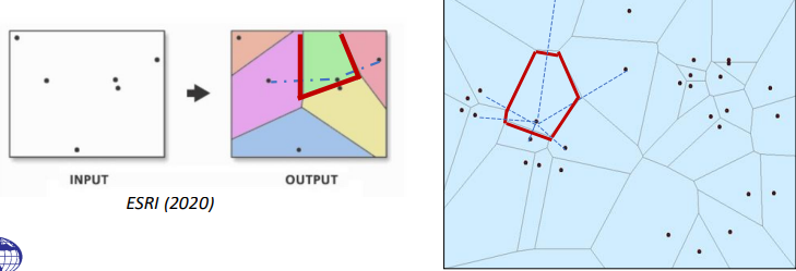
Thiessen polygons
Creates a polygon of the areas closest to each feature for a set of input feature
target’s zone of influence or “catchment area”
partitioning of the plane into polygons that have this characteristic, that is containing all the locations that are closer to the polygon’s ‘midpoint’ than to any other midpoint
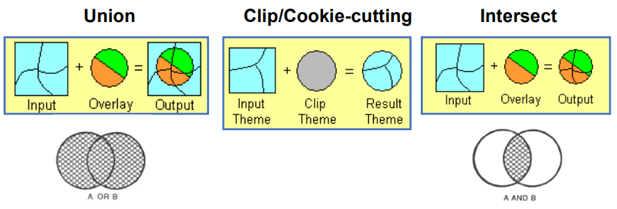
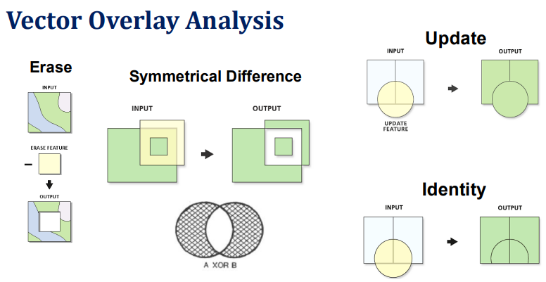
Vector Overlay Analysis
New spatial data layer from two or more old data layers
Can be done within vector and raster
Should be georeferenced in the same coordinate system; and
Should cover the same area of interest
Basic principle:
Compare the properties of the same location in both data layers, and to produce a new characteristic for that location in the output layer.
Individual data layers to be overlaid have to be topologically correct
lines should meet at nodes and polygon boundaries are closed
A spatial join involves matching rows from the join layer to the target layer based on a spatial relationship and writing to an output feature class
When a match is found during processing, a row is added to the output feature class containing the shape and attributes from the target layer and the matching attributes from the join layer
III. Examples and Applications
check powerpoint ;>