Human Chapter 1
1.1: Maps
Reference Maps
Reference: designed for people to refer to for general information about places
Political maps: show and label human-created boundaries and designations, such as countries, states, cities, and capitals
Physical maps: show and label natual features, such as mountains, rivers, and deserts
Road maps: show and label highways, streets, and alleys
Plat maps: show and label property lines and details of land ownership
Thematic Maps
Thematic maps: how spatial aspects of information or a phenomenon
Choropleth maps: use various colors, shades of one color, or patterns to show the location and distribution of spatial data
often show rates or other quantitative data

Dot distribution maps: show the specific location and distribution of something across a map
each dot represents a specified quantity
any kind of symbol can be used

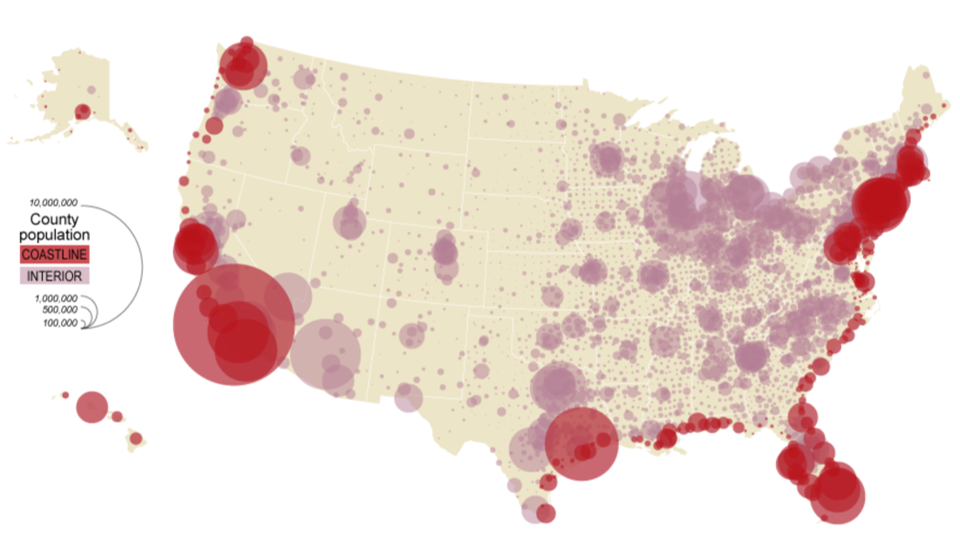
Graduated symbol maps: use symbols of different sizes to indicate different amounts of something
larger sizes indicate more of something and smaller sizes indicate less
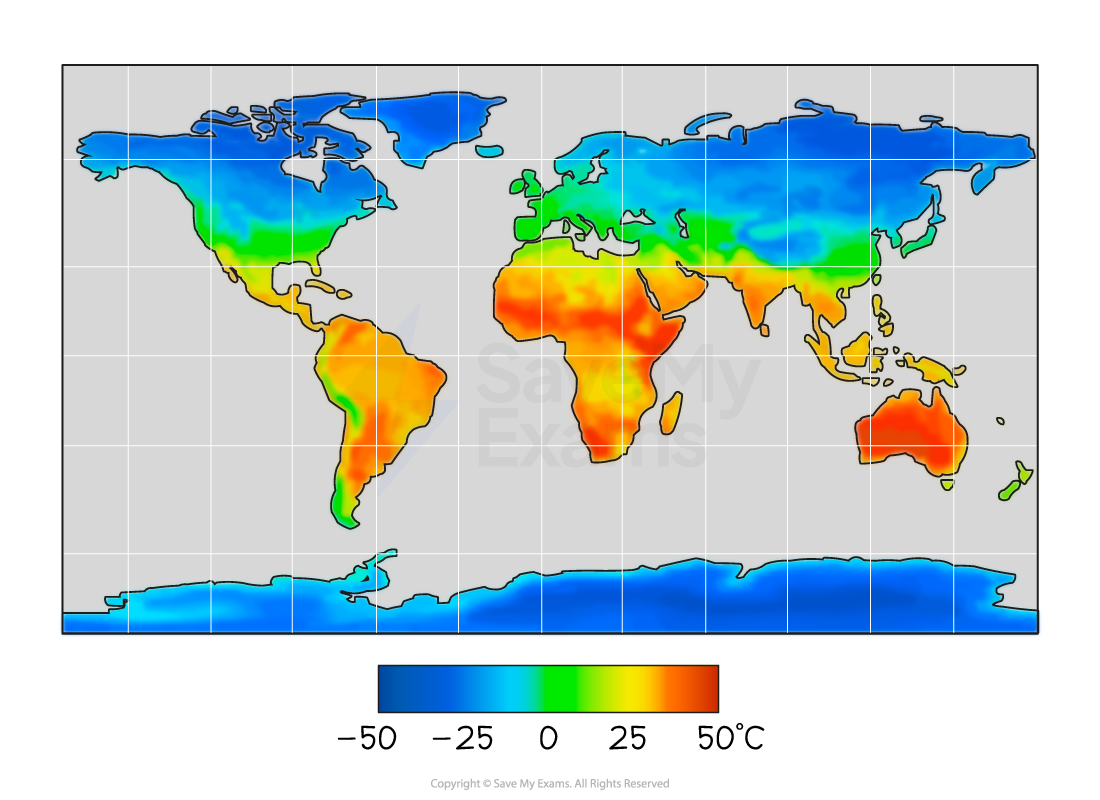
Isoline maps: use lines that connect points of equal value to depict variations of data across space
also called isometric maps
close lines depict rapid change

Topographic maps: points of equal elevation are connected

Cartogram maps: sizes of areas are relative to some statistic

Scale
Scale: the ratio between the size of things on the real world and their size on the map
Cartographic scale: refers to the way the map communicates the ratio of its size to the size of what it represents
1 in= 10 miles
1:200,000 means one unit on the map is equal to 200,000 of that same unit in reality
Small scale maps: show a larger area with less detail (Ex: US Map)
Large scale maps: show a smaller area with more detail (Ex: Philadelphia map)
Types of Spatial Patterns Represented on a Map
Location
Absolute location: the precise spot where something is according to a system
Lines of latitude and longitude
Latitude: distance north or south of the equator
Longitude: distance east or west of the prime meridian
Prime Meridian: Imaginary line that runs from pole to pole through Greenwhich, England
Relative Location: a description of where something is in relation to other things
Connectivity: how well two locations are tied together by roads or other links
Accessibility: how quickly and easily people in one location can interact with people in another location
Direction: used in order to describe where things are in relation to eachother
Cardinal directions: north, south, east, west
Intermediate directions: southeast, southwest, northeast, northwest
Distance: a measurement of how far or how near things are to eachother
Absolute distance: measured in terms of feet, miles, meters, or kilometers
Relative distance: indicates the degree of nearness based on time or money
is often dependent on mode of travel
Elevation: distance of features above sea level
measured in feet or meters
usually shown on isoline maps
Pattern Distribution: the way a phenomenon is spread out over an area
Patterns: general arrangement of things
Clustered or agglomerated: arranged in a group or concentrated area such as restaurants in a food court
Linear: arranged in a straight line, such as towns along a railroad line
Dispersed: spread out over a large area, such as large malls in a city
Circular: equally spaced from a central point, such as the distribution of homes of people who shop at a particular store
Geometric: in regular arrangement, such as the squares or blocks formed by roads in the midwest
Random: appear to have no order to their position, such as the distribution of pet owners in a city
Projections
All maps have some distortion
Must decide whether to preserve area, shape, distance, or direction
Types of Projections
Projection | Purpose | Strength | Distortion | Image |
Mercator | Navigation |
|
|  |
Peters | Spatial Distributions related to area |
|
|  |
Conic | General use in midlatitude countries |
|
|  |
Robinson | General use |
|
|  |
1.2: Geographic Data
Landscape Analysis
Observation and Interpretation
Field observation: used to refer to the act of physically visiting a location, place, or region, and recording, firsthand, information there
Spatial data: all the information that can be tied to specific locations
Remote sensing: gathers information from satellites that orbit the earth or other craft above the atmosphere
Aerial photography: professional images captured from planes within the atmosphere
Geospatial Data
Quantitative or qualitative
Fieldwork: observing and recording information on location, or in the field
Can come from census, interviews, or informal observations
Other Sources of Geospatial Data
Government policy documents such as treaties or agreements, articles and videos, or photos
Locational data on apps
1.3: The Power of Geographic Data
Using Geographic Data to Solve Problems
Geovisualizations: allow people to zoom in or out to see data in ways that were previously impossible
Maps are only as valuable as the data used to create them
Geospatial Technologies
Type | Description | Uses |
Global Positioning System (GPS) | GPS receivers on the earth’s surface use the locations of multiple satellites to determine and record a receivers exact location |
|
Remote Sensing | The use of cameras or other sensors mounted on aircraft or satellites to collect digital images or video of the Earth’s surface |
|
Geographic Information System (GIS) | Computer system that can store, analyze, and display information from multiple digital maps or geospatial data sets |
|
Smartphone and Computer Applications | Location-aware apps that gather, store, and use locational data from computers or other personal devices |
|
Solutions In Action
Community-based solution: increase the liklihood of success because they create buy-in from local residents and are more likely to be culturally accepted
1.4: Spatial Concepts
Spatial approach: considers the arrangement of the phenomena being studied across the surface of the Earth
Focuses on location, distance, direction, flow, orientation, pattern, and interconnection
Major Geographic Spatial Concepts
Location
Location: identifies where specific phenomena are located either on a grid system or relative to another location
Absolute and relative
Place
Place: refers to the specific human and physical characteristics
Region: group of places in the same area that share a common characteristic
Site: the characteristics at the immediate location
Situation: the location of a place relative to its surroundings and its connectivity to other places
Sense of place: the perceived charcteristics of a place
Toponyms: place names
Some provide insight into physical geography, history, or culture
Distance and Time
Time-space compression: the shrinking of “time distance” or relative distance between locations because of improved methods of transportation and communication
Impact of Distance
Spatial interaction: the contact, movement, and flow of things between locations
Flow: the patterns and movement of ideas, people, products, or other phenomena
Friction of distance: when things are further apart, they tend to be less connected
Distance decay: the inverse relationship between distance and connection
Patterns and Distribution
Patterns: the general arrangement of things being studied
Distribution: the way a phenomenon is spread out or arranged over an area to describe patterns
Spatial association: matching patterns of distribution
indicates two or more phenomena may be related or associated with another
Human-Environmental Interaction
Geographic Concepts
Natural Resources
Natural resource: includes items that occur in the natural environment that people can use
Renewable natural resources: theoretically unlimited and will not be depleted based on use by people
Non-renewable natural resources: limited and can be exhausted by human resources
Sustainability
Sustainability: an overarching theme of human geography and relates to using resources now in ways that allow their use in the future while minimizing negative impacts on the environment
Land Use
Land use: the study of how land is utilized, modified, and organized by people
Built enviroment: the physical artifacts that humans have created and that form part of the landscape, in their understanding of land use
Cultural landscape: anything built by humans
Theories of Human-Environmental Interaction
Cultural ecology: the study of how humans adapt to the environment
Environmental determinism: the belief that landforms and climate are the most powerful forces shaping human behavior and societal development while ignoring the influence of culture
Possibilism: ultural choices and technological advancements are the primary factors that shape how people adapt to their environment
1.6: Scales of Analysis
Different Scales of Analysis
Scale | Area Shown | Examples | Image |
Global | The entire world |
|  |
World Regional | Multiple countries of the world |
| 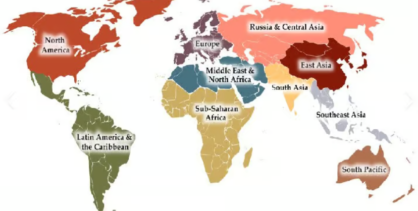 |
National | One country |
| |
National Regional | A portion of a country or region(s) within a country |
|  |
Local | A province, state, city, county, or neighborhood |
| 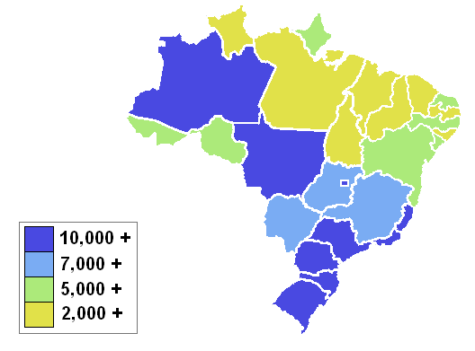 |
Data Aggregation
Aggregation: when geographers organize data into different scales
Ex: census tract, city, county, or country
Regional Analysis
Types of Regions
Formal/ Uniform Regions
United by one or more traits
Political (Brazil), physical (the Sahara), cultural (southwestern Nigeria, where most speak Yoruba), economic (the Gold Coast of Africa, which exports gold)
Functional/ Nodal Regions
Organized around a focal point
Defined by a usually political, social, or economic activity
United by networks of communication, transportation, etc.
Perceptual/ Vernacular Regions
Defined by the informal sense of place that people ascribe to them
Boundaries vary
Ex: The Middle East, Upstate New York