1.2 Geographic Data Notes
Geographers study the why of where
Field Observation includes geographers interacting with maps, taking notes, counting and measuring as well as interviews and GIS (Geographic Information Systems)
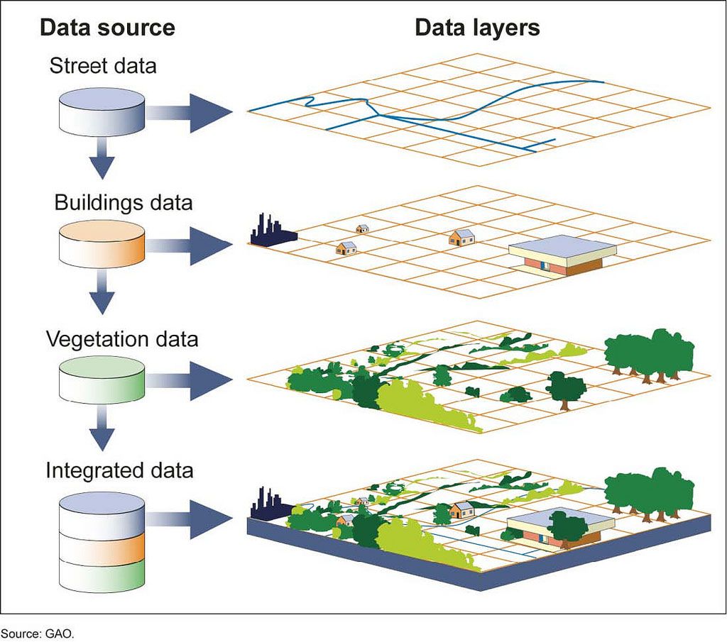
Geographic Information Systems (GIS) is a computer system that collects, stores, analyzes, and displays geographic data.
Remote sensing is information gathered from satellites orbiting the Earth
Online mapping and visualization is the sources that provide online maps for people to analyze data
Field Observation are when someone visits a place firsthand and records information gathered while there
Landscape analysis is studying and describing a landscape
1.2 IMPORTANT VOCABULARY
Landscape Analysis- The task of defining and describing landscapes
Field Observations- Referring to the act of physically visiting a location, place or region and recording, firsthand, information there
Spatial Data- All of the information that can be tied to specific locations
Aerial Photography- Professional images captured from planes within the atmosphere
Fieldwork- Observing and recording information on location, or in the field