
AP HUG Weekly Notes Quiz 9/6/24
A method for collecting geographical data.
A method of collecting geographical data is “fieldwork”. This is where a geographer will visit the site of a geographical location and observe, take notes, and analyze the landscape. This methods allows geographers to note as much detail as they’d like but limits their data to what is visible.
Distance-Decay
When things are far apart, they tend to be less connected.
Time-Space Compression
The shrinking distances between places due to modern and efficent methods of transporation and communication.
Relative-Distance in real world terms
Chipotle is a 5 minute walk down the block from the school.
Latitude lines are based off the prime meridian (true)
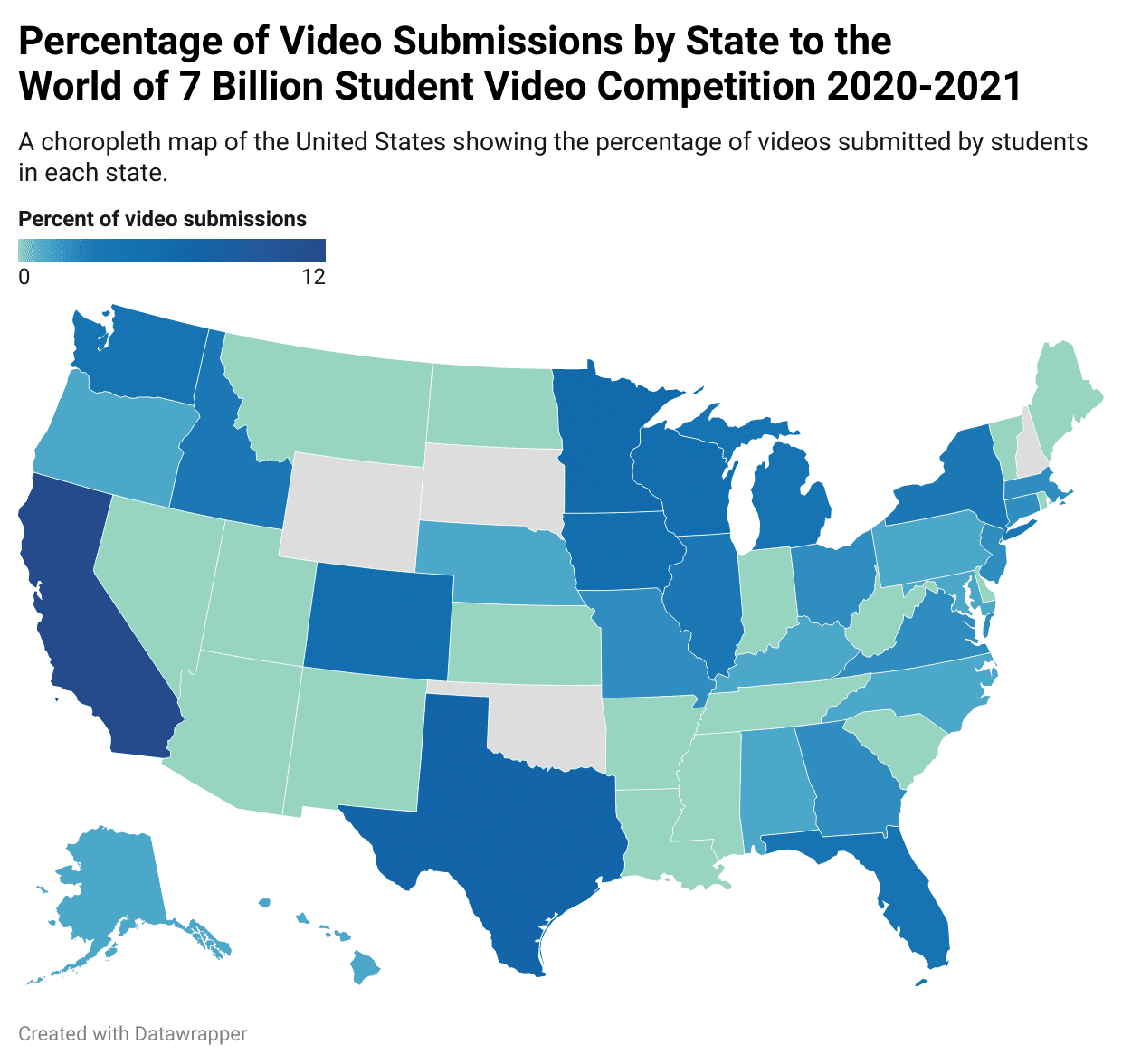
Chloropleth Map (shown below)
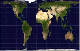
Gal-Peters Projection (shown below)
Map Projections
Not all map protections are used for the same purpose, depending on the distortion of the projection it decides the purpose.
A method for collecting geographical data.
A method of collecting geographical data is “fieldwork”. This is where a geographer will visit the site of a geographical location and observe, take notes, and analyze the landscape. This methods allows geographers to note as much detail as they’d like but limits their data to what is visible.
Distance-Decay
When things are far apart, they tend to be less connected.
Time-Space Compression
The shrinking distances between places due to modern and efficent methods of transporation and communication.
Relative-Distance in real world terms
Chipotle is a 5 minute walk down the block from the school.
Latitude lines are based off the prime meridian (true)
Chloropleth Map (shown below)
Gal-Peters Projection (shown below)
Map Projections
Not all map protections are used for the same purpose, depending on the distortion of the projection it decides the purpose.