Drone Payload, Installation and Applications
Payload: Definition and Overview
Payload is the additional weight a drone or UAV can carry beyond its own structure.
Includes:
Extra cameras
Sensors
Packages for delivery
Impact of Payload on Flight
Carrying a heavier payload expands the potential activities of a drone.
Flight Time Reduction:
Flight time decreases as the additional weight requires more power to lift.
Importance of Thrust-to-Weight Ratio:
A higher thrust-to-weight ratio allows the drone to carry greater payloads.
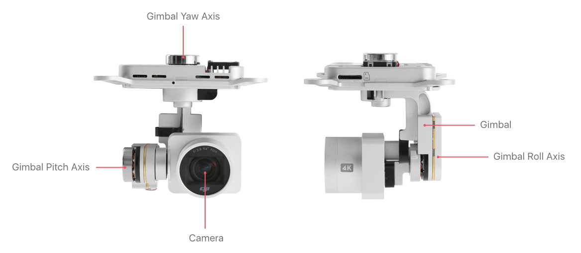
Gimbal Overview
A gimbal is a pivoted support allowing rotational movement around an axis.
Types of Gimbals:
1 Axis (Tilt Axis)
2 Axis (Pan & Tilt Axis)
3 Axis (Pan, Roll & Tilt Axis)
Types of Payload Cameras
RGB Cameras:
Capture standard RGB bands of light.
Useful for orthomosaic maps and aerial videos.
Sensitive to red, green, and blue light.
Multispectral Cameras:
See beyond normal vision using visible and near-infrared light.
Applications include monitoring crop health and soil quality.
Thermal Cameras:
Detect infrared light/heat not visible to the human eye.
Applications of Sensors
RGB Sensors
Used in:
Traffic Monitoring
Crowd Monitoring
Disaster Management
Border Security
Aerial Surveillance
Mapping and Project Monitoring
Multispectral Camera Applications
Specific uses:
Crop health monitoring
Yield estimation
Irrigation measurement
Thermal Camera Applications
Used for:
Solar panel inspection
Powerline monitoring
Wildlife observation
Fire fighting
Pipeline inspection
LiDAR Technology
LiDAR (Light Detection And Ranging):
An active remote sensing technology that uses laser beams to measure distances and create 3D maps.
Application in agriculture and forestry for vegetation inspection.
Uses of LiDAR:
Power Lines Inspection
Building inspections
Mining Topography
Collision avoidance
Air Quality Sensors
Detect particulate matter (e.g., PM1, PM2.5) and various gases (CO, CO₂, etc.) for pollution and industrial monitoring.
Radar Sensors
Millimeter Wave (MMW) Radar:
Operates in the 30 GHz to 300 GHz frequency range.
Essential for collision avoidance and navigation in drones.
Specialized Payloads
Agricultural Tank and Sprayer:
Used for precise aerial application of fertilizers and pesticides.
Megaphone/Speakers:
Enables drones to broadcast messages for public announcements and emergency responses.
Fire Extinguisher Payload:
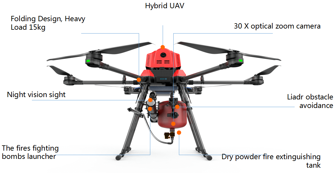
Pressurized Tank & Sprayer
Dry Ball Release (bursts on impact with dry chemicals)
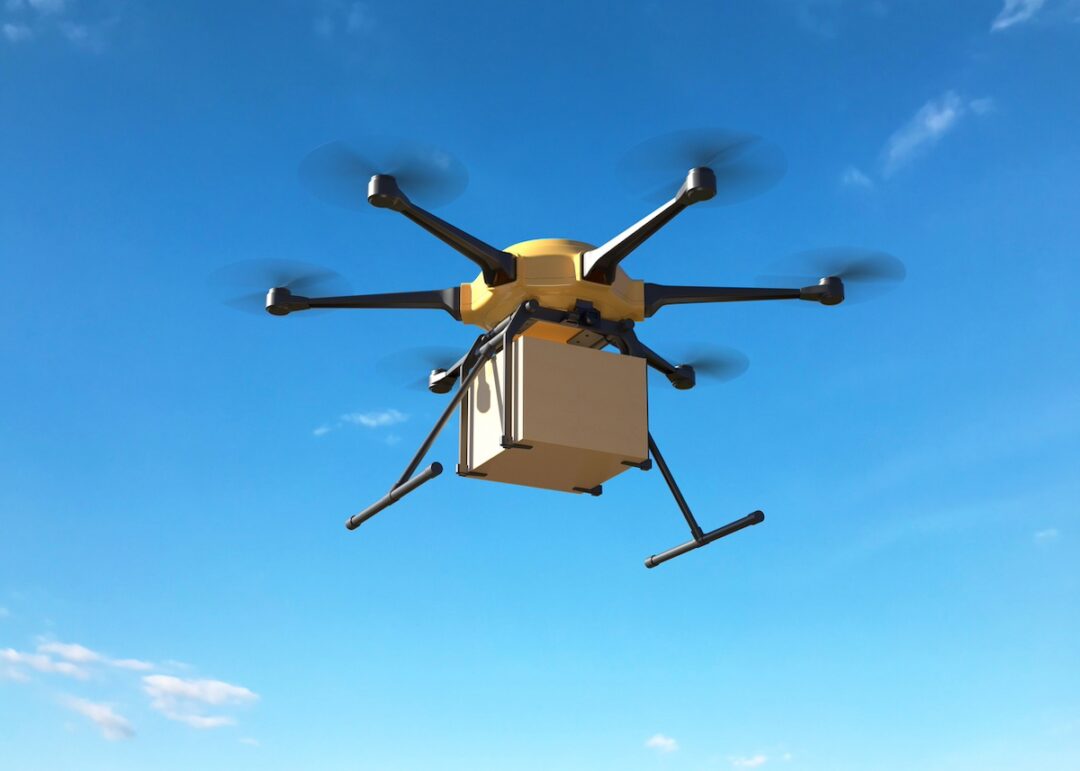
Package Drop Drones:
Designed to transport goods efficiently, including packages, medicines, and food.