Topography and Soil
Spot elevation
uses contour lines to represent the 3D landforms in 2D space (commonly used)
contour line is imaginary - connects all points of equal elevation
DEM - Digital elevation model

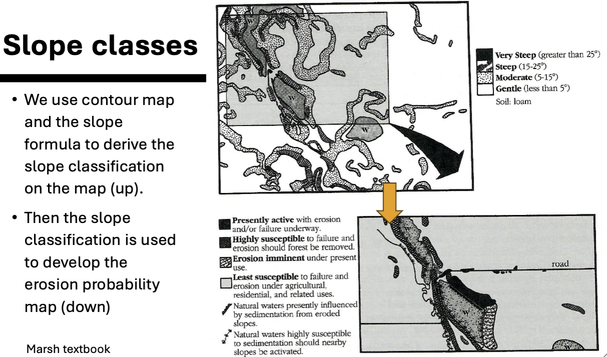
Erosion and Slope Classes
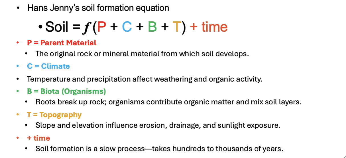
Soil
weathering of rocks and the action of living organism
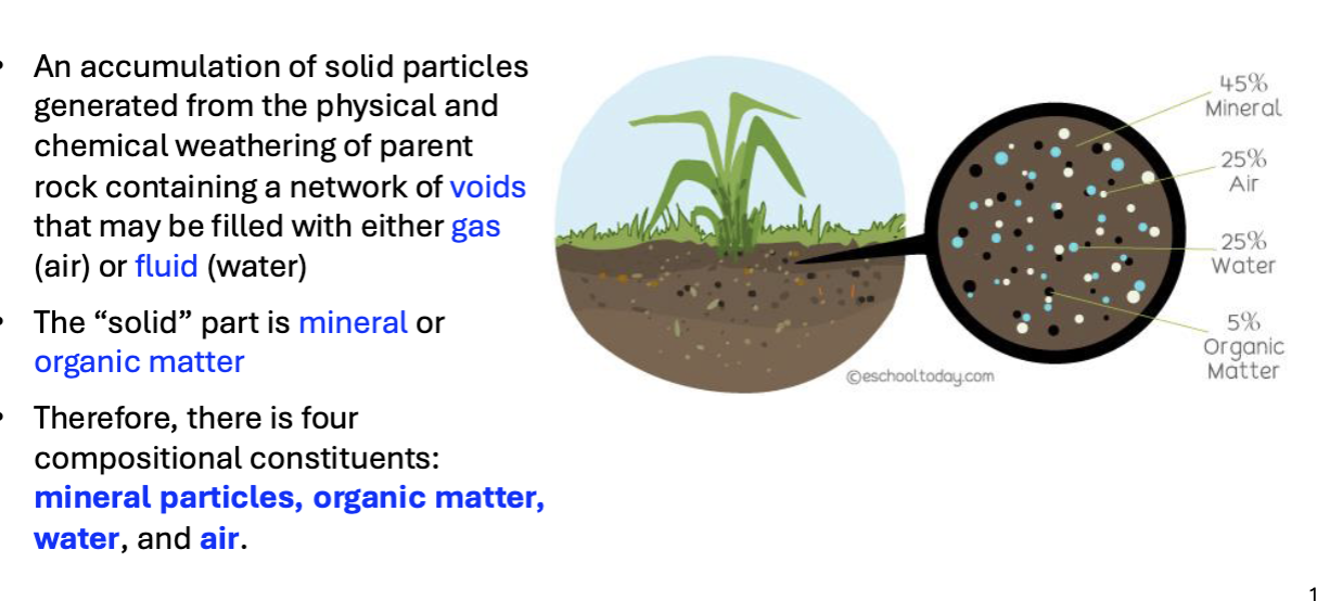
mineral and organic matter
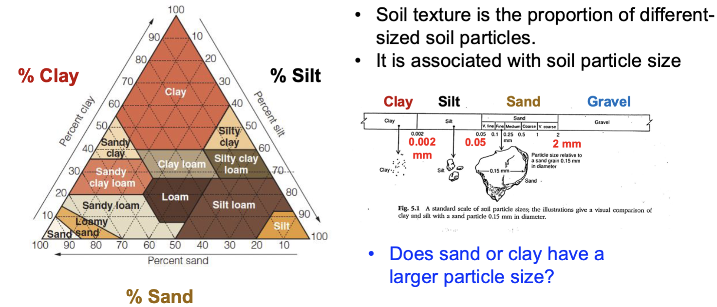
Soil texture is determined by particulate size
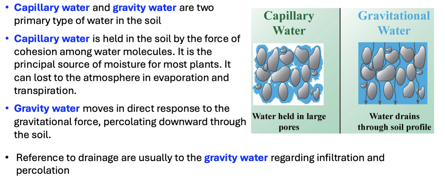
Two types of water in the soil
Moisture Deficit = ET (evapotranspiration) - Effective Precipitation
large moisture deficit = trees lack moisture and are more prone to burn (forest fires)
More small particles hold more water (water holding capacity)
Larger particles have a high bearing capacity
Climate region
• Primarily based on climatic factors like temperature and rainfall patterns.
Ecoregion:
• Considers both climate and the specific plant and animal communities that thrive within that climate, including factors like soil type and topography.