Tuesday Precedent & Massing
Intro
Massing, Policy, and Planning
Volcanic Viewshafts
Find ways to build complexity into our programmes
Develop programmes and massing to work with development envelopes
Next Tuesday first concept design charette to get concepts moving
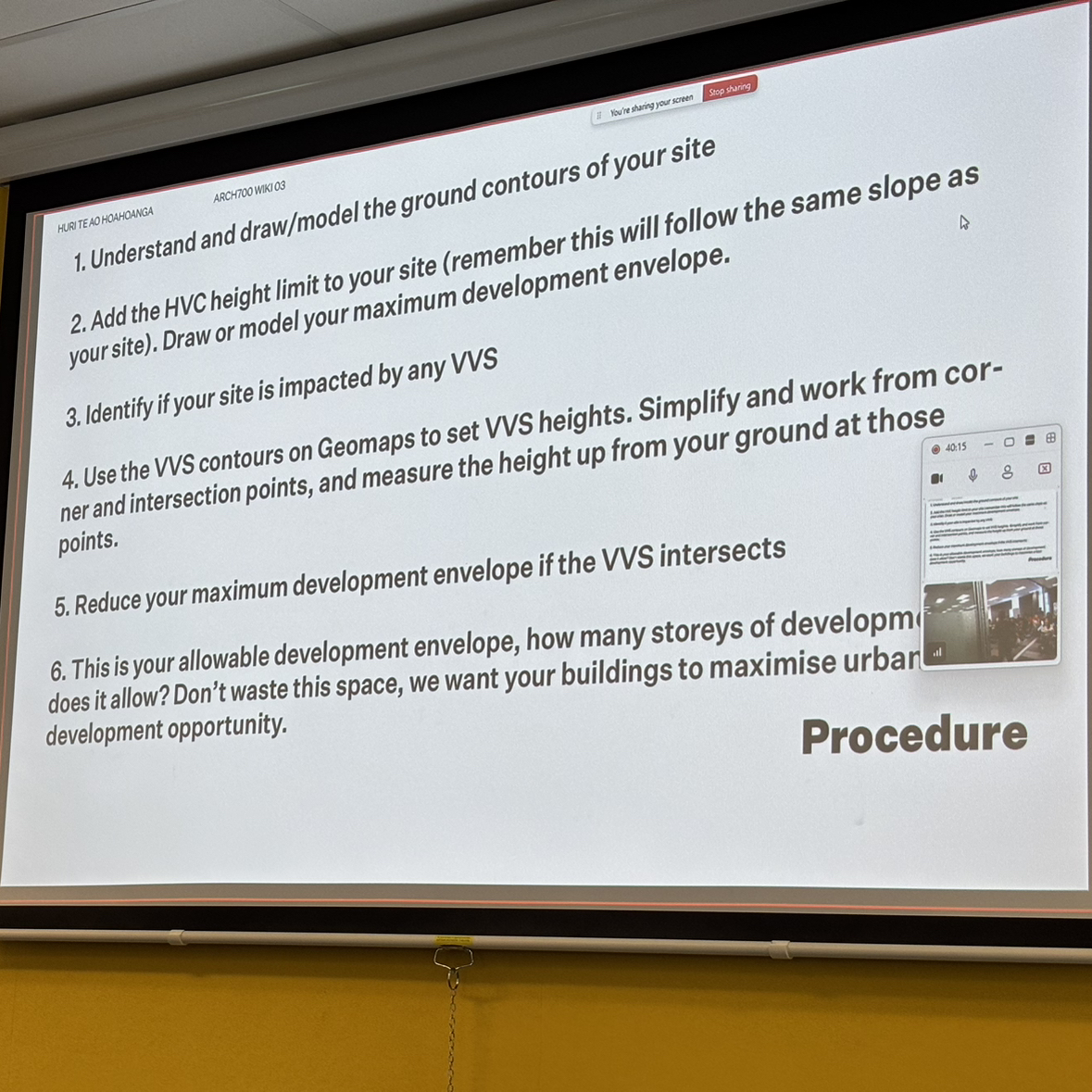
Lecture
Massing involves arragement and composition of building volumes that influence visual and spatial experience
simplified arrangement of shapes on site
figuring out how to organise site
Use Forma or physical blocks
additional relaionships
street/urban space
circulation: how to circulate from city to building and internally
morphology
shading
orientation
National Government Policy
plans shape the way we approach massing
national policy statmenet on urban developemnt
medium density residential standards
increase density algin with 15 min walkable catchment of city and 10 min of transport that
Local policy
Unitary Plan
driven increases in density
organising city into zoning key areas which infers different rules within those zones
Read Unitary Plan 101 (on canvas)
allowed height on a particular site measured frm bottom of building to top
Height variance control
establishes heights that can be developed
understand slope of your site, what contours are like, heigh is projected off the sloped site from both ends (at 0m +15, at 5m + 15m)
Volcanic view shafts
protect views to the maunga from specific locations at tamaki
some can start from locations on the motorway even not even around site
by hvc/vvs will enable to map these views onto your site which cuts into available volume of site
Geomaps > Layers > Plans and Places > Unitary Plan management Layers > Overlays > Natural Heritage > regionaly significant volcanic view shafts & overlay contours
13.5m above the ground following contour line is a view shaft going through site (site is the light grey outlines)
draw from 2 points to visualise it vertically
2 Thicker dark lines starting from gulf, 1 starting from previous roundabout (now existing start of footpath)
If dark line cuts through your site then edge of trianlge volcanic view is cutting from your site causing a step of volume/form for your building
These show height limits, understand slope and contours of your site geomaps and topo model
Check HVC (Height Variance Control)slide on canvas that shows that data
Plan change 120 (coming soon) enables number of houses you can develop in an area so affects residential zones for future
maximise use of available envelope for development opportunity
Tutorial
Precinct collaboration researched about it now sites become individual not collaborative to other sites
Land key actions onto your site
Programmes informed by typology research and how they approach it and their context that they operate in and how they
Collaging existing plans to scale onto your site
What does __ mean to you?
After
Read Unitary Plan 101
Unitary Plan GIS viewer
Site Volume
Reorganising Programme
Precinct Volume