Chapter 16: Streams and Floods
The Hydrologic Cycle
all water that cycles through various reservoirs (groundwater to atmosphere)
the sun drives this cycle from ice-water-water vapor
carries products of weathering
reservoirs
94% ground water / saltwater
76 % ground water / freshwater
1.76% glacial water (cycle changes based on tilt of earth)
Precipitation: water vapor condenses to form rain or snow
Infiltration: precipitation that falls and interacts with the ground, moving through soil and cracks in rocks
Runoff: precipitation that does not infiltrate, moving along the surface (usually by streams)
Evaporation/Transpiration: loss of water through heat from the surface/plants
The Form of Streams
Stream: ANY flowing body of water CONFINED to a channel moving DOWNHILL
river, brook, creek
Channel: main location of flowing water
Valley: area that a stream channel can form. this area will flood
Floodplain: a flat area on either side of the channel; area where normal flooding occurs
Tributary: lesser streams that feed into the trunk of the main stream (MS River has many)
Natural Levees: sediment build-up at the margins of channels caused when a stream overflows its banks
out of the channel is lower velocity so largest sediments drop out
as a stream floods, it builds up its own system to prevent future flooding
Delta: a depositional platform build of sediments deposited in an ocean or lake at the mouth of a stream (MS River Delta)
How are they formed?
a dramatic decrease in velocity - sediments drop out of suspension
Stream Patterns
Meandering streams: characterized by low sediment loads and low flow velocities
flows on very flat floodplains and forms meanders (curves) and oxbow lakes
ex. MS River
point bar: inside of a meander; lowest velocity, so deposition
cut bank: the outside of a meander; highest velocity, so erosion
makes the river’s meanders bigger
meanders get so large that it pinches off PB/CB and oxbow becomes a lake while the stream just cuts through to be more efficient.
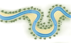
Oxbow lake: a meander cut-off that is separated from the stream, but still holds water.
stream enlarges cut bank
meanders get closer together
stream cuts new channel (usually during a storm)
this isolates the old channel as a lake
oxbow lakes are not permanent… it eventually fills in.
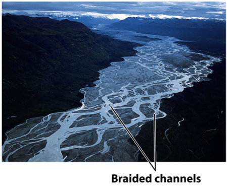
Braided streams: high sediment loads and high flow velocities. stream has many channels, divided into an interlacing network
often form in rivers with large volumes of sediment (ex. at the edge of melting glaciers, or mountain valleys) or arid regions (too much sed, not enough water)
Streams as Geosystems
Flood: increased discharge due to imbalance between inflow and outflow
Flood frequency curve: probability that a flood with a certain discharge will occur in any given year (m³/s)
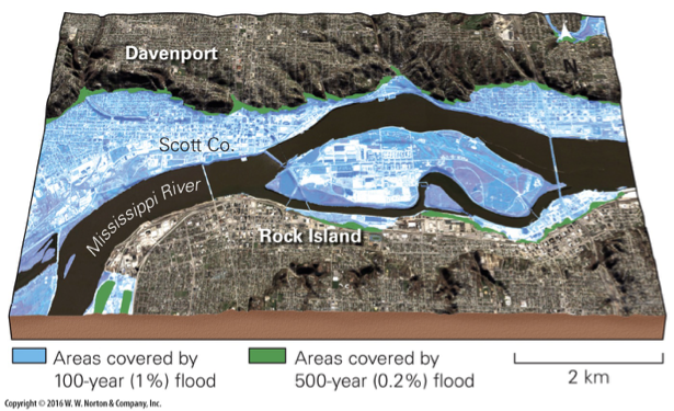
Causes of Flooding:
excessive rainfall
heavy snow melt
human development on flood plain
storms (hurricanes)
Controlling flooding:
upstream dams or tanks that trap water and release it slowly
artificial levees keep water in channel to certain level
walls of stone/concrete on channel banks to reduce erosion (cutbanks)
bypasses that divert water to the side channel out of main channel