Huge - U1 Review
Topic 1: Map Projections and Types/ Intro
Basics
geography: greek discovery
geo: earth
graphy: writing
physical: physical environment (weather and climate)
human: humans and human activities
Geography = Why of where
why they are they located in a specific spot, distribution, patterns?
Influences? Expenses?
historians = look at past
geographers = look at space to understand place
immigrants = people coming in
emmigrants = people leaving
Map Types
reference maps: refer to general information about places
political: human-created boundaries, basic maps of countries, states, cities, capitals
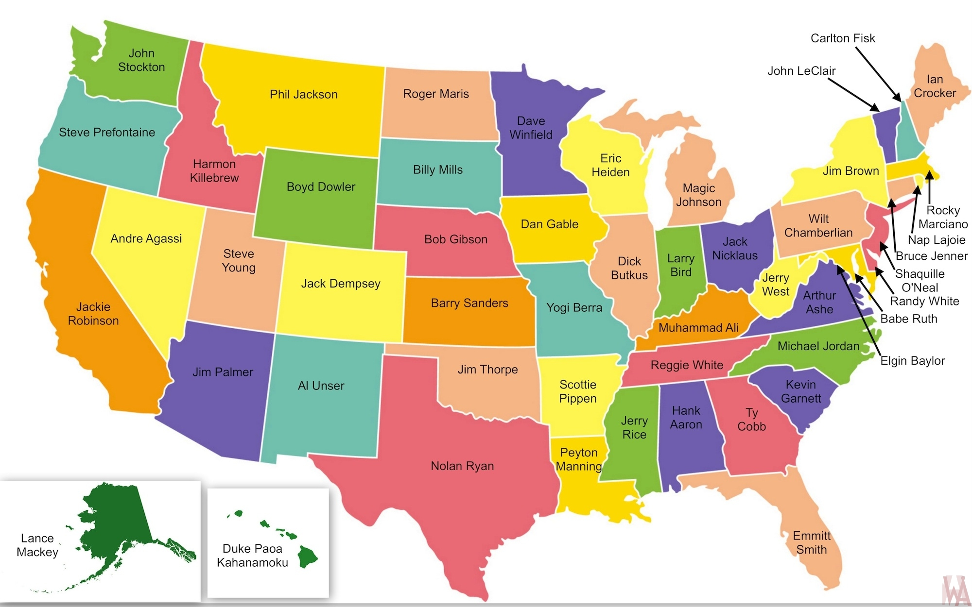
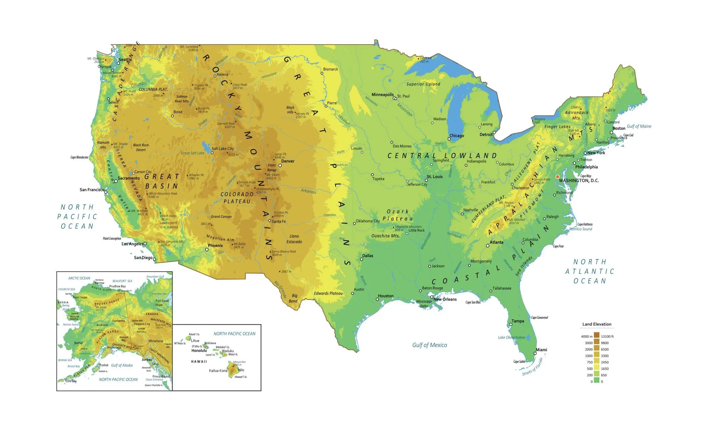
physical: natural features such as mountains, rivers, deserts
road: location of geographic areas, absolute location, highways, streets, etc, gps
Thematic maps: spatial aspects of information, how information is displayed, themes
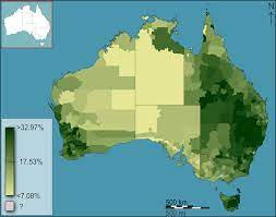
choropleth: uses different colors (usually one color with many shades) to show distribution of data
the darker the color, higher value
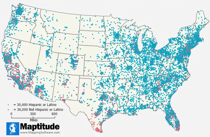
dot: dots that represent a specific quantity of something
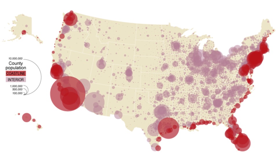
graduated symbol: has different shapes of different sizes to indicate different amounts of something (usually circles)
larger = more
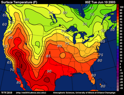
isoline: map that shows liens to connect points of equal values across space
lines closer together = rapid change
lines further apart: same value
elevation
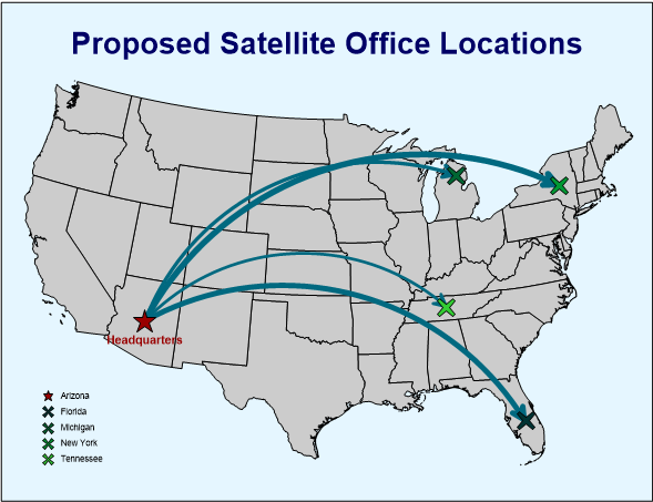
flowline: thickness of lines showing movement of goods, people, etc.
thicker = more
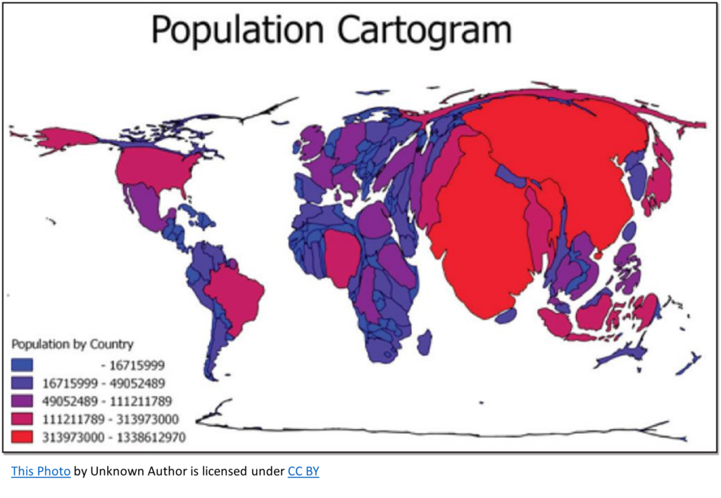
cartogram: assigning data by size, distortion, enlargement based on data
Absolute and Relative Location
absolute location: precise spot where something is located, addresses
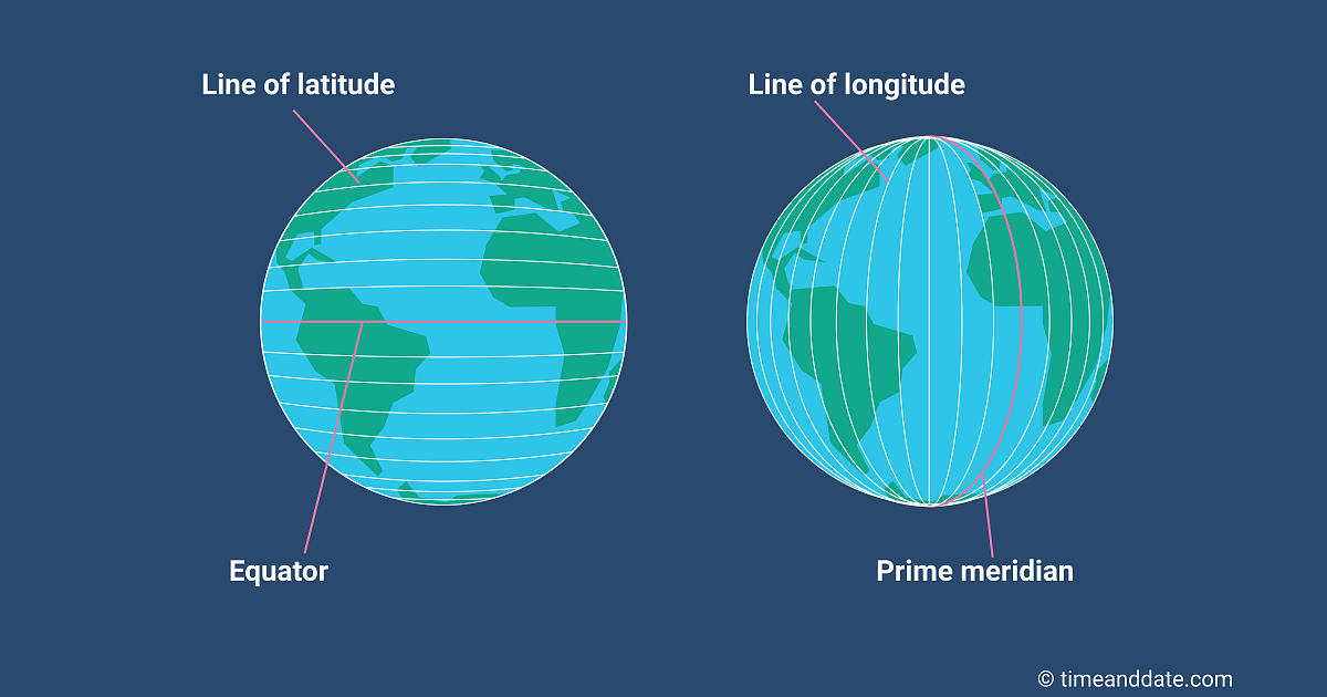
grid system: uses latitude and longitude
latitude: north and south of 0 degrees, horizontal
parallels
equator: 0 degrees latitude
temp zones
not equal in length, get shorter as they reach north and south poles
longitude: east and west of 0 degrees, vertical
meridians
equal in length because they meet and touch
prime meridian: 0 degrees longitude, Greenwich England
international date line: 180 degrees longitude
time zones, 15 degrees apart = 1 hr
KNOW HOW TO USE TIME ZONES …
relatsive location: where something is located in relation to other things, according to other things
orlando is located north of miami
not exact
need to know other location in order to know the other
able to change
spatial interaction: connections, contacts, movement and flow of things between places; travel time
Topic 2: Map Projections
Map Projection Basics
map projection: taking the 3 dimensional Earth/globe and transferring it onto a 2 dimensional surface, a map.
cartography: imperfect science of map making
distortion - during this process, gloves are transferred with grids
globe does not have perfect squares like flat ones
new image will ALWAYS be distorted and inaccurate
all projections are always distorted but atleast one part of SADD needs to be preserved or kept in the new image
SADD: shape, area/size, distance, direction
Map projection perspective models: cylindrical, conical, planar
interrupted maps: wedges/missing pieces in map that try to remove distortion
un__i__nterrupted maps: have no breaks in them burt have more distortion
Map Projection Types
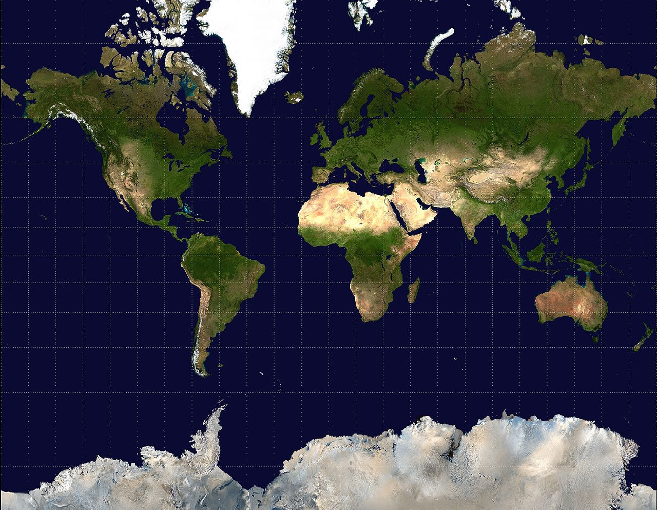
__mercator: t__he one we see the most (in the u.s.)
cylindrical
used for direction and navigation
strengths: directions are accurate, shapes are accurate
weaknesses: sizes are inaccurate, land near poles are large
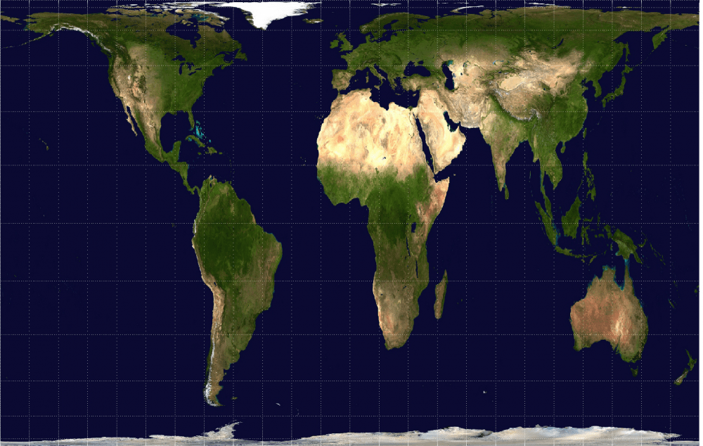
Peters
cylindrical
spatial distributions relates to area
sizes are true
weakness: shapes inaccurate near poles
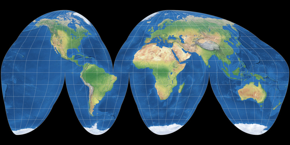
goode-homolosine
interrupted
spatial distribution
area and shape kept
weakness: interrupts oceans
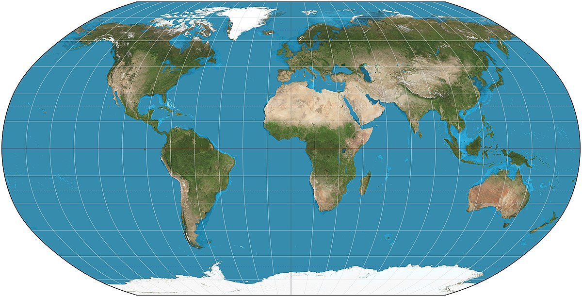
robinson- “compromise map”
minimizes distortion
size accurate
ocean size accurate
weakness: antarctica large and greenland flattened
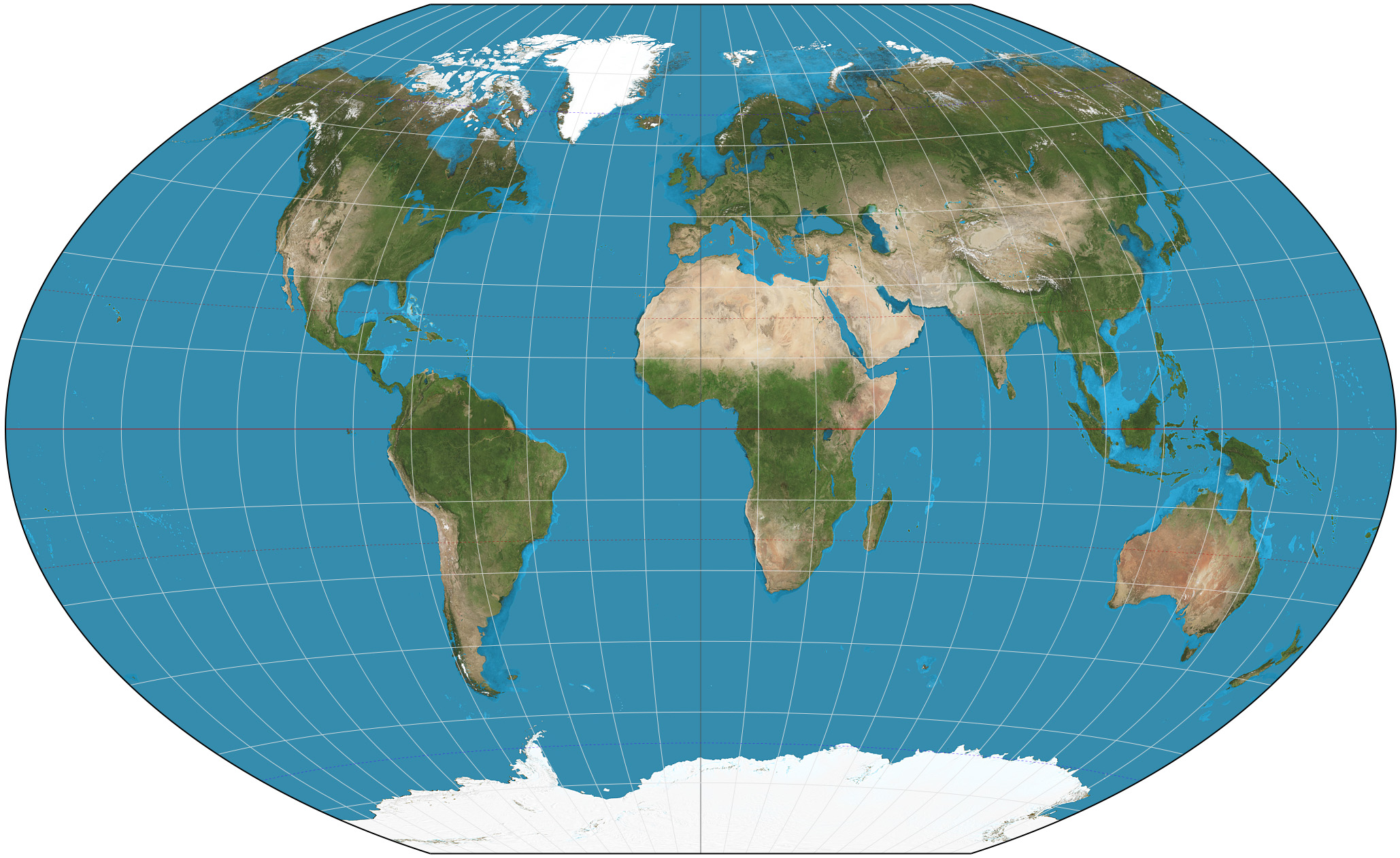
winkel tripel
shows little distortion to land distance and direction
weakness: north and south poles distorted, long. and lat. curved
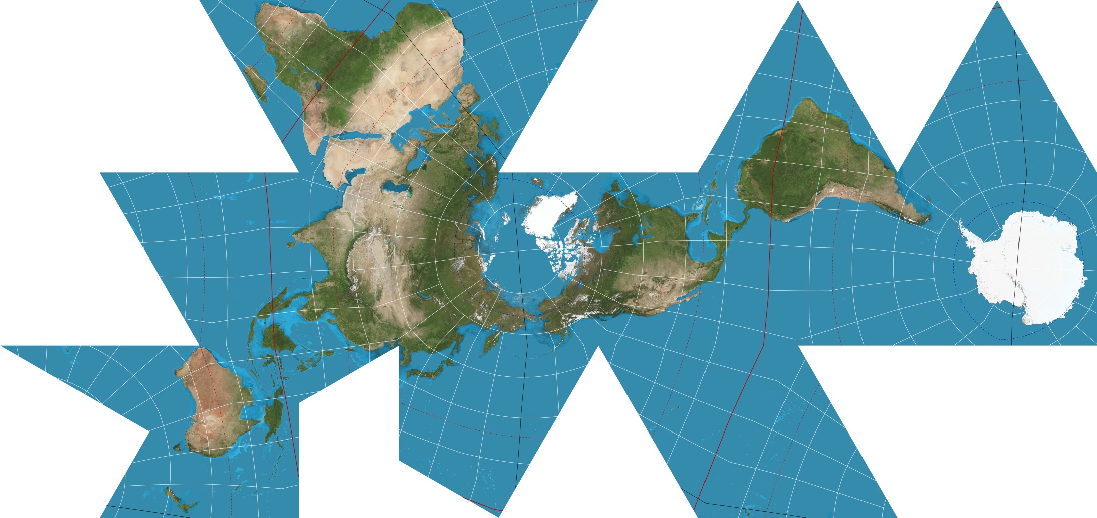
fuller
interrupted map
keeps size and shape of land masses, doesn’t interrupt them
disorienting, difficult to use, doesn’t use cardinal directions
Topic 3: Geographic Data
Data is gathered by fieldwork/observations
fieldwork: act of a person physically visiting location and recording firsthand information there
such as: written accounts, reports, documents, interviews, photographs, etc.
The US Census
mandated by constitution
allows the house of reps to add more seats according to growing or decreasing population
funding of towns/cities/counties (law enforcement, schools, hospitals, etc.)
business use: allows them to know where to build their business
Geospatial Technologies
geospatial technologies: used by businesses, organizations, people, and the gov. to make decisions
advanced tech makes this easier
Geographic Information Systems (GIS)
takes lots of data from satellites (drones), stores it and analyzes it
display sit onto maps and has layers (thematic and physical)
used for analysis of crime data, pollution, build planning
basically google maps
patterns and trends
Satellite Navigation Systems/Global Positioning System (GPS)
satellites orbit earth and give information to gps receivers
absolute location
Aerial Photography
professional pictures by planes and or drones
Remote Sensing
from a distance
uses cameras and other sensors of aircrafts and or satellites that orbit earth above atmosphere to collect images of the surface
for weather and envir. changes
Other Stuff (??)
landscape analysis: studying and describing landscape, with goal of assessing the impact of humans there
helps geographers plan for use or restoration
impact we’ve had on an area
quantitative data: straight up facts, can’t be argued, info that is measured and recorded in numbers
used with GIS
qualitative data: interviews, documents, visual observations, open-ended
harder to analyze because it includes peoples’ pov.
bias
Topic 4: Spatial Concepts
five themes of geography: location, place, movement, human environment interaction (HEI), and region
Place
sense of place: feeling at home in a place that you’ve been to (multiple times), infusing emotion or memory
able to change
placelessness: removal of sense of place, location that doesn’t look unique anymore, everything looks similar to other places, franchise
p__erception of place:__ haven’t been there before, assumptions and perception of a place through media
landscape (natural v cultural)
cultural landscape: imprint of human activity on landscapes
Carl Sauer
sequent occupance: sequential adding of layers by different cultures over time, having some impact on the next culture
Location
absolute and relative
toponym: the official name of a place/location
site/physical landscape
site: actual location of settlement, physical characteristics specific to area
climate, water, wildlife
situation: location of a place relative to surrounding other places, the benefits of living there
accessibility, other location benefits, how close they are to materials
Movement
movement/migration of goods, people, and ideas
intervening opportunity: closer places that are alike to sites farther away diminishes attractiveness/visits of that place, for convenience
ex. Chinatown and China
Time-Space Compression: the processes that cause relative distance/travel times between places to grow closer and smaller
components - transportation and communication
ex. it took days to travel to another country but now you can travel there by plane in a few hours
Globalization: places and locations feeling closer, more connected through technology, socially and economically, internet eliminates social space
distance decay: when you are closer to people, the more connect you are, as you grow farther from each other in physical distance, the less connected you are
ex. cell towers
diffusion: characteristics that spread from one place to another through space and time (goods, people, ideas)
spatial interaction
hearth: where characteristic begins, it’s origin before it spreads
relocation diffusion: people move from areas and bring their culture and traditions from their origin
expansion/migration diffusion: culture remains at origin/hearth, and spreads into surrounding areas
contagious: spread from place to place rapidly due to close contact, regardless of their identity
ex. virus, gossip, news, internet
hierarchical: transmission of trend/thing from place to place due to level of interaction, higher social status starts with it and passes it down to normal people
ex. ice bucket challenge
reverse: when culture spreads from bottom of hierarchy to higher part of hierarchy
ex. walmart and the gossip
simulus: spread of idea to make innovative product
technology, transportation, improvement
ex. languages: japanese and korean take some similarities from chinese
+ HEI and Regions
Topic 4: HEI and Scales of Analysis
Human Environment Interaction (HEI)
Human Environment Interaction (HEI): relationships between people and environment, how people adapt and change it
Cultural Ecology: how humans interact or adapt to environment
Environmental determinism: old belief that climate and landforms shaped human behavior and cultural development
justified racism and imperialism
people in colder climates (england) were more productive and awake while people in warmer clients (like Africa) were more lazy and not productive because of the heat
why people vacation in layed back tropics and people are more active and walk in england
environment determines culture
Environmental possibilism: modern belief that even though the environment limits humans, humans are meant to justify and modify land due to human needs, is the role of human culture
panama canal, vegas
environment influence each other
Map Scales
Scale: ratio between size of things on maps and in the real world,
a hand-held map is not the real size of earth
Types of Map Scales
cartographic: the way the map communicates the ratio of the size and what it represents
words: one inch = ten miles
ratio: 1/20,000 (1 uit on the map = 200,000 units on ground)
line: length of line indicates distance on map
small scale: large area, not much detail (zoom out)
large scale: small area, lots of detail (zoom in)
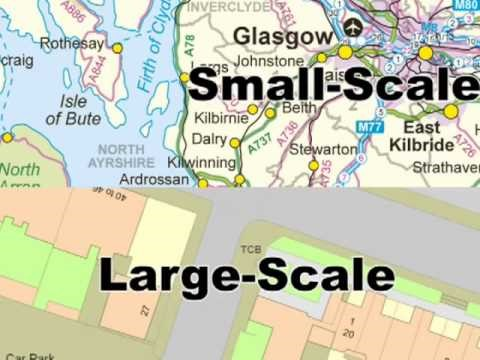
geographic scale/scale of map/aka relative scale: the amount of land/territory that map shows
global~~:~~ shows entire world map
local scale: cities
global, continent, national/state, local
Scales of analysis
scale of map is the same, but how information and details are shown can be different, how it is dividing data
global, regional, national/state (country), sub-state (state in u.s., province in other countries), city/local, census tract (a neighborhood)
how it is written:
scale of the map: _
scale of analysis: _
Topic 5: Regional Analysis
dividing the world into different sections
regions: based on one or more of their unifying/same characteristics or patterns of activity
formal
functional
vernacular/perceptual
can be transitional, contested, overlapping
up for debate
Formal
unified with one or more specific traits, formal
economic
same currencies, trades,
social/cultural
people and what they identify as, race, religion, languages
political
states and capitals, president?,
environmental
physical features, weather, landforms/scapes
Functional
organized around central node/focal point/starting point (ex. school buses), relationship based on economics, travel, communication
cities, schools, ports, transportation/service areas
Perceptual/Vernacular
based on ppls’ perspective/assumptions/perception of a location
informal, identities
how other places view them