measuring physical and biological factors
Physical factors
Microclimate/weather
Temperature
Humidity
Rainfall
Wind speed
Altitude
Latitude
Substrate characteristics
Type
Texture
Component
Temperature
Water characteristics
Temperature
Depth
Flow
Suspended solids
Inundation
Turbidity
Habitat features
Size
Shape age
Shelter
Inclination
Instability
Run off
Natural disturbance
Landslip
Flood
Fire
Management
Landscaping
Chemical Factors
Substrate characteristics
pH
Oxygen
Salinity
Organic content
Chemical elements
Water characteristics
pH
Oxygen content
Ammonia
Salinity
Conductivity
Chemical elements
Rainfall
pH
Sulphur dioxide
Nitrogen oxide levels
Nutrient levels
Nitrates
Phosphates
Sulphates
Calcium
Magnesium
Silicon
Micronutrients
Management
Liming
Fertilising
Detoxification
Biological factors
Food for heterotrophs
Seasonal availability
Quantity
Quality
Accessibility
Competition for resources
Space
Light
Food
Mates
Death and disease
Predation
Parasitism
Disease
Exploitation
Removal of pests
Vegetation features
Sward height
Diversity
Structure
Patchiness
Habitat features
Type diversity
Structure
Species features
Invasive species
Algal blooms
Disturbance
By humans
By animals
Management
Species removal
Species (re-) introduction
Habitat reclamation
Habitat rehabilitation
Habitat stabilisation
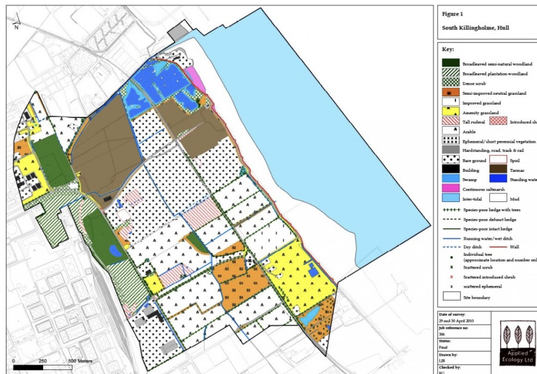
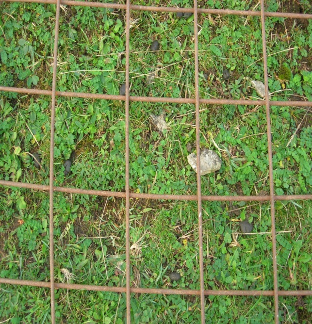
Habitat mapping
The method uses a standard habitat classification system
with each habitat type being mapped according to a standard colourpalette and mapping codes.
details of the habitats present and their botanical character are recorded in the form of habitat ‘target notes’
These are shown as numbers on the Phase 1 map and are cross-referenced to detailed descriptions of the habitats and plant species present in these particular location
Target notes are recorded in strategic locations across the survey area in order to provide details of both typical and unique areas of semi-natural habitat, as well as other important habitat/biodiversity features, including those too small to map accurately in the field.
Monitoring microclimactic variables
Climatic conditions crucial in development of organisms
Temperature-many animals avoid climatic extremes.
Wind speed-influence transpiration. Some can be drying others can be cooling
Tools such as weather stations, thermometers and anemometers
Monitoring water
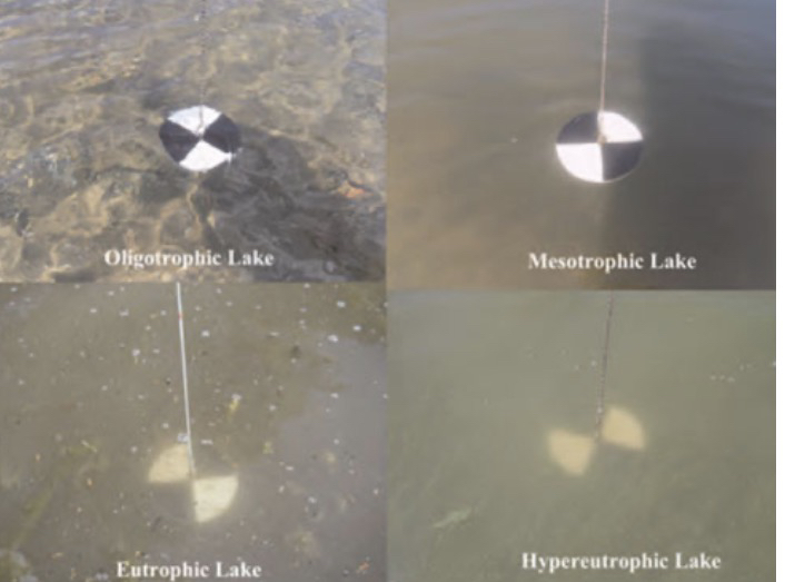
Secchi disk
Chlorophyll a concentration also measured
Other physical attributes
Dimensions
Aspect
Topography