Chapter 4 Angles and Directions
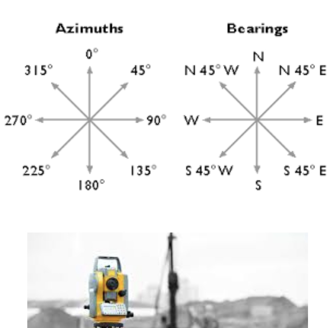
Azimuths and Bearings
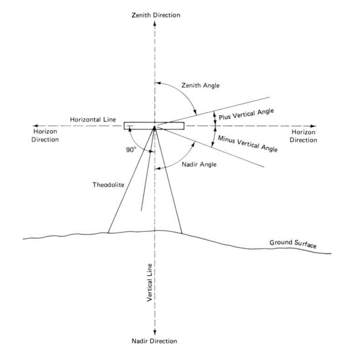
Types of Vertical Angles
Vertical Angles: Angles associated with the observer's horizon.
Zenith Angles: Angles measured above the observer.
Nadir Angles: Angles measured below the observer.
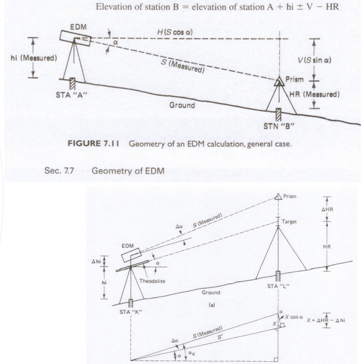
Vertical Angles, Slope and Elevation
If the Height of the Instrument = Height of the Prism
If the Height of the Instrument ≠ Height of the Prism
Types of Horizontal Angles
Interior Angles: Angles formed inside a polygon.
Exterior Angles: Angles formed outside a polygon.
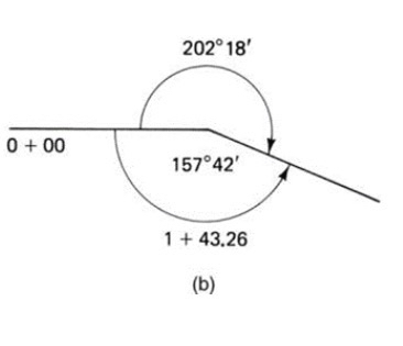
Deflection Angles: Angles related to the change in direction of a line.
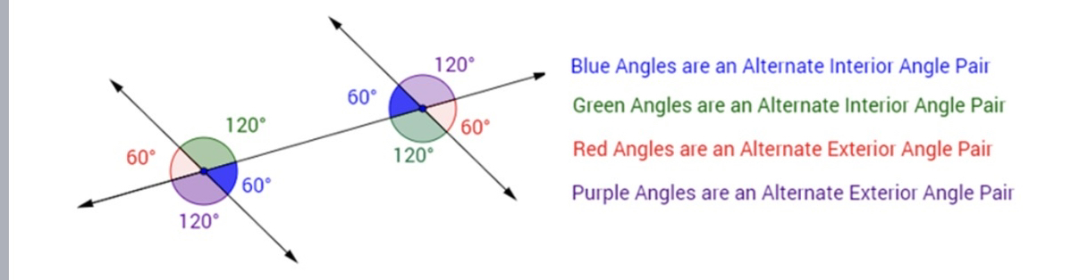
Alternate Angles and Supplementary Angles
Closed Traverse
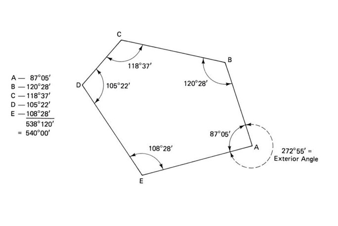
Definition: A traversal where the start and endpoint connect to form a closed loop.
Sum of Interior Angles:
Formula:
Where ( n ) = number of sides.
Open Traverse
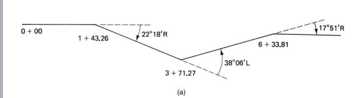
Definition: A traversal that does not close back onto the start point.
Example measures:
Directions: Azimuth
Directions: Bearings
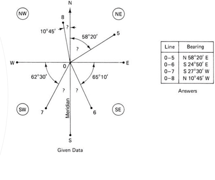
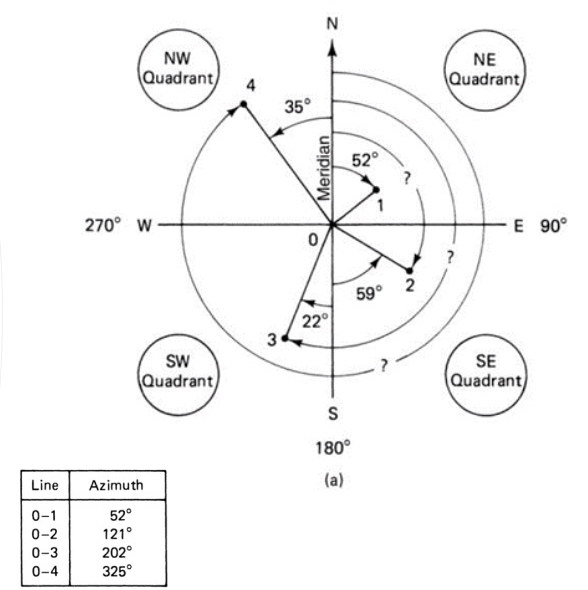
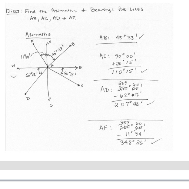
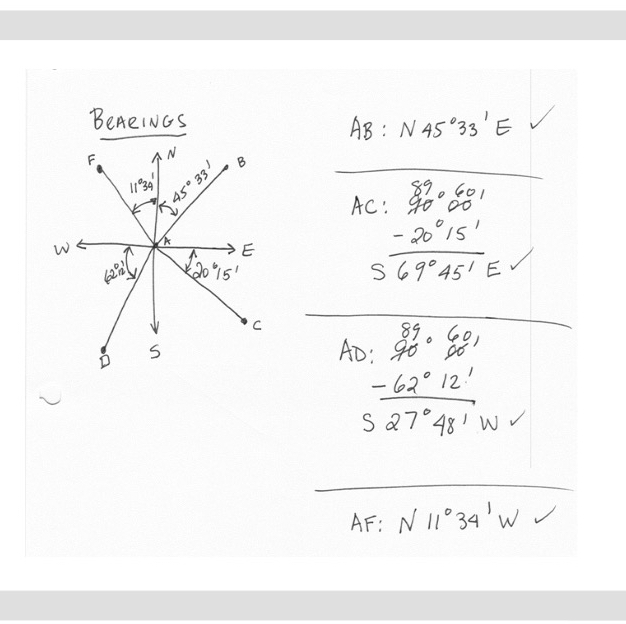
Finding Azimuths & Bearings
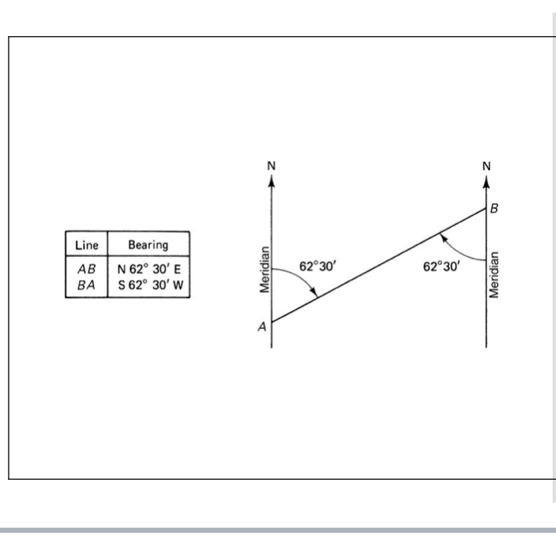
Reverse Bearings & Azimuths
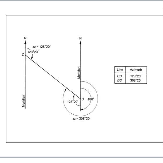
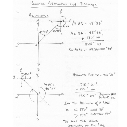
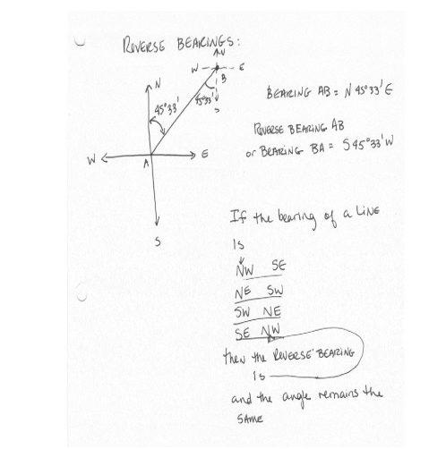
Converting Azimuth to Bearings
To Convert Azimuth to Bearing:
NE Quadrant: Bearing = Azimuth.
SE Quadrant: Bearing = 180° - Azimuth.
SW Quadrant: Bearing = Azimuth - 180°.
NW Quadrant: Bearing = 360° - Azimuth.
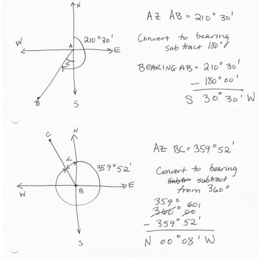
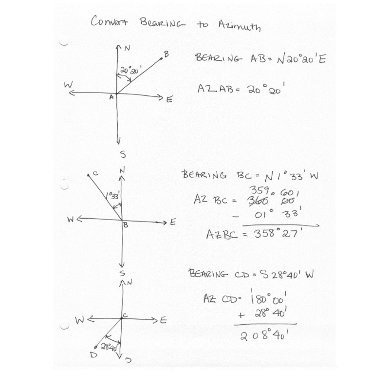
Converting Bearing to Azimuth
NE Quadrant: Azimuth = Bearing
SE Quadrant: Azimuth = 180 - Bearing
SW Quadrant: Azimuth = 180 + Bearing
NW Quadrant: Azimuth = 360 - Bearing
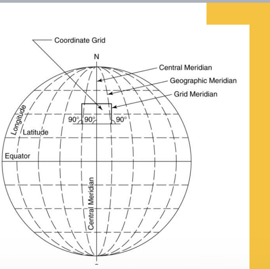
Meridians as a Reference for Angles
Types of Meridians:
Geographic Meridian
Magnetic Meridian
Grid Meridian
Coordinate Grid
Geographic: Reference lines used for understanding longitudes. The Central Meridian is critical in defining the geographic landscape.
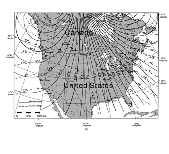
Magnetic Declination
Magnetic Declination: The angle that indicates the difference between magnetic north (measured by a compass) and true north (geodetic north).
Isogonic Map: Shows variations in magnetic declination globally.
Isogonic Lines: Lines reflecting changes in declination over time.
Setting up a Total Station
Total Station: Instrument used in surveying that combines an electronic theodolite with an electronic distance measuring device. It is crucial for making precise measurements in surveying tasks. Procedural setup involves calibration to ensure accuracy.