River landforms Waterfall formation
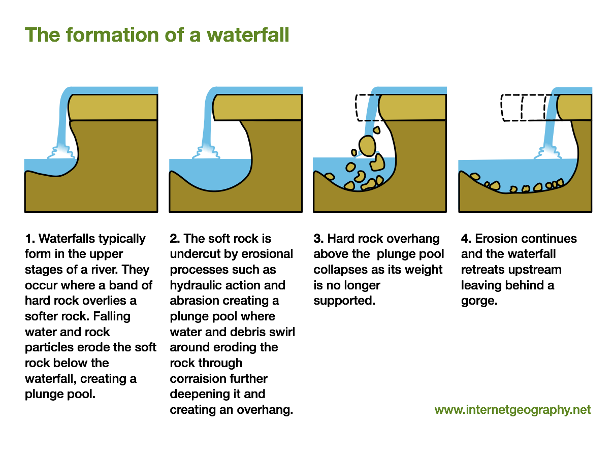
A River flows over hard rock overlaying soft rock. The soft rock is eroded at a faster rate as the River flows forming a step in the River bed. Hydraulic action and abrasion deepen the river bed creating a plunge pool and undercuts the hardrock creating an overhang. Eventually the notch deepens and the hard rock becomes unsupported and undercut. The hard rock eventually collapses into the plungepool the extra material is broken up and used to further abrade and erode the bed. The processes of erosion continues further eroding the notch and plungepool and the hardrock becomes undercut and collapses again causing the Waterfall to retreat upstream and leave behind a steep sided valley or gorge. Examples include Niagra and Angel falls.
Rapid formation
Areas along a river where water flows faster and more turbulent.
bed material is more resistant to erosion than downstream. It becomes shallower more rocks exposed. As water splashes over the rocks air bubbles are mixed into it and portions of the surface aquire a white colour this is known as whitewater. Eg. Zambezi or the Nile
Oxbow lake formation
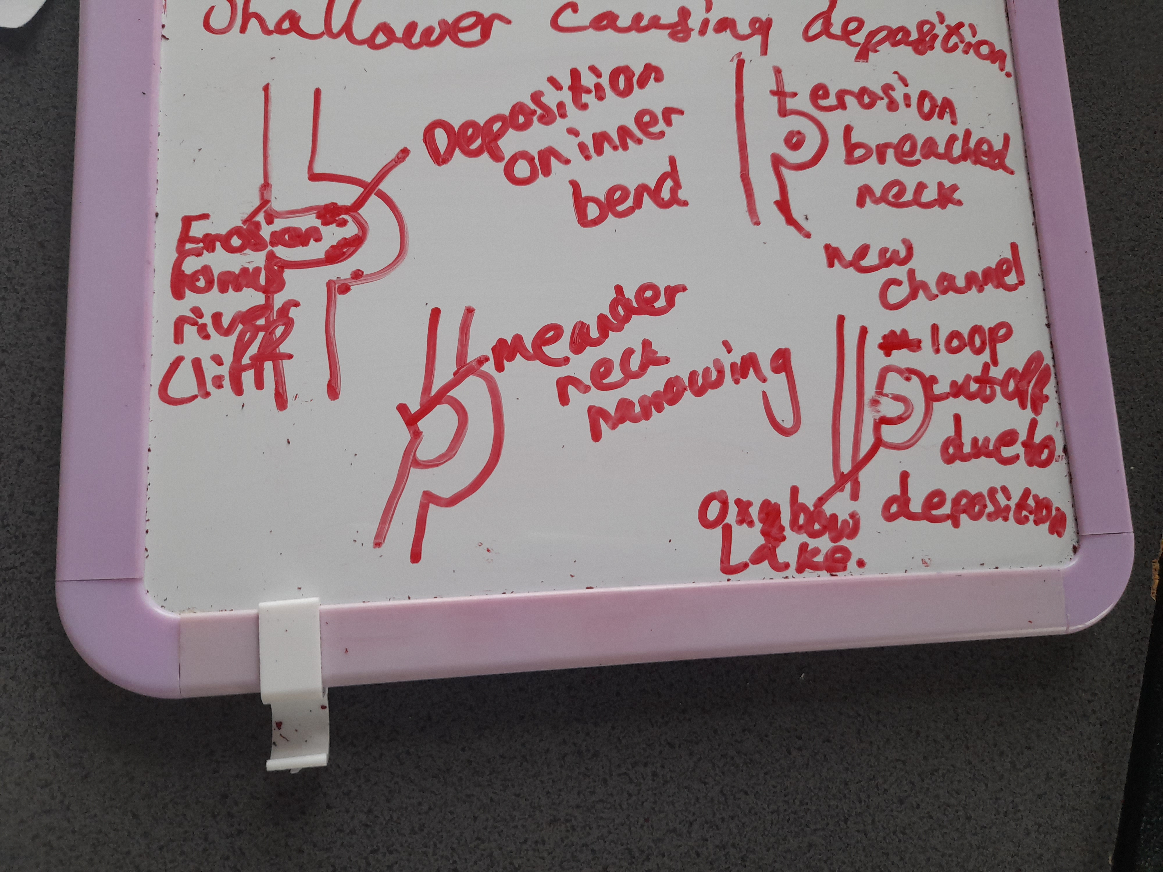
A river flows fastest on its outside bend and slower on its inside bend. Meandering river deposits material on the inner bend as it does not have the energy to carry it. Erosion occurs on the outer bend forming a river cliff, (rocks, soil are eroded eventually forming a cliff). THis causes the river to meander, lateral erosion and deposition continues to form new banks. The neck of the meander narrows as erosion on either side narrows the neck of land between. Erosion possibly during a flood breaches the neck of the meander, some of the rivers discharge follows the new channel downstream. Eventually the meander loop becomes cut off from the main channel due to deposition of soil and sediment and the oxbow lake is formed. The oxbow lake is gradually filled in with sediment and plant growth leaving a meander scar on the floodplain.
Common in middle or lower course due to high energy and high discharge.
Floodplains
Affected by lateral erosion of meanders. When the outer edge meets the edge of the valley, erosion cuts into it widening it. Meanders erode across a broad belt of land. As they migrate downstream they widen the entire valley. Floodplains are covered in point bar deposits and alluvium from floods. When the river reaches its channel carrying capacity after a period of high rainfall or snowmelt, inundation occurs. As water leaves the channel it slows, there is a drop in energy resulting in deposition. Sand and gravel settle first. Silt further away from the channel. Clay once water infiltrates or evaporates. After successive floods a thick alluvial deposit is formed giving an upward convex shaped profile.