Drone Data & Analysis Notes
Introduction to Drone Data & Analysis
Principles of Observation and Inference
Observation and inference are reliant on:
Interpreter's training
Experience and biases
Visual and analytical abilities
Human interpretation remains a key component in remote sensing applications.
The understanding of basic photo interpretation is crucial.
Photo Interpretation
Definition: The examination of aerial photographs to identify objects and assess their significance.
Observation yields raw data; inference is the logical process that enables interpretation.
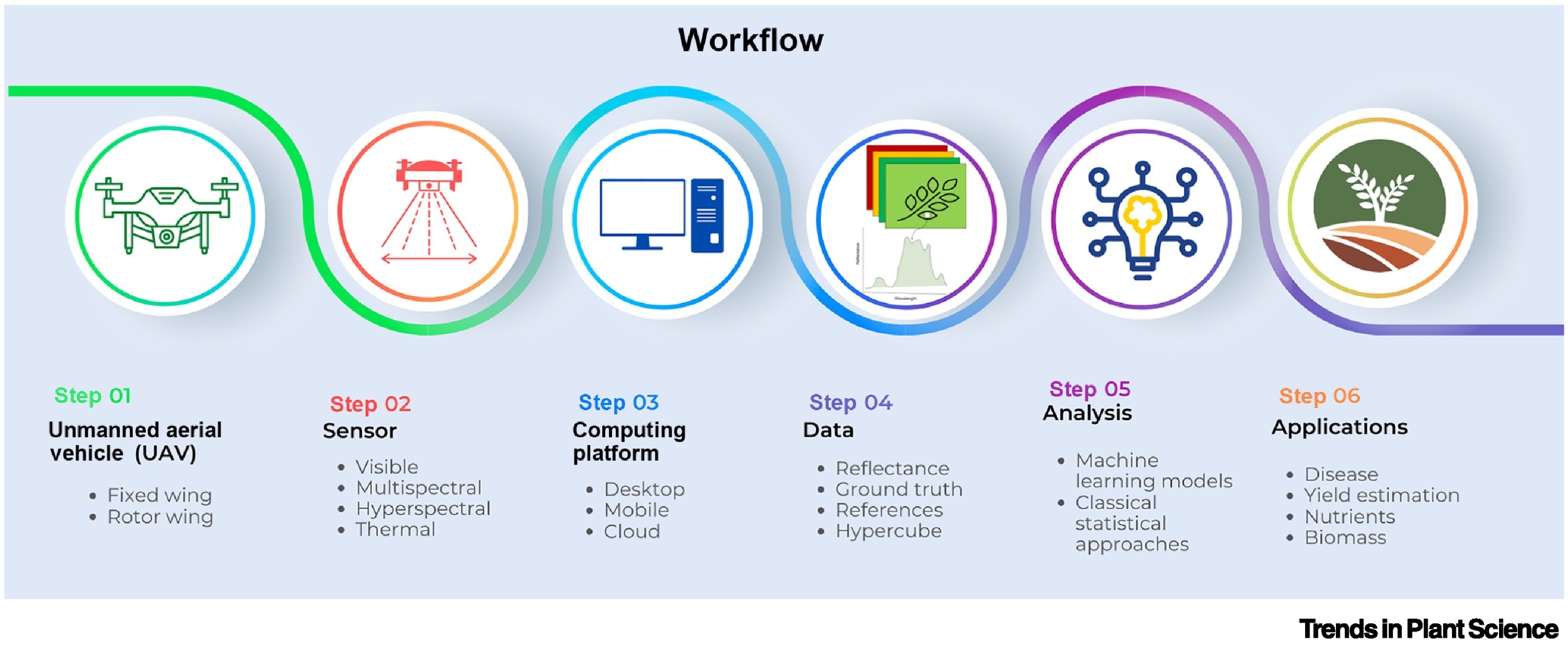
Drone data ; the collection of information captured by drones equipped with sensors and cameras, allows for enhanced analysis and monitoring of landscapes, infrastructure, and environmental changes.
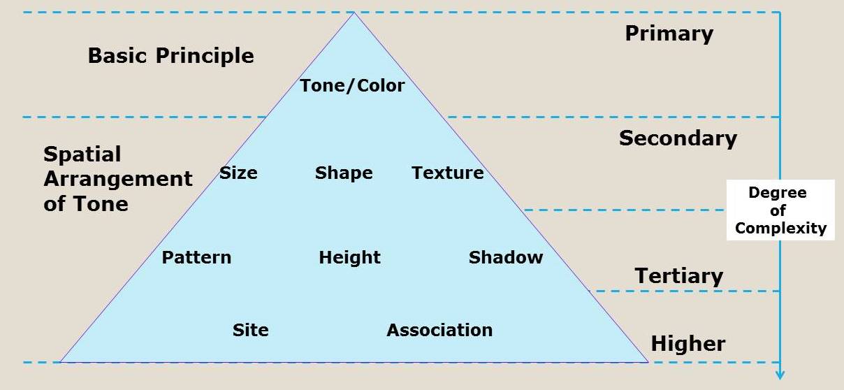
Key Elements of Image/Video Interpretation
Shape
General outlines of objects:
Road: Linear
Building: Polygonal
Trees: Random
Size
Space occupied by an object helps in distinguishing between various objects without measurements.
Example: Comparing the sizes of pyramids like Menkaure and Khufu.
Shadow
Influenced by the sun's position; shadows are essential for estimating an object's height, aiding in recognition.
Color
Indicates light reflection:
Water appears blue
Sand appears brown
Plants appear green
Tone
Variations in shades within the same color:
Example: Dark and light tones reflecting on vegetation types.
Texture
Indicates roughness or smoothness:
Examples: The smoothness of a paved road vs. the roughness of a pine forest.
Pattern
Arrangement of shapes and objects can be systematic or random:
Examples: Farms may show systematic patterns, forests appear random.
Height & Depth
Objects like buildings exhibit radial relief and can be identified by the shadows they cast.
Site
The position of an object relative to its surroundings is crucial for understanding contextual data.
Situation
The context or setting of objects as observed in the image:
Example: A construction site vs. completed buildings.
Association
Understanding how an object relates to known entities:
Example: Power stations have predictable materials and structures associated with them.
Introduction to Photogrammetry
Definition: A technique derived from photography to measure distances or dimensions.
Photogram: An image captured for measurement purposes.
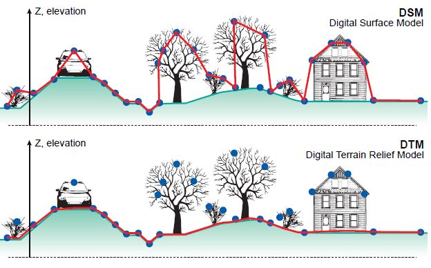
● DTM is used for ground rupture modelling, land use studies , and rural planning, allowing for accurate representation of terrain and surface features.
● DSM Digital Surface Model, provides information about the natural and built features on the Earth's surface, aiding in urban planning and vegetation analysis.
● DEM Stands for Digital Elevation Model , which represents the terrain's surface in three-dimensional form and is essential for applications including topographic mapping, flood modeling, and geospatial analysis.
3D point cloud data captures detailed information about the surface and objects within a given area, enabling precise measurements, feature extraction, and visualization for various applications such as construction, forestry, and environmental monitoring.
● 3D textured mesh is the most realistic representation of the real- world terrain, providing detailed visualizations for simulations, virtual reality applications, and infrastructure design.
Photogrammetry
Process involves capturing and interpreting images from aerial surveys to generate accurate 3D models and spatial data, enhancing the understanding of landscapes and structures.

Area reconnaissance
Mission flight planning
Data acquisition
Data gathering
Post-processing and report generation
Data analysis involves interpreting the collected data to derive meaningful insights, utilizing various statistical methods and tools.