Glacial landforms - Deposition
2.A Glacial landforms develop due to a variety of interconnected climatic & geomorphic processes
Key terms:
•DRIFT: collective name for all glacial and fluvioglacial deposits
•TILL: the name given to all material deposited by the ice itself
•LODGEMENT TILL: deposited as the glacier advances à drumlins
•ABLATION TILL: deposited as the glacier retreats à Erratics, Moraines, Till sheets
Why does deposition occur?
LOSS OF ENERGY
Glaciologists will often perform till fabric analysis on material they suspect to have been deposited by a glacier. They are looking for signs that it is glacial in origin.
The giveaway clues are that the material is unsorted, unstratified, angular and a matrix of different materials and sizes.
GLACIAL DEPOSITIONAL LANDFORM (1) - TILL
Definition: deposit of unsorted material left behind by glacial ice.
Till sheets:
Till sheets – material transported by the glacier is deposited subglacially as the glacier retreats and is plastered onto obstacles and squeezed into gaps.
Often vast scale, covering whole tracts of land, particularly over lowland areas.
In England, till is often referred to as boulder clay, (although this is something of a misnomer as till does not need to contain boulders, nor clay! In East Anglia, for example, the till is chalky as the ice passed over the chalk escarpment of the East Anglian Heights.)
Till sheets can be really deep – in the Gulf of Alaska they are 5000m thick, in the North Sea they are 920m and in East Anglia they are 143m.
Till sheets may be slightly rounded due to reworking by meltwater. They may also be more sorted, can be aligned to the direction of ice flow, and are often lodged at an angle of about 45°.
They comprise a matrix of materials and individual clasts can vary enormously in terms of their size.
Example of Till sheets: Holderness Coastline in Yorkshire
→ Glacial till deposits make up a large portion of Britain’s geology today. The Holderness Coastline in Yorkshire has the fastest erosion rate in Europe, disappearing by up to 10m per year. This is because the coastline is made up of a soft boulder clay deposited by the glaciers as they retreated across the country 20,000 years ago.
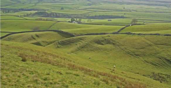
GLACIAL DEPOSITIONAL LANDFORM (2) - DRUMLINS
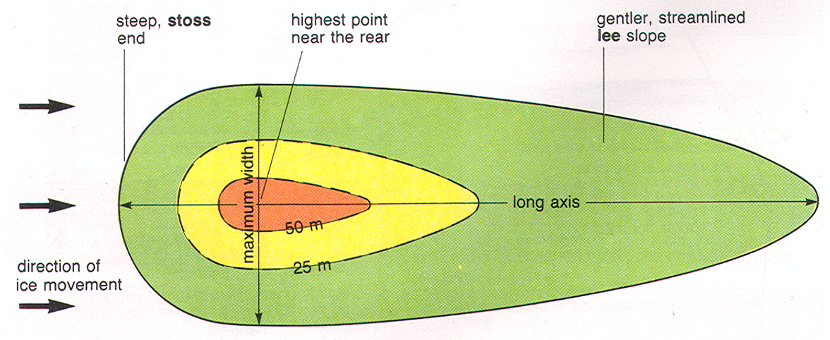
Definition: A large mound of glacial debris that has been streamlined into an elongated hill (egg shaped). They often occur in groups (swarms)
Drumlins are usually found in large numbers, or swarms, giving rise to the term “basket of eggs topography”.
Their long axis is parallel to the direction of ice movement. They can therefore usefully be used to show the route the glacier took as it advanced (lodgement).
They have a steep and blunted stoss end facing the direction from which the ice advanced, and a more streamlined lee end (downstream), minimising resistance to the surrounding moving ice.
The shape of the drumlin can be described by using the elongation ratio:
length of drumlin (long axis) / maximum width
They may be over 50m in height, 1000m in length and 500m in width.
The faster the ice flow, the more elongated the drumlin.
Drumlins are usually found in low-lying undulating regions, particularly where a valley glacier flows into a lowland plain, causing a thinning of the ice and loss of energy.
Due to their occurrence in swarms, they give rise to a characteristic hummocky terrain with small ponds in the poorly drained sites in between the drumlins.
Examples of Drumlins:
East-central Wisconsin (5000 drumlins)
Nova Scotia (2300 drumlins)
New York State, formed by Laurentide Ice Sheet (10,000 drumlins)
Upper Ribblesdale, North Yorkshire (pictured above)
Explanations for Drumlins:
Drumlins are unique amongst glacial deposits as they are thought to have been created as glaciers advance. They are thus termed as a type of lodgement till.
However, their precise method of formation is disputed, mainly because they are formed subglacially (under the ice), so glaciologists cannot observe their formation directly.
There are two main theories:
A glacier will deposit material subglacially as till. This is particularly encouraged in warm-based glaciers where pressure melting allows more deposition, particularly when the bed is irregular. Boulton (1987) suggests that the subglacial till is then moulded as the glacier passes over it, and is plastered around objects. Some of the till is squeezed into gaps in the bed, creating a smooth surface. Because pressure is exerted on the till as it is forced against obstacles, the clasts align to the direction of flow, with each clast sitting at an angle of about 45°. This theory could explain why some drumlins contain a rock core.
Shaw et al. (1989) however suggest that subglacial meltwater carves cavities in the base of the ice and these cavities are then infilled with sediments as the meltwater ceases to flow.
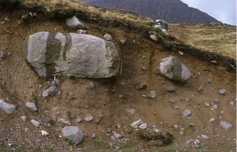
GLACIAL DEPOSITIONAL LANDFORM (3) - ERRATICS
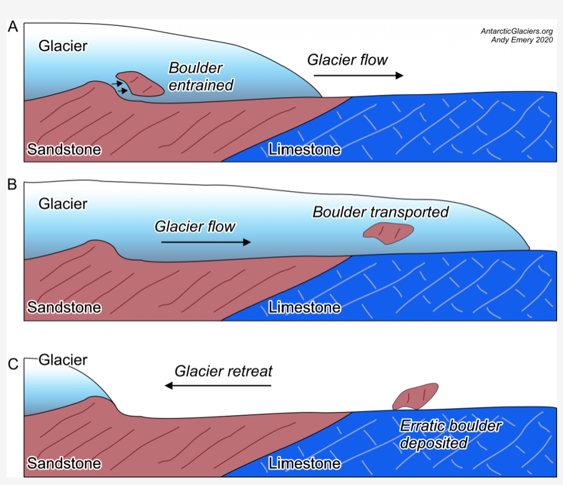
Definition: Erratics are large boulders foreign to the local geology that have been dumped by the ice, usually on flat areas. They vary in size, from individual pebbles to giant boulders.
They are deposited as the glacier retreats: ablation till.
By determining from where the erratics originally came, it is possible to track ice movements. Some erratics have been transported great distances.
For example, volcanic material from Ailsa Craig in the Firth of Clyde, Scotland, has been found as erratics 250km to the south on the Lancashire plain.
Further afield, boulders weighing over 16,000t have been found in southern Alberta, some 300km from their source region in the Canadian Rockies.
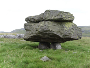
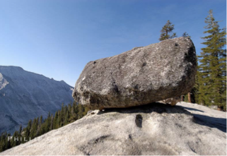
Some erratics have been left stranded in precarious positions as perched rocks, making for very dramatic scenery.
Formation of Erratics:
Glaciers erode underlying bedrock through plucking - these rocks (erratics) are transported a distances (sometimes very far) by the glacier
When a glacier melts or retreats, energy required to carry the erratics is lost, and they are dropped and deposited in new loations.
As a result, some erratics often stand out as they differ in size and shape from the surrounding rocks
→ provides clues about glacier’s movement & origin.
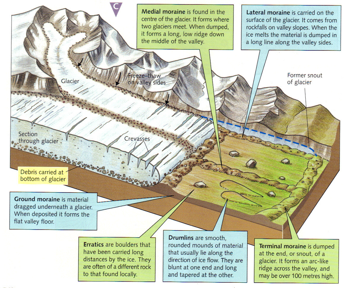
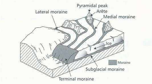
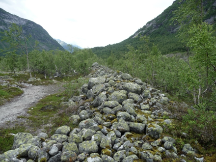
GLACIAL DEPOSITIONAL LANDFORMS (4) - MORAINES
Definition: huge piles of loose, sharp rock fragments
It is ablation till: deposited as the glacier retreats.
Morainic material is an unsorted, unstratified, angular matrix.
Moraines are often reworked by subsequent glaciations, by meltwater, through aeolian erosion or by human development, so their “pristine” presence in the landscape is not always guaranteed.
Locations of Moraine:
Moraine at the snout (end moraine): terminal, recessional, push
Moraine at the sides of the glacier: lateral, medial
Moraine under the glacier: subglacial (or ground)
Type of Moraine | Location | Explanation | Example(s) |
Terminal | At the snout (end of glacier) |
| The terminal moraine of the Franz Josef glacier in New Zealand is 430m high (They can be vast landforms. However, on average they are 30-60m high) |
Recessional | At the snout |
| can be found in many Highland Glens (Cairngorms), e.g. at Allt Bheadhair. |
Push | At the snout |
| can be found in front of the glaciers on Axel Heiberg Island, Canada. |
Lateral | At the sides |
| in the UK is at Cwm Idwal, Snowdonia. More dramatic ones can be found overseas, for example along the Tasman Glacier in New Zealand. |
Medial | On top/inside |
| Example: The Kaskawash Glacier in Yukon, USA has a medial moraine that is 1km wide at the point of confluence, but which reduces to just 7m width 4km downstream. |
Ground | Subglacial |
| Grinnell Glacier in Glacier National Park, USA, has expansive ground moraine consisting of really quite large boulders. |