Rivers Summary
The River Severn
**__UPPER COURSE__**
In the upper course the river is high energy as its driven by gravity, deep V shaped valleys which are caused by vertical erosion & hydraulic action, which over time results in freeze thaw and chemical weathering meaning a deeper and wider v shaped valley. There are also interlocking spurs which are because of the different rock resistances.
In the upper course there are also waterfalls and therefore gorges this can be seen where the “River Severn breaks its neck. (Also, because of erosion)
**__MIDDLE COURSE__**
Followed by the middle course, lower energy, lateral erosion, meanders which are w/ riffles and pools, riffles are shallow and straight and pools are deep and bendy, there are also oxbow lakes
**__LOWER COURSE__**
Then the lower course has low energy water, it’s almost flat with lots of floodplains & deposition, then the estuary which Is Bristol Channel
==River transportation Methods==
Traction: Rolling of boulders and pebbles along the riverbed
Saltation: the transport of hard particles over an uneven surface
Suspension: solid material held in water in transit
Solution: soluble particles dissolved in the river.
==Factors that increase the rate of erosion==
Abrasion: Rocks wear down the riverbed.
Attrition: Rocks smash together to make smaller rocks
Hydraulic action: River against the riverbanks force causes trapped air in cracks and crevices.
Solution: Soluble
particles are dissolved into the river.
==Flashy hydrograph – mostly seen in urban areas – results in flash floods==
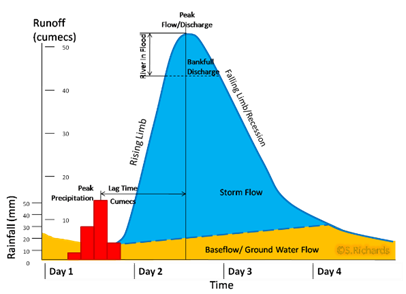
- Short lag time
- Small river basin
- Frequent and heavy rain
- Impermeable rocks
- Steep valley
- Urban land use
- Little vegetation
- Saturated soil
==Slow flat hydrograph – mostly seen in rural areas==
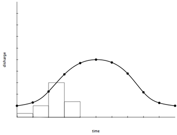
- Longer lag time
- Lower peak discharge
- Larger river basin
- Permeable rocks
- Light rain
Vegetation/forests
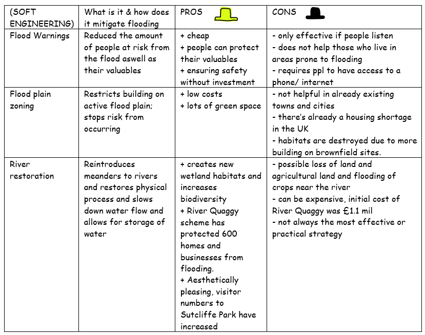
==SOFT ENGINEERING==
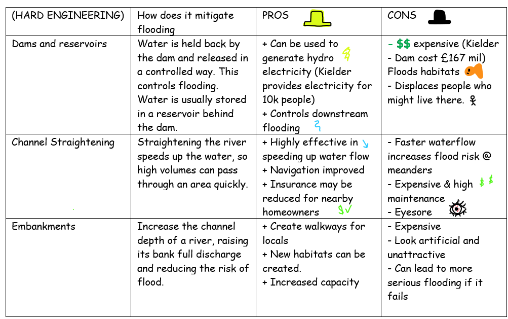
==HARD ENGINEERING==
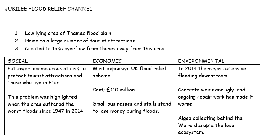
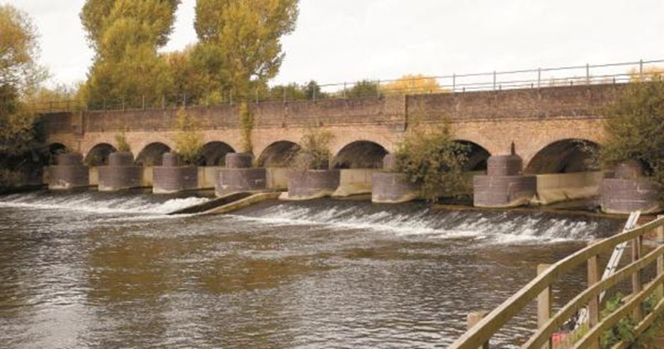
==CASE STUDY==